• Our new ticketing site is now live! Using either this or the original site (both powered by TrainSplit) helps support the running of the forum with every ticket purchase! Find out more and ask any questions/give us feedback in this thread!

The line to Beddau: Can it be done?

Status
Not open for further replies.

Tumbleweed

Member
Joined
17 Apr 2013
Messages
189
The track bed is still intact apart from Gwaun Miskin where the A473 bypass severs it but there are arrangements to replace the embankment with a bridge when required.

 
Sponsor Post - registered members do not see these adverts; click here to register, or click here to log in
R

RailUK Forums

DaveHarries

Established Member
Joined
12 Dec 2011
Messages
2,576
Location
England
url]http://www.trackbed.com/pages/location_tonteg.htm[/url]
Interesting to see what the author of that page says about Tonteg Junction which is that "The typical McKenzie & Holland signalbox can be seen from this later view which miraculously still stands only a few yards from this location further up to the left of this view and is now used as a shed. The vents can be seen from the road when driving down "Power station hill" towards the A470."

Where is / was PSH, and the other question is can the box still be seen or have the road "improvements" of the last few years got rid of all trace of it?

Would be interested in bagging a photo it if I get a chance.

Dave
 

rf_ioliver

Member
Joined
17 Apr 2011
Messages
1,028
Interesting to see what the author of that page says about Tonteg Junction which is that "The typical McKenzie & Holland signalbox can be seen from this later view which miraculously still stands only a few yards from this location further up to the left of this view and is now used as a shed. The vents can be seen from the road when driving down "Power station hill" towards the A470."

Where is / was PSH, and the other question is can the box still be seen or have the road "improvements" of the last few years got rid of all trace of it?

Would be interested in bagging a photo it if I get a chance.

Dave

I think everything is gone to the east of Tonteg. What remains are the platforms underneath the road bridge (now blocked to cars) - whether these are visible under the bushes, trees etc is another thing.

You can see the view of where the barry line and the LLTVR to Trefforest were in the Wikipedia article: http://en.wikipedia.org/wiki/Tonteg_Halt_railway_station

I think, though not sure and it'll be a few months before I can check, the original 1930's platform might be still in some form of "existence" further down the lane from the "new" Tonteg Junction platforms...however even in the 30's this wasn't much more than some raised ground AFAIU.

t.

Ian
 
Joined
7 Jul 2009
Messages
138
Location
Talbot Green
Where is / was PSH, and the other question is can the box still be seen or have the road "improvements" of the last few years got rid of all trace of it?

Would be interested in bagging a photo it if I get a chance.

Dave

I wish you'd asked that yesterday :)

I walked down old powerstation hill (it is still there, but no longer in use by traffic) to an interview. I'd have had a look on the way back up.
 

rf_ioliver

Member
Joined
17 Apr 2011
Messages
1,028
I wish you'd asked that yesterday :)

I walked down old powerstation hill (it is still there, but no longer in use by traffic) to an interview. I'd have had a look on the way back up.

If you're down that way again, any chance you could take a look at whether the site of the pre.1930s platform still exists?

Would be nice to get a picture of that onto the Wikipedia article. The only thing I have is a photo from the 1950s from a book.

t.

Ian
 
Joined
7 Jul 2009
Messages
138
Location
Talbot Green
If you're down that way again, any chance you could take a look at whether the site of the pre.1930s platform still exists?

Would be nice to get a picture of that onto the Wikipedia article. The only thing I have is a photo from the 1950s from a book.

t.

Ian

Yeah, will do.

I'd need to satisfy my curiousity now anyway.

I'll try and see what I can find next time I'm over that way (which could very well be early next week.)
 
Last edited:

rf_ioliver

Member
Joined
17 Apr 2011
Messages
1,028
Excellent...here are the two places:

Tonteg Junction (well known at the end of Cheriton Grove)

http://maps.google.co.uk/maps?ll=51...001742&t=h&z=20&layer=t&lci=com.panoramio.all

Pre-1930 realignment Tonteg Halt:

http://maps.google.co.uk/maps?ll=51...001742&t=h&z=20&layer=t&lci=com.panoramio.all

I have no idea how much is left, but last time I was there (>15 years ago!) there was a footpath running up from the lane. The halt was at the top of this just next to the bridge abutments. I suspect that this is the place now:

http://maps.google.co.uk/?ll=51.570...=xskQWQO3tsPlRN4qXWyxIw&cbp=12,144.01,,0,2.72

t.

Ian
 
Last edited:
Joined
7 Jul 2009
Messages
138
Location
Talbot Green
Excellent...here are the two places:

Tonteg Junction (well known at the end of Cheriton Grove)

http://maps.google.co.uk/maps?ll=51...001742&t=h&z=20&layer=t&lci=com.panoramio.all

Pre-1930 realignment Tonteg Halt:

http://maps.google.co.uk/maps?ll=51...001742&t=h&z=20&layer=t&lci=com.panoramio.all

I have no idea how much is left, but last time I was there (>15 years ago!) there was a footpath running up from the lane. The halt was at the top of this just next to the bridge abutments. I suspect that this is the place now:

http://maps.google.co.uk/?ll=51.570...=xskQWQO3tsPlRN4qXWyxIw&cbp=12,144.01,,0,2.72

t.

Ian

The first link there is now part of a community path shadowing the new road layout (A473). I'm pretty certain that there is nothing railway related there anymore, and I used to commute (by bike) past here daily.

The second and third links appear to be in much the same place. I don't know as much, but I will have a look next time I am in the area.


Edit:

Actually, I'm not up to much, the weather is good, and I'm curious.

Back in an hour or so, I could do with a bike ride anyway.
 
Last edited:

rf_ioliver

Member
Joined
17 Apr 2011
Messages
1,028
The first link is the bridge just south of Cheriton Grove, the other two should be where the pre 1930 station was, about 100-200m further down the lane, though I have no idea of what the area looks like now

Ian
 
Joined
7 Jul 2009
Messages
138
Location
Talbot Green
Ok. I'm back.

I took as many photos as I thought I could logically to give an idea.

Results here

I will have a close look at the picture of the information sign later and try to copy it onto here as a quote.

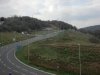
There should also be 2 attachments, one showing a pic from the sign of the site at closure in 1965, and one of the same area now (using two buildings as a reference point)
 

Attachments

  • DSC03000.jpg
    DSC03000.jpg
    82.2 KB · Views: 49
  • DSC03001.jpg
    DSC03001.jpg
    111.1 KB · Views: 48

Gwenllian2001

Member
Joined
15 Jan 2012
Messages
671
Location
Maesteg
I can't help wonder if Beddau - Cardiff via Creigiau would be a better idea than the via heavily used SWML. The route would take in Cross Inn, for Llantrisant and Criegiau. Cardiff is expanding ever westward and this is an area that is likely to need good transport links if it is not to go the way of Swansea.
 

anthony263

Established Member
Joined
19 Aug 2008
Messages
6,892
Location
South Wales
Well they may have to use light rail if they want to run from Cregiau to Beddau. I have seen the proposal to re-open the line between Radyr and Cregiau with the Coryton - Radyr trains running through to Cregiau.

I agree with the lessons having to be learned from what has been going on in Swansea with regards to transport infrastructure. That said I would hope that some day in the future Swansea will get its act together and we see light rail return to the streets of Swansea
 

rf_ioliver

Member
Joined
17 Apr 2011
Messages
1,028
Well they may have to use light rail if they want to run from Cregiau to Beddau. I have seen the proposal to re-open the line between Radyr and Cregiau with the Coryton - Radyr trains running through to Cregiau.

Creigau to Beddau is still possible. The trackbed exists still from Creigau via Rhiwsaeson to Cross-Inn. The junction at Cross-Inn is to the east (in the direction of Tonteg) though you'd need a new bridge over the bypass at Cross-Inn.

But while you're reinstating that you'd get Beddau-Llantrisant almost for free and you could theoretically continue from Creigau to Efail-Isaf; might be very difficult toward Tonteg from there.

So, from Beddau, 1tph to Pontyclun, 1tph to Cardiff via Creigau and from Efail Isaf 1tph via Creigau to Cardiff....sounds good, anyone got some spare cash?

t.

Ian
 

Rhydgaled

Established Member
Joined
25 Nov 2010
Messages
4,861
Assuming that the desire would be through running to Cardiff surely the biggest problem would be capacity on the SWML especially with plans for a half hourly Maesteg service.
Agreed, capacity on the South Wales Main Line is a concern I've had with several service enhancements I would like to see. Basically, I think there should be:
  • at least 3tph from Swansea:
    • 1 all-stops (to/from Cardiff)
    • 1 or 2 fast (to/from London/Manchester)
    • and 1 fast+Pyle (to/from Bristol)
  • plus another 1tph from Carmarthen/Pembrokeshire (to/from Cardiff/Portsmouth)
  • Maybe another 1tph from a new Morriston Parkway station, with a few extensions from the southern part of the HOWL
Add in freight, and the Maesteg service at Bridgend, and... Ouch.

Is even 4tph from further west and 2tph from Maesteg going to fit without limiting freight to night-time running? If by some stroke of good fortune Wales gets some 3-car class 377s, what capacity impact would having the 1tph all-stops from Swansea couple to a Maesteg service at Bridgend have compared to running the full 6tph into Cardiff? If the intermediate stops between Bridgend and Cardiff only need 1tph you could also combine the other Maesteg with the Swansea - Bristol service at Bridgend.

Personally I think the line probably needs to be quadrupled from Cardiff to Bridgend, if not Port Talbot, but not in the normal sense. The current line makes quite a deviation (via Llanharan) from the direct route between Cardiff and Bridgend. I say, keep the existing route as the 'slow lines' and build the new 'fast lines' on a new, shorter, straighter, route designed for higher speeds (would electric trains accelerate fast enough to make 125mph worthwhile?)
 

Rhydgaled

Established Member
Joined
25 Nov 2010
Messages
4,861
The good burgers of Cowbridge would be delighted.
I think such a line would pass a little to the north of there, terain permitting, so probablly neither scope for a station (especially given its the fast lines, though you may have room for a stopping path on the route in addition to the fast trains) or upsetting residents with fast trains roaring through.

Is there a good free online mapping source showing height that I could use to see where the gradients might not be too bad?
 

krus_aragon

Established Member
Joined
10 Jun 2009
Messages
6,105
Location
North Wales
I think such a line would pass a little to the north of there, terain permitting, so probablly neither scope for a station (especially given its the fast lines, though you may have room for a stopping path on the route in addition to the fast trains) or upsetting residents with fast trains roaring through.

Is there a good free online mapping source showing height that I could use to see where the gradients might not be too bad?

The Ordnance Survey is your friend. Either http://www.getamap.ordnancesurveyleisure.co.uk if you've got Silverlight installed, or use the OS layer of maps.bing.co.uk instead.
 

anthony263

Established Member
Joined
19 Aug 2008
Messages
6,892
Location
South Wales
The Caerphilly - Newport line being re-opened is an interesting one.

I am not going to be too surprised if we see a tram-train network on some parts of the Carrdiff Valley Lines network including soem around Newport and Swansea.

The Aberdare - Hirwaun line should continue down to Swansea
 

Gwenllian2001

Member
Joined
15 Jan 2012
Messages
671
Location
Maesteg
It should be a fairly straightforward job. It can be done without interfering with other services until the re-instatement of Waterhall Junction becomes necessary. That could be done with a weekend posession.
 

anthony263

Established Member
Joined
19 Aug 2008
Messages
6,892
Location
South Wales
The only problem I can see is the lack of paths between Pontyclun and Cardiff Central especially when the Maesteg service is cut back to Half Hourly.

If what I have read in the newspaper is true Wales could soon be allowed to borrow money from the international markets although the M4 relief road is going to be one of the welsh governments top priorities.

If they want to build a new relief road for the m4 then go ahead as long as money is also spent on upgrading and improving public transport. The Cardiff City Metro proposal and trams for Swansea would be two schemes I would like to see funded.

That said I think the WG will also pay for the north wales coast to be wired during CP6 hopefully including Wrexham - Bidston.

Back to the Beddau branch with all the traffic heading out of Talbot Green towards the M4 especially at rush hours I can say a rail service even if its a shuttle to Pontyclun would be well used providing the service frequency is good and there is good connections at Pontyclun.

As for the rolling stock, how about super stretched Parry People Mover class 139's ;)
 
Last edited:

Gwenllian2001

Member
Joined
15 Jan 2012
Messages
671
Location
Maesteg
The only problem I can see is the lack of paths between Pontyclun and Cardiff Central especially when the Maesteg service is cut back to Half Hourly.
>
Back to the Beddau branch with all the traffic heading out of Talbot Green towards the M4 especially at rush hours I can say a rail service even if its a shuttle to Pontyclun would be well used providing the service frequency is good and there is good connections at Pontyclun.

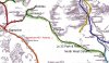
The proposed service will not touch Pontyclun. (see attachment). It will have stations at Beddau; Llantrisant; Creigiau; Park & Ride at M4 Jc 33 and a station, yet to be named in North West Cardiff.
 

Attachments

  • evr2.jpg
    evr2.jpg
    163.9 KB · Views: 32

Gwenllian2001

Member
Joined
15 Jan 2012
Messages
671
Location
Maesteg
I should point out that the map is an old one and could give rise to some confusion.

Llantrisant, as shown on the map, is now Pontyclun.

The nearest station to Llantrisant was, confusingly, Cross Inn.

The new Llantrisant Station will be close to, but not on, the site of Cross Inn.

The old station was on the Llantrisant - Pontypridd route, just south of where the line diverged towards Creigiau.
 

Gwenllian2001

Member
Joined
15 Jan 2012
Messages
671
Location
Maesteg
For added clarity I have attached a simplified map with some lines removed, for added clarity, and the approximate positions of the proposed stations.
 

Attachments

  • evr2.jpg
    evr2.jpg
    156.5 KB · Views: 30

anthony263

Established Member
Joined
19 Aug 2008
Messages
6,892
Location
South Wales
Sorry yes I did miss read the map.

I agree about the line shown in the map which I believed is proposed to be worked by tram trains and call at the various cityline stations before continuing along the relief lines from Cardiff Central to St Mellons.

I belief a station is planned to be built after after the Cardiff Bay branch pass over the mainline which will serve the Callaghan Square development with a platform also built on the Cardiff Bay branch which will be served by the Coryton - Cardiff Bay service which would also use tram-trains.

The service intervals is supposed to be 4tph.

Both services I think will be very well used especially if the service to Cardiff Bay continues as proposed to the Sports Villiage. A new Station would be built at Ely Bridge which would serve some industrial area's as well as Ely itself.

The only concerns I have is that what would serve Danescourt station and would the services be able to cope with the crowds at Ninian Park on match day although I suppose the Merthyr Tydfil trains could stop additionally at Ninian Park when they are diverted along the cityline to reduce the Merthyr - Cardiff journey down to 45 minutes.

If this line does get the go ahead I hope they will also re-open the branch down to Pontyclun as that will allow passengers an alternative way into Cardiff and acess to services to Pencoed, Bridgend and Maesteg etc.

I do have a pdf document of the Cardiff Metro proposals which is too large to attach to this post however I can send it by PM or emil if anyone wants a copy
 
Last edited:

rf_ioliver

Member
Joined
17 Apr 2011
Messages
1,028
The old station was on the Llantrisant - Pontypridd route, just south of where the line diverged towards Creigiau.

Do you mean Cross Inn before the junction (which is in the opposite direction) to the line that goes via Creigiau and Rhiwsaeson? That line only had a connection to the Barry Line at Creigiau for a few years late 19th centure (IIRC)

Ian
 

Gwenllian2001

Member
Joined
15 Jan 2012
Messages
671
Location
Maesteg
Do you mean Cross Inn before the junction (which is in the opposite direction) to the line that goes via Creigiau and Rhiwsaeson? That line only had a connection to the Barry Line at Creigiau for a few years late 19th centure (IIRC)

Ian
Cross Inn was between Llantrisant and Common Branch Jc, where the line diverged onto the Llantrisant No 1 Railway. (See map). The connection with the Barry Railway at Creigiau was only used to convey materials during the construction of the Barry Main Line. It was removed as soon as the line was complete.

It is noteworthy that the Taff Vale considered running an alternative Pontypridd - Cardiff passenger service over this route as far back as 1904, but despite drawing up plans for 'Motor Platforms', nothing was done. The line was always something of a 'Cinderella' serving collieries that were poor and short lived. The main source of traffic was Creigiau Quarry.

Perhaps its time has now come. We shall see.
 
Status
Not open for further replies.

Top