• Our new ticketing site is now live! Using either this or the original site (both powered by TrainSplit) helps support the running of the forum with every ticket purchase! Find out more and ask any questions/give us feedback in this thread!

New National Rail Map - Very Wrong

Status
Not open for further replies.

fandroid

Established Member
Joined
9 Nov 2014
Messages
2,557
Location
Hampshire
I think the accuracy of which train service stops at a station and which doesn't is quite very important. The map has to assume that a new passenger is using it, one with no local knowledge. That's what maps are for! Such a passenger will just know that they want to go from station A to station B. If station B is inaccurately shown as a stop for operator 1 when it isn't then they risk getting on the wrong train and being overcarried.

I know that in reality most people double check with other sources of information, but there are circumstances when that's not easy/possible and the map should not misinform them. If you're going to create a sophisticated information source then you have to ensure that it's as accurate as it's humanly possible to be. It shouldn't just appear sophisticated, it should actually be sophisticated with accuracy to match.
 
Last edited:
Sponsor Post - registered members do not see these adverts; click here to register, or click here to log in
R

RailUK Forums

Statto

Established Member
Joined
8 Feb 2011
Messages
4,053
Location
At home or at the pub
As others have said, the vast majority of the public just want a representation of the lines, not that they're accurate or would notice, or care about, the inconsistencies
No they don't, they want a map that is accurate, & maps should be accurate regardless of design, particularly as we're in 2025 not 1925, actually a map published in 1925 would have been more accurate than this joke of a map.

The map still has TFW avoiding Earlestown, when they stop there, & still has AWS & CS stopping at Rugeley Trent Valley, when they don't stop there, also has CS stopping at Stafford too, the CS doesn't stop there.
 

BurtonM

Member
Joined
3 Feb 2014
Messages
975
Location
Manchester
  • 'Langsett/primrose View' on Supertram is missing a capital P.
  • Fixed walking link isn't marked for Wigan North Western to Wallgate
  • Squires Gate is marked as an airport interchange (for Blackpool Airport) - while it's an operational airfield, it doesn't have any scheduled flights?
  • Deansgate-Castlefield Metrolink stop is listed as 'deansgate/Castelfield'. fixed!
  • MediaCityUK Metrolink stop is listed as 'Media City Uk'.
  • Hall-i'-th'-Wood is missing its apostrophes and capitalised incorrectly as 'Hall-I-Th-Wood'.
  • Leeds is marked as being the airport station for Leeds Bradford airport. There's then the 'Leeds Airbus' link between Leeds, Bradford and the airport, which doesn't seem to exist as far as I can tell... and Leeds Bradford Airport isn't marked as being an airport.
    Luton Airport Parkway is set up the same way where the station is marked as the airport interchange - but the airport station on the Luton DART isn't.
    There's no differentiation between stations that are at airports, and stations with links to airports.
  • Butler's Hill on NET is listed as 'bulter's Hill'. Gained a capital B, but still spelt wrong.
  • Hyson Green Market on NET is listed as 'Hyson Gree Market'. fixed!
  • Lewisham has a rather interesting junction layout...
 
Last edited:

MrMappy

New Member
Joined
30 Nov 2025
Messages
3
Location
Stone
Another one that's just the same as it was on the old map, maybe that's what you were inferring when you said 'still'?

View attachment 193331 View attachment 193330
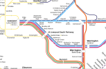
There's no service on the west to south chord anymore. Shipley is the only triangular station now.

== Doublepost prevention - post automatically merged: ==

View attachment 193048Apparently Kentish town Station doesn't exist anymore.

The tube lines are also quite inaccurate too.
Ah, the only image I've seen with Southern removed to Euston leaving a gap.
 

chrisjo

Member
Joined
18 May 2024
Messages
596
Location
Llanishen
Ah, the only image I've seen with Southern removed to Euston leaving a gap.
The gap was there the last time I looked, but not now, which it interesting in itself because it shows that we're on at least the 3rd edit of the map already. The changes being made must be getting based on input from somewhere.
 

Farigiraf

Member
Joined
23 Jul 2023
Messages
1,135
Location
Bridge on the River Cam
Another one that's just the same as it was on the old map, maybe that's what you were inferring when you said 'still'?

View attachment 193331 View attachment 193330
The map you refer to as 'old' seems to have been introduced around the same time as the interactive one - which may explain the huge amount of errors in both. NR may have decided to pick a new company for mapmaking who made these new maps from scratch with minimal double-checking.

This is the actual 'old' map (last updated May 2025), and is rather accurate, as Project Mapping (who made it for NR) update it twice a year.
 

mattpharrison

Member
Joined
11 Sep 2013
Messages
23
Location
Manchester
What an absolutely ghastly typeface they've used for this. It looks like some kind of childish cousin of Comic Sans.

Would it have been too much for them to have used RA2?
May I present an alternative, nicely set in RA2? I've been working on this for some time now. It's loosely based on my map for Northern, with a load of improvements as suggested by forum users here. Keen to hear thoughts!

(Ignore the bottom right corner, I haven't redesigned the line via Altrincham yet)

== Doublepost prevention - post automatically merged: ==

After being spoilt by the brilliant colour coded Northern map, this one seems rubbish. For something zoomable, why is it so unreadable? Especially in and around London, it seems ridiculously cluttered!
As the designer of the new Northern map, thank you! Appreciate the feedback (good and bad).
 

Attachments

  • Screenshot 2025-12-05 at 14.29.39.png
    Screenshot 2025-12-05 at 14.29.39.png
    434.6 KB · Views: 216
Last edited:

pokemonsuper9

Established Member
Joined
20 Dec 2022
Messages
4,584
Location
Greater Manchester
May I present an alternative, nicely set in RA2? I've been working on this for some time now. It's loosely based on my map for Northern, with a load of improvements as suggested by forum users here. Keen to hear thoughts!
Looks good, although if I may point out two errors, there should be a curve from the Patricroft direction joining the West Coast Main line towards Wigan (currently served at peak time) and the limited service from Ellesmere Port - Warrington - Liverpool via the third side of the Earlestown triangle isn't shown.
 

mattpharrison

Member
Joined
11 Sep 2013
Messages
23
Location
Manchester
Looks good, although if I may point out two errors, there should be a curve from the Patricroft direction joining the West Coast Main line towards Wigan (currently served at peak time) and the limited service from Ellesmere Port - Warrington - Liverpool via the third side of the Earlestown triangle isn't shown.
Thank you - I had both of those in there originally, and took them out - but might restore them before I share the full map.

It's a tough balancing act when representing limited services; arguably there should be some more (or some fewer) dots on station calls in various places. On the line through to Blackpool North for example - Avanti have one train on a Sunday which stops at Poulton-le-Fylde / Kirkham & Wesham, so do we represent that with a dot, or leave it blank as the vast majority of services bypass those stations? It's always a trade off between clarity, consistency and accuracy.
 

pokemonsuper9

Established Member
Joined
20 Dec 2022
Messages
4,584
Location
Greater Manchester
Thank you - I had both of those in there originally, and took them out - but might restore them before I share the full map.

It's a tough balancing act when representing limited services; arguably there should be some more (or some fewer) dots on station calls in various places. On the line through to Blackpool North for example - Avanti have one train on a Sunday which stops at Poulton-le-Fylde / Kirkham & Wesham, so do we represent that with a dot, or leave it blank as the vast majority of services bypass those stations? It's always a trade off between clarity, consistency and accuracy.
I think the Wigan - Manchester peak time trains are much more important to show, there are quite a lot (~6tpd each way) and since once Golborne station opens, they will (likely) be made hourly and form it's core service, that part of the curve gets more passenger services (including some TPE services and a couple extra Northern services) than from Newton-le-Willows (only 3 Northerns per day).

The third part of the Earlestown triangle is a reasonable omiission, given the 1 train per day.
 
Last edited:

mattpharrison

Member
Joined
11 Sep 2013
Messages
23
Location
Manchester
I think the Wigan - Manchester peak time trains are much more important to show, there are quite a lot (~6tpd each way) and since once Golborne station opens, they will (likely) be made hourly and form it's core service, that part of the curve gets more passenger services (including some TPE services and a couple extra Northern services) than from Newton-le-Willows (only 3 Northerns per day).
Excellent point, well made. Consider it reinstated!
 
Joined
3 Mar 2020
Messages
669
Location
Furness
The map you refer to as 'old' seems to have been introduced around the same time as the interactive one - which may explain the huge amount of errors in both. NR may have decided to pick a new company for mapmaking who made these new maps from scratch with minimal double-checking.

This is the actual 'old' map (last updated May 2025), and is rather accurate, as Project Mapping (who made it for NR) update it twice a year.
Is there actually a ' definitive map ' of the railways then? I rather suspect some point in the past there has been some degree of difficulty digitalising 'the map' and what we have recently been discussing here is the 'error carried forwards' approach of that. That's not a criticism. Just a consequence of the process.
 

Farigiraf

Member
Joined
23 Jul 2023
Messages
1,135
Location
Bridge on the River Cam
I rather suspect some point in the past there has been some degree of difficulty digitalising 'the map' and what we have recently been discussing here is the 'error carried forwards' approach of that. That's not a criticism. Just a consequence of the process.
The previous (non-interactive) maps made by Project Mapping were largely free of errors. It seems the new one has been done from scratch, resulting in numerous errors which were not in prior versions of the NR website maps. These are natural if you're making a map of such scale, though some checking with a rail enthusiast would've definitely been worth it.

Thank you - I had both of those in there originally, and took them out - but might restore them before I share the full map.

It's a tough balancing act when representing limited services; arguably there should be some more (or some fewer) dots on station calls in various places. On the line through to Blackpool North for example - Avanti have one train on a Sunday which stops at Poulton-le-Fylde / Kirkham & Wesham, so do we represent that with a dot, or leave it blank as the vast majority of services bypass those stations? It's always a trade off between clarity, consistency and accuracy.
Great map, I'd certainly use it over the official version if it included tram and underground networks.

How about having a dashed line for infrequent but relevant routes and services (i.e. only at peak times), with a dotted line for very limited (i.e. only a few times per day) routes/services? This may result in a quite complicated map but would make it more useful and fix the 'balancing act' issue.

Station calls are a more complex issue - how do you separate peak-only calls with parliamentary services? Having two styles of dot (on top of the 'regular calls' dot) to show varying degrees of limited service is again, quite complicated. My suggestion is having a fainter dot than usual for peak-only stops, with a fainter station name for stations with a parliamentary service - though there are still grey areas with regards to that.
 

mattpharrison

Member
Joined
11 Sep 2013
Messages
23
Location
Manchester
Great map, I'd certainly use it over the official version if it included tram and underground networks.
It certainly will - trams and Tyne & Wear Metro are all represented on this version.
How about having a dashed line for infrequent but relevant routes and services (i.e. only at peak times), with a dotted line for very limited (i.e. only a few times per day) routes/services? This may result in a quite complicated map but would make it more useful and fix the 'balancing act' issue.

Station calls are a more complex issue - how do you separate peak-only calls with parliamentary services? Having two styles of dot (on top of the 'regular calls' dot) to show varying degrees of limited service is again, quite complicated. My suggestion is having a fainter dot than usual for peak-only stops, with a fainter station name for stations with a parliamentary service - though there are still grey areas with regards to that.
Good suggestions - we had a combo of all of these things on the Northern map, which even in itself was fiendishly complicated. Stations with limited calls on lines with more frequent services (like Clifton, on the line up to Bolton), lines with peak-only services, lines where Northern runs occasionally but other operators run more frequently, request stops (though we chose not to differentiate these in anticipation of them becoming 'normal' stops), temporarily closed stations, and even a station closed in one direction but open in the other direction. To name a few complications!
 

enginedin

Member
Joined
15 Dec 2020
Messages
473
Location
UK
No they don't, they want a map that is accurate, & maps should be accurate regardless of design,
We'll have to agree to disagree - but I'd put a large amount of money on the vast majority of a the public not caring if junctions were shown the wrong way on a map which was clearly diagrammatic rather than geospatially accurate.
 

birchesgreen

Established Member
Joined
18 Aug 2015
Messages
7,652
Location
Solihull
We'll have to agree to disagree - but I'd put a large amount of money on the vast majority of a the public not caring if junctions were shown the wrong way on a map which was clearly diagrammatic rather than geospatially accurate.
They will care if they get on the wrong train because of the map.
 

enginedin

Member
Joined
15 Dec 2020
Messages
473
Location
UK
They will care if they get on the wrong train because of the map.
I hoped I'd made it clear that's not what I was referring to.

The original point was someone being upset that the junction for the line coming from Oxford Parkway is denoted as being north of that coming from Worcester, when they are actually the other way round. That would not cause someone to get the wrong train, in the same way that there are plenty of equivalent issues on the Tube map that nobody on here has ever complained about.
 

The Planner

Veteran Member
Joined
15 Apr 2008
Messages
19,630
I hoped I'd made it clear that's not what I was referring to.

The original point was someone being upset that the junction for the line coming from Oxford Parkway is denoted as being north of that coming from Worcester, when they are actually the other way round. That would not cause someone to get the wrong train, in the same way that there are plenty of equivalent issues on the Tube map that nobody on here has ever complained about.
:D I wasn't upset at all. If you are going to do something, do it properly. @mattpharrison has made a much better effort.
 

cryptus

Member
Joined
21 Jul 2025
Messages
10
Location
Croydon
Hardly the greatest mistake in the context of some of these other ones, but Reeves Corner on Tramlink should be on the one-way section from Waddon Marsh towards West Croydon; the map makes it look like the tram goes Church Street > Reeves Corner > Centrale which is physically impossible!
 

Smwrff

Member
Joined
27 Dec 2023
Messages
250
Location
Cymru Fawr
Looking at the GWR and TfW areas, Copplestone is no longer a request stop on the Barnstaple branch. If they are wanting to use the English names, then it is Treforest Estate and Treforest without the extra 'f'. Kidwelly and Ferryside are no longer request stops. Narberth, Kilgetty, Saundersfoot and Penally aren't shown as being request stops when they are (except the limited summer Saturday GWR service), yet Lamphey is correctly shown as being a request stop on the same line. Talybont and Dyffryn Ardudwy are no longer request stops. Minor but they've got Dovey Junction east of where the lines join. Deganwy, Conwy, Penmaenmawr, Llanfairfechan and Llanfairpwll are no longer request stops. I'm not sure what's going on at Newton-le-Willows but it shows Transport for Wales as running via a new route and not via or calling at Earlestown. Llanwrst is not a request stop but is listed as one.
Trefforest is the correct spelling (why spell it incorrectly in 'English') and has been adopted by TfW in 'both languages'.

Similarly Llandaf (not Llandaff).
 
Status
Not open for further replies.

Top