• Our new ticketing site is now live! Using either this or the original site (both powered by TrainSplit) helps support the running of the forum with every ticket purchase! Find out more and ask any questions/give us feedback in this thread!

Walking and Rambling discussion

Sponsor Post - registered members do not see these adverts; click here to register, or click here to log in
R

RailUK Forums

SuspectUsual

Established Member
Joined
11 Jul 2018
Messages
6,732
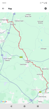
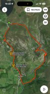
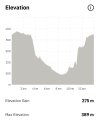
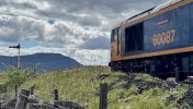
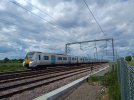
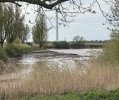
Muler to Keld and back a couple of days ago - out up the east bank of the Swale and back on the west. About 8 miles including a couple of detours. Very nice, especially once the sun came through
 

Attachments

  • IMG_3696.jpeg
    IMG_3696.jpeg
    1.1 MB · Views: 14
  • IMG_3718.jpeg
    IMG_3718.jpeg
    3.2 MB · Views: 14
  • IMG_3730.jpeg
    4.8 MB · Views: 6
  • IMG_3703.jpeg
    IMG_3703.jpeg
    4.4 MB · Views: 14

32475

Member
Joined
2 Nov 2019
Messages
815
Location
Sandwich
I noticed today that the England Coast Path appears to have been rebranded the King Charles III England Coast Path. Is this a belated April Fool’s thing or a case of toadying of the worst kind? No I’m not anti monarchy per se but is this sort of thing really necessary or somebody wanting recognition in the next new year’s honours list?
IMG_2655.png
 

StephenHunter

Established Member
Joined
22 Jul 2017
Messages
2,916
Location
London
No, it seems to have been rebranded in 2023 for the Coronation.

Anyway, the worst kind of toadying is putting toads in someone else's garden.
 

Hadders

Veteran Member
Associate Staff
Senior Fares Advisor
Joined
27 Apr 2011
Messages
18,134
I noticed today that the England Coast Path appears to have been rebranded the King Charles III England Coast Path. Is this a belated April Fool’s thing or a case of toadying of the worst kind? No I’m not anti monarchy per se but is this sort of thing really necessary or somebody wanting recognition in the next new year’s honours list?
View attachment 177903
It has been rebranded. I visited the Wirrall last weekend and walked a small section of the coast path and noticed new signage was in place which is very welcome because the last time I was there the signage was somewhat lacking.
 

ChrisC

Established Member
Joined
7 Oct 2018
Messages
2,255
Location
Nottinghamshire
This photo was taken on 23rd May 2023 when I was walking along the coast north of Liverpool towards Hightown. I remember taking the photo as I was quite surprised to see it less than 3 weeks after the coronation.

IMG_4868.jpeg
 

dangie

On Moderation
Joined
4 May 2011
Messages
2,353
Location
Rugeley Staffordshire
Although I have an OS Map subscription I love paper maps.

I’m currently planning some walks & cycle rides for a week we are spending at Chelmorton near Buxton in July. I dug out my old, but well used Ordnance Survey Landranger 1:50000 Buxton, Matlock & Dovedale plus the Outdoor Leisure 1:25000 White Peak Area maps.

Imagine my surprise when I realised that Carsington Water wasn’t on either of them! Bearing in mind construction began in 1979 and completed in 1991 it’s time for new maps I think :)
 

StephenHunter

Established Member
Joined
22 Jul 2017
Messages
2,916
Location
London
Although I have an OS Map subscription I love paper maps.

I’m currently planning some walks & cycle rides for a week we are spending at Chelmorton near Buxton in July. I dug out my old, but well used Ordnance Survey Landranger 1:50000 Buxton, Matlock & Dovedale plus the Outdoor Leisure 1:25000 White Peak Area maps.

Imagine my surprise when I realised that Carsington Water wasn’t on either of them! Bearing in mind construction began in 1979 and completed in 1991 it’s time for new maps I think :)
I find paper maps rather fiddly to use myself.
 

johnnychips

Established Member
Joined
19 Nov 2011
Messages
3,826
Location
Leeds
Three weeks ago, I took the train to Skipton, then a rather full Solo on Kirby Lonsdale coaches 75 to Malham. A rather hairy scramble up Goredale Scar took me to one source of the Aire near Middle House Farm, then across to the official source just above Malham Tarn, marked by a large rock. It was a bright, blowy day, and the limestone pavement was busy. Descent to Malham brought great views of the cove, then I followed the Aire down the Pennine Way. A variation took me to Coniston Cold to keep as close to the river as possible, rewarded by a huge shower all the way into Gargrave. The most challenging day on my Aire odyssey, 31km and 675m of ascent.

Today I took the Arriva 163 from Leeds to Selby, which took an amazing 1h 45m, followed by the 401 to Snaith. The walk from there to the confluence with the Ouse at Airmyn was an easy 14km, broken by a visit to the excellent Rose and Crown at Rawcliffe. At the confluence, the banks are woody and I only got a fleeting view. On to Goole, a rather sorry-looking town to catch one of the twice-daily trains to Leeds, which had a surprisingly good load of eight passengers.

So I’ve walked the length of the Aire in six disjointed stages, keeping as close to the river as possible. I did 163km (the official length is 148km, but it wasn’t possible to stick to the banks all the time) and using public transport, which was unfailingly excellent. It came in at about £40 in all from my Leeds base with senior railcard but full bus fares.

Now I need to decide whether to do the Calder or the Wharfe next…

1745098336883.jpeg


1745097977012.jpeg
 

THC

Member
Joined
21 Sep 2009
Messages
721
Location
Stuck on the GEML
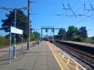
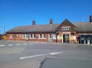
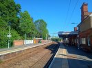
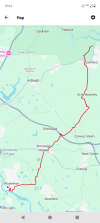
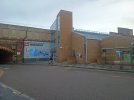
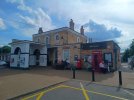
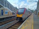
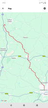
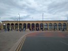
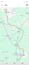
Shenfield to Sawbridgeworth, 20.5 miles. A lovely day's walk through west Essex, heading north from Shenfield to Wyatt's Green then skirting High Ongar to reach the railway at big Ongar, as the Easter Express arrived to a crowded platform. I walked on through Shelley to Moreton - a place I will live if I ever win the lottery - then to Matching and Sheering, over the M11 before leaving Essex right at the walk's end. The last hundred metres was in Hertfordshire, right on the county line at Sawbridgeworth station, from where I caught the train home.

THC
 

Attachments

  • IMG_20250419_082722273.jpg
    IMG_20250419_082722273.jpg
    4.2 MB · Views: 16
  • IMG_20250419_113508978.jpg
    IMG_20250419_113508978.jpg
    2.9 MB · Views: 14
  • IMG_20250419_160711850.jpg
    IMG_20250419_160711850.jpg
    3.2 MB · Views: 15
  • Screenshot_20250419-160057.png
    Screenshot_20250419-160057.png
    470.7 KB · Views: 15

High Dyke

Established Member
Joined
1 Jan 2013
Messages
5,006
Location
Yellabelly Country
Having suffered some knees problems through winter, I decided to test them out again by continuing on with the London LOOP (section 17).

A nice sunny day saw the start from Cockfosters station onwards over the fields and country parks of Enfield Chase to finish near to Enfield Lock station and a train home.
20250409_142633(1).jpg 20250409_150729(1).jpg 20250409_155731(1).jpg 20250409_163935(1).jpg
A selection of scenic pictures of a walk in the London area.
 
Last edited:

Peter Mugridge

Veteran Member
Joined
8 Apr 2010
Messages
17,831
Location
Epsom
Apsley railway station to Berkhamsted railway station, 5½ miles in 4½ hours, Saturday 12th April 2025. Grand Union Canal towpath.

1745147314447.png
 

SuspectUsual

Established Member
Joined
11 Jul 2018
Messages
6,732
A loop round Malham today starting and ending at the (free!) Watersinks car park up by the tarn.

Just over 900 feet of climb in just under 9 miles of walking. The descent into Gordale Scar was a bit tricky for me but I managed it eventually

Despite the weather, relatively few people about apart from in Malham and at Janet’s Foss where quite a few were swimming
 

Attachments

  • IMG_4113.jpeg
    IMG_4113.jpeg
    2.1 MB · Views: 5
  • IMG_4114.jpeg
    IMG_4114.jpeg
    166.4 KB · Views: 4

Kite159

Veteran Member
Joined
27 Jan 2014
Messages
22,759
Location
West of Andover
Made of the most of the weather to get round to walking the river Avon between Bath & Bristol. Splitting it at Keynsham.
Quite rural in places, definitely one worth doing this time of year when the ground is dried and the path hasn't got overgrown. Although at times the river was hidden from view.

I made the mistake of following the OS map which had the path on the 'south' bank near Swineford switching over to the 'north' bank at the old railway bridge near Avon Riverside station. There is a path up that hill but it was a case of grabbing onto the trees as it's steep. Far safer to swap to the north bank at a modern bridge near the sewage works or even at the old railway bridge near Saltford.
 

johnnychips

Established Member
Joined
19 Nov 2011
Messages
3,826
Location
Leeds
I was delighted to attempt and complete the Yorkshire Three Peaks yesterday. One of the most enjoyable and challenging walks I’ve ever done at 25 miles and 1800m of ascent.

i got the first train from Leeds to Horton-in-Ribblesdale, arriving 0858, and impulsively made the decision to do the route clockwise Ingleborough, Whernside, Pehyghent, rather than the traditional anti-clockwise route. I think that was wise: the ascent to Ingleborough is not too steep, but the descent is and I am glad I didn’t have to face going up it at the end of the day. I had the summit of Penyghent to myself at 1800 with views over Morcambe Bay and as far as the Scafells.

I suppose I had to post the obligatory photo at Ribblehead on a rail forum, but this one at Blea Moor is rather special. I wonder if you can work out why…
 

Attachments

  • IMG_3075.jpeg
    IMG_3075.jpeg
    843.2 KB · Views: 46

THC

Member
Joined
21 Sep 2009
Messages
721
Location
Stuck on the GEML
Manningtree to Wivenhoe, 10.5 miles. I headed south from Manningtree station, catching barely a glimpse of the River Stour over my shoulder as I climbed to Lawford church. From there I carried on south, passing the Bromleys big and small before crossing the A120 on a ghost road bridge - waiting for the new and snappily-titled Colchester-Tendring Border Community no doubt - and crossing the fields to Elmstead Market. From there I headed south west and finally found some waterside, thanks to the River Colne at Wivenhoe, a delightful little town.

THC
 

Attachments

  • IMG_20250510_112621696.jpg
    IMG_20250510_112621696.jpg
    4.6 MB · Views: 9
  • IMG_20250510_112837273.jpg
    IMG_20250510_112837273.jpg
    5.2 MB · Views: 5
  • IMG_20250510_154154505_HDR.jpg
    IMG_20250510_154154505_HDR.jpg
    5.6 MB · Views: 8
  • Screenshot_20250510-155403.png
    Screenshot_20250510-155403.png
    520.4 KB · Views: 6

_toommm_

Established Member
Joined
8 Jul 2017
Messages
6,295
Location
South West London
I was delighted to attempt and complete the Yorkshire Three Peaks yesterday. One of the most enjoyable and challenging walks I’ve ever done at 25 miles and 1800m of ascent.

i got the first train from Leeds to Horton-in-Ribblesdale, arriving 0858, and impulsively made the decision to do the route clockwise Ingleborough, Whernside, Pehyghent, rather than the traditional anti-clockwise route. I think that was wise: the ascent to Ingleborough is not too steep, but the descent is and I am glad I didn’t have to face going up it at the end of the day. I had the summit of Penyghent to myself at 1800 with views over Morcambe Bay and as far as the Scafells.

I suppose I had to post the obligatory photo at Ribblehead on a rail forum, but this one at Blea Moor is rather special. I wonder if you can work out why…

Congratulations! How long did it take for you to do the full route? And how did you find the route between Pen-Y-Ghent and Whernside, as I always find it to be really boggy.

I always find starting at Ribblehead better, as I invariably have to wait for a train home, and The Station Inn at Ribblehead is a great pub to relax in at the end of a long day.
 

THC

Member
Joined
21 Sep 2009
Messages
721
Location
Stuck on the GEML
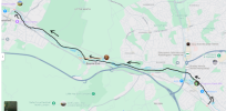
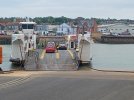
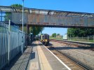
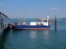
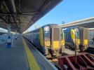
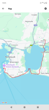
Havant to Portsmouth Harbour, 13 miles. From the station I walked straight onto the old Hayling Billy trail to Langstone, then onto Hayling Island itself, skirting Langstone Harbour all the way to the beach. Over the dunes for a well earned pint while waiting for the Hayling Ferry over to Portsea Island and the city of Portsmouth. Along Eastney beach to Southsea Common then through Old Portsmouth to the Harbour. The ferry to Ryde can wait until tomorrow.

THC
 

Attachments

  • IMG_20250514_114523526.jpg
    IMG_20250514_114523526.jpg
    5 MB · Views: 18
  • IMG_20250514_145426975.jpg
    IMG_20250514_145426975.jpg
    2.7 MB · Views: 10
  • IMG_20250514_164009503_HDR.jpg
    IMG_20250514_164009503_HDR.jpg
    4.3 MB · Views: 18
  • Screenshot_20250514-164612.png
    Screenshot_20250514-164612.png
    426.9 KB · Views: 19

johnnychips

Established Member
Joined
19 Nov 2011
Messages
3,826
Location
Leeds
Congratulations! How long did it take for you to do the full route? And how did you find the route between Pen-Y-Ghent and Whernside, as I always find it to be really boggy.
Apologies for the late reply! It took me ten hours, including half an hour on the summit of Penyghent. The path now is completely ‘solid’ all the way, and I think the boggy bit you refer to has been bypassed. I think this has made it about a mile longer than it was.
 

_toommm_

Established Member
Joined
8 Jul 2017
Messages
6,295
Location
South West London
Apologies for the late reply! It took me ten hours, including half an hour on the summit of Penyghent. The path now is completely ‘solid’ all the way, and I think the boggy bit you refer to has been bypassed. I think this has made it about a mile longer than it was.

That gives me the incentive to go again this summer. Thanks for replying :)
 

THC

Member
Joined
21 Sep 2009
Messages
721
Location
Stuck on the GEML
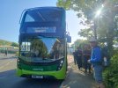
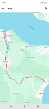
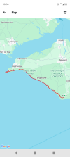
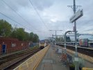
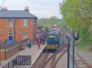
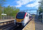
Sandown to Cowes, 14.3 miles - 1/3. Arriving at Sandown on an ex-District line train set the tone for today's walk on two old Isle of Wight railway lines, firstly from Sandown to Newport in the centre of the island, then beside the River Medina to Cowes at its northern tip.
--
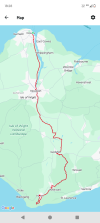
Cowes to Niton, 19.3 miles - 2/3. From the northern tip to the southern point of this lovely island, I retraced yesterday's path from the ferry terminal to Newport before heading up to Godshill. A long pub lunch was perhaps not the best preparation for a climb to Worsley Obelisk and the highest point of the trip so far, but the result was worth it - long views in all directions. Downhill from there to Whitwell and over the downs to Niton, just above the southernmost point, before a climb back to the village centre, from where the coastal path lies in wait for tomorrow.
--
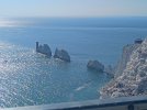
Niton to The Needles, 19.3 miles - 3/3. Today's walk was from the southern tip to the westernmost point of the Isle of Wight along the Coastal Path, including four miles along the beach, deserted for the most part. Back up to the ridge for the descent into Freshwater and then two final climbs, firstly to the Tennyson Monument and then to the last headland, descending to views of The Needles. A suitable end to a stunning day.

THC
 

Attachments

  • IMG_20250515_125753345.jpg
    IMG_20250515_125753345.jpg
    2.2 MB · Views: 12
  • IMG_20250515_181152461.jpg
    IMG_20250515_181152461.jpg
    2.6 MB · Views: 6
  • IMG_20250517_075658117_HDR.jpg
    IMG_20250517_075658117_HDR.jpg
    4.6 MB · Views: 6
  • IMG_20250517_171217769.jpg
    IMG_20250517_171217769.jpg
    3 MB · Views: 7
  • IMG_20250517_180535331_HDR.jpg
    IMG_20250517_180535331_HDR.jpg
    3.7 MB · Views: 12
  • Screenshot_20250515-184543.png
    Screenshot_20250515-184543.png
    309.5 KB · Views: 9
  • Screenshot_20250516-182812.png
    Screenshot_20250516-182812.png
    377.6 KB · Views: 11
  • Screenshot_20250517-180803.png
    Screenshot_20250517-180803.png
    309.2 KB · Views: 12

adc82140

Established Member
Joined
10 May 2008
Messages
3,402
Sandbanks Ferry to Peverill Point at Swanage via the SW coastal path and Ballard Down last Monday. 9 miles. Coincided with Barfleur heading past on its way to Cherbourg, and some shunting at Swanage station while I waited for the Breezer 50 bus back to the car.
 

THC

Member
Joined
21 Sep 2009
Messages
721
Location
Stuck on the GEML
Chelmsford to Audley End, 29.5 miles. North out of Chelmsford along the footpaths and green lanes to Pleshey and a change of direction, north west around the edge of Barnston to Great Dunmow. I walked north out of Dunmow to the parish church, then across fields to Great Easton, past a Rolls Royce and Bentley dealership (there's posh) then onto Tilty and what's left of the abbey. From there I skirted a few villages until the Fleur de Lys at Widdington provided much-needed refreshment, setting me up nicely for the final five miles through Newport and Wendens Ambo to Audley End station. Audley End proper can wait until tomorrow, along with Saffron Walden and the roads less travelled to Cambridge.

THC
 

Attachments

  • IMG_20250531_062155862.jpg
    IMG_20250531_062155862.jpg
    4.6 MB · Views: 7
  • IMG_20250531_165826947.jpg
    IMG_20250531_165826947.jpg
    3.9 MB · Views: 4
  • IMG_20250531_170443708_HDR.jpg
    IMG_20250531_170443708_HDR.jpg
    4.4 MB · Views: 7
  • Screenshot_20250531-171228.png
    Screenshot_20250531-171228.png
    434.1 KB · Views: 7

32475

Member
Joined
2 Nov 2019
Messages
815
Location
Sandwich
Chelmsford to Audley End, 29.5 miles. North out of Chelmsford along the footpaths and green lanes to Pleshey and a change of direction, north west around the edge of Barnston to Great Dunmow. I walked north out of Dunmow to the parish church, then across fields to Great Easton, past a Rolls Royce and Bentley dealership (there's posh) then onto Tilty and what's left of the abbey. From there I skirted a few villages until the Fleur de Lys at Widdington provided much-needed refreshment, setting me up nicely for the final five miles through Newport and Wendens Ambo to Audley End station. Audley End proper can wait until tomorrow, along with Saffron Walden and the roads less travelled to Cambridge.

THC
Great mileage, well done!
 

THC

Member
Joined
21 Sep 2009
Messages
721
Location
Stuck on the GEML
Audley End to Cambridge, 23.5 miles. I picked up where I left off yesterday, heading through Audley End proper (although no sighting of the house) to Saffron Walden - the best place to live in the UK apparently, and it's not hard to see why. A lovely town. Up the downs from Walden then back down through the Chesterfords, then climbing again to the border with Cambridgeshire. Over the watershed and down to Babraham before various cycle paths took me through Shelford and the biomedical campus, past the new Cambridge South station into Cambridge itself. I doubled back at King's College, across Parker's Piece and down Hills Road to the station for the train out again. Chelmsford to Cambridge, 53 miles in two days. Done. Time to go home.

THC
 

Attachments

  • IMG_20250601_152635236.jpg
    IMG_20250601_152635236.jpg
    4.2 MB · Views: 11
  • IMG_20250601_155121727.jpg
    IMG_20250601_155121727.jpg
    2.5 MB · Views: 9
  • IMG_20250601_171130281.jpg
    IMG_20250601_171130281.jpg
    3.7 MB · Views: 11
  • Screenshot_20250601-173003.png
    Screenshot_20250601-173003.png
    505.5 KB · Views: 9

Kite159

Veteran Member
Joined
27 Jan 2014
Messages
22,759
Location
West of Andover
I followed in @THC 's footsteps and walked the next section of the Leicester arm of the Grand Union, starting from North Kilworth (did the section south of that point earlier in the year) with a bus from Market Harbrough. Heading towards Foxton locks before following the Market Harbrough arm into the town.

Two completely different experiences, the first section was heavy rural with the towpath quite dicey in places with erosion and undergrowth making some parts quite narrow. But was very peaceful with some excellent views of the countryside. The Market Harbrough branch was part of a cycle path so the surface was decent but in parts I couldn't see the canal due to reeds alongside the canal bank.

Just Foxton to the Glen Parva area of Leicester and the last section into Leicester which I'm planning to combine with the old railway walk, although I need to research where the Grand Union ends and the river navigation begins.

Also today I did another long section of the Leeds & Liverpool canal, strolling from Skipton towards Shipley, although in hindsight I ought to have bailed at Crossflatts as my feet are telling me I've done too much (especially with a 15 mile walk yesterday as well). Decent towpath and some excellent views of the countryside, although not the quietest as it runs close to the main road. The best part was the section between Bingley & Saltaire which was quiet enough to listen to the birds

Still only leaves 2 more sections to clear the canal :) (Cherry Tree to Adlington & the Rufford branch)
 

THC

Member
Joined
21 Sep 2009
Messages
721
Location
Stuck on the GEML
I followed in @THC 's footsteps and walked the next section of the Leicester arm of the Grand Union, starting from North Kilworth (did the section south of that point earlier in the year) with a bus from Market Harbrough. Heading towards Foxton locks before following the Market Harbrough arm into the town.

Two completely different experiences, the first section was heavy rural with the towpath quite dicey in places with erosion and undergrowth making some parts quite narrow. But was very peaceful with some excellent views of the countryside. The Market Harbrough branch was part of a cycle path so the surface was decent but in parts I couldn't see the canal due to reeds alongside the canal bank.

Just Foxton to the Glen Parva area of Leicester and the last section into Leicester which I'm planning to combine with the old railway walk, although I need to research where the Grand Union ends and the river navigation begins.

Also today I did another long section of the Leeds & Liverpool canal, strolling from Skipton towards Shipley, although in hindsight I ought to have bailed at Crossflatts as my feet are telling me I've done too much (especially with a 15 mile walk yesterday as well). Decent towpath and some excellent views of the countryside, although not the quietest as it runs close to the main road. The best part was the section between Bingley & Saltaire which was quiet enough to listen to the birds

Still only leaves 2 more sections to clear the canal :) (Cherry Tree to Adlington & the Rufford branch)
That stretch of the Grand Union Leicester line is really tough going in places, especially when wet. One of my favourite parts of the canal network, however. Can recommend the walk from Leicester to Loughborough - varied, some interesting features and several good pubs along the way.

I walked the L&L main line over five days back in 2013 as a charity fundraiser but have yet to walk the Rufford or Leigh branches. The first two days from Leeds to Burnley were in blistering sunshine, the next two in constant rain, and I finally dried out walking down the Stanley link into Liverpool on day five. A never to be forgotten experience!

THC
 

Top