StephenHunter
Established Member
How long does it take to do 24 miles? It takes me around four hours to do eight, including lunch.


That took me seven hours and 45 minutes, so marginally over 3mph.How long does it take to do 24 miles? It takes me around four hours to do eight, including lunch.

It has been rebranded. I visited the Wirrall last weekend and walked a small section of the coast path and noticed new signage was in place which is very welcome because the last time I was there the signage was somewhat lacking.I noticed today that the England Coast Path appears to have been rebranded the King Charles III England Coast Path. Is this a belated April Fool’s thing or a case of toadying of the worst kind? No I’m not anti monarchy per se but is this sort of thing really necessary or somebody wanting recognition in the next new year’s honours list?
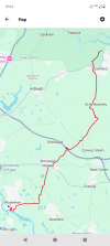
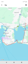
View attachment 177903


I find paper maps rather fiddly to use myself.Although I have an OS Map subscription I love paper maps.
I’m currently planning some walks & cycle rides for a week we are spending at Chelmorton near Buxton in July. I dug out my old, but well used Ordnance Survey Landranger 1:50000 Buxton, Matlock & Dovedale plus the Outdoor Leisure 1:25000 White Peak Area maps.
Imagine my surprise when I realised that Carsington Water wasn’t on either of them! Bearing in mind construction began in 1979 and completed in 1991 it’s time for new maps I think

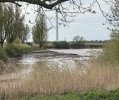


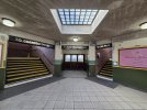


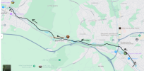


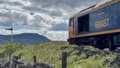
Ingleborough meets Ingleborough!suppose I had to post the obligatory photo at Ribblehead on a rail forum, but this one at Blea Moor is rather special. I wonder if you can work out why…


I was delighted to attempt and complete the Yorkshire Three Peaks yesterday. One of the most enjoyable and challenging walks I’ve ever done at 25 miles and 1800m of ascent.
i got the first train from Leeds to Horton-in-Ribblesdale, arriving 0858, and impulsively made the decision to do the route clockwise Ingleborough, Whernside, Pehyghent, rather than the traditional anti-clockwise route. I think that was wise: the ascent to Ingleborough is not too steep, but the descent is and I am glad I didn’t have to face going up it at the end of the day. I had the summit of Penyghent to myself at 1800 with views over Morcambe Bay and as far as the Scafells.
I suppose I had to post the obligatory photo at Ribblehead on a rail forum, but this one at Blea Moor is rather special. I wonder if you can work out why…
Apologies for the late reply! It took me ten hours, including half an hour on the summit of Penyghent. The path now is completely ‘solid’ all the way, and I think the boggy bit you refer to has been bypassed. I think this has made it about a mile longer than it was.Congratulations! How long did it take for you to do the full route? And how did you find the route between Pen-Y-Ghent and Whernside, as I always find it to be really boggy.
Apologies for the late reply! It took me ten hours, including half an hour on the summit of Penyghent. The path now is completely ‘solid’ all the way, and I think the boggy bit you refer to has been bypassed. I think this has made it about a mile longer than it was.
Good luck!That gives me the incentive to go again this summer. Thanks for replying
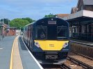
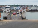
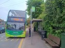
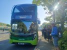
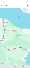
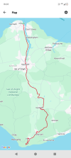
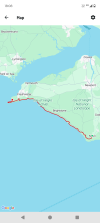
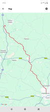
Great mileage, well done!Chelmsford to Audley End, 29.5 miles. North out of Chelmsford along the footpaths and green lanes to Pleshey and a change of direction, north west around the edge of Barnston to Great Dunmow. I walked north out of Dunmow to the parish church, then across fields to Great Easton, past a Rolls Royce and Bentley dealership (there's posh) then onto Tilty and what's left of the abbey. From there I skirted a few villages until the Fleur de Lys at Widdington provided much-needed refreshment, setting me up nicely for the final five miles through Newport and Wendens Ambo to Audley End station. Audley End proper can wait until tomorrow, along with Saffron Walden and the roads less travelled to Cambridge.
THC
(Cherry Tree to Adlington & the Rufford branch)
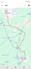
That stretch of the Grand Union Leicester line is really tough going in places, especially when wet. One of my favourite parts of the canal network, however. Can recommend the walk from Leicester to Loughborough - varied, some interesting features and several good pubs along the way.I followed in @THC 's footsteps and walked the next section of the Leicester arm of the Grand Union, starting from North Kilworth (did the section south of that point earlier in the year) with a bus from Market Harbrough. Heading towards Foxton locks before following the Market Harbrough arm into the town.
Two completely different experiences, the first section was heavy rural with the towpath quite dicey in places with erosion and undergrowth making some parts quite narrow. But was very peaceful with some excellent views of the countryside. The Market Harbrough branch was part of a cycle path so the surface was decent but in parts I couldn't see the canal due to reeds alongside the canal bank.
Just Foxton to the Glen Parva area of Leicester and the last section into Leicester which I'm planning to combine with the old railway walk, although I need to research where the Grand Union ends and the river navigation begins.
Also today I did another long section of the Leeds & Liverpool canal, strolling from Skipton towards Shipley, although in hindsight I ought to have bailed at Crossflatts as my feet are telling me I've done too much (especially with a 15 mile walk yesterday as well). Decent towpath and some excellent views of the countryside, although not the quietest as it runs close to the main road. The best part was the section between Bingley & Saltaire which was quiet enough to listen to the birds
Still only leaves 2 more sections to clear the canal