Our new ticketing site is now live! Using either this or the original site (both powered by TrainSplit) helps support the running of the forum with every ticket purchase! Find out more and ask any questions/give us feedback in this thread!
The bit I don't get is spending so much money on an extension to the Cardiff Bay line that doesn't provide a station nearer to Cardiff Bay? The Pierhead St Station seems to be just as far away from the waterfront by The Senedd, and still the wrong side of the busy roads - what am I missing?
Do you want a station by the bay itself (i.e. the waterfront) or a station near where people live, work and visit?
Both the redevelopment of the existing station site and the new station on/next to Pierhead Street will be big improvements for visitors and residents alike. Pierhead St will presumably allow for some kind of queuing system for those leaving the new arena to board the trains and hopefully this is phase one of a south/eastern Cardiff leg of the line.
The alignment from Cardiff Bay station to the new Pierhead seems to be down Docks Lane. Was that the previous route? How will they get through that big building on the corner of Bute Street and Hemingway Road?
Never seen any plans for Roath Dock, still part of the Port of Cardiff as far as I know. Roach Basin has not yet been developed properly, a few failed schemes for housing etc, not sure what the plan is currently.
Maybe a Metro station will create some interest from developers again.
Never seen any plans for Roath Dock, still part of the Port of Cardiff as far as I know. Roach Basin has not yet been developed properly, a few failed schemes for housing etc, not sure what the plan is currently.
Maybe a Metro station will create some interest from developers again.
This is sort of the problem with the extensions really, nearly all of the routes they are propsing is either vacant or unused, or at best industrial which doesn't really lend itself well to public transport use as most of the people working there will be out and about in vans.
I suppose it could be built now and hope developers want to redevelop it later but seems awfully speculative to chose a route on that basis.
This is sort of the problem with the extensions really, nearly all of the routes they are propsing is either vacant or unused, or at best industrial which doesn't really lend itself well to public transport use as most of the people working there will be out and about in vans.
I suppose it could be built now and hope developers want to redevelop it later but seems awfully speculative to chose a route on that basis.
The master plan is to get from the present Cardiff Bay station to the lines serving the Tremorfa steel mill and hence link with the freight line through the residential area of Splott.
£2.7m from the UK government to start the process of adding 5 new stations on the SWML between Cardiff & STJ. Includes Cardiff Parkway which has already been given permission and is currently stuck with the Welsh Government awaiting approval.
Will add a lot of areas to the Metro which currently have no rail provision, if they all come to fruition.
£2.7m from the UK government to start the process of adding 5 new stations on the SWML between Cardiff & STJ. Includes Cardiff Parkway which has already been given permission and is currently stuck with the Welsh Government awaiting approval.
Will add a lot of areas to the Metro which currently have no rail provision, if they all come to fruition.
Of those, I can make a pretty educated guess as to where Magor will be; the area where the station once was is easily visible on Google Maps. TfW could probably get away with platforms on the Relief lines only (in this case, the outer 2 tracks).
Of those, I can make a pretty educated guess as to where Magor will be; the area where the station once was is easily visible on Google Maps. TfW could probably get away with platforms on the Relief lines only (in this case, the outer 2 tracks).
The alignment from Cardiff Bay station to the new Pierhead seems to be down Docks Lane. Was that the previous route? How will they get through that big building on the corner of Bute Street and Hemingway Road?
Apologies if people have seen these before, but they show reasonably clearly what the "previous route" was - well, back in the 1950s or so, anyway! Five tracks to the Bay Station, and a route beyond to the Oval Basin (now Roald Dahl Plass).
From the collections at the National Museum of Wales - if you click on the link and search for "tempest" you will get a list which includes the above images (and many more), and if you search for "soames" you will get others. Check the rights before republishing (note that I've embedded links to the images above rather than attaching them as images).
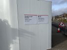
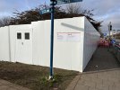
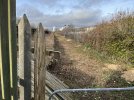
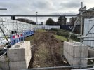
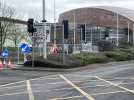
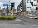
I cycled through Cardiff Bay station area for the first time in a week or so, and there’s a lot more happening: a big site hoarding has gone up between the station and Lloyd George Ave and Hemingway Road. There are also lane closures on Lloyd George Avenue, and signs of some preparatory work for the on-street extension to Pierhead St (note the orange minidigger parked by the Red Dragon Centre). Lots of TfW signage making it clear who is responsible.
== Doublepost prevention - post automatically merged: ==
Extra pics added later:
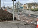
The orange digger has dug a trench in this lane of Lloyd George Ave as it approaches The Flourish. My guess is that this is for utilities diversions.
== Doublepost prevention - post automatically merged: ==
More utilities diversions in Bute Place, behind the Millennium Centre.
So, it looks like they are pressing ahead by going on-street from the present Bay station towards the WMC & Senedd. This area can get pretty jammed up with traffic. Why could they simply not have gone straight across Lloyd George Avenue and then through what is now the soon to be demolished entertainments complex whilst still leaving enough space for the proposed arena? I also think it is regrettable that they built to new Premier Inn when knowing that they wanted to take the Metro through this area could have gone on the derelict land and avoided some street running?
My Image below shows groundwork for the Metro track by the WMC with the new Premier Inn on the left.
So, it looks like they are pressing ahead by going on-street from the present Bay station towards the WMC & Senedd. This area can get pretty jammed up with traffic. Why could they simply not have gone straight across Lloyd George Avenue and then through what is now the soon to be demolished entertainments complex whilst still leaving enough space for the proposed arena? I also think it is regrettable that they built to new Premier Inn when knowing that they wanted to take the Metro through this area could have gone on the derelict land and avoided some street running?
My Image below shows groundwork for the Metro track by the WMC with the new Premier Inn on the left.
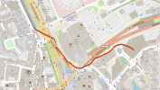
I strongly suspect that roads will be closed to cars where they are used for tram track. I wouldn't take the current groundworks as a guide to the exact route that the track will take, as it's extremely likely that the trenches are being dug to move pipes and cables out of the way before the track is laid, and it makes a lot more sense for those utilities to end up in a traffic lane rather than directly beneath the tram track in case they need to be accessed again for modifications or maintenance. The sketch map provided as part of the recent consultation (sadly now closed and I didn't save a copy of it at the time... d'oh!) suggested that the trams will not continue down Bute Place where the trenches currently are, but instead squeeze through the rough ground adjacent to the road tunnel portal and the multi-storey car park. I've attempted a crude sketch here based on OpenStreetMap.
I suspect that Bute Place will be converted to single carriageway, and quite possibly the southern end of Lloyd George Ave / The Flourish too. That'll remove a lot of conflict between cars and rail vehicles.
EDIT: one other thing - the speed with which this work has begun leads me to think that some of it is utilities diversions that were already planned when the Metro proposal involved a short extension to the Flourish, as funding for the Pierhead St extension has only literally just been confirmed and so they can't have had time to do any design works for it yet! It's quite possible that the eventual route will change to take advantage of the demolition of the Red Dragon Centre, but that someone at TfW decided that it was worth doing the planned utilities works anyway.
Hey sorry if this seems like a silly question/the info can be found in the thread but is there any plans for the Pierhead station in light of the proposed extension?
And would anyone be able to summarise the proposed new stations in Cardiff and potential opening dates, I’ve been trying to keep up but feel I have missed some/some appear to be mothballed
Hey sorry if this seems like a silly question/the info can be found in the thread but is there any plans for the Pierhead station in light of the proposed extension?
And would anyone be able to summarise the proposed new stations in Cardiff and potential opening dates, I’ve been trying to keep up but feel I have missed some/some appear to be mothballed
- Pierhead Street is intended to serve the Millennium Centre and the new arena on the Red Dragon Centre site. It's going to be on the patch of undeveloped land between the Premier Inn and Caspian Point. Beyond that, I've seen no sketches or anything.
- Butetown station (the final name will be chosen later - this is a "working title") is going to be on the Bay branch line, adjacent to Lloyd George Avenue and roughly level with where Maria St and Vellacott Close are. (EDIT - works on this are starting soon, initial ground surveys have been done)
- Gabalfa station is almost certainly happening but I'm not sure exactly where it'll be yet
- Crwys Road station is definitely happening but no works have started on the ground yet
All the others (Ely Mill, another station in the Heath/Roath area, all the various new stations on the main line proposed in the Burns Report) are not as yet formally proposed and funded. But I'm happy to be corrected if other people know better.
== Doublepost prevention - post automatically merged: ==
So, it looks like they are pressing ahead by going on-street from the present Bay station towards the WMC & Senedd. This area can get pretty jammed up with traffic. Why could they simply not have gone straight across Lloyd George Avenue and then through what is now the soon to be demolished entertainments complex whilst still leaving enough space for the proposed arena? I also think it is regrettable that they built to new Premier Inn when knowing that they wanted to take the Metro through this area could have gone on the derelict land and avoided some street running?
My Image below shows groundwork for the Metro track by the WMC with the new Premier Inn on the left.
I cycled through Cardiff Bay again this evening and the construction work on The Flourish and Bute Terrace turns out to be... district heating. There are large-bore insulated pipes being laid, so it's probably unrelated to TfW's works. Here's a press release - the heat will come from the massive Viridor incinerator plant and the heat will be used to serve the Senedd.
Any extension work past Cardiff Bay station would need detailed plans and planning permission. The current planning consent ends at the current station.
I'd hope to see the next stage progress quicker than the current project, which is a year or decades behind, depending on your view of it. The Cardiff Council leader, Huw Thomas, has said it will proceed "at pace". At what pace remains to be seen.
The Vridor rubbish incinerator should never have been placed in a built up area. Smoke from it can often be seen and when we have high pressure, temperature inversion traps the pollution. So much for having ‘free' heat!
I see a lot of works equipment in a compound on the south side of Callaghan Square. Wonder if that has anything to do with the now funded Metro link between the Bay Line and the south side of Central station? Anyone know what route this link will take?
It's not actually in what most Cardiffians would refer to as Gabalfa. It's in Mynachdy between Mynachdy Road and the railway.
TBF Mynachdy in in the Gabalfa ward while, confusingly, the Gabalfa council estate isn't! It's another example on the ever shifting boundaries of Cardiff suburbs. Let's not get started on where Canton is or isn't!
I thought that when they double tracked the City Line curve south of the Canton depot that all would be well. Apparently this not the case as the City Line will continue to be limited to one train every 30 minutes - which is appalling for an urban railway serving densely populated west Cardiff plus having trains from the valleys. It means that full benefit of all the money spent electrifying the system via Radyr is not being realised. As this area is under Network Rail - they should get on and sort out this bottleneck as a top priority.
I thought that when they double tracked the City Line curve south of the Canton depot that all would be well. Apparently this not the case as the City Line will continue to be limited to one train every 30 minutes - which is appalling for an urban railway serving densely populated west Cardiff plus having trains from the valleys. It means that full benefit of all the money spent electrifying the system via Radyr is not being realised. As this area is under Network Rail - they should get on and sort out this bottleneck as a top priority.
The last service diagram I saw said that the City Line service would be trains looping through the city in both directions - so Pontypridd-Radyr-Queen St-Central-Fairwater-Radyr-Pontypridd and vice versa, every 30 minutes in each direction. I suspect that part of the reason the service isn't being enhanced further is lack of capacity elsewhere (e.g. at Central and Queen St).
I do strongly suspect that the City Line will eventually be served by additional services running onto the newly-funded tramway between Central and the Bay (via a ramp down from the mainline embankment into the existing car park) as this avoids the need to find additional platform capacity on the main line at Central. So the City Line stations would have 2tph via Central and Queen St and perhaps 4 tph to Central (EDIT - this'd be Central's new low-level tramway platforms) and the Bay. But that's purely speculation on my part.
The area by the WMC was annouced as an extension only a few weeks ago. Has a route been agreed and planning permission secured etc? This all seems to be happening very quickly if so. Is it not unconnected road/highway works?
The area by the WMC was annouced as an extension only a few weeks ago. Has a route been agreed and planning permission secured etc? This all seems to be happening very quickly if so. Is it not unconnected road/highway works?
MikePJ in post 333 above suggests that I was incorrect in suggesting that it is Metro work and that it was to insert an underground heating system for the WMC and proposed Arena using waste heat from the nearby rubbish incinerator. Goodness knows if it is Metro related?
We are aware of an issue with emails from the Forum to Microsoft-based email accounts (hotmail/outlook/live.com email addresses). This is being looked into currently, thanks for your patience meanwhile.