• Our new ticketing site is now live! Using either this or the original site (both powered by TrainSplit) helps support the running of the forum with every ticket purchase! Find out more and ask any questions/give us feedback in this thread!

"Naming-and-maps" query

Status
Not open for further replies.

Calthrop

Established Member
Joined
6 Dec 2015
Messages
3,689
One discovers frequently, the great and various number of subjects knowledge and expertise of which can be found among participants on RailUKforums. I have some hopes, thus, that someone might shed light on the following -- admittedly rather abstruse -- matter which has aroused curiosity.

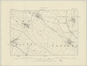
A thing which I happened on recently, in the course of a "general knowledge"-type game. I chanced to discover, shown on various maps, a clearly natural stream of quite substantial length (some ten miles), in the pleasant hilly country east of Leicester: rising near Knossington close to the Rutland border, and running basically west-to-north-west to join larger streams; passing en route through Twyford and Ashby Folville. No map seemed, however, to mark this stream with a name: not even -- to my surprise -- the Ordnance Survey "one-inch-to-one-mile" one. (Googling furnished no help, either.) The confluence of waters after about ten miles or so of the nameless stream, comes in quite quick succession. Our stream flows into another of -- from the map -- about the same magnitude but of lesser length, coming up from the south-east; which has a name on the map: the Queniborough Brook. A mile or so west of this confluence, the Queniborough Brook joins the River Wreake, flowing from the north-east; a couple of miles further west, the Wreake in turn joins the River Soar, which flows through Leicester.

I can't recall having ever previously encountered map-wise, a natural watercourse of such relative substance: which was not shown at least on the OS as above, with a proper name -- if not "River", then "Brook / Beck / whatever". My question is: is it commoner -- let's say, in the more populated parts of England -- than I'd imagined, for there to be natural streams (even quite long ones, as with the one in question here: ten miles or so), which do not have an officially-recognised name, and are shown nameless even on quite large-scale maps?
 
Sponsor Post - registered members do not see these adverts; click here to register, or click here to log in
R

RailUK Forums

Mcr Warrior

Veteran Member
Joined
8 Jan 2009
Messages
17,165
Is this the Brook that flows in due course through Twyford? Believe it's known as the 'Gaddesby Brook' and is shown as such on 1:25000 scale OS maps.
 

Calthrop

Established Member
Joined
6 Dec 2015
Messages
3,689
That's the one: a few miles downstream from Twyford, and after passing through the mentioned Ashby Folville -- it flows just to the south of the village of Gaddesby and its Hall. I'm just surprised that the OS -- normally pretty obsessive about sticking names onto everything -- refrains from name-labelling this particular stream.
 

Mcr Warrior

Veteran Member
Joined
8 Jan 2009
Messages
17,165
I'm just surprised that the OS -- normally pretty obsessive about sticking names onto everything -- refrains from name-labelling this particular stream.
Just to re-confirm that the brook is named on the 1:25000 scale OS map.

Link below to post on Geograph website, double click and then zoom in on the accompanying OS map extract.


Calthrop

Established Member
Joined
6 Dec 2015
Messages
3,689
Many thanks, people -- I tend to be archaic and kind-of informationally-challenged. Still a bit surprised that the "inch-to-mile" (have just discovered that the relevant one in my possession, is effectively prehistoric -- 1962 !) fails to name-label it; but, I suppose, errors / omissions / anomalies anywhere, are frequent enough.
 

Gloster

Veteran Member
Joined
4 Sep 2020
Messages
12,943
Location
Up the creek
All sorts of maps are available on the National Library of Scotland website: try googling NLS maps . A bit fiddly to use the first time, but once you have got used to it there is an awful lot of interest to find. For instance, I recently sorted out a couple of queries about Bovey Tracey’s track plan using it. There is not, unfortunately, complete coverage in some scales, but it is pretty good. (If an incompetent technophobe like me can work out how to use it, anyone can.)
 

Calthrop

Established Member
Joined
6 Dec 2015
Messages
3,689
Thanks for above counsel -- if the stodgy old "one-inch" or its newer equivalent, fail one: other options available, I learn !
 

Mcr Warrior

Veteran Member
Joined
8 Jan 2009
Messages
17,165
To be fair, had a look at an old Victorian era (six inch to the mile scale) map of the area on the NLS website and couldn't see the "Gaddesby Brook" so named, even although its course straddled from one side of the map sheet to the other, maybe it's one of those quirks that has persisted over many years / many map editions.


Calthrop

Established Member
Joined
6 Dec 2015
Messages
3,689
To be fair, had a look at an old Victorian era (six inch to the mile scale) map of the area on the NLS website and couldn't see the "Gaddesby Brook" so named, even although its course straddled from one side of the map sheet to the other, maybe it's one of those quirks that has persisted over many years / many map editions.


Many thanks for the reproduction provided, of said map from "way back when". I have somewhere in my dwelling, a "passed down in family" one-inch-to-mile OS sheet dating from the very early 20th century, including that very area (we had family connections thereabouts, a bit further northward); however -- a bit of a complicated tale -- it has always been (unlike comparable others which we have) just on the basic paper: no linen-or-similar backing -- so it's in ruinous condition, essentially split into many pieces along its folds: I had those pieces collected in an envelope, awaiting planned reassembly (sticking the pieces on to a "master sheet", envisaged) -- but have no idea just at this present, where I've put said envelope ! When it eventually comes to light, I'll look with interest at the "Gaddesby Brook": in the light of our general findings and as per your post, I expect it most likely, to lack a name.
 

eMeS

Member
Joined
12 Jun 2011
Messages
954
Location
Milton Keynes, UK
I have a pile of old OS maps - a few 1" to 1 mile - and if you look at them somewhat aimlessly, anomalies are soon spotted, but I've rarely had a problem when using them "for real".
 

Calthrop

Established Member
Joined
6 Dec 2015
Messages
3,689
I'm weird -- fascinated by maps lifelong, but a rather sedentary sort: do a lot more general dreaming over them, than using them "for real" :smile: !
 

Gloster

Veteran Member
Joined
4 Sep 2020
Messages
12,943
Location
Up the creek
I love maps and can spend hours looking at them or working out mental challenges (What’s the largest round trip I could make on this sheet while keeping to A- and B-Roads?) I also have a habit of building imaginary railways which should be both technically possible and not too economically implausible. Yesterday’s purchase was Carmarthen and Tenby (One-inch, Sheet 152), which has a lot of sea, so Laugharne got a branch. (Would D.T. have been happy in having a railway in his dominion?)
 

Calthrop

Established Member
Joined
6 Dec 2015
Messages
3,689
I've been creating imaginary railways, hand-in-hand with perusing maps, since early-ish childhood; often totally without considerations of technical possibility or economic plausibility ! (Started a thread prompted by this virtually lifelong fancy of mine, on Railway History and Nostalgia a few years ago.) Have often felt moved, thus to supply to England and the southern half of Wales, public narrow gauge lines / systems in the "classic" mould; to supplement the regrettably few of such which they actually had in genuine history ("Our Time-Line", as the alternative-history buffs say).
 

Calthrop

Established Member
Joined
6 Dec 2015
Messages
3,689
Thanks -- Gaddesby Brook indeed labelled as such thereon (name shown a little way south-east of Ashby Folville). The linked-to excerpt also shows, labelled with its name, a stretch of our brook's confluent (if that is a word) Queniborough Brook, as mentioned in my OP.

A different, but to me interesting, matter brought up by the linked-to excerpt: with its plainly showing the abandoned course of the old LNW / Great Northern Joint rail line between Market Harborough and Melton Mowbray and further north, running north / south. Stretch of line on map excerpt, includes the site of its station which bore the intriguing name of John O'Gaunt. The map excerpt would seem to suggest that at a road junction a short way west of the station site, there is a hamlet of John O'Gaunt, labelled with the name. However, on my 1960s "inch-to-mile" map -- showing the rail route as a dashed-line "Track of old railway" -- the only indication of the name John O'Gaunt is a very small wood labelled "John O'Gaunt (Fox Covert)", immediately south of the triangular formation where the Leicester Belgrave Road branch diverged westward from the north / south route. All very trivial in the great general scheme of things; but of interest, if one is the kind of person who finds such stuff interesting !
 

Mcr Warrior

Veteran Member
Joined
8 Jan 2009
Messages
17,165
The ever reliable Wikipedia suggests that the former John O' Gaunt station, near Twyford in Leicestershire, was indeed named after the covert in the vicinity.

Station closed to passengers in 1953 and to goods traffic in 1962, I understand.

Noted that the afore-mentioned Gaddesby Brook is the watercourse that flows under the 60 foot high, now disused, John O'Gaunt viaduct, just to the South of the former station site.

The covert itself is located about a mile and a third South of the old station.
 

Gloster

Veteran Member
Joined
4 Sep 2020
Messages
12,943
Location
Up the creek
The Wikipedia article on Burrough Court (modern spelling) gives a useful reference (British History Online) which also refers to the covert being the source of the name. Although there are several Twyfords it is odd they didn’t use Burrow on the Hill as the station name, unless they thought it would be confused with Harrow on the Hill.

Of incidental interest, the now lost Burrough Court was where the Prince of Wales first met Mrs Simpson. Well, even a national disaster must start somewhere.
 

MotCO

Established Member
Joined
25 Aug 2014
Messages
6,084
I'm weird -- fascinated by maps lifelong, but a rather sedentary sort: do a lot more general dreaming over them, than using them "for real" :smile: !
I love maps and can spend hours looking at them
I also enjoy looking at maps - particularly old and new maps side by side to see how roads and towns have developed. Is there a natural association between having an interest in maps and an interest in transport?
 

Mcr Warrior

Veteran Member
Joined
8 Jan 2009
Messages
17,165
Apparently when the station was opened in 1879, it was originally known as Burrow and Twyford, after the two villages in the area. The amended name of John O' Gaunt (post 1883?) wouldn't have meant too much to folk outside the local area. Burrough Court, just to the East of the station, was built in 1906 but burnt down in 1944.

The vested interests of the Leicestershire fox hunting lobby was reflected in the 1874 Act that authorised the building of the Great Northern & London & North Western Joint Railway line through the area, stipulating that certain fences in the vicinity of the line only be built so high, so as to not to impede the progress of the hunt.
 

Calthrop

Established Member
Joined
6 Dec 2015
Messages
3,689
The ever reliable Wikipedia suggests that the former John O' Gaunt station, near Twyford in Leicestershire, was indeed named after the covert in the vicinity.

Station closed to passengers in 1953 and to goods traffic in 1962, I understand.

Noted that the afore-mentioned Gaddesby Brook is the watercourse that flows under the 60 foot high, now disused, John O'Gaunt viaduct, just to the South of the former station site.

The covert itself is located about a mile and a third South of the old station.
The Wikipedia article on Burrough Court (modern spelling) gives a useful reference (British History Online) which also refers to the covert being the source of the name. Although there are several Twyfords it is odd they didn’t use Burrow on the Hill as the station name, unless they thought it would be confused with Harrow on the Hill.

Of incidental interest, the now lost Burrough Court was where the Prince of Wales first met Mrs Simpson. Well, even a national disaster must start somewhere.

I find all this, highly interesting: am fascinated by that particular part of the country (long reckoned "foxhunters' heaven", as per your latest @Mcr Warrior [which appeared during my composition of this post]) -- grew up relatively close to the area, but have seen little of it first-hand -- and the delightful "hybrid" LNW / GN secondary rail system which served it. Wiki would seem to inform me that John O'Gaunt now qualifies as a "locality", rather than a village or hamlet as such; and that -- as above -- it got its name from the former station, which as we learn was named after the covert. (It occurred to me to wonder how that woodland feature came by the said name -- which one feels has got to be that of the medieval political / military figure, scion of Royal Family, John of Gaunt, 1340 -- 99: but I've found no clue on the Net, as to "how come".)

Referring again to my 1960s OS map (it's never before had such intensive use, since coming into my possession !) -- I've been noting the places mentioned: including Burrough [OS's spelling] on the Hill, not hitherto on my radar; and per the map, seemingly a hamlet of Burrough Court, just south-west of the village, and adjacent thereto, Burrough Court Farm -- but, as we learn, no country house any more. Re your latest, @Mcr Warrior -- I'd been wondering what strange mental processes on the part of the LNW / GN led them to name the station after the fox covert; and it had originally been Burrow / Burrough & Twyford -- ??? (Tony Dewick's Complete Atlas of Railway Station Names -- usually very informative and precise about different names held at different times -- indeed gives those earlier, and later, versions of the station's name.)

I also enjoy looking at maps - particularly old and new maps side by side to see how roads and towns have developed. Is there a natural association between having an interest in maps and an interest in transport?

My bolding -- in my experience of fellow-enthusiasts: the interests go together often, but by no means always ...
 

MotCO

Established Member
Joined
25 Aug 2014
Messages
6,084
in the 1874 Act that authorised the building of the Great Northern & London & North Western Joint Railway line through the area, stipulating that certain fences in the vicinity of the line only be built so high, so as to not to impede the progress of the hunt.
So fences along the railway had to be be built low so that horses could jump over them, straight onto the track?
 

Mcr Warrior

Veteran Member
Joined
8 Jan 2009
Messages
17,165
So fences along the railway had to be be built low so that horses could jump over them, straight onto the track?
Yep. That's the impression that I got from my reference source, namely...

"The Railway Haters: Opposition To Railways, From the 19th to 21st Centuries"​

By David L. Brandon, Alan Brooke. (2019)

Presumably when the railway was initially being promoted, the proposed line would have cut across long established fox hunting circuits operated by the likes of the Quorn Hunt in that part of rural Leicestershire.
 

Ediswan

Established Member
Joined
15 Nov 2012
Messages
3,416
Location
Stevenage
So fences along the railway had to be be built low so that horses could jump over them, straight onto the track?
Be wary of judging by modern standards. In 1874, when that act was passed, we were still using small children as chimney sweeps. (That came to an end in 1875.)
 

Mcr Warrior

Veteran Member
Joined
8 Jan 2009
Messages
17,165
Indeed. Would imagine that the Quorn Hunt was extremely influential and well connected, and certainly not outside the bounds of possibility for them to have given instructions that whatever railway traffic there was be suspended whilst the hunt was in operation.
 

Ediswan

Established Member
Joined
15 Nov 2012
Messages
3,416
Location
Stevenage
Indeed. Would imagine that the Quorn Hunt was extremely influential and well connected, and certainly not outside the bounds of possibility for them to have given instructions that whatever railway traffic there was be suspended whilst the hunt was in operation.
Plus, we are not talking about some old nags escaping their field. These would be expensive hunters, with their owners in the saddle. The hounds don't come cheap either. It seems reasonable to assume that some procedure would have been put in place to reduce the risk of a collision.
 

Gloster

Veteran Member
Joined
4 Sep 2020
Messages
12,943
Location
Up the creek
Indeed. Would imagine that the Quorn Hunt was extremely influential and well connected, and certainly not outside the bounds of possibility for them to have given instructions that whatever railway traffic there was be suspended whilst the hunt was in operation.
Even in the early 1980s such attitudes persisted. I was on early turn one day in a signal box on the West of England mainline when an elderly gentleman came into the box. He was dressed like an archetypal huntin’, shootin’ and fishin’ type: tweed hacking jacket, roll-neck pullover, jodhpurs and what looked like well-polished riding boots. He may have had a flat cap, but he didn’t have a whip. In appeared he had a rather ruddy appearance, white hair and one of those flamboyant RAF-style moustaches that had seen better days and where the white is tinged with yellow.

He said that in a day or two The Hunt would be out in a rather vague area around five to ten miles of the line and could trains run slowly so that they could stop if it was on the line. It was not so much a tentative question or an arrogant demand, but rather as if he considered it a perfectly reasonable request which would be immediately agreed to. He was a bit put out when I referred to the Divisional Manager’s Office, but said they would almost certainly turn him down, and also when I warned him that the hunt should not trespass on the railway.
 

Mcr Warrior

Veteran Member
Joined
8 Jan 2009
Messages
17,165
According to "Lost Lines - Joint Railways" by Nigel Welbourn (2010 edition), John O'Gaunt station apparently once saw special trains, "for spectators, huntsmen and horses" so the hunt was obviously an important event in the area.

Doesn't specify when this was exactly, though! :s
 
Status
Not open for further replies.

Top