
One discovers frequently, the great and various number of subjects knowledge and expertise of which can be found among participants on RailUKforums. I have some hopes, thus, that someone might shed light on the following -- admittedly rather abstruse -- matter which has aroused curiosity.
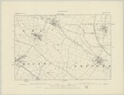
A thing which I happened on recently, in the course of a "general knowledge"-type game. I chanced to discover, shown on various maps, a clearly natural stream of quite substantial length (some ten miles), in the pleasant hilly country east of Leicester: rising near Knossington close to the Rutland border, and running basically west-to-north-west to join larger streams; passing en route through Twyford and Ashby Folville. No map seemed, however, to mark this stream with a name: not even -- to my surprise -- the Ordnance Survey "one-inch-to-one-mile" one. (Googling furnished no help, either.) The confluence of waters after about ten miles or so of the nameless stream, comes in quite quick succession. Our stream flows into another of -- from the map -- about the same magnitude but of lesser length, coming up from the south-east; which has a name on the map: the Queniborough Brook. A mile or so west of this confluence, the Queniborough Brook joins the River Wreake, flowing from the north-east; a couple of miles further west, the Wreake in turn joins the River Soar, which flows through Leicester.
I can't recall having ever previously encountered map-wise, a natural watercourse of such relative substance: which was not shown at least on the OS as above, with a proper name -- if not "River", then "Brook / Beck / whatever". My question is: is it commoner -- let's say, in the more populated parts of England -- than I'd imagined, for there to be natural streams (even quite long ones, as with the one in question here: ten miles or so), which do not have an officially-recognised name, and are shown nameless even on quite large-scale maps?
A thing which I happened on recently, in the course of a "general knowledge"-type game. I chanced to discover, shown on various maps, a clearly natural stream of quite substantial length (some ten miles), in the pleasant hilly country east of Leicester: rising near Knossington close to the Rutland border, and running basically west-to-north-west to join larger streams; passing en route through Twyford and Ashby Folville. No map seemed, however, to mark this stream with a name: not even -- to my surprise -- the Ordnance Survey "one-inch-to-one-mile" one. (Googling furnished no help, either.) The confluence of waters after about ten miles or so of the nameless stream, comes in quite quick succession. Our stream flows into another of -- from the map -- about the same magnitude but of lesser length, coming up from the south-east; which has a name on the map: the Queniborough Brook. A mile or so west of this confluence, the Queniborough Brook joins the River Wreake, flowing from the north-east; a couple of miles further west, the Wreake in turn joins the River Soar, which flows through Leicester.
I can't recall having ever previously encountered map-wise, a natural watercourse of such relative substance: which was not shown at least on the OS as above, with a proper name -- if not "River", then "Brook / Beck / whatever". My question is: is it commoner -- let's say, in the more populated parts of England -- than I'd imagined, for there to be natural streams (even quite long ones, as with the one in question here: ten miles or so), which do not have an officially-recognised name, and are shown nameless even on quite large-scale maps?



 !
!