YorksLad12
Established Member
Na then,
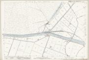
This is probably one for current or former Lincolnshire residents. I've been doing some double-checking and tidy-ups of my Yorkshire Stations map while I'm not working and have the time to devote to it. According to Wikipedia, Medge Hall (and it's associated Halt) are in Lincolnshire, on the former GC route from Thorne South towards Crowle.
However: using the NLS side-by-side map and selecting 1830-1880s county layers suggests that "Midge" Hall is just in Yorkshire, and that the county boundary is along what looks like a drain that crosses Chapel Road, a bit further to the east.
Long shot, perhaps, but... anyone have a clue where the country boundary was?
This is probably one for current or former Lincolnshire residents. I've been doing some double-checking and tidy-ups of my Yorkshire Stations map while I'm not working and have the time to devote to it. According to Wikipedia, Medge Hall (and it's associated Halt) are in Lincolnshire, on the former GC route from Thorne South towards Crowle.
However: using the NLS side-by-side map and selecting 1830-1880s county layers suggests that "Midge" Hall is just in Yorkshire, and that the county boundary is along what looks like a drain that crosses Chapel Road, a bit further to the east.
Long shot, perhaps, but... anyone have a clue where the country boundary was?