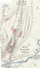
This extract (coutesy of the National Library of Scotland) from the OS 25" map of 1886, surveyed in the two previous years, may be of interest. It shews the new station in use, with details of some of the permanent platforms and what look like some temporary platform sections, but the old junction still in place. The start of the quadrupling works can be seen further to the north. Even at this scale, it is clear how the modification of the layout to create the two independent routes built in the severe reverse curve for the Midland.