Hi,
Here are the route options I though of. I've already posted a link to this first bit but here are some notes to go with it.
Assumptions
■The East Midlands station will be at the Toton yard
■The route will branch from the main allignment of HS2
Here are two ideas, each rather different.
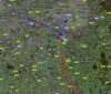
The black line is the published route of HS2.
Red Route
Leaves HS2 and curves around to the east of the National Arboretum
Crosses the existing tracks and then is built alongside the current Tamworth to Derby line on the east side
Would need a flyover/diveunder for the Burton-Leicester line junction
Burton station would get demolished and rebuilt on a slightly different allignment
Willington suffers a bit as the extra tracks are forced through
The line curves to the east, crosses the River Trent and runs parallelish to the A50
It continues eastwards, over the river, and follows the existing freight tracks through Castle Donnington
It then curves northwards as it crosses the M1 and crosses the River at Trentlock
There needs to be a flyover to get through/over Trent Junction and then it goes up the Erewash Valley line through Long Eaton to Toton
This is a very flat route with no major civil engineering apart from a number of river crossing bridges. There seem to be no tunnels needed.
Blue Route
Leaves HS2 just after the Birmingham delta junction
It runs just to the North (West) of the M42
Bit of a squeeze past Tamworth - may need to alter the motorway services to fit it in
Then alongside the M42 & A42 on the west side tto Measham
Across the A42 where it wiggles amd then up to Ashby on the east of the A42
Over the Leicester - Burton line and then use the short existing unused track stub
Past the villages of Newbold & Worthington using a much straighted allignment of the disused Derby - Ashby route and use this under the A42 and through the village of Tonge
Tunnel under East Midlands Airport which emerges near the M1 Junction 24 (Wouldn't an underground Airport station be nice?
Over the M1 and curve into an allignment to go through to Toton as the red route
This route seems shorter and whilst requiring more earthworks has one tunnel and far fewer river bridges than the red route. I suspect something like this is the preferred route
--- old post above --- --- new post below ---
Assumptions
■The East Midlands station will be at the Toton yard
■The Sheffield station will be at Meadowhall
The red and blue lines are the basic ideas. The pink section is an alternative route for part of the red route and the purple section is where it could join a part blue and part red route
Here are two ideas, each with a different focus.
Common bits
Leaves Toton yard and heads North. Will probably need a new faster allignemnt rather than follow the current Erewash valley line
The river bridge would also cross the current line, near the existing junction, and end up with the HS line on the east of the existing tracks
Red Route
This would follow the exising track past Ilkeston
The HS line would use a new faster allignment past Eastwood and then would need to be located carefully through the nature reserves built on the old industrial land
At / near the Midland Railway centre junction it would cross the existing tracks and again cross back south of Alfreton
There would probably need to be a short tunnel here
It continues northwards, curving slightly to avoid the villiage of Pisley
It then goes to the west of Holmewood
As it crosses the A617 it picks up the route of the Great Central Railway and, with some curve easing follows that past Arkwright Town to Staverly
In Staverly it uses the route of the new road which itself was built on the GCR allignment. A new replacement road will be needed
It reaches just to the west of Rensihaw - all options are the same from here northwards
Pink Alternative Route The route from Holmewood to Rensihaw is a bit curvey using the old GCR allignment. A straighter one could be considered.
As it crosses the A617 it would take a more easterly route
This would pass through the Staverly Country Park and use the existing, disused, Bolsover colliery route through the town.
Blue Route
This would diverge from the existing track and pass to the east of Eastwood through the undeveloped gap (near the Ikea store)
It runs just to the west of Newgate Priory (probably need a green tunnel her to ger away with this)
The village of Selston is in the way - a tunnel is probably the answer which can alsp pass under the M1
As it reaches the A38 and the outlet shopping mall it would follow somethingn close to the old GCR route for a mile or so
A gentle curve take it due north to the east of the M1
Opps - Harwick Hall grounds are in the way. A full or green tunnel may solve this
It passes to the west of Bolsover and crosses the M1 where the existing, disused colliery branch does
It then goes to the east of Staverly to Rensihaw
Purple Alternative Route The Hardwick Hall bit may be too tricky to get away with. It could be avoided.
From the A38 the route could head northwest past the Tibshelf motorway services
It could go through the village of Tibshelf on something similar to the old GCR allignment through it and then join the red route south of Holmewood
Common bits
From Renishaw head north using old abandoned allignemnts - there are plenty of them
Follow the freight only route to the east of the Orgreave opencast mine
The old disused route into Tinsley yard has far too sharp curves. A tunnel or flyover will be needed to cross the freight line and for the village of Catcliffe
It then runs along the east side of the old Tinsley yard
There are some warehouses and factories in the way - these would need to be demolished and replaced elsewhere
The station would be parallel to the M1, probably above the SuperTram track, next to Meadowhall shopping centre and it could easily be intergrated with the existing stations


 and I've come up with some more ideas. Here's my speculation about the Leeds HS2 station.


