• Our new ticketing site is now live! Using either this or the original site (both powered by TrainSplit) helps support the running of the forum with every ticket purchase! Find out more and ask any questions/give us feedback in this thread!

Dorchester South

Status
Not open for further replies.

LorryF

Member
Joined
22 Dec 2024
Messages
12
Location
dorchester
I am so interested in Dorchester South. I am looking at old ordnance survey maps and there was a single platform on Prince of Wales Road and Monmouth Road. The single platform on Prince of Wales has been removed. What was this platform used for as it’s away from main railway station and always has been. I know Culliford Bridge is totally different shape than it used to be and was changed by 1955, did the railway board or county council change this bridge that supports cars driving over it, and can I find out what year it was done and why. i am searching internet and British Newspaper Archives without any luck
 
Sponsor Post - registered members do not see these adverts; click here to register, or click here to log in
R

RailUK Forums

The exile

Established Member
Joined
31 Mar 2010
Messages
9,455
Location
Somerset
IIRC the platform you mention was the main station and trains in one direction (can’t remember which) had to reverse in or out. Whatever it was, it was a very strange arrangement and the current main station is a relatively modern addition.
 

jupiter

Member
Joined
9 May 2021
Messages
340
Location
Dorset
The Southern were due to carry on towards Exeter but stopped, presumably a temporary lack of funds. In the meantime the Western built south towards Weymouth and wouldn't let the Southern cross their metals any further west. A compromise was reached and the line at Dorchester takes a tight turn south to join the Western line to Weymouth. The station moved back up the line and today exists on a tight curving track.
 

Western Lord

Member
Joined
17 Mar 2014
Messages
1,065
Although a southbound platform on the curve was built in 1878, Weymouth to Bournemouth trains had to reverse into the terminal platform until 1970.
 

Gloster

Veteran Member
Joined
4 Sep 2020
Messages
13,039
Location
Up the creek
The line from the east was built by the Southampton & Dorchester Railway and there were closely plans by the closely related London & Southampton Railway (which took over the S&D in 1848) to continue the line to Exeter, so the original station wa laid out with this intention in mind. Once other lines became the preference for Exeter the idea was abandoned, but once a line from the north was built through Dorchester to Weymouth a short connection was built round to this. However, until 1970, when an Up platform on the curve was opened, Up trains from Weymouth to east of Dorchester had to reverse into the old platform to serve Dorchester: the platform on the curve that allowed Down trains to continue to Weymouth without reversal opened in 1879.
 

alf

On Moderation
Joined
1 Mar 2021
Messages
427
Location
Bournemouth
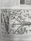
Here’s a map from the Scottish National library collection, that illustrates how easy it would have been to turn north from the Dorchester terminal platform, and join the ex-GWR line to Yeovil, and then direct to Exeter, using an existing earthwork to relay a north to west chord at Yeovil junction.
 

Attachments

  • 386BEA84-BE81-4963-9199-1EBF51220A6E.jpeg
    386BEA84-BE81-4963-9199-1EBF51220A6E.jpeg
    1.1 MB · Views: 35
Last edited by a moderator:

LorryF

Member
Joined
22 Dec 2024
Messages
12
Location
dorchester
This is a separate platform slightly down track from main Dorchester South’s stations platform. I think it could be a platform to walk across railway line to other side as Culliford Bridge a lot thinner previously. Did people walk across railway tracks historically.
 

Gloster

Veteran Member
Joined
4 Sep 2020
Messages
13,039
Location
Up the creek
This is a separate platform slightly down track from main Dorchester South’s stations platform. I think it could be a platform to walk across railway line to other side as Culliford Bridge a lot thinner previously. Did people walk across railway tracks historically.

By ‘down track’ do you mean towards Weymouth, which is the Down direction in railway parlance?

On the north side of the line there was a dock, a short platform, just on the Wareham side of the Culliford Road bridge. I presume that this was a Horse or Milk Dock. Quite near the station on the north side of the line in the old goods yard, although set back from the line, there was a Cattle Dock.

Yes, people did walk across the line, but unlike in many, even most, countries British railways are fenced off, so they shouldn’t have done so except at the indicated foot crossings, which normally had ballast (the stones that lie under the rails and sleepers to keep them in place and drained) up to the level of the top of the rails or timber decking.
 

30907

Veteran Member
Joined
30 Sep 2012
Messages
21,980
Location
Airedale
I have checked the online 1:2500 maps and the most recent (1970) shows what looks like the Dock mentioned by Gloster. It doesnt show on the much earlier 25" maps (the last is 1929).
 

Gloster

Veteran Member
Joined
4 Sep 2020
Messages
13,039
Location
Up the creek
The Dock does appear on the 1901 and 1928 25” maps, although not marked as a platform, but not on the 1886 one.
 

Snow1964

Established Member
Joined
7 Oct 2019
Messages
11,213
Location
West Wiltshire
A real oddity was the agreement to use the GWR line to Weymouth, which at the time was broad gauge.

GWR agreed to install mixed gauge provided the same distance the other way from Dorchester junction was converted, so there was for a while broad gauge running for about 7 miles through Dorchester South to a bit of heathland. Unclear if it was ever used.
 
Status
Not open for further replies.

Top