LorryF
Member
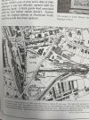
I am so interested in Dorchester South. I am looking at old ordnance survey maps and there was a single platform on Prince of Wales Road and Monmouth Road. The single platform on Prince of Wales has been removed. What was this platform used for as it’s away from main railway station and always has been. I know Culliford Bridge is totally different shape than it used to be and was changed by 1955, did the railway board or county council change this bridge that supports cars driving over it, and can I find out what year it was done and why. i am searching internet and British Newspaper Archives without any luck