The opening shot in
this video shows a skew arch that seems to have been built either for a road or a railway line: this has intrigued me ever since I first saw it some years back.
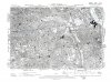
This map shows the bridge abutments, at 73/18, by the dog kennels (today the rubbish incinerator, the big white building in the film clip). As far as I know, no line ever went through this arch: I've not seen anything on any map.
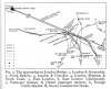
If it were built for a projected railway line, then where was the line going? At the west end, it would have come off the line coming from Bricklayers Arms and Willow Walk (the southern-most two lines on the six-track viaduct on the map) a little to the west of the map boundary, but this would have meant crossing the East London lines to Peckham (lifted when this map was published) and the west side of New Cross Gate on the flat roughly at 65/23: that's very unlikely. Going south-eastwards, it leads towards the line from the Surrey Docks to New Cross Gate and the South London Line, joining it at around 76/02: this would have allowed a direct if circuitous connection from the latter to the goods depots.
I doubt if it was built for a road: only major roads had this sort of bridge, and there was nowhere for a major road to go here. Minor roads went through the standard viaduct arches.