• Our new ticketing site is now live! Using either this or the original site (both powered by TrainSplit) helps support the running of the forum with every ticket purchase! Find out more and ask any questions/give us feedback in this thread!

What has happened to the no longer used railway lines?

Joined
11 Sep 2026
Messages
7
Location
Luton
The line between Luton and Dunstable has been converted to a busway while part of the line to Leighton Buzzard is made into a road.

What has happened to the other disused railway lines?

Thank you.
 
Sponsor Post - registered members do not see these adverts; click here to register, or click here to log in
R

RailUK Forums

ANDREW_D_WEBB

Member
Joined
21 Aug 2013
Messages
1,007
Location
London
Various things:
  • preservation projects
  • rebuilt as railways (e.g. Borders Railway)
  • rebuilt as tramways (e.g. parts of the Croydon Tram)
  • Built over for housing / industry / commerce
  • Sold (back) to farmers
  • Converted to cycle paths or footpaths
  • Left abandoned to rust and / or be visited by metal thieves
 

The exile

Established Member
Joined
31 Mar 2010
Messages
9,503
Location
Somerset
Various things:
  • preservation projects
  • rebuilt as railways (e.g. Borders Railway)
  • rebuilt as tramways (e.g. parts of the Croydon Tram)
  • Built over for housing / industry / commerce
  • Sold (back) to farmers
  • Converted to cycle paths or footpaths
  • Left abandoned to rust and / or be visited by metal thieves
At least one tunnel was at one point in use as a shooting range (Devizes), while IIRC others have housed mushroom farms.
 

InvernessTMD

Member
Joined
7 Aug 2022
Messages
145
Location
Central Scotland
Left abandoned to rust and / or be visited by metal thieves
Do you know of any lines in Scotland in this state? I've always fancied "urban exploring" but it mostly seems to amount to breaking and entering disused buildings. An abandoned railway line sounds like an interesting day out!
 

Lucan

Established Member
Joined
21 Feb 2018
Messages
1,265
Location
Wales
Catesby Tunnel in Northamptonshire, 3000 yards long on the closed Great Central, is now used as a test track for road vehicles. It has the advantages of having no wind in regard to aerodynamic testing, and also of secrecy for prototypes.
 

AlterEgo

Verified Rep - Wingin' It! Paul Lucas
Joined
30 Dec 2008
Messages
29,716
Location
LBK
The line between Luton and Dunstable has been converted to a busway while part of the line to Leighton Buzzard is made into a road.

What has happened to the other disused railway lines?

Thank you.
Goodness me, how long have you got? There's about 13,000 miles of disused railway. Is there a specific one you have in mind?
 

ANDREW_D_WEBB

Member
Joined
21 Aug 2013
Messages
1,007
Location
London
Isn't the old Woodhead Tunnel used for high voltage cables?
Aldwych branch and the Green Park to Charing Cross section of the Underground are both used as film sets as required
 
Joined
11 Sep 2026
Messages
7
Location
Luton
Goodness me, how long have you got? There's about 13,000 miles of disused railway. Is there a specific one you have in mind?
As much time allows. In terms of specifics nothing as such. Maybe the most notable disused railway lines and the most interesting repurposing of them.
 

WesternLancer

Veteran Member
Joined
12 Apr 2019
Messages
15,445
I'd suggest by mileage the majority of disused lines are just there in the landscape, slowly going / gone back to nature - probably sold back to adjacent landowners in many cases but still a feature if you know what to look for - depending on the nature of the farmland and how easy it is to do they can end up cleared and ploughed back (common in flat landscapes) but often embankments and cuttings are just there to see.

Something I find interesting is to look at old Ordnance Survey (OS) maps where disused lines, where they are a distinguishable landscape feature, are marked on the maps. Streetmap.co.uk gives free access to small sections of maps - but the easiest thing is to go to a charity shop and buy a few old OS maps which are usually dirt cheap (c£1 or less in my experience) and find the lines - the older the map edition the better - post beaching era - as the lines were more likely to be clear on the land and thus justify being mapped - so OS maps from the late 1960s / 1970s and 1980s usually have plenty of old lines you can clearly follow - as we get closer to today the lines are less distinct so you can see parts of their routes them get gradually removed from the maps - or get OS maps of different editions from an area where you live from different time periods and compare - again pretty cheap from charity shops or on e-bay

as an example - here's a bundle of various 1960s OS maps from Oxfam on line - 12 for £15 +p&p - but better to go to a local charity shop and then you can look to see ones that show what you are looking for before splashing out with your loose change :D


OP could also look at the Railway Ramblers website too


Disused Stations website shows old maps around closed stations on closed lines which of course gives a clear indication of where lines one were - and they always include an OS map snippet too

 
Last edited:
Joined
11 Sep 2026
Messages
7
Location
Luton
I'd suggest by mileage the majority of disused lines are just there in the landscape, slowly going / gone back to nature - probably sold back to adjacent landowners in many cases but still a feature if you know what to look for - depending on the nature of the farmland and how easy it is to do they can end up cleared and ploughed back (common in flat landscapes) but often embankments and cuttings are just there to see.

Something I find interesting is to look at old Ordnance Survey (OS) maps where disused lines, where they are a distinguishable landscape feature, are marked on the maps. Streetmap.co.uk gives free access to small sections of maps - but the easiest thing is to go to a charity shop and buy a few old OS maps which are usually dirt cheap (c£1 or less in my experience) and find the lines - the older the map edition the better - post beaching era - as the lines were more likely to be clear on the land and thus justify being mapped - so OS maps from the late 1960s / 1970s and 1980s usually have plenty of old lines you can clearly follow - as we get closer to today the lines are less distinct so you can see parts of their routes them get gradually removed from the maps - or get OS maps of different editions from an area where you live from different time periods and compare - again pretty cheap from charity shops or on e-bay

as an example - here's a bundle of various 1960s OS maps from Oxfam on line - 12 for £15 +p&p - but better to go to a local charity shop and then you can look to see ones that show what you are looking for before splashing out with your loose change :D


OP could also look at the Railway Ramblers website too


Disused Stations website shows old maps around closed stations on closed lines which of course gives a clear indication of where lines one were - and they always include an OS map snippet too

Thank you. I will take look.
 

edwin_m

Veteran Member
Joined
21 Apr 2013
Messages
28,774
Location
Nottingham
The most unusual one I can think of is a section near the eastern end of the old Oxford-Cambridge line, used for a radio telescope.
 

Magdalia

Established Member
Joined
1 Jan 2022
Messages
7,443
Location
The Fens
part of the line to Leighton Buzzard is made into a road.
There is a current discussion here on roads on former railways:


The line between Luton and Dunstable has been converted to a busway
Chesterton Junction-St Ives is a longer example.

And part of it is a foot/cycle path.

Chesterton Junction-St Ives also has a cycleway.

Bishops Stortford-Braintree is now mostly the Flitch Way.


Flitch Way​

Enjoy 15 miles of flat, traffic free, beautiful Essex countryside following a former railway line from Braintree to Bishops Stortford. Perfect for walking, cycling and horse riding.
 

Sun Chariot

Established Member
Joined
16 Mar 2009
Messages
6,780
Location
2 miles and 50 years away from the Longmoor Milita
Various things:
  • preservation projects
  • rebuilt as railways (e.g. Borders Railway)
  • rebuilt as tramways (e.g. parts of the Croydon Tram)
  • Built over for housing / industry / commerce
  • Sold (back) to farmers
  • Converted to cycle paths or footpaths
  • Left abandoned to rust and / or be visited by metal thieves
Not forgetting many lines have in entirety (e.g. Par Harbour to Fowey) or in part, been converted to public road or private-haul road.
 

ox_chap

Member
Joined
7 Jun 2026
Messages
100
Location
Oxfordshire
How about the track coming off the mainline, just before it passes into Box Tunnel, ran into what is always suggested to have been a major nuclear bunker. The original line was used to remove limestone, and it then played a role during the Second World War. There's a wikipedia page available to read.
 

John Webb

Established Member
Joined
5 Jun 2010
Messages
3,788
Location
St Albans
Isn't the old Woodhead Tunnel used for high voltage cables?....
It was the old tunnels originally, but as soon as the Woodhead line closed completely in 1981, the CEGB rerouted the cables through the 1953 tunnel as it was in a much better condition than the 1845/52 single bore tunnels.
 

Mcr Warrior

Veteran Member
Joined
8 Jan 2009
Messages
17,331
It was the old tunnels originally, but as soon as the Woodhead line closed completely in 1981, the CEGB rerouted the cables through the 1953 tunnel as it was in a much better condition than the 1845/52 single bore tunnels.
The third Woodhead tunnel was indeed re-used by National Grid plc for re-routing a number of their high voltage electricity cables (between Longdendale and Dunford Bridge). This was late 2000s / early 2010s (so not immediately after line closure in the 1980s).
 

DelW

Established Member
Joined
15 Jan 2015
Messages
6,054
Some lines just disappear into the landscape with the track still in-situ.

This is Google's 2011 view of the Trawsfynydd branch in Blaenau Ffestiniog, a little way beyond the current end of the Conwy Valley line. It doesn't look too bad apart the large bush on the left:
Screenshot_20260911-215038_Maps.jpg
(image of slightly overgrown railway)

but turn through 180° and it looked very different:
Screenshot_20260911-215106_Maps.jpg
(image of very overgrown railway)

It's a while since I've been there, but I assume it'll be much more overgrown by now.

Despite the then-extant warning signs, I doubt if anyone has been in much danger "trespassing" there for a good many years.
 

edwin_m

Veteran Member
Joined
21 Apr 2013
Messages
28,774
Location
Nottingham
Two useful sites where one can easily spend hours seeing what happened to disused railway lines:

https://www.railmaponline.com/uk-and-irish-railways: shows pretty much every railway that ever existed, on a variety of mapping backgrounds including modern maps.

https://maps.nls.uk/: has a range of out-of-copyright maps including some very large scale ones, which can be displayed side by side or superimposed on modern mapping or aerial photographs.

Both of these are location-enabled so will show your exact position on the map if opened on a smartphone.
 

Jim the Jim

Member
Joined
18 Dec 2020
Messages
280
Location
Cambridge
There can be a lot of variation even on a short stretch of line. After branching off the Ely line, the first section of the old Cambridge to Mildenhall line goes through a dirt track, a tarmacked cycle track, overgrown fenced off land, gardens, houses, more tarmacked paths, a woodland path, and trees between fields, all within about a mile and a half. The fact that it used to be a single continuous rail route is no longer obvious on the ground at all.
 

Rescars

Established Member
Joined
25 May 2021
Messages
2,606
Location
Surrey
Some routes (or bits of them) have lasted a very long time. Parts of the Croydon Merstham and Godstone are still in use as footpaths, access to garages and it seems also a little piece as a vineyard. The CM&G closed in 1838!
 

6PAN

Member
Joined
22 Aug 2026
Messages
42
Location
Hampshire
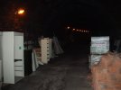
Chesil tunnel, Winchester, on the former Didcot, Newbury and Southampton line has been divided into two. The north end is home to a shooting range while the southern end is used by the local council to store building materials, office furniture and spare wheely bins.
 

Attachments

  • P6180224.JPG
    P6180224.JPG
    1.1 MB · Views: 15

KHCT

Member
Joined
17 Sep 2025
Messages
141
Location
East Yorks
The 25m deep cutting at Little Weighton on the Hull & Barnsey was used as a landfill for building waste. There's actually been quite a fuss locally over recent years about plans to expand it further along the (very deep) cutting.
 

Fenchurch SP

Member
Joined
11 Jan 2021
Messages
211
Location
Merstham
Some routes (or bits of them) have lasted a very long time. Parts of the Croydon Merstham and Godstone are still in use as footpaths, access to garages and it seems also a little piece as a vineyard. The CM&G closed in 1838!
Bit nitpicky but the vineyard is either side of the former railway cutting.
 

Tester

Established Member
Joined
5 Jul 2020
Messages
1,743
Location
Watford
I'm a big walker of disused railway lines. I have done hundreds of them, and am nowhere near running out!

My recommended resources are:

1. The National Library of Scotland side-by-side maps referred to upthread. Typically with the O.S. 1:10,000/10,560 1949-1975 map on the left, showing as was, and either Open Street Map or Google Satellite on the right, showing as is now.

2. The Mapfactor Navigator sat-nav app. Free and works offline, this is remarkably good at showing walkable disused railway lines.

Enjoy!
 

6PAN

Member
Joined
22 Aug 2026
Messages
42
Location
Hampshire
The old Fallowfield Loop Line runs at the bottom of the road I live on
Is that Brailsford Road by any chance? I lived there in the 1970s when the line was still open and it ran right behind the house. I actually got to travel on it one Sunday when Oxford Road to Warrington trains were diverted that way due to engineering work.
 

rmHawk765

Member
Joined
8 Apr 2025
Messages
783
Location
ECML South
I guess the old Thameslink lines to Moorgate count as 'no longer used' - while now blocked off, the track is still mostly there and if I remember correctly Hidden London does tours down there sometimes. It's not the only disused line in London, others have mentioned similar cases.

The one nearest to me is probably the old Welwyn-Hertford line which is now mostly a nice walking path (which is also part of the National Cycle Network).
 

Scouseinmanc

Member
Joined
7 Jan 2009
Messages
183
Location
Manchester
Is that Brailsford Road by any chance? I lived there in the 1970s when the line was still open and it ran right behind the house. I actually got to travel on it one Sunday when Oxford Road to Warrington trains were diverted that way due to engineering work.
Very near to what was Wilbraham Rd station
 

Top