aron2smith
Member
I was on a Greater Anglia train recently and looked at the network map in the corner of the carriage, under Cambridge South, I remember it saying 'Opening June 2026'.

Yep. Although it triggered me the maps were all the wrong way around; given the train never changes which way it faces, they could have stuck it by the other door so that London on the map is towards the London end of the trainI was on a Greater Anglia train recently and looked at the network map in the corner of the carriage, under Cambridge South, I remember it saying 'Opening June 2026'.
I commute on the London to cambridge route 4 days per week. Quite a few trains have been saying that! Not sure what's gone wrong in their systems but it always raises some eyebrows when it comes up!My daughter was on a Cambridge to Liverpool Street train the other day that indicated on the internal displays that the first stop after Cambridge would be Cambridge South, which created a certain amount of confusion!

Yes the conductors are asking the drivers of 755 operated services through Cambridge to delete the South from the PIS.My daughter was on a Cambridge to Liverpool Street train the other day that indicated on the internal displays that the first stop after Cambridge would be Cambridge South, which created a certain amount of confusion!
Can’t they just use the PIS code they used before Xmas, that’s what GN are doingYes the conductors are asking the drivers of 755 operated services through Cambridge to delete the South from the PIS.
No we use our headcode as normal and then delete Cambridge South.Can’t they just use the PIS code they used before Xmas, that’s what GN are doing
Yeah you’ll always get the odd driver who doesn’t but it’s very straightforward. I used to enjoy editing the schedules. Control can also do it remotely.So every driver has to manually edit this for every run? Oof, no wonder it's being missed/forgotten/ignored by some drivers, especially if running late. Wow!
"This train will be stopping additionally at Corrour"Yeah you’ll always get the odd driver who doesn’t but it’s very straightforward. I used to enjoy editing the schedules. Control can also do it remotely.
Now that wouldn’t be possible as it’s not cleared for ASDO"This train will be stopping additionally at Corrour"

A minor detail!!Now that wouldn’t be possible as it’s not cleared for ASDO


 www.bbc.co.uk
Walkers and cyclists will be unable to use a bridge on a guided busway for two months while safety fencing is being installed.
The bridge, between the Cambridge Biomedical Campus and Trumpington, will also be closed in one direction for buses, with diversion routes put in place.
The closure is part of Cambridgeshire County Council's work to install safety fencing between the busway track and the shared pathway running alongside it.
It agreed to install the permanent fencing and barriers after it was fined £6m following the deaths of three people on the Busway.
The safety works are due to take place between March and May, as reported by the Local Democracy Reporting Service.
Why? Wouldn't it be advantageous if the station opened before these works start, as the station can then be an alternative point to cross the railway close to the temporarily closed one?Update here on closure of the busway bridge for safety fences to be installed.
Hopefully this will be completed before the station opens.
No. The station footbridge will be platform side of the barrier line, and it would be overwhelmed by the amount of traffic, especially cycles.Wouldn't it be advantageous if the station opened before these works start, as the station can then be an alternative point to cross the railway close to the temporarily closed one?

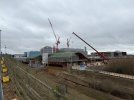
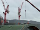
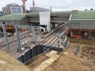
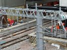
Thank you for another great set of pictures. I went through it yesterday and the platforms are looking pretty much ready.Here are some photos from this morning. The busway path closes in a couple of days so these are likely the last for a while.
Lots of work to the landscaping and streetscape now, plus looks like the lawn is being laid on the roof today.

The south end bridge only spans what are currently the down lines, and is the emergency evacuation route from the central island platforms 2 and 3 into Hobsons Park. My understanding is that it is for evacuation only.From plans I can see there is also a secondary/emergency footbridge at the southern end, will this be open in normal service or just when the main footbridge?
So basically July? Is it any wonder people have given up and bought new cars?The station will open on 28th June (2026!)
Very harsh. If folks have done that then it's their own fault....So basically July? Is it any wonder people have given up and bought new cars?
People in Winslow are already trading theirs in for new models!So basically July? Is it any wonder people have given up and bought new cars?
Yup - these were visible!Went through yesterday - and the platform name boards were being erected on platform 1
It looks like the emergency egress route is separate from the bridge, which does indeed only span the down lines. At the moment it appears the the bridge may be open for regular use, but I can imagine it will be of limited appeal. It is also possible barriers will appear prior to opening.The south end bridge only spans what are currently the down lines, and is the emergency evacuation route from the central island platforms 2 and 3 into Hobsons Park. My understanding is that it is for evacuation only.
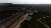
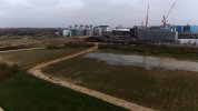
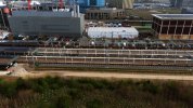
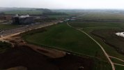
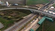
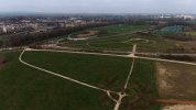
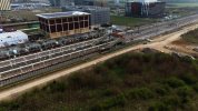
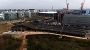
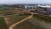
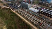
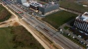
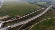
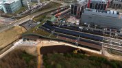
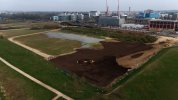
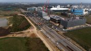
I'm not convinced! I don't see anywhere at the south end for barriers in your pictures.It looks like the emergency egress route is separate from the bridge, which does indeed only span the down lines. At the moment it appears the the bridge may be open for regular use, but I can imagine it will be of limited appeal. It is also possible barriers will appear prior to opening.
As far as I'm aware there is still no official announcement of the opening date.So basically July?
I'm excited for this station to open, but I'm slightly worried by the fact that the main footbridge is at the north end, same as at Cambridge station, meaning that everyone will want to be at that end of the train to change or exit, same as at Cambridge. From plans I can see there is also a secondary/emergency footbridge at the southern end, will this be open in normal service or just when the main footbridge is closed?
It's a "Secondary Means of Evacuation" footbridge, specifically there to give people on the island platform a second way out in an emergency. It crosses to platform 4 only where passengers will then have a small walk along platform 4 to the emergency exit.The south end bridge only spans what are currently the down lines, and is the emergency evacuation route from the central island platforms 2 and 3 into Hobsons Park. My understanding is that it is for evacuation only.
Indeed. The official line, as per https://www.networkrail.co.uk/our-w...he-railway-in-anglia/cambridge-south-station/, is "Cambridge South station is expected to open for public use in June 2026."As far as I'm aware there is still no official announcement of the opening date.

Thanks, presumably that means anyone going north could use it to change from the island platform to the other northbound platform (and vice-versa)?It's a "Secondary Means of Evacuation" footbridge, specifically there to give people on the island platform a second way out in an emergency. It crosses to platform 4 only where passengers will then have a small walk along platform 4 to the emergency exit.
The bridge will be open and available for use by anyone normally. There will be no gates or barriers and it does have lighting.
Wouldn't that just encourage fare evasion? Anyone without a ticket could go this way if there are no barriers.The bridge will be open and available for use by anyone normally. There will be no gates or barriers and it does have lighting.
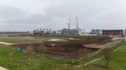
Looks like they're in the process of restoring this. Original path looks pretty clear now, and the farmland they were using is having soil put back.Does anyone know when the cycle path will be reinstated to its original route under the Addenbrooke's Road bridge?