• Our new ticketing site is now live! Using either this or the original site (both powered by TrainSplit) helps support the running of the forum with every ticket purchase! Find out more and ask any questions/give us feedback in this thread!

Walking and Rambling discussion

bspahh

Established Member
Joined
5 Jan 2017
Messages
2,414
Whistles, do walkers still carry whistles, and know how to use them ? On the various "mountain rescue" TV shows, casualties are shown shouting for help, shining torches, using mobile phones, never (that I recall) using a whistle.
I've got a Lowe Airzone backpack which has a whistle in the buckle for the chest strap, and instructions on how to use the whistle and arm signals to wave at a helicopter on the inside of the lid.

I don't know if I'm the target audience though, as the text is too small for me to read without reading glasses ;)
 
Sponsor Post - registered members do not see these adverts; click here to register, or click here to log in
R

RailUK Forums

johnnychips

Established Member
Joined
19 Nov 2011
Messages
3,822
Location
Leeds
Before my summer break, I managed to walk the River Wharfe from its confluence with the Ouse at Cawood as far as Otley. I’ve just finished the rest of it, and am celebrating with a £1.99 pint of Harvester Stout in the Spoons at Otley.

You may have gathered I have not walked it in order or in the same direction. Here are the legs I did subsequently:

1. Took the DalesBus 875 from Leeds to Buckden, and walked down the valley to Grassington. Really pleasant, some road walking on quiet lanes. I took a rest in Conistone church and glanced up at a memorial to six cavers who died in the nearby Mossdale Cavern in 1967. I had never heard of this (I was only six at the time). I read up on it and found that they are still buried there. A man in the pub in Grassington said he knew about it: it was just totally freak weather. It touched me a lot.

2. The source of the Wharfe is officially at Beckermonds, but that is at the confluence of two streams. The source of one, Oughtershaw Beck, could theoretically be reached by taxi up the hill from Hawes, but then I realised the other, Greenfield Beck, could be reached by walking over the hill from Horton in Ribblesdale, so I took the first train. It was a great walk, I hardly saw anyone and finished at Hubberholme in a rainstorm. I visited the church, which is breathtaking in its simplicity. On to the Buck Inn at Buckden for a pint and the 875 back to Leeds.

3. Once more on the 875 to Grassington. The week before there had been a ‘beach’ by the bridge; today it was in full flow. This was a good portent for The Strid, where basically the river turns sideways. It is about 2.5m wide and 60m deep. It did not disappoint and it is easy to see why the survival rate for those who fall in is zero. From Bolton Abbey it rained steadily but the heavens opened as I got to The Fleece in Addingham. At £6.50 for a pint of Peroni, maybe it deserves its name.

4. So today I got the 874 to Addingham. The walk to Ilkley is fine along the river, but then to follow it closely basically means the main road, so I headed north to some gusty hills and am now in Otley. The sole of my boot semi-detached itself halfway round but thankfully held up.

The whole Wharfe walk cost about £40 with public transport, and whoever invented the DalesBus network needs a medal. Next river is the Nidd, and I need to get its source in before the winter timetable kicks in as it will involve a steep walk from Kettlewell to Great Whernside. The photo shows The Strid. You can get much closer on the west side, but I didn’t know that.


IMG_3550.jpeg
 
Last edited:

StephenHunter

Established Member
Joined
22 Jul 2017
Messages
2,895
Location
London
More adventurous than canal walking!
I walked along the Grand Union Canal when I walked back from Hack Green Nuclear Bunker to Nantwich. I had a close encounter with four sheep, who decided to stand in rather close proximity to the path through the field.


Four sheep standing in a green field, behind a gate.
 

John Webb

Established Member
Joined
5 Jun 2010
Messages
3,746
Location
St Albans
I walked along the Grand Union Canal when I walked back from Hack Green Nuclear Bunker to Nantwich.......
Surely the Shropshire Union Canal? The Grand Union runs between London and Birmingham!

.....Next river is the Nidd, and I need to get its source in before the winter timetable kicks in as it will involve a steep walk from Kettlewell to Great Whernside.....
I know Nidderdale well, having had a number of holidays there over the years. It's much quieter than the main part of the Dales; apparently during the formation of the Dales National Park, Bradford had it excluded due to their various reservoirs. But it is given AONB (Area of Outstanding Natural Beauty) status and well deserves it.
There are still traces in the upper part of the Nidd Valley Light Railway, built to serve the building of Angram and Scarhouse reservoirs, most notably at grid reference SE099765 (where there is a Carpark marked on the OL30 OS Explorer Map North and Central Yorkshire Dales); it is a blocked-up tunnel. Once South and East of Lofthouse there is less trace of the railway - only on the E side of Gouthwaite Reservoir does the public footpath use the trackbed to any degree.
 
Last edited:

johnnychips

Established Member
Joined
19 Nov 2011
Messages
3,822
Location
Leeds
Thanks for your observations, @John Webb The line of the railway on the map seems quite distinct in the Scar House area, and I was surprised it hadn’t been used as a footpath as similar disused tracks have. Perhaps it’s overgrown? This Sunday I could walk from Kettlewell over Great Whernside to Scar House, or do it the other way: the bus times make both a possibility. I am tending towards the former to get the climbing out of the way, but would welcome any advice, especially on the terrain between Nidd Head and the start of the reservoir.
 

John Webb

Established Member
Joined
5 Jun 2010
Messages
3,746
Location
St Albans
Thanks for your observations, @John Webb The line of the railway on the map seems quite distinct in the Scar House area, and I was surprised it hadn’t been used as a footpath as similar disused tracks have. Perhaps it’s overgrown? This Sunday I could walk from Kettlewell over Great Whernside to Scar House, or do it the other way: the bus times make both a possibility. I am tending towards the former to get the climbing out of the way, but would welcome any advice, especially on the terrain between Nidd Head and the start of the reservoir.
From Lofthouse to Scar House the Light Railway ran up the side of the access road that still leads up there and which leads to the car park and public toilets close to Scar House reservoir's dam. Also the site of the workers' 'village' of which there are significant traces.
I've never been up to the top end of Angram Reservoir and can't comment on the lie of the land from there to Nidd Head. The map contours suggest a steep descent becoming less steep as the reservoirs are approached. No footpaths marked on that area - possibly a relic of the attempt by Bradford to ensure the minimum risk of water contamination when the reservoirs were in use?
 

THC

Member
Joined
21 Sep 2009
Messages
717
Location
Stuck on the GEML
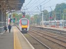
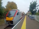
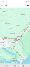
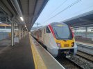
Ipswich to Campsea Ashe (Wickham Market), 21 miles - part one of the East Suffolk Line walk. I started at Ipswich station and headed along the waterfront, then up through the town and Christchurch Park, taking care to avoid the Parkrun masses before passing through what will become the new Garden Suburb. From there I took a diversion through Westerfield before crossing a ridge to Tuddenham St Martin, picking up the Fynn Valley path to Playford, Little Bealings and the edge of Martlesham. I turned along the creek to the River Deben, which took me round Woodbridge and a pint stop aboard a ship, then on to Melton. From there I headed uphill of sorts to Ufford, crossing a much smaller Deben to end up at Campsea Ashe for Wickham Market station and the train home.

THC
 

Attachments

  • IMG_20251011_084153162.jpg
    IMG_20251011_084153162.jpg
    2.2 MB · Views: 3
  • IMG_20251011_135349436.jpg
    IMG_20251011_135349436.jpg
    3.8 MB · Views: 2
  • IMG_20251011_160449556.jpg
    IMG_20251011_160449556.jpg
    5 MB · Views: 4
  • Screenshot_20251011-155846.png
    Screenshot_20251011-155846.png
    555.8 KB · Views: 4

Killingworth

Established Member
Joined
30 May 2018
Messages
6,430
Location
Sheffield
The newly launched Steel Cotton Rail Trail, station to station from Sheffield to Manchester may be too easy for serious walkers, although the sections between Dore and Grindleford and from Edale to Chinley require a little more effort.

There's a dedicated website with downloadable leaflets for each section, see; https://peakdistrictbytrain.org/the-steel-cotton-rail-trail/ Some very contrasting scenery along the way.

20250703_173027.jpg

This trail can be combined with many other walks from each station. An example might be the Sheffield Round Walk starting at Dore, see; https://www.welcometosheffield.co.uk/media/0rhffgob/sheffield-round-walk.pdf

I recently saw a small group from Manchester starting that with a good value hotel booked in Sheffield on a Sunday night half way.
 
Last edited:

Kite159

Veteran Member
Joined
27 Jan 2014
Messages
22,709
Location
West of Andover
I ended up walking the recently (last few weeks I think) opened Lichfield - Brownhills Greenway today, linking up with the path which continues towards Walsall along the route of the former South Staffordshire line. Says something when it's so new Google maps still shows it as a railway!

A solid path with only a couple areas of mud, however some areas was like walking on loose ballast which hopefully will settle in as it gets more use. Quite nice as it runs alongside the part restored Lichfield canal at the Lichfield end. The footbridge at the site of the disused Hammerwich station was unusual, as was an old level crossing complete with old signal box.
 

johnnychips

Established Member
Joined
19 Nov 2011
Messages
3,822
Location
Leeds
Three weeks ago, I caught the Dalesbus 875 from Leeds to Kettlewell to access the source of the Nidd by first climbing Great Whernside. It was a great walk on a lovely sunny day. The decision to follow the Nidd down from its actual source, rather than take a path above it was a mistake: tussocks and bogs. I went head over heels twice and up to my knee once. And the sole half came off my boot again. I was very relieved to attain the path next to Angram and Scar House reservoirs (now both looking much fuller). The 862 bus to Otley from Scar House had thirty passengers on board - it is great these services are so popular and useful.

Today, lacking boots, I got the Dalesbuses to Ilkley then Malham, and chose a route along minor roads and tracks to Kilnsey. The weather forecast was wrong and I got rather wet. To make matters worse the pub in Kilnsey was closed, possibly permanently, so I had to while an hour sheltering under Kilnsey Crag, which thoughtfully has a huge overhang. Dalesbus two miles to Kettlewell to a pub with a fire, then back to Leeds. Despite it being grotty weather, patronage on all the buses was good.

The photo shows my broken boot and the nascent River Nidd.
IMG_0308.jpeg
 

Iskra

Established Member
Joined
11 Jun 2014
Messages
10,663
Location
West Riding
Today, I did a ten miler from Burbage Bridge, across Stanage Edge to Bamford edge. It was misty most of the way but thankfully the clouds parted to give us some views of Ladybower. The paths weren’t too muddy and it was good exercise and a nice easy winters walk. There’s a little coffee/cake van at Burbage bridge which warmed us up. We just got back to the car and the rain started, so perfect timing!IMG_3437.jpegIMG_3425.jpegIMG_3427.jpegIMG_3430.jpeg
 

Tester

Established Member
Joined
5 Jul 2020
Messages
1,656
Location
Watford
I ended up walking the recently (last few weeks I think) opened Lichfield - Brownhills Greenway today, linking up with the path which continues towards Walsall along the route of the former South Staffordshire line. Says something when it's so new Google maps still shows it as a railway!

A solid path with only a couple areas of mud, however some areas was like walking on loose ballast which hopefully will settle in as it gets more use. Quite nice as it runs alongside the part restored Lichfield canal at the Lichfield end. The footbridge at the site of the disused Hammerwich station was unusual, as was an old level crossing complete with old signal box.
That's one for the list - thank you!
 

Railwaycat

Member
Joined
15 Jul 2023
Messages
277
Location
Derbyshire
Today, I did a ten miler from Burbage Bridge, across Stanage Edge to Bamford edge. It was misty most of the way but thankfully the clouds parted to give us some views of Ladybower. The paths weren’t too muddy and it was good exercise and a nice easy winters walk. There’s a little coffee/cake van at Burbage bridge which warmed us up. We just got back to the car and the rain started, so perfect timing!View attachment 192006View attachment 192007View attachment 192008View attachment 192009

Great views.

Does that walk take you near Marjery Hill? I normally go looking for Mountain Hares on Bleaklow, but I was doing a bit of research recently and it appears they are present in an area around Marjery Hill, although Bleaklow is probably more easily accessible, as it doesn't need much of a climb.
 
Joined
22 Jan 2024
Messages
588
Location
Yorkshire
Three weeks ago, I caught the Dalesbus 875 from Leeds to Kettlewell to access the source of the Nidd by first climbing Great Whernside. It was a great walk on a lovely sunny day. The decision to follow the Nidd down from its actual source, rather than take a path above it was a mistake: tussocks and bogs. I went head over heels twice and up to my knee once. And the sole half came off my boot again. I was very relieved to attain the path next to Angram and Scar House reservoirs (now both looking much fuller). The 862 bus to Otley from Scar House had thirty passengers on board - it is great these services are so popular and useful.

Not been up to Scar House and Angram since late August - at that time they were the lowest I have ever seen them, especially Scar House. Went to Thruscross round about the same time and that was pretty low too - part of the former village of West End was visible, with the foundations of the church just appearing out of the water.
 

Iskra

Established Member
Joined
11 Jun 2014
Messages
10,663
Location
West Riding
Great views.

Does that walk take you near Marjery Hill? I normally go looking for Mountain Hares on Bleaklow, but I was doing a bit of research recently and it appears they are present in an area around Marjery Hill, although Bleaklow is probably more easily accessible, as it doesn't need much of a climb.
Thank you. No, this time we came from the South and walked from Burbage bridge, along Stanage Edge and over Bamford moor. I have been up Bleaklow before, and the clue is definitely in the name… We stumbled upon a hare when hiking to the B29 crash site I believe, so they are definitely present in the area.
 

Railwaycat

Member
Joined
15 Jul 2023
Messages
277
Location
Derbyshire
Thank you. No, this time we came from the South and walked from Burbage bridge, along Stanage Edge and over Bamford moor. I have been up Bleaklow before, and the clue is definitely in the name… We stumbled upon a hare when hiking to the B29 crash site I believe, so they are definitely present in the area.

Yes, I'm told they are still present, although I have only been once this year and didn't see any - the troubles always been getting them in the snow, either too much (road closed) or (normally these days) too little.
Here's one I did manage to get though:
 

Attachments

  • P1800272-Edit_DxO.jpg
    P1800272-Edit_DxO.jpg
    708.2 KB · Views: 20

Iskra

Established Member
Joined
11 Jun 2014
Messages
10,663
Location
West Riding
Yes, I'm told they are still present, although I have only been once this year and didn't see any - the troubles always been getting them in the snow, either too much (road closed) or (normally these days) too little.
Here's one I did manage to get though:
Wow, that’s a nice shot!
 

Railwaycat

Member
Joined
15 Jul 2023
Messages
277
Location
Derbyshire
Wow, that’s a nice shot!
Thank you.
I'm hoping to get up to Bleaklow next week, as light snow is forecast for Buxton, but I'm not too hopeful of seeing anything. In 2018-19, they were plentiful - I went early one morning in late March (unfortunately their winter coat was on its way out), sat on a small mound drinking my coffee, and they were popping up in all directions, it was a magical experience. I went frequently in those two years, and sightings were often in double figures. This last two years I've only been a handful of times (lost confidence in going up there on my own since heart surgery, although I'm now fit enough), and I've only seen a handful altogether, none in January this year. Just been looking at a .gov report from March, and that confirms a big drop in recent years in the Peak. Just hope they can recover.
 

Iskra

Established Member
Joined
11 Jun 2014
Messages
10,663
Location
West Riding
Thank you.
I'm hoping to get up to Bleaklow next week, as light snow is forecast for Buxton, but I'm not too hopeful of seeing anything. In 2018-19, they were plentiful - I went early one morning in late March (unfortunately their winter coat was on its way out), sat on a small mound drinking my coffee, and they were popping up in all directions, it was a magical experience. I went frequently in those two years, and sightings were often in double figures. This last two years I've only been a handful of times (lost confidence in going up there on my own since heart surgery, although I'm now fit enough), and I've only seen a handful altogether, none in January this year. Just been looking at a .gov report from March, and that confirms a big drop in recent years in the Peak. Just hope they can recover.
I managed to find my photo that I got of one. Please note, I wasn’t expecting to see one so it was a quick shot before it disappeared so it isn’t up to professional Hare photography standards! (It’s right in the middle)


IMG_4612.jpeg
 

Railwaycat

Member
Joined
15 Jul 2023
Messages
277
Location
Derbyshire
April 2024
That's quite white/grey still.
I was reading that transition to winter coat is about the same time each year - I'm a bit concerned that they might not have turned next week, but I couldn't find any mention of approximate dates in any articles (I usually go January - March) - but winter to summer transition time is very variable.
 

Kite159

Veteran Member
Joined
27 Jan 2014
Messages
22,709
Location
West of Andover
I was at Beaulieu Park twice yesterday, once to start a walk out to Heybridge Basin, the other on a 73 service passing through the bus station en route to Chelmsford. Two buses waiting, not a single soul to board either time.

THC
I presume along the canal? If so what was the towpath like in terms of surface quality?
 

THC

Member
Joined
21 Sep 2009
Messages
717
Location
Stuck on the GEML
I presume along the canal? If so what was the towpath like in terms of surface quality?
Slippery underfoot!

Beaulieu Park to Heybridge Basin, 12.3 miles. From our new railway station I headed along the still-closed approach to Springfield, then cut along the northern edge of Chelmer Village to pick up the navigation towpath all the way to Heybridge Basin and the bus home.

THC
 

Attachments

  • IMG_20251122_091127694_HDR.jpg
    IMG_20251122_091127694_HDR.jpg
    3.9 MB · Views: 15
  • IMG_20251122_133159249.jpg
    IMG_20251122_133159249.jpg
    3.2 MB · Views: 15
  • IMG_20251122_134316621.jpg
    IMG_20251122_134316621.jpg
    4.2 MB · Views: 16
  • Screenshot_20251122-134254.png
    Screenshot_20251122-134254.png
    545.4 KB · Views: 17

THC

Member
Joined
21 Sep 2009
Messages
717
Location
Stuck on the GEML
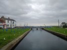
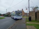
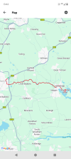
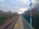
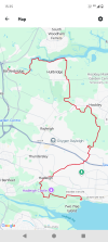
Battlesbridge to Leigh-on-Sea, 16 miles. The setting for my final walk of the year was the Saffron Trail footpath that zigzags through south Essex. Once I'd negotiated the first mile - a busy road, not pleasant - it took me along the River Crouch towpath to Hullbridge, then turning south to Hockley Woods and across the railway to Eastwood. From there I took the back road to Hadleigh, crossing the A13 and into the country park, up and around Hadleigh Castle before heading along the southern edge of Leigh to the railway station and onto Old Leigh for a sunset finish.

THC
 

Attachments

  • IMG_20251230_092012622.jpg
    IMG_20251230_092012622.jpg
    5.3 MB · Views: 15
  • IMG_20251230_155250726_HDR.jpg
    IMG_20251230_155250726_HDR.jpg
    2.5 MB · Views: 10
  • IMG_20251230_153101122.jpg
    IMG_20251230_153101122.jpg
    5 MB · Views: 14
  • Screenshot_20251230-153501.png
    Screenshot_20251230-153501.png
    604 KB · Views: 13

Gathursty

Established Member
Joined
31 May 2011
Messages
2,649
Location
Wigan
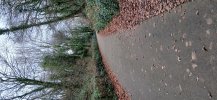
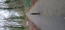
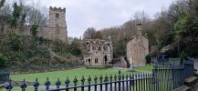
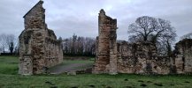
Yesterday I walked up and down the Holywell branch line from Greenfield. The route and line is steep but relatively short - about a mile long. It passes Basingwerk Abbey ruins and St Winifrede's Well which was shut but from the roadside you get a fairly good view of the well's water.

The path is tarmac all the way. The car park at Greenfield is free. There's no visible remains of the line apart from the bridge over the A548. Unfortunately the toilets in Holywell town centre had the cubical locks all removed so the only options were cafes or Tesco. Otherwise a lovely stroll for those who don't want a long hike.
 

Attachments

  • 20251230_102509.jpg
    20251230_102509.jpg
    3.3 MB · Views: 13
  • 20251230_102300.jpg
    20251230_102300.jpg
    4 MB · Views: 15
  • 20251230_101103.jpg
    20251230_101103.jpg
    3 MB · Views: 12
  • 20251230_090550.jpg
    20251230_090550.jpg
    2.6 MB · Views: 14

The Pelican

Member
Joined
3 Oct 2025
Messages
391
Location
London
Holywell looks very interesting- Wikipedia suggests that the railway was built but not opened as a freight branch, closed, and then opened again. It's also near the ten mile tunnel which was built to extract the products of lead mines. Because this had a narrow gauge railway running down it, it provides one of the stranger examples of an underground railway system between two distant points! The modern equivalent would be the recent Boulby postash mine with a long conveyer belt tunnel.
 

Top