
-
Our new ticketing site is now live! Using either this or the original site (both powered by TrainSplit) helps support the running of the forum with every ticket purchase! Find out more and ask any questions/give us feedback in this thread!
You are using an out of date browser. It may not display this or other websites correctly.
You should upgrade or use an alternative browser.
You should upgrade or use an alternative browser.
East-West Rail (EWR): Oxford-Bletchley construction progress
- Thread starter yorkie
- Start date
- Status
- Not open for further replies.

Sponsor Post - registered members do not see these adverts; click here to register, or click here to log in
R
RailUK Forums
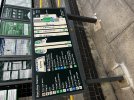
Thank you. Lovely looking map. Braille etc. maybe a bit 'busy'?New station map at Bletchley with the high level platforms included!
Am I missing something? Bridge access at Platform 7 shown, but not elsewhere?- bridge to nowhere?
swt_passenger
Veteran Member
- Joined
- 7 Apr 2010
- Messages
- 34,308
The signs like that are provided by some sort of deal with RNIB I believe, they’re an addition to normal rail style wayfinding. The braille goes with that territory I think…Thank you. Lovely looking map. Braille etc. maybe a bit 'busy'?
Am I missing something? Bridge access at Platform 7 shown, but not elsewhere?- bridge to nowhere?
The other accesses to the link bridge are dealt with by the letter U?
Thank you- I didn't 'see the wood for the trees'. Hope it works well in practice.The signs like that are provided by some sort of deal with RNIB I believe, they’re an addition to normal rail style wayfinding. The braille goes with that territory I think…
The other accesses to the link bridge are dealt with by the letter U?
The U/D feels a bit over-engineered and yet unclear. Steps illustrations are fairly didactic, and lifts could be too. The direction doesn't seem so important, but possibly it is an accessibility thing and folks (visually impaired/blind) might want prep for whether it's up or down? Not sure. Very inclusive in any case 
Quite a big, serious station now! I hope it becomes an important hub, with the commercial devt and house-building / TOD that should bring.
Quite a big, serious station now! I hope it becomes an important hub, with the commercial devt and house-building / TOD that should bring.
Remember that this is primarily a relief map to be felt with the fingers, with labels not just in Braille but so it can be read by others (without Braille, or sighted) as well. The RNIB's explanation of this "RNIB Map for All" concept is part of this document (with their other business services).The U/D feels a bit over-engineered and yet unclear. Steps illustrations are fairly didactic, and lifts could be too. The direction doesn't seem so important, but possibly it is an accessibility thing and folks (visually impaired/blind) might want prep for whether it's up or down? Not sure. Very inclusive in any case

AlbertBeale
Established Member
New station map at Bletchley with the high level platforms included!
Isn't that upside down with the south at the top?!
zwk500
Veteran Member
It's not 'upside down' as nobody will be navigating the station with a compass. The relative positions to 'you are here' are correct. The layout has presumably been driven by the choice to have the key to the left, leaving a slightly awkward choice to have either lots of blank space or this layout.Isn't that upside down with the south at the top?!
AlbertBeale
Established Member
It's not 'upside down' as nobody will be navigating the station with a compass. The relative positions to 'you are here' are correct. The layout has presumably been driven by the choice to have the key to the left, leaving a slightly awkward choice to have either lots of blank space or this layout.
A compass doesn't come into it. If I have at least a vague "mental map" of a place like a station, and some idea of which trains/platforms point north or south, and so on - which I normally would do of course - then looking at a map and finding it's got the wrong orientation ("wrong" compared with all conventional maps, including what's in my head, that is!) completely throws me. The conflicting and non-standard information makes it massively harder to get round the place. There are good reasons why maps have a standard orientation! (The reasons being, of course, that it enables users to make the most efficient use of their intelligence.) In this case, since we all know that the high-level platforms are on the east side of the main station, then finding a "map" which has them shown on the left is hopelessly confusing.
BlueLeanie
On Moderation
A compass doesn't come into it. If I have at least a vague "mental map" of a place like a station, and some idea of which trains/platforms point north or south, and so on - which I normally would do of course - then looking at a map and finding it's got the wrong orientation ("wrong" compared with all conventional maps, including what's in my head, that is!) completely throws me. The conflicting and non-standard information makes it massively harder to get round the place. There are good reasons why maps have a standard orientation! (The reasons being, of course, that it enables users to make the most efficient use of their intelligence.) In this case, since we all know that the high-level platforms are on the east side of the main station, then finding a "map" which has them shown on the left is hopelessly confusing.
Without looking Google maps, I'd have no idea of the orientation of the rails/platforms. North/magnetic North? When it comes to a map, I want it to be relative to where I am so Port & Starboard thanks.
Falcon1200
Established Member
There are good reasons why maps have a standard orientation! (The reasons being, of course, that it enables users to make the most efficient use of their intelligence.) In this case, since we all know that the high-level platforms are on the east side of the main station, then finding a "map" which has them shown on the left is hopelessly confusing.
I agree, absolutely! All maps, of whatever type and function, should have north at the top, east at the right, etc. I have been in signalling centres where, thanks to the location of the box, the track diagrams are the other way round, ie north at the bottom, and it is most confusing.
Fermiboson
Member
Only if you spend time staring at maps and images of stations, which is not something a lot of people outside this forum do. The average commuter probably has little idea of the layout of their station aside from how to get from the entrance to their platform.A compass doesn't come into it. If I have at least a vague "mental map" of a place like a station, and some idea of which trains/platforms point north or south, and so on - which I normally would do of course - then looking at a map and finding it's got the wrong orientation ("wrong" compared with all conventional maps, including what's in my head, that is!) completely throws me. The conflicting and non-standard information makes it massively harder to get round the place. There are good reasons why maps have a standard orientation! (The reasons being, of course, that it enables users to make the most efficient use of their intelligence.) In this case, since we all know that the high-level platforms are on the east side of the main station, then finding a "map" which has them shown on the left is hopelessly confusing.
spyinthesky
Member
Not quite the case such as SATNAV.I agree, absolutely! All maps, of whatever type and function, should have north at the top, east at the right, etc. I have been in signalling centres where, thanks to the location of the box, the track diagrams are the other way round, ie north at the bottom, and it is most confusing.
I do agree that North should be shown as a minimum but such visual displays as this if North is not at the top then the layout of the station should be as it is faced.

Topological
Established Member
Mildly off topic, but it is frustrating how few maps preserve North at the top. Most mobile phone maps re-orientate themselves to the direction you are facing (or it thinks you are facing) no matter how many times you change the settings.I agree, absolutely! All maps, of whatever type and function, should have north at the top, east at the right, etc. I have been in signalling centres where, thanks to the location of the box, the track diagrams are the other way round, ie north at the bottom, and it is most confusing.
I suspect people really do think in terms of their own left and right, rather than left being West and right being East.
Those of us who then mentally calculate our left and right based on the map are getting to be a minority.
== Doublepost prevention - post automatically merged: ==
SATNAV is another application which is constantly re-orientating itself. I think mine has a N arrow on it though.Not quite the case such as SATNAV.
I do agree that North should be shown as a minimum but such visual displays as this if North is not at the top then the layout of the station should be as it is faced.
zwk500
Veteran Member
Then you are very much an exception to the norm.A compass doesn't come into it. If I have at least a vague "mental map" of a place like a station, and some idea of which trains/platforms point north or south, and so on - which I normally would do of course -
There are many maps which show north other than at the top, not least strip maps.There are good reasons why maps have a standard orientation! (The reasons being, of course, that it enables users to make the most efficient use of their intelligence.)
We on this forum may, but those who are using the map probably don't. As it happens that layout is more intuitive to me because that's how it looks in the Sectional Appendix, but then I accept very low percentage of people needing that map will be familiar with that document.In this case, since we all know that the high-level platforms are on the east side of the main station, then finding a "map" which has them shown on the left is hopelessly confusing.
Last edited:

Nottingham59
Established Member
It's the railway. Up is towards London. 

Elecman
Established Member
Not always if the lines don’t originate from London (L&Y for instance)It's the railway. Up is towards London.
I did wonder if that was common practice for station plans - I suspect not.It's the railway. Up is towards London.
But the real point is that this is not a map - it's a building plan. Ideally it would be oriented as the building is when you stand in front of it, but for these ones that is often not practical. They are big and could get in the way, so have to have their back to a wall or similar. And the height (depth) is limited by an arm's reach (a small one, at that), so they end up being in wide-screen landscape format.
When one is put inside the station building it will tend to be against a wall, and there may be no site facing into the station. The one I'm familiar with, at Reading, is like that; it's on the front wall at the foot of the stairs. That one is oriented "as you stand", with the platforms horizontal, but with so many platforms I suspect it's a bit bigger top-to-bottom than they'd like. There's a picture of it on Euan's Guide
Peter Sarf
Established Member
My Garmin Sat Nav lets me choose if I want the top of the screen to be North OR if I want the top of the screen to be the direction I am travelling.Mildly off topic, but it is frustrating how few maps preserve North at the top. Most mobile phone maps re-orientate themselves to the direction you are facing (or it thinks you are facing) no matter how many times you change the settings.
I suspect people really do think in terms of their own left and right, rather than left being West and right being East.
Those of us who then mentally calculate our left and right based on the map are getting to be a minority.
== Doublepost prevention - post automatically merged: ==
SATNAV is another application which is constantly re-orientating itself. I think mine has a N arrow on it though.
I strongly prefer North upwards as I usually think in terms of whether I am driving North, East, West or South.
I am with @AlbertBeale on this one Up is North for me. And it throws me otherwise.Then you are very much an exception to the norm.
There are many maps which show north other than at the top, not least strip maps.
We on this forum may, but those who are using the map probably don't. As it happens that layout is more intuitive to me because that's how it looks in the Sectional Appendix, but then I accept very low percentage of people needing that map will be familiar with that document.
I think it is best to view station layout signs as NOT maps but more like signs telling people what is ahead, what is to the left and what is to the right. Indeed I feel that people who navigate by left, right, forward or reverse are more likely to not read a map but rely on directions.
So perhaps don't refer to these station layout signs as a "map" ?.
zwk500
Veteran Member
From my observations of driving, being driven by friends and family or looking around on the motorway, the overwhelming majority of people prefer their satnavs to show them the road 'looking ahead'. I find that much more intuitive because the most important thing when driving is whether you are turning left or right not what the cardinal direction is. Although I'd be interested to see any stats on that.My Garmin Sat Nav lets me choose if I want the top of the screen to be North OR if I want the top of the screen to be the direction I am travelling.
I strongly prefer North upwards as I usually think in terms of whether I am driving North, East, West or South.
I am with @AlbertBeale on this one Up is North for me. And it throws me otherwise.
On this I agree 'plan' or 'layout' might be a better termI think it is best to view station layout signs as NOT maps but more like signs telling people what is ahead, what is to the left and what is to the right. Indeed I feel that people who navigate by left, right, forward or reverse are more likely to not read a map but rely on directions.
So perhaps don't refer to these station layout signs as a "map" ?.
AlbertBeale
Established Member
Only if you spend time staring at maps and images of stations, which is not something a lot of people outside this forum do. The average commuter probably has little idea of the layout of their station aside from how to get from the entrance to their platform.
Most people using Bletchley station will know that trains from Bletchley to MK etc are "northbound"(ish), and ones to London are - similarly - southbound, and can see where the high level platforms are. So most users with a few braincells have a vague mental map of their situation - hence the stupidity if having a station plan on display which has it all upside down. If you have a general idea in your head, you don't need to stop every couple of steps to find instructions for which foot to use next; if the information presented is not in a standard - and hence easily absorbable - form, then you don't have a straightforward "internal map" and you then might need a sign every few yards saying "do this" and "do that". (Or are people so dumbed down these days that everyone needs an individual guide to show them to their platform?)
Albert, please don't take this personally. I find your references to 'most people', 'few braincells' and 'so dumbed down' unhelpful regarding what is intended to help folk with impaired vision to be well-enough 'informed' to have some independence (and hence dignity) in being able to orientate themselves and navigate easily to where they need to be. Many folk, including myself increasingly, appreciate this kind of help, and wayfinding along the way. Making the railway, designed and built largely in a bygone age, more accessible to people with a range of dis-abilities is a cost and for many a nuisance but one much appreciated by many others. Such criticisms as I have made are aimed largely at seeking to further improve matters, while recognising that I too can be 'overtaken' by exasperations and 'soundings off'.Most people using Bletchley station will know that trains from Bletchley to MK etc are "northbound"(ish), and ones to London are - similarly - southbound, and can see where the high level platforms are. So most users with a few braincells have a vague mental map of their situation - hence the stupidity if having a station plan on display which has it all upside down. If you have a general idea in your head, you don't need to stop every couple of steps to find instructions for which foot to use next; if the information presented is not in a standard - and hence easily absorbable - form, then you don't have a straightforward "internal map" and you then might need a sign every few yards saying "do this" and "do that". (Or are people so dumbed down these days that everyone needs an individual guide to show them to their platform?)
To introduce another maybe controversial observation? I have heard it suggested that maybe there is a gendered aspect to reading of maps/ plans etc- that women are more likely to 'turn a map round' to reflect the direction of travel, whereas men prefer north to the top. I'll need to seek out reliable research findings. Hopefully RNIB, who are sponsoring these diagrams, are well-advised by those they exist to help.
That might helpfully extend to the removal of unnecessary 'cutter' and 'noise', enabling focus on what works and what is truly needed.
In passing, I note the recent passing of Kenneth Grange, the 'designer' of the InterCity 125 train, who sought to bring functionality to the design process and product rather than mere 'flash-in-the-pan' fashion.
AlbertBeale
Established Member
Albert, please don't take this personally. I find your references to 'most people', 'few braincells' and 'so dumbed down' unhelpful regarding what is intended to help folk with impaired vision to be well-enough 'informed' to have some independence (and hence dignity) in being able to orientate themselves and navigate easily to where they need to be. Many folk, including myself increasingly, appreciate this kind of help, and wayfinding along the way. Making the railway, designed and built largely in a bygone age, more accessible to people with a range of dis-abilities is a cost and for many a nuisance but one much appreciated by many others. Such criticisms as I have made are aimed largely at seeking to further improve matters, while recognising that I too can be 'overtaken' by exasperations and 'soundings off'.
To introduce another maybe controversial observation? I have heard it suggested that maybe there is a gendered aspect to reading of maps/ plans etc- that women are more likely to 'turn a map round' to reflect the direction of travel, whereas men prefer north to the top. I'll need to seek out reliable research findings. Hopefully RNIB, who are sponsoring these diagrams, are well-advised by those they exist to help.
That might helpfully extend to the removal of unnecessary 'cutter' and 'noise', enabling focus on what works and what is truly needed.
In passing, I note the recent passing of Kenneth Grange, the 'designer' of the InterCity 125 train, who sought to bring functionality to the design process and product rather than mere 'flash-in-the-pan' fashion.
Many apologies - I absolutely wasn't meaning to criticise a tactile station plan being set up in whatever way is best for people needing to use it. I can see now that I was conflating my observations too much - sorry!
My critical references were relating to a recent fad for visual maps to no longer be in a standard orientation, and the problems that can cause ... and how that can itself encourage people not to use maps intelligently and to best effect.
As to gendered stereotypes - yes, that [that women are more likely to "turn maps round"] is sometimes said (generally by men about women). A friend of mine who has an academic background in environmental psychology and related stuff has been known to blow her top at such a suggestion ... women, as I understand it, tend to be bad at map reading if they're told they'll be bad at map reading, not because of something inherent in their "feminine nature". (Just as lots of categories of people live up/down to expectations put upon them.
And apologies again for expressing myself badly before.
In my view, I'd say that most people going through Bletchley (I don't have concrete confirmation of stats other than living there) know that trains from Bletchley to MK are from Platform 3, and to London are from Platform 4. I don't think north/southbound ever comes into the thought process. Also, Bletchley is just really well signposted and relatively straightforward to navigate, so I don't think the map will confuse many people.Most people using Bletchley station will know that trains from Bletchley to MK etc are "northbound"(ish), and ones to London are - similarly - southbound, and can see where the high level platforms are. So most users with a few braincells have a vague mental map of their situation - hence the stupidity if having a station plan on display which has it all upside down. If you have a general idea in your head, you don't need to stop every couple of steps to find instructions for which foot to use next; if the information presented is not in a standard - and hence easily absorbable - form, then you don't have a straightforward "internal map" and you then might need a sign every few yards saying "do this" and "do that". (Or are people so dumbed down these days that everyone needs an individual guide to show them to their platform?)
Thank you, Albert. I had a minor stroke last year so maybe a bit 'touchy' at times.Many apologies - I absolutely wasn't meaning to criticise a tactile station plan being set up in whatever way is best for people needing to use it. I can see now that I was conflating my observations too much - sorry!
My critical references were relating to a recent fad for visual maps to no longer be in a standard orientation, and the problems that can cause ... and how that can itself encourage people not to use maps intelligently and to best effect.
As to gendered stereotypes - yes, that [that women are more likely to "turn maps round"] is sometimes said (generally by men about women). A friend of mine who has an academic background in environmental psychology and related stuff has been known to blow her top at such a suggestion ... women, as I understand it, tend to be bad at map reading if they're told they'll be bad at map reading, not because of something inherent in their "feminine nature". (Just as lots of categories of people live up/down to expectations put upon them.
And apologies again for expressing myself badly before.
Regarding gendered stereotypes- I was for twenty years an architect lecturing to construction students and seeking to challenge gender stereotypes- not easy! So few females; so much 'macho' behaviour and reinforcement in social groups. Easy these days too to find oneself in issues related to 'wokeism', e.g in relation to 'safe spaces', toilet provision etc.
Having now been 'energised' by this issue, I found, by Googling, this RNIB document about Tactile maps:
and this book, on gender issues in travel, which I might follow up if I can find a cheap edition! :

Gendered Journeys, Mobile Emotions | Gillian Reynolds, Gayle Letherby
It is increasingly acknowledged that an analysis of emotions is necessary to fully understand the social world, and recent research on transport, travel and
Hopefully thoughtful application of such advances in knowledge, taking into account feedback in use, will be helping users of Bletchley Station as they find their way to and between trains.

WesternBiker
Member
I agree. By definition, most of the people using the station plan are going to be those that aren't familiar with the station (or any other where they find a plan useful)!In my view, I'd say that most people going through Bletchley (I don't have concrete confirmation of stats other than living there) know that trains from Bletchley to MK are from Platform 3, and to London are from Platform 4. I don't think north/southbound ever comes into the thought process. Also, Bletchley is just really well signposted and relatively straightforward to navigate, so I don't think the map will confuse many people.
There is quite a lot of research into why some people are good at using maps and others are not - all related to spatial awareness, which varies a lot between individuals. One of the factors is people's ability to shift perspective from the street-level view in front of them, to the bird's eye perspective of a map, and then put the two together. The other factor is what is called mental rotation - the ability to turn a picture around (and underlies the ability to put "north" at the top of a map - and all those IQ tests with rotated pictures). One hopes the designers of the station plans have taken the research into account.
Like a lot of skills, part of it is innate, and part of it is training. I was part of a generation brought up to use OS maps outdoors from an early age (Scouts etc) so prefer to have north at the top, etc. But I'm aware others don't - I know a couple of people whose view of the world is entirely made up of street-level images, and they cannot use a map or plan at all. (And for the record, they are PhD-educated and male!!)
work-traveller
Member
- Joined
- 18 May 2012
- Messages
- 421
'Gendered Journeys' - I might have to buy a monocle, just so I can let it drop from my face in amazementand this book, on gender issues in travel, which I might follow up if I can find a cheap edition! :
Gendered Journeys, Mobile Emotions | Gillian Reynolds, Gayle Letherby
It is increasingly acknowledged that an analysis of emotions is necessary to fully understand the social world, and recent research on transport, travel andwww.taylorfrancis.com
a_c_skinner
Established Member
- Joined
- 21 Jun 2013
- Messages
- 1,705
Where is the like button? Yes, a common understanding please.I agree, absolutely! All maps, of whatever type and function, should have north at the top, east at the right, etc. I have been in signalling centres where, thanks to the location of the box, the track diagrams are the other way round, ie north at the bottom, and it is most confusing.
AlbertBeale
Established Member
I agree. By definition, most of the people using the station plan are going to be those that aren't familiar with the station (or any other where they find a plan useful)!
There is quite a lot of research into why some people are good at using maps and others are not - all related to spatial awareness, which varies a lot between individuals. One of the factors is people's ability to shift perspective from the street-level view in front of them, to the bird's eye perspective of a map, and then put the two together. The other factor is what is called mental rotation - the ability to turn a picture around (and underlies the ability to put "north" at the top of a map - and all those IQ tests with rotated pictures). One hopes the designers of the station plans have taken the research into account.
Like a lot of skills, part of it is innate, and part of it is training. I was part of a generation brought up to use OS maps outdoors from an early age (Scouts etc) so prefer to have north at the top, etc. But I'm aware others don't - I know a couple of people whose view of the world is entirely made up of street-level images, and they cannot use a map or plan at all. (And for the record, they are PhD-educated and male!!)
Most of the times I'm at a station and look for a map/plan, I do have a broad idea of direction, what's where, etc; but I'm looking for a specific exit, or where the loo is, or an odd platform I've not used before, or whatever. And to do that I need a map which is oriented the same way as my general mental map of the area ... which is invariably "the right way up".
Peter Sarf
Established Member
It also means that if you take a photo of a map where North is upwards then it makes sense whatever your own orientation is when you look at the photo later. North being upwards has been a standard for quite a while.Most of the times I'm at a station and look for a map/plan, I do have a broad idea of direction, what's where, etc; but I'm looking for a specific exit, or where the loo is, or an odd platform I've not used before, or whatever. And to do that I need a map which is oriented the same way as my general mental map of the area ... which is invariably "the right way up".
- Status
- Not open for further replies.