• Our new ticketing site is now live! Using either this or the original site (both powered by TrainSplit) helps support the running of the forum with every ticket purchase! Find out more and ask any questions/give us feedback in this thread!

Borders Railway - Now Open

Status
Not open for further replies.

Gareth Marston

Established Member
Joined
26 Jun 2010
Messages
6,231
Location
Newtown Montgomeryshire
I'd always heard that the mining in the area meant there was no way of tackling the Sherrifhall bottle-neck on the Edinburgh by-pass. Interesting to know that this doesn't appear to be the case (?)

Personally I'd rather that they focussed on building the line to Gorebridge first (and dealt with the Galashiels end once it was up and running through Midlothian) as I think that the northern end of the line should be busier.

The "doing it all at once" approach is one of the reasons why the Edinburgh Trams aren't yet running - they'd have been working by now if they'd built it in sections. Hope we aren't seeing similar problems here.

yes the doing it all at once or nothing approach is endemic. The Cambrian hourly project is a prime example too, there could have been extra services at the eastern (Montgomeryshire Severn valley) end without any need for £ millions on reinstating infrastructure at any point in the last 16 years since it was first mooted yet because stakeholders in Ceredigion have had to be appeased we've had to wait on the infrastructure for the whole shebang.
 
Sponsor Post - registered members do not see these adverts; click here to register, or click here to log in
R

RailUK Forums

fegguk

Member
Joined
11 Sep 2012
Messages
181
Location
Hawick
Although, as previously stated, the line will be mainly single track with 3 dynamic loops, is it being constructed so that it all can be easily converted to double track if need be in the future ?

I presume also that all structures/bridges are designed so that they will be OHLE compatible perchance (even if unlikely) the line is electrified in the future.

To see some of the design details of some of the new bridges check out the scottish Borders council web site planning application. If you search application by week, since the newyear, you will be able to look at plans for some of the indvidual structures. most apear to be single track, I believe the policy is for all new structures to be OHLE compatible.
--- old post above --- --- new post below ---
The road sits on an East-West alignment there wheras the railway will be on a North-South(ish) alignment so it is not necessarily the case that geological factors affecting the road would also affect the railway.

In the past railway companies and to purchase the coal under their lines as compensation to the mine owner to stop undermining. I would not be unreasonable to assume this was the case here, Hence the area directly under the railway may not have been as extensively mined as the rest of the surrounding area. Most mines in the area have been closed since the 1970s
 

tbtc

Veteran Member
Joined
16 Dec 2008
Messages
18,051
Location
Reston City Centre
If only they had...

A direct tram service from Edinburgh Park Station, through Edinburgh Park, the Gyle and onto the Airport would have been busily generating a contribution for years.

That's it - they could have had that running for a year or two (ironing out problems with the trams, getting staff trained etc) and it'd probably be running through to Princes Street by now.

Instead they decided to dig up the whole route all the way to Leith, causing lots of bother, rather than concentrating resources at one end. I'm a big supporter of the tram and a big critic of how they have implemented it. Looks like some of the same mistakes are happening in the Borders (a line to "Greater Dalkeith" would be plenty busy and could have been operating by now, but they have to go for the "big bang" approach...)

yes the doing it all at once or nothing approach is endemic. The Cambrian hourly project is a prime example too, there could have been extra services at the eastern (Montgomeryshire Severn valley) end without any need for £ millions on reinstating infrastructure at any point in the last 16 years since it was first mooted yet because stakeholders in Ceredigion have had to be appeased we've had to wait on the infrastructure for the whole shebang.

It's frustrating when things could have been up and running by now but those in charge are persuing this approach - I really can't see why there's this vogue for doing things like this, but people in Montgomeryshire are paying the price for it, sadly). Frustrating.
 

D365

Veteran Member
Joined
29 Jun 2012
Messages
13,157
Positions are in great demand, what DMUs (before any possible electrification) are going to be made available?
 

Xenophon PCDGS

Veteran Member
Joined
17 Apr 2011
Messages
35,391
Location
A typical commuter-belt part of north-west England
But seriously, I feel that an extension to Hawick is possible as it would reach a reasonable population in the towns of Melrose, St. Boswells and Hawick. To be very honest I was very surprised that they plan was to stop at Tweedbank, as the original line went through to Hawick.

Did you note that the last three words in my posting were...."and reaching Carlisle" ?

The Hawick to Carlisle line section once had stations at Stobs, Shankend, Riccarton Junction (junction with the Border Counties Railway), Steele Road, Newcastleton, Kershope Foot, Penton, Riddings Junction, Scotch Dyke, Longtown, Lyneside and Harker, before reaching Carlisle. This particular section from Hawick to Carlisle was the one that has even less chance of being opened, than from the end of the current section at Tweedbank onwards to Hawick.
 

clc

Established Member
Joined
31 Oct 2011
Messages
1,326
Positions are in great demand, what DMUs (before any possible electrification) are going to be made available?

The Cumbernauld electrification will release some Class 156's next year.
 

Frothy

Member
Joined
19 Jul 2012
Messages
165
Location
Deepest darkest France
This particular section from Hawick to Carlisle was the one that has even less chance of being opened, than from the end of the current section at Tweedbank onwards to Hawick.

I think it may only take a couple of years after the opening to Tweedbank for the relevant bodies to start looking at Tweedbank-Hawick. Until it becomes necessary as a through route, I don't think the Hawick-Carlisle section will re-open. That is probably decades away.
 

Xenophon PCDGS

Veteran Member
Joined
17 Apr 2011
Messages
35,391
Location
A typical commuter-belt part of north-west England
I think it may only take a couple of years after the opening to Tweedbank for the relevant bodies to start looking at Tweedbank-Hawick. Until it becomes necessary as a through route, I don't think the Hawick-Carlisle section will re-open. That is probably decades away.

This highlighted section was the point that I endeavoured to convey in my original posting. I have no axe to grind whatsoever with aspirations of an extension from Tweedbank to Hawick.
 

tbtc

Veteran Member
Joined
16 Dec 2008
Messages
18,051
Location
Reston City Centre
Any re-opening of the line all the way to Carlisle would be a lot slower than the WCML though Lockerbie etc (approx 75mins for approx 90 miles), so would only be worth it for whatever market there is from the Galashiels/ Hawick area to Carlisle (forget about Edinburgh passengers).
 

lancastrian

Member
Joined
2 Jan 2010
Messages
537
Location
Bolton, Lancashire
Do you know of a precedent anywhere for rebuilding 18 miles of railway to serve a town of 16,000 people?

Perhaps not, but its not just Hawick. The route will pas through Melrose & St. Boswells, which will add about another 3,500 population between them. But if you include the surrounding area, which includes Kelso (7,500) and Jedburgh (4,000) plus about another 10,000 in the surrounding countryside.

If you look at the route from Edinburgh, there is a large population as far as Eskbank for Dalkeith (11,600) but after that you have Newtongrange (2,000), Gorebridge (6,000), Stow (700) and finally Galashiels (12,500).

So I think that as they are already building a line to a place with a population smaller than Hawick, so the precedent for building a line to a town of 16,000 people, is in-fact the Borders railway itself.
 

railjock

Member
Joined
30 Jun 2012
Messages
373
Perhaps not, but its not just Hawick. The route will pas through Melrose & St. Boswells, which will add about another 3,500 population between them. But if you include the surrounding area, which includes Kelso (7,500) and Jedburgh (4,000) plus about another 10,000 in the surrounding countryside.

If you look at the route from Edinburgh, there is a large population as far as Eskbank for Dalkeith (11,600) but after that you have Newtongrange (2,000), Gorebridge (6,000), Stow (700) and finally Galashiels (12,500).

So I think that as they are already building a line to a place with a population smaller than Hawick, so the precedent for building a line to a town of 16,000 people, is in-fact the Borders railway itself.


Eskbank is halfway between Dalkeith and Bonnyrigg so that gives a potential total catchment of over 20,000. My view is that any extension will depend on the planned line to Tweedbank being successfull and is many years off.
 

MidnightFlyer

Veteran Member
Joined
16 May 2010
Messages
12,856
Any re-opening of the line all the way to Carlisle would be a lot slower than the WCML though Lockerbie etc (approx 75mins for approx 90 miles), so would only be worth it for whatever market there is from the Galashiels/ Hawick area to Carlisle (forget about Edinburgh passengers).

Indeed. A more useful development would be to reopen the old curve between the Beattock and Cobbinshaw branches of the WCML south of Carstairs to eliminate the very tight 30mph~ curve immediately south of the station currently used. The old formation was a lot straighter and I would guess could shave 2-3 mins off times between Carlisle and Edinburgh if used, though that would all depend on the speed of the turnouts for the new line.

Looking at Google Maps (http://goo.gl/maps/eXgTy; it should be rather obvious where the old line is) it looks completely clear, it would just need a bit of realignment to the Carnwrath Road and the farm track. Certainly a lot more viable than the Carlisle-Hawick at least!
 

railjock

Member
Joined
30 Jun 2012
Messages
373
Indeed. A more useful development would be to reopen the old curve between the Beattock and Cobbinshaw branches of the WCML south of Carstairs to eliminate the very tight 30mph~ curve immediately south of the station currently used. The old formation was a lot straighter and I would guess could shave 2-3 mins off times between Carlisle and Edinburgh if used, though that would all depend on the speed of the turnouts for the new line.

Looking at Google Maps (http://goo.gl/maps/eXgTy; it should be rather obvious where the old line is) it looks completely clear, it would just need a bit of realignment to the Carnwrath Road and the farm track. Certainly a lot more viable than the Carlisle-Hawick at least!


Travelled on the line many times on business and often wondered why they ever closed the queens curve as it is clearly a lot better for WCML trains to/from Edinburgh.
 

MidnightFlyer

Veteran Member
Joined
16 May 2010
Messages
12,856
Out of interest when did it close? Finding data for small bits of line such as that is near impossible! I agree though, certainly would be a good little project.
 

railjock

Member
Joined
30 Jun 2012
Messages
373
Out of interest when did it close? Finding data for small bits of line such as that is near impossible! I agree though, certainly would be a good little project.


Can't really tell as google doesn't deliver much but I think it was either late 1800s or early 1900s. Maybe connected with opening the branch line that crossed it?
 

PaulLothian

Member
Joined
27 Sep 2010
Messages
695
Location
Linlithgow
Out of interest when did it close? Finding data for small bits of line such as that is near impossible! I agree though, certainly would be a good little project.

An old copy I have of the Stephenson Loconotive Society Journal reports on a 1943 visit by a member, SHP Higgins.

"A driver, aged about 58, who had worked all his life at Carstairs,told me... that the rails had been taken up many years ago. In his youth he remembered playing playing on the line which had two sets of metals very much over-grown with grass. There was no service over this branch, and it was said that only one train had worked over the line."

All of which would indicate it was totally out of use at the start of the 20th century, which is interesting, but doesn't explain why it was constructed and abandoned!
 

Xenophon PCDGS

Veteran Member
Joined
17 Apr 2011
Messages
35,391
Location
A typical commuter-belt part of north-west England
Out of interest when did it close? Finding data for small bits of line such as that is near impossible! I agree though, certainly would be a good little project.

Are we discussing the Moffat Railway, which was south of Beattock, but if so, this was only a branch line to the single terminal station of Moffat, which was closed to passengers in 1954.

Another line to branch off the main line was near to Elvanfoot station and was the Leadhills and Wanlockhead Light Railway which opened in 1901 and was closed in 1938. I suppose the Strawfrank Junction avoiding line is not the one you seek.
 
Last edited:

MidnightFlyer

Veteran Member
Joined
16 May 2010
Messages
12,856
Nope, the line I'm discussing is well north of Beattock, it's the old curve to the south of Carstairs station, as shown in the Google Maps link I included. Lines such as the Moffat one you mention are easy to source, the line I'm after isn't.

The subsequent replies from posters should have made it clear which we are discussing.
 

MidnightFlyer

Veteran Member
Joined
16 May 2010
Messages
12,856
It's not that either. It's not a branchline or anything like that, it was a curve between the Lockerbie branch of the WCML and the Cobbinshaw branch of the WCML, about half a mile long to the south east of the current curve. The line I'm speaking of is in the centre of the picture here, it's rather clear: http://goo.gl/maps/h7Hpa
 

railjock

Member
Joined
30 Jun 2012
Messages
373
It was called the Queen's curve and I'm sure I did read somewhere that it was only used once or twice for a Royal train. I discounted that because it sounded ludicrous but now I'm not so sure.
 

tbtc

Veteran Member
Joined
16 Dec 2008
Messages
18,051
Location
Reston City Centre
Indeed. A more useful development would be to reopen the old curve between the Beattock and Cobbinshaw branches of the WCML south of Carstairs to eliminate the very tight 30mph~ curve immediately south of the station currently used. The old formation was a lot straighter and I would guess could shave 2-3 mins off times between Carlisle and Edinburgh if used, though that would all depend on the speed of the turnouts for the new line.

Looking at Google Maps (http://goo.gl/maps/eXgTy; it should be rather obvious where the old line is) it looks completely clear, it would just need a bit of realignment to the Carnwrath Road and the farm track. Certainly a lot more viable than the Carlisle-Hawick at least!

It's a chord I've wondered about a few times in the past too - if anyone starts a "slow sections on fast lines" thread then I think that this would be a high contender!
 

MidnightFlyer

Veteran Member
Joined
16 May 2010
Messages
12,856
Indeed, it would also be an opportunity to remodel the Carstairs area and create a much more straightforward and useful track layout too, creating just a basic junction from the north to the Edinburgh or Lockerbie branches, closing the old south curve. It would also allow greater linespeeds and straightening of tracks. I don't think anyone could argue that the current track arrangements around Carstairs are easy to understand!
 

tbtc

Veteran Member
Joined
16 Dec 2008
Messages
18,051
Location
Reston City Centre
Indeed, it would also be an opportunity to remodel the Carstairs area and create a much more straightforward and useful track layout too, creating just a basic junction from the north to the Edinburgh or Lockerbie branches, closing the old south curve. It would also allow greater linespeeds and straightening of tracks. I don't think anyone could argue that the current track arrangements around Carstairs are easy to understand!

I certainly won't argue!

I've probably mentioned this before, but I spent many childhood weekends on the platforms there, when "Cross Country" services had loco hauled portions from Edinburgh and Glasgow joining/ splitting there. It was great at the time.

But given how services now operate, you could knock the whole thing down and remodel to allow much faster straighter alignments - grade separated junctions would probably be too ambitious, but you'd shave a couple of minutes off long distance services.
 

route:oxford

Established Member
Joined
1 Nov 2008
Messages
4,949
I've been doing a bit of digging around.

Fortunately, the National Library of Scotland has a comprehensive set of maps of the area from the late 19th and early 20th century

maps.nls.uk

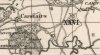
The 1905 map show the line as closed, but the line to Bankhead station as open.

The 1885 map shows the "express" line as being open.

That would suggest that the closure of the express route and realignment of the route to Edinburgh was necessary as a consequence of opening the Bankhead route.

If I've got it right, there should be a couple of maps attached...
 

Attachments

  • Carstairs 1905.JPG
    Carstairs 1905.JPG
    99.6 KB · Views: 75
  • Carstairs 1885.JPG
    Carstairs 1885.JPG
    64.5 KB · Views: 71

railjock

Member
Joined
30 Jun 2012
Messages
373
I've been doing a bit of digging around.

Fortunately, the National Library of Scotland has a comprehensive set of maps of the area from the late 19th and early 20th century

maps.nls.uk

The 1905 map show the line as closed, but the line to Bankhead station as open.

The 1885 map shows the "express" line as being open.

That would suggest that the closure of the express route and realignment of the route to Edinburgh was necessary as a consequence of opening the Bankhead route.

If I've got it right, there should be a couple of maps attached...


Thanks, very strange decision. Surely it made sense to keep the 'express' route and build the Dolphinton branch ( a minor rural branch ) around it.
 
Status
Not open for further replies.

Top