

A group of forum members set off from the Askham Bar Park & Ride (site of the former Chalenors Whin Jn) to Riccall last Sunday, 4th September.
Here is a panorama showing the site of the former Chalenors Whin Junction (see aerial view before the Park & Ride was re-located), on the left is the current - and original - ECML, the trees in the middle of the picture mark the path the old line towards Selby (which was, for many years, the East Coast Main Line) and to the right the fencing shows where the spiral path down to the trackbed, and the start of the route which immediately goes under Tadcaster Road.

I forgot to take any photos until we were at the southern edge of Bishopthorpe, so the first few were taken a few days later.
From the site of the Park & Ride, the route spirals down into the trackbed, passing underneath the A1036 (Tadcaster Road):

The next few photos are taken between the bridges under Tadcaster Road and the A64. If you walk or cycle from York City Centre you probabably would not pass through this section.


Soon, the junction with the route from the City Centre is reached. This is the start of the York Solar System model, and the Sun is located here. I took this photo looking back towards the site of Chalenors Whin Junction. To the right is the path which leads towards the Racecourse, Millenium Bridge and York City Centre.

Then the route continues, clearly recognisable as a trackbed, until we reach the edge of Bishopthorpe.

For the first stretch through Bishopthorpe, the route narrows between houses and gardens, there really isn't much space at all, and I saw paramedics treating someone who appeared to come off their bike. The next photo shows the end of this narrow section, as from then on the route is on a quiet road, Appleton Court for a short stretch.

At the end of Appleton Court, the route resumes (uninterrupted from this point until the edge of Riccall) with the bridge under Appleton Road.

The path is particularly busy in the Bishopthorpe area; it is clearly popular with residents as well as visitors to the area. Resting places are provided.

The Jupiter model is located at the access path to Keble Park North, Bishopthorpe.

From this point on, the photos were taken on the day of our group walk. The next image (taken at Bishopthorpe) shows the route being at a split-level (looking back towards York), it's unclear why half of the trackbed was lowered, does anyone know the reason?

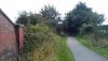
Just beyond that point, the route becomes attractively tree-lined..

...and another feature of the route is the numerous access paths. This one linking the path with Acaster Lane, Bishopthorpe:

Note the unusual use of cable troughs from the railway line forming a ring around the tree.
Next we come to the bridge over the River Ouse (photo taken looking back towards York). From Wikipedia:
Outside the outer ring-road, the Naburn swing bridge, built in 1871, used to carry the York-Selby railway until it was diverted in 1983. The bridge now constitutes part of the York & Selby cycle path, connecting the TransPennine trail to York.[15] It is also known as the "Fisherman Bridge" due to a large metal sculpture of a fisherman with bike and dog, sitting on top which was added in 2000 as part of the York Council "Creative Communities 2000" scheme.[16]

Just beyond the bridge over the river, we come across a bridge over York Road (Naburn)...

...followed immediately by the site of the former Naburn Station.

..the building is used as a hostel, B&B and tea garden and there are benches, cycle racks and a 'Trust Hut'.

There is another interesting feature (which you can walk up) made of cable troughs just before the access path to Howden Lane.

The next photo shows this location from the opposite direction (looking towards York). There are plenty of places like this where you can stop and sit for a break along the route.

The route continues to be well lined with trees at this point.

(Continues in a later post)
There is one final opportunity to diverge off the path to Naburn, with the path towards Vicarage Lane, leading to The Blacksmiths Arms. (Incidentally I don't think I've ever actually visited the village of Naburn, despite passing nearby on numerous occasions).

There are occasional deviations, such as the one shown below, but with very few exceptions they are still on the trackbed. Sometimes a dirt path is provided alongside the main tarmac covered path.

I believe this next location is the bridge under Moor Lane, a minor road linking Naburn to the west with the A19 to the east. The first photograph is looking back towards York..

...and here we see a view showing the footsteps leading to the road above, along with another place for people to stop for a break, again concrete cable troughs, presumably used when the line was active, are put to good use here.

..and the next shot shows the route continuing towards Riccall from under the bridge.

Then we move on to the site of the model of Uranus, these model sites are identified on Google Maps (but not Open Street Map).

The next bridge we come to is actually under a bridleway. Although only a bench can be seen in the photograph below, more extensive seating is provided similar to that shown in previous photos.

The path then becomes less open, and returns to being tree-lined, and we discovered some large unidentified stone slabs. Does anyone know what these are, or why they are there?

Although a very straight path, as mentioned earlier, there are deviations to add variety, as can be seen here.

This bridge carries the minor road from Stillingfleet to Escrick (map). Just beyond this bridge is a cutting in which Escrick station (closed to passengers in 1953 and completely in 1961) once stood...

...however the path does not use the railway alignment at this point, and instead climbs out of the cutting, giving a view of fields to the east. We did pause here and drop down into the cutting (steps are provided), where there was originally a maze (the photo shown on that site shows what I remember it being like when I first cycled the route in Year 7) but this is now overgrown.

From here the route is again a nice mixture of being tree-lined and open, as can be shown in the photo below.

And, as we near the end of the route along the old trackbed, more benches are provided, and in the distance the sound of traffic on the A19 - getting ever closer - starts to become noticeable.

And we reach the end, just before the site of the old level crossing (an accident occurred here in 1952 involving the 4.45 pm. Tees-Tyne Pullman Express), there is a bench and shelter, and the path continues to the road on the right. For those wishing to visit the final model in the Solar System, Pluto (no longer a planet; the text provided is yet to be updated but asks the question!) you need to bear left, and climb to the top of a mound. Although the mound is an interesting feature, its purpose is unclear as there is no view from it as it's surrounded by trees. The site can be seen on Google maps aerial view.

And finally, two of our group of seven forum members at the model of Pluto.

If you are reading this and would like to get involved in more walks(or cycle rides!) like this, please do get in touch!
Attachments

Last edited:


