• Our new ticketing site is now live! Using either this or the original site (both powered by TrainSplit) helps support the running of the forum with every ticket purchase! Find out more and ask any questions/give us feedback in this thread!

Walking and Rambling discussion

Techniquest

Veteran Member
Joined
19 Jun 2005
Messages
21,828
Location
Nowhere Heath
Nice! I had forgot that they were considering reopening the line to Youghal once upon a time. It’s been ages since the bit they did open was done, I think I did it on an Irish Trekker ticket back in 2012.

Good to hear it’s a decent route, one to remember if I ever find myself back in the Emerald Isle again.

Today, my big walk was 14.5 miles from St Ives, Cambridgeshire, to Cambridge North Station along most of the guided busway. I say most because a significant bit between Fen Drayton RSPB and Swazesey had a few flood on it. To ensure I missed the flood completely, which would have potentially challenged even wellies because the path could not be seen under the flood, I took a good bit of diversion via country lanes to reach the nice little village of Swazesey and back to the busway.

It’s getting a lot of disruption this year due to having safety fences installed, so some of the busway is closed to vehicles. I will have to return next year to finish the job! Other than that, an excellent walk which I’m very glad I did, especially today with some fantastic spring weather :D
 
Sponsor Post - registered members do not see these adverts; click here to register, or click here to log in
R

RailUK Forums

High Dyke

Established Member
Joined
1 Jan 2013
Messages
4,995
Location
Yellabelly Country
Oh, I don't think it exists on phones.

...but you could do a screenshot of the photo itself and post that instead of the actual photo file? Pretty sure all phones have a screenshot function?
I've resized the pictures below, from their original resolution, using the edit option in gallery. There should be an option to resize images.

A further section of the London LOOP today. Section 20 from Chigwell to Havering-atte-Bower. Whilst it was a glorious day, much of the route along tracks or through woodland was rather boggy. Even open fields were spongy to walk on. This is one of the trickier sections regarding public transport, the 'hourly' bus service at the end is a bit sporadic (none on Sundays).

I caught the Central Line from Mile End to Buckhurst Hill (having travelled from King's Cross) and then caught the 167 bus, alighting at Brooke Way, Chigwell. The adjacent road junction is where Section 19 and Section 20 changeover.

A regular feature of the LOOP is the inevitable trek across a golf course. Arriving at Havering-atte-Bower, and with an hour to spare before the 357 bus was due, I took the short walk to the Orange Tree PH, for a refreshing pint. Conveniently, there's a bus stop right outside the pub.

20260302_105535.jpg 20260302_123757.jpg 20260302_141948.jpg 20260302_143447.jpg
Images:
  • Buckhurst Hill station (Central Line)
  • Hainault Forest
  • Pine trees on Wellingtonia Avenue
  • Painted village sign
 

styles

Established Member
Joined
7 Dec 2014
Messages
4,614
Location
Gwynedd
Has anyone undertaken some very long distance footpath?

I am considering taking time off between contracts to walk the King Charles III coastal path: https://www.nationaltrail.co.uk/en_GB/trails/england-coast-path/trail-information/

It's not yet finished but it will be around 2700 miles plus around 180 miles doing Offa's Dyke to link it up. 30 miles a day is within my summer walking ability accounting for some ascent. I'm not a huge fan of just beasting through walks as quickly as possible though and like to stop and enjoy the area, so realistically I'd be allocating about 6 months to it.

The longest multi-day hike or bike trip I've done has been 2 weeks, so it's quite a big jump going to 6 months.

Are there any particular tips or tricks people would recommend?
 

THC

Member
Joined
21 Sep 2009
Messages
717
Location
Stuck on the GEML
The longest multi-day hike or bike trip I've done has been 2 weeks, so it's quite a big jump going to 6 months.

Are there any particular tips or tricks people would recommend?
Yes. Unless you are *very* fit it will be difficult to sustain 30-mile days for very long, especially if climbs and descents are involved. If your daily span of comfort is 30 miles then plan for 20-mile days with regular rest days built in. And take good care of your feet as you go, because blisters will sideline you no matter how fit you are!

THC
 

ChrisC

Established Member
Joined
7 Oct 2018
Messages
2,251
Location
Nottinghamshire
30 miles a day is within my summer walking ability accounting for some ascent. I'm not a huge fan of just beasting through walks as quickly as possible though and like to stop and enjoy the area, so realistically I'd be allocating about 6 months to it.

The longest multi-day hike or bike trip I've done has been 2 weeks, so it's quite a big jump going to 6 months.

Are there any particular tips or tricks people would recommend?
What a wonderful thing to do. I’ve never walked those sort of distances in a day, although I did do a few 25 mile sponsored walks for charity around 50 years ago when I was in my teens. Most of my walking has been between 10 and 15 miles at the most in a day but now as I get older 8-10 miles is my absolute limit and that’s without too many hills!

I have walked quite a few sections of the coastal path and my tip would be to carefully study OS maps to take serious note of the terrain. The flat sections such as Lincolnshire and East Anglia are relatively easy going. Sections where you are walking on top of high cliffs can be deceptively difficult and can be very hard going if the path keeps dropping almost down to sea level to cross valleys and then climbs steeply back up again. Even sections of the South Coast can be very tiring. For example from Eastbourne to Brighton is a wonderful section but there’s the climb up to Beachy Head and up and down The Seven Sisters. Last summer I did some walking on the Dorset Coast around Lulworth and Durdle Door and it was heavy going. On some sections you may be able to do 30 miles but on others you will have had enough after less than half that distance. The heavy going sections are usually the most scenic so that’s where you would want to take your time anyway.
 

styles

Established Member
Joined
7 Dec 2014
Messages
4,614
Location
Gwynedd
What a wonderful thing to do. I’ve never walked those sort of distances in a day, although I did do a few 25 mile sponsored walks for charity around 50 years ago when I was in my teens. Most of my walking has been between 10 and 15 miles at the most in a day but now as I get older 8-10 miles is my absolute limit and that’s without too many hills!
Yes I think it'll be an enjoyable few months, and quite relaxing despite the distance commitment. I am normally more of a winter Munro bagger, but there is something quite lovely about coastal walks. Also I do like my fish and chips!
I have walked quite a few sections of the coastal path and my tip would be to carefully study OS maps to take serious note of the terrain. The flat sections such as Lincolnshire and East Anglia are relatively easy going. Sections where you are walking on top of high cliffs can be deceptively difficult and can be very hard going if the path keeps dropping almost down to sea level to cross valleys and then climbs steeply back up again. Even sections of the South Coast can be very tiring. For example from Eastbourne to Brighton is a wonderful section but there’s the climb up to Beachy Head and up and down The Seven Sisters. Last summer I did some walking on the Dorset Coast around Lulworth and Durdle Door and it was heavy going. On some sections you may be able to do 30 miles but on others you will have had enough after less than half that distance. The heavy going sections are usually the most scenic so that’s where you would want to take your time anyway.
Yes this is a really good point. I'm acutely aware that I perceive a lot of coastal areas as flat but in reality there are stretches which are quite up and down. I've done a lot of the north Wales coastal path and that was exceptionally flat, but then you have the Fife coastal path and there's a chain walk on it :D

I am not actually planning on 30 miles a day, which would take ~100 days, but closer to 20 miles a day to make it around 6 months. It's still a fair whack of walking each day but I think that's sustainable.
 

ChrisC

Established Member
Joined
7 Oct 2018
Messages
2,251
Location
Nottinghamshire
Yes this is a really good point. I'm acutely aware that I perceive a lot of coastal areas as flat but in reality there are stretches which are quite up and down. I've done a lot of the north Wales coastal path and that was exceptionally flat, but then you have the Fife coastal path and there's a chain walk on it :D
I’m planning on doing quite a few sections of the Fife coastal path next month. It will just be a selection of short sections. As I’m now approaching my 70th birthday, and will be walking on my own, I will be avoiding the chain walk! It‘s one of the few parts of the Scottish coast l have never visited. Hotels in St Andrews are so expensive so I’m staying in Dundee and using the bus to reach places.

One of my favourite coastal walks is in Scotland, but in a very different location. I love walking down the length of the west coast of the Isle of South Uist in the Outer Hebrides, but it’s over 10 years ago now since I last did it.
 

D6130

Established Member
Joined
12 Jan 2021
Messages
8,919
Location
West Yorkshire/Tuscany
Hotels in St Andrews are so expensive so I’m staying in Dundee and using the bus to reach places.
If you can organise your trip to be in St Andrews during the university holidays, you can get good value accommodation in the university's halls of residence. That's what my wife and I do every August to celebrate our wedding anniversary. (We were married there in the Burgh Hall).
 

THC

Member
Joined
21 Sep 2009
Messages
717
Location
Stuck on the GEML
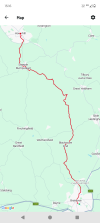
Braintree to Haverhill, 21 miles. An attempt to make the most of the sunshine by starting early was foiled as the blue skies of mid Essex gave way to fog further north, so the first few miles from Braintree northwards afforded only limited visibility. Bocking Churchstreet was the only settlement of any note in the first half of the walk, as I passed Blackmore End then to the east of Wethersfield airfield on minor roads before reaching Toppesfield and the halfway point. Back onto the field paths, I carried on in a north westerly direction, passing Dyer's End and Stambourne before reaching Steeple Bumpstead for a well deserved pitstop at the Fox and Hounds. Suitably refreshed, I carried on in the same direction to enter Haverhill from the south, crossing into Suffolk and turning onto the old Colne Valley Railway trackbed before finding Haverhill high street and the bus station to begin the long journey home.

THC
 

Attachments

  • IMG_20260320_071926833.jpg
    IMG_20260320_071926833.jpg
    3.8 MB · Views: 9
  • IMG_20260320_153204038.jpg
    IMG_20260320_153204038.jpg
    5 MB · Views: 9
  • IMG_20260320_170012117_HDR.jpg
    IMG_20260320_170012117_HDR.jpg
    4.3 MB · Views: 9
  • Screenshot_20260320-151630.png
    Screenshot_20260320-151630.png
    365.6 KB · Views: 9

Kite159

Veteran Member
Joined
27 Jan 2014
Messages
22,708
Location
West of Andover
Likewise, I've been making the most of the sunshine to finish a couple of longer distance disused railway line paths. Yesterday catching the route 317 bus from Okehampton town centre to Meeth to walk towards Torington along the Tarka Trail (which was very lovely in the sunshine). Today heading to Lincoln with a route 30 bus to Bardney to head back towards Lincoln along the Water Rail Way, which was an interesting experience as the path was between the River Witham & the South Delph Drain. Although the worse section was between the Lincoln Bypass & the city centre where it seems to be used by cyclists training for the Tour De France in terms of speed (and rudeness). One of these days I will research how to visit Langrick Bridge to walk the section towards Boston

(Both bus routes are somewhat limited so require a bit of planning)
 

SuspectUsual

Established Member
Joined
11 Jul 2018
Messages
6,664
First decent walk of the year

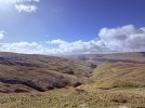
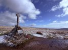
I’ve had today earmarked for a walk for a while, and settled on going up Buckden Pike from Kettlewell. In the end the weather forecast wasn’t great so I did it from Starbotton instead to save a bit of time

Started in bright sunshine and a stiff breeze, got to the summit trig point just as the weather started to change, and the first 20 minutes of the descent was walking straight into a 40mph wind laced with sleet and snow. By the time I got down to Buckden it was bright and sunny again. Did the last bit along the road because the paths by the river were flooded

11.8 km / 7.3 miles

2 hours 20 minutes (including time taking photos)

544 metres / 1,785 feet ascent
 

Attachments

  • IMG_6358.jpeg
    IMG_6358.jpeg
    2.9 MB · Views: 13
  • IMG_6365.jpeg
    IMG_6365.jpeg
    3 MB · Views: 13

Techniquest

Veteran Member
Joined
19 Jun 2005
Messages
21,828
Location
Nowhere Heath
I didn’t envy your weather in the strong wind etc, but very nice scenery :)

Monday just gone, 23rd March 2026, I did Ebbw Vale to Merthyr Tydfil via Route 46. 14.2 miles all in, including a diversion for coffee and a couple of small bits getting lost on the way out of Ebbw Vale. Those climbs up to Beaufort were not fun, definitely much tougher than Maps made it look!

I’d done part of it on foot before, originally I was just going to Rhymney however I kept with the 46 all the way to Pant. Just before the Brecon Mountain Railway, I ended up diverting into the suburbs and down lots of steeply graded roads into Merthyr Tydfil itself, before getting a much needed coffee and supplies.

Stats from Strava:

Average pace: 14:13/mile
Moving time: 3h21m59s
Elapsed time: 3h52m58s
Fastest split: 13:19/mile

By far, not my fastest as there was a lot of map checking and route finding along the way too, not to mention the climbs. 982 feet of elevation gains, a lot of which was near the start but also a lot of ups along the Heads of the Valleys. Some pace was dropped while eating and drinking on the move too, my endurance walks very often involve keeping moving and eating at the same time. Plus of course by the end I was shattered so the bits in Merthyr were never going to be quick :lol:

Also worth mentioning I’d done a 66 mile ride the day before as well!
 
Last edited:

Kite159

Veteran Member
Joined
27 Jan 2014
Messages
22,708
Location
West of Andover
I walked the Alston Branch Line today (from Alston towards Haltwhistle). The first section was on a path alongside the heritage narrow South Tynedale Railway, some very stunning views along the way, even the infrequent bus route from Haltwhistle had some stunning views. Reminds me of the old railway lines in the Peak District

The biggest issue was near Lambley Viaduct where due to a land dispute at the old station site, walkers have to go down some steep stairs to go underneath the viaduct (giving some excellent views) and up more stairs back to the old trackbed on the south side. Surface quality was very varied, certainly not one to do in winter as it was still a bit muddy in places (although the weather was quite variable)

Cyclists have a longer detour via the roads and miss out the viaduct, which is a bit of a shame.
 

styles

Established Member
Joined
7 Dec 2014
Messages
4,614
Location
Gwynedd
I walked the Alston Branch Line today (from Alston towards Haltwhistle). The first section was on a path alongside the heritage narrow South Tynedale Railway, some very stunning views along the way, even the infrequent bus route from Haltwhistle had some stunning views. Reminds me of the old railway lines in the Peak District
Did this walk a few years ago. Probably one of my favourite non-mountainous walks!

20201102_091130.jpg
The biggest issue was near Lambley Viaduct where due to a land dispute at the old station site
A land dispute at an old station site? I'm shocked!
walkers have to go down some steep stairs to go underneath the viaduct (giving some excellent views) and up more stairs back to the old trackbed on the south side. Surface quality was very varied, certainly not one to do in winter as it was still a bit muddy in places (although the weather was quite variable)

Cyclists have a longer detour via the roads and miss out the viaduct, which is a bit of a shame.
Not that I'm advocating it, but the trail from Alston to Haltwhistle is one where I wouldn't be surprised to see a family out cycling, even if technically it isn't a bridleway or designated cycle route. It was autumn when we visited, and had rained the day before, but the surface was all manageable by foot or by bike I'd say.

We'd been staying in an AirBnb in Alston post-lockdown. Got the train from Haltwhistle to Newcastle then beyond. A really fun trip.
 

Kite159

Veteran Member
Joined
27 Jan 2014
Messages
22,708
Location
West of Andover
I did pass a couple of cyclists on the section alongside the heritage line, but it was mostly quiet. Busiest section was the area closest to Haltwhistle.
 

Iskra

Established Member
Joined
11 Jun 2014
Messages
10,663
Location
West Riding
Does anyone have any recommendations for hikes along or around the Settle Carlisle line please? I’ve done the Horton in Ribblesdale/Ribblehead/Dent areas extensively so would preferably be looking for something around the other stations.
 

D6130

Established Member
Joined
12 Jan 2021
Messages
8,919
Location
West Yorkshire/Tuscany
If you're really fit and have good weather:

Garsdale-Kirkby Stephen via Wild Boar Fell.
Garsdale-Kirkby Stephen via Mallerstang Edge.

Less strenuous:

Garsdale-Kirkby Stephen via Mallerstang Valley
Kirkby Stephen to Appleby via Smardale, Crosby Garrett and Great Asby.
(Not sure whether the pub in Great Asby is still open).

Langwathby-Lazonby (or vice-versa) via the Long Meg stone circle.
 

Iskra

Established Member
Joined
11 Jun 2014
Messages
10,663
Location
West Riding
If you're really fit and have good weather:

Garsdale-Kirkby Stephen via Wild Boar Fell.
Garsdale-Kirkby Stephen via Mallerstang Edge.

Less strenuous:

Garsdale-Kirkby Stephen via Mallerstang Valley
Kirkby Stephen to Appleby via Smardale, Crosby Garrett and Great Asby.
(Not sure whether the pub in Great Asby is still open).

Langwathby-Lazonby (or vice-versa) via the Long Meg stone circle.
Thanks, Wild Boar Fell was my first thought, I think that could be the one I go for. I’ll probably do the others at some point in the future though.
 

181

Member
Joined
12 Feb 2013
Messages
940
Has anyone undertaken some very long distance footpath?

I am considering taking time off between contracts to walk the King Charles III coastal path: https://www.nationaltrail.co.uk/en_GB/trails/england-coast-path/trail-information/

It's not yet finished but it will be around 2700 miles plus around 180 miles doing Offa's Dyke to link it up. 30 miles a day is within my summer walking ability accounting for some ascent. I'm not a huge fan of just beasting through walks as quickly as possible though and like to stop and enjoy the area, so realistically I'd be allocating about 6 months to it.

The longest multi-day hike or bike trip I've done has been 2 weeks, so it's quite a big jump going to 6 months.

Are there any particular tips or tricks people would recommend?
(I know the above was posted a few weeks ago but I've only just seen it).

You might be interested in this book by someone who walked the entire coast of Great Britain (i.e. not just England like you are considering) back in the 1970s: https://www.amazon.co.uk/Turn-Right-Lands-End-Merrill/dp/0902280678. As I recall, it took him about 10 months, including a few weeks off after one of his ankle bones broke through overuse, and it was common for him to do 30-mile days.
 

Kite159

Veteran Member
Joined
27 Jan 2014
Messages
22,708
Location
West of Andover
With Strava seemingly putting more features behind its paywall and maps becoming more unstable, does anybody have any alternative app suggestions which logs activities via a phone (so ignoring those which require a special watch). Preferably with a map to allow viewing of where you are and where you are going, especially if it's an area with multiple paths.

(From a chat with @Techniquest)

In other stuff, I've completed the rural Ashby Canal and made a good start with the Macclesfield canal as I've been making the most of the May sunshine before rural towpaths become more overgrown with hedges & bushes
 

StephenHunter

Established Member
Joined
22 Jul 2017
Messages
2,895
Location
London
With Strava seemingly putting more features behind its paywall and maps becoming more unstable, does anybody have any alternative app suggestions which logs activities via a phone (so ignoring those which require a special watch). Preferably with a map to allow viewing of where you are and where you are going, especially if it's an area with multiple paths.

(From a chat with @Techniquest)

In other stuff, I've completed the rural Ashby Canal and made a good start with the Macclesfield canal as I've been making the most of the May sunshine before rural towpaths become more overgrown with hedges & bushes
GoJauntly?
 

Techniquest

Veteran Member
Joined
19 Jun 2005
Messages
21,828
Location
Nowhere Heath
With Strava seemingly putting more features behind its paywall and maps becoming more unstable, does anybody have any alternative app suggestions which logs activities via a phone (so ignoring those which require a special watch). Preferably with a map to allow viewing of where you are and where you are going, especially if it's an area with multiple paths.

(From a chat with @Techniquest)

In other stuff, I've completed the rural Ashby Canal and made a good start with the Macclesfield canal as I've been making the most of the May sunshine before rural towpaths become more overgrown with hedges & bushes

Thanks for the tag :)

MapMyWalk is reportedly an option, I used to use MapMyRide and I think there’s a walking version. I need to research it yet.
 

railwalker

Member
Joined
11 Apr 2023
Messages
22
Location
skipton
Does anyone have any recommendations for hikes along or around the Settle Carlisle line please? I’ve done the Horton in Ribblesdale/Ribblehead/Dent areas extensively so would preferably be looking for something around the other stations.
There are two groups that do regular walks along the Settle Carlisle line. Even if you don't fancy walking with a group, the walk descriptions often mean you can use them to plot a route.

https://www.foscl.org.uk/

https://www.friendsofdalesrail.org/walks.html
 

Kite159

Veteran Member
Joined
27 Jan 2014
Messages
22,708
Location
West of Andover
I can't remember if it was mentioned earlier in this thread, but has anybody walked alongside the River Aire between Castleford & Knottingley? I'm getting conflicting views if the path actually exists or if's simply a path which shows on a map but doesn't actually exist (or is in any state to be walked along)
 

johnnychips

Established Member
Joined
19 Nov 2011
Messages
3,822
Location
Leeds
When I walked this last year, I walked along the river as far as Fairburn Ings, then into the village with no issues. I have previously walked south along the Aire from Fairburn to Brotherton. I am unsure if you can walk along the river next to Brotherton itself: you may have to divert into the village. After that it’s fine.
 

Kite159

Veteran Member
Joined
27 Jan 2014
Messages
22,708
Location
West of Andover
Thanks :)

Any idea if the towpath is accessible in the Whitley Bridge area (Templar Close), looking at satellite view and Street view there seems to be something between the canal & the housing estate but can't confirm anything at the images are not great.
 

THC

Member
Joined
21 Sep 2009
Messages
717
Location
Stuck on the GEML
Thanks :)

Any idea if the towpath is accessible in the Whitley Bridge area (Templar Close), looking at satellite view and Street view there seems to be something between the canal & the housing estate but can't confirm anything at the images are not great.
I learned very recently to never take these things for granted when walking the Severn Way from Welshpool to Worcester. On three separate occasions the path completely disappeared despite both the guidebook and OS app claiming its presence. One expects riverine footpaths to change course over time in line with the banks, but these were all deliberate closures compounded by the failure of Shropshire Council to enforce the right of way. And this is where a right of way is in place - not all towpaths carry one.

THC
 

Top