• Our new ticketing site is now live! Using either this or the original site (both powered by TrainSplit) helps support the running of the forum with every ticket purchase! Find out more and ask any questions/give us feedback in this thread!

Walking and Rambling discussion

32475

Member
Joined
2 Nov 2019
Messages
815
Location
Sandwich
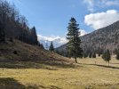
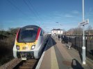
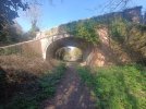
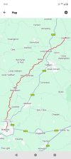
I always like to include a bit of railway archaeology in my walks and this one last week included a few hundred yards of the old trackbed of the East Kent Railway. Closed in the early 50s but this stretch near Knowlton is still traceable. Also nearby is a wonderful holloway which was an unexpected bonus.
IMG_0216.jpegIMG_0213.jpegIMG_0289.jpeg
 
Sponsor Post - registered members do not see these adverts; click here to register, or click here to log in
R

RailUK Forums

32475

Member
Joined
2 Nov 2019
Messages
815
Location
Sandwich
Last week’s walk took in the sites of 3 East Kent Railway stations, namely Ash Town, Staple and Wingham Colliery Halt plus walking over the course of the now filled in cutting but never track laid extension to Stodmarsh. All of the above are long since obliterated but you can still see clues to the course of the railway if you know where to look.
My route also took in Seaton, Wickhambreaux and Ickham.
IMG_0367.jpegIMG_0294.jpegIMG_0302.jpeg
 

dangie

On Moderation
Joined
4 May 2011
Messages
2,353
Location
Rugeley Staffordshire
Does anyone use a poncho to keep the rain off when it rains? I used one years ago when summer walking in the Alps as I found them better in the warm weather both for keeping dry and not overheating. However that was years ago and that poncho has long deceased.

Going down to Boscastle Cornwall in a couple of weeks. Probably do some of the South West Coastal Path plus other local walks. Thinking of getting another poncho. On Amazon they range from £5 to £50 and more. I’m thinking that something in the region of £15-20 should get something ok for a piece of kit that is really no more than a cut open large bin bag. However it needs to be large enough to cover a smallish rucksack on my back and a camera bag on my front.

Any thoughts or advice would be appreciated.
 

bspahh

Established Member
Joined
5 Jan 2017
Messages
2,421
Does anyone use a poncho to keep the rain off when it rains? I used one years ago when summer walking in the Alps as I found them better in the warm weather both for keeping dry and not overheating. However that was years ago and that poncho has long deceased.

Going down to Boscastle Cornwall in a couple of weeks. Probably do some of the South West Coastal Path plus other local walks. Thinking of getting another poncho. On Amazon they range from £5 to £50 and more. I’m thinking that something in the region of £15-20 should get something ok for a piece of kit that is really no more than a cut open large bin bag. However it needs to be large enough to cover a smallish rucksack on my back and a camera bag on my front.

Any thoughts or advice would be appreciated.
I bought one once. I was unimpressed. When it was windy, it was cold and turned into a sail. If you have one which is waterproof, then the fabric will rustle, which I found annoying. When I used it in the rain and then packed it away, it was wet and bulky. I had to have another jacket as well as the poncho for the wind.

On a budget, I would wait for jackets in the middle of Lidl or Aldi. You can get something for £20-30 which will be close in performance to much more expensive jackets.

I like Paramo Alta jackets. I bought have bought a couple from their outlet on eBay. They aren't cheap, but they are really comfortable. Its really adjustable, with velcro and elastic cuffs, so you can seal them up its cold, but still look at a watch. There are zips under the arms for more ventilation if you're getting hot.

The fabric is breathable. You can reproof them with Nikwax Tech wash and TX Direct.

The outer layer of the fabric absorbs a bit of water. That means in a shower you don't get a dry top and a soaking wet band at from the water that has run off the jacket. In heavy rain, you need overtrousers. In prolonged heavy rain you also need waterproof boots.

 

dangie

On Moderation
Joined
4 May 2011
Messages
2,353
Location
Rugeley Staffordshire
I bought one once. I was unimpressed. When it was windy, it was cold and turned into a sail. If you have one which is waterproof, then the fabric will rustle, which I found annoying. When I used it in the rain and then packed it away, it was wet and bulky. I had to have another jacket as well as the poncho for the wind.

On a budget, I would wait for jackets in the middle of Lidl or Aldi. You can get something for £20-30 which will be close in performance to much more expensive jackets.

I like Paramo Alta jackets. I bought have bought a couple from their outlet on eBay. They aren't cheap, but they are really comfortable. Its really adjustable, with velcro and elastic cuffs, so you can seal them up its cold, but still look at a watch. There are zips under the arms for more ventilation if you're getting hot.

The fabric is breathable. You can reproof them with Nikwax Tech wash and TX Direct.

The outer layer of the fabric absorbs a bit of water. That means in a shower you don't get a dry top and a soaking wet band at from the water that has run off the jacket. In heavy rain, you need overtrousers. In prolonged heavy rain you also need waterproof boots.
Thank you for the reply. I already have sets of rain and wet weather gear, jacket & over trousers etc, but for the shortish walks we’ll be doing I was hoping not to need them. If it’s already raining or the forecast is for rain we’ll find something else to do. The poncho idea was really for something quick to cover both myself & rucksac/camera bag in case of the inevitable shower.
 

dangie

On Moderation
Joined
4 May 2011
Messages
2,353
Location
Rugeley Staffordshire
Just walked the short stretch of the South West Coast Path from Tintagel to Boscastle. Beautiful December day. Very mild temperature, blue sky, little wind. Absolutely fabulous scenery..... and beer in the Cobweb Inn Boscastle. Heaven.
 

Iskra

Established Member
Joined
11 Jun 2014
Messages
10,680
Location
West Riding
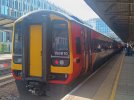
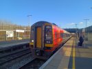
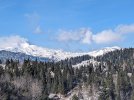
I took the early morning EMR service to Edale today and climbed Mam Tor and walked along to Back Tor. Absolutely worth braving the freezing conditions to blow away the post-Christmas malaise.


IMG_7841.jpegIMG_7850.jpegIMG_7884.jpegIMG_7895.jpegIMG_7898.jpegIMG_7901.jpeg
 

D6130

Established Member
Joined
12 Jan 2021
Messages
8,998
Location
West Yorkshire/Tuscany

THC

Member
Joined
21 Sep 2009
Messages
718
Location
Stuck on the GEML
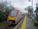
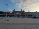
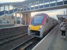
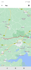
Great Dunmow to Halstead, 17 miles. A fine way to start the year's walking with a day out in the north Essex sunshine, which bathed everything in an ethereal glow thanks to sub-zero temperatures all day. The floods of recent times thankfully subsided, I crossed en route rivers Chelmer, Pant, and finished bedside the Colne at Halstead. And the twenty minute approach to Stebbing church and village is an early contender for mile of the year. Beautiful. :E
THC
 

Attachments

  • IMG_20250112_090557335_HDR.jpg
    IMG_20250112_090557335_HDR.jpg
    4.1 MB · Views: 17
  • IMG_20250112_100539768.jpg
    IMG_20250112_100539768.jpg
    2.2 MB · Views: 12
  • IMG_20250112_154350354.jpg
    IMG_20250112_154350354.jpg
    3.9 MB · Views: 17
  • Screenshot_20250112-155003.png
    Screenshot_20250112-155003.png
    457.6 KB · Views: 16

32475

Member
Joined
2 Nov 2019
Messages
815
Location
Sandwich
One from last week from Seabrook near Folkestone to Appledore along the Royal Military Canal. Tiny churches and pillboxes aplenty. IMG_1019.jpegIMG_0922.jpegIMG_0935.jpegIMG_0941.jpeg
 

32475

Member
Joined
2 Nov 2019
Messages
815
Location
Sandwich
What's the towpath like as that canal has been on my list to do at some point?
Hi Kite159. Given the time of year eg cold and wet I have to say the path is generally pretty good. In Hythe it’s paved, some of it is farm track but all very walkable and flat as a pancake as you would expect. The only tricky bit of path is a narrow sloped surface for half a mile I think near Ruckinge. There’s plenty to see on the way. Look out for the old Hythe Tramway depot just north of the canal, the RH&DR terminus and the route goes under the Hastings- Ashford line. At the extreme east end of the canal the towpath doesn’t start until a few hundred yards and is on the south side where there’s a car park. Next time I’m planning to continue from Appledore to Rye and Winchelsea.
 

Kite159

Veteran Member
Joined
27 Jan 2014
Messages
22,744
Location
West of Andover
Thanks, one more to go onto ze list :)

------

Making use of a free day today, I headed towards Devon to make a start with the off-road sections of the Tarka Trail in North Devon, walking along the beautiful disused section from Bideford to Barnstaple. First section was a bit noisy when it ran close to the road but it soon changed into very peaceful and quite remote. Just leaves the section from Braunton to Barnstaple & Bideford - Meeth to try and do at some point.
 
Last edited:

THC

Member
Joined
21 Sep 2009
Messages
718
Location
Stuck on the GEML
18 January 2025

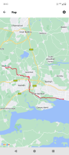
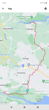
Billericay to Chalkwell, 18.5 miles. This was south Essex in all its glory, including a blocked footpath at Wickford that meant I had to divert through a traveller site and take my chances with the canine welcoming committee. Despite a couple of nips to my left ankle no blood resulted so I'll take that as a draw. Crossing the A127 I skirted the edge of Basildon, on through Bowers Gifford for a bit of the England Coast Path to Benfleet. I then walked across Hadleigh Marsh, under what's left of the castle before the last couple of miles through Old Leigh to finish at Chalkwell, in sight of the Crow Stone where the Thames turns into the sea.

--

25 January 2025

== Doublepost prevention - post automatically merged: ==

Hullbridge to Benfleet, 11.5 miles. Another adventure in south Essex, starting in sight of the River Crouch as it flows out towards the sea, turning south to head for Hockley Woods and the friendliest walkers ever - each and every one I met said hello, even the kids. Across the A127 and on through Daws Heath with its lovely clapboard houses, then through Hadleigh and down to sea level for views over to Canvey then the finish at historic Benfleet. And what a lovely day for it - sunshine all the way. 8-)

THC
 

Attachments

  • IMG_20250118_094752935.jpg
    IMG_20250118_094752935.jpg
    3.9 MB · Views: 19
  • IMG_20250118_151523611.jpg
    IMG_20250118_151523611.jpg
    4.8 MB · Views: 18
  • IMG_20250118_162237602.jpg
    IMG_20250118_162237602.jpg
    3.6 MB · Views: 18
  • Screenshot_20250118-181056.png
    Screenshot_20250118-181056.png
    539.3 KB · Views: 20
  • IMG_20250125_110109736_HDR.jpg
    IMG_20250125_110109736_HDR.jpg
    4.3 MB · Views: 7
  • IMG_20250125_115917595.jpg
    IMG_20250125_115917595.jpg
    3.2 MB · Views: 7
  • IMG_20250125_153032548.jpg
    IMG_20250125_153032548.jpg
    1.8 MB · Views: 4
  • Screenshot_20250125-154536.png
    Screenshot_20250125-154536.png
    543 KB · Views: 4
Last edited:

johnnychips

Established Member
Joined
19 Nov 2011
Messages
3,823
Location
Leeds
Along the River Aire today from my new home in Leeds to Knottingley. Lovely sunny day, very busy with dogs and cyclists to Woodlesford, less so afterwards. Diverted to Fairburn village for a welcome pint at The Three Horseshoes. It was strange not seeing the cooling towers at Ferrybridge: instead there are massive gas-powered stations instead. Finally, a cheap pint in the Railway at Knottingley - a friendly locals’ pub. It was about 17 miles.

The photo shows the ‘Ferrybridge’ from 1797, and on the right is the ex-A1, which has now itself been bypassed.

1737836878326.jpeg
 
Last edited:

THC

Member
Joined
21 Sep 2009
Messages
718
Location
Stuck on the GEML
15 February 2025

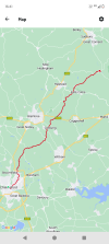
Chelmsford to Bures, 27 miles. An early start to stay ahead of the sleet paid off as I walked from Essex's county town (city these days) to finish right on its border with Suffolk. From the city centre I set out through Springfield and Beaulieu, joining the Essex Way footpath briefly at Fuller Street. On through White Notley village to Cressing then over the A120 at Bradwell led me up hill and down dale (well, what passes for such in Essex) to Colne Engaine then through the back roads and on to Bures for a pint at the Eight Bells and the train home. Back to Bures tomorrow to continue on to Ipswich - if my legs are still working!

---

16 February 2025

== Doublepost prevention - post automatically merged: ==

Bures to Ipswich, 21.5 miles. Back to the border this morning for day two, following yesterday's marathon walk from Chelmsford to the edge of Essex. I crossed into Suffolk in the first half mile, sticking to minor roads all the way to Nayland. From there it was up the hill to Stoke-by-Nayland and over the fields to Shelley, where a chance encounter with the lord of the manor set me on the correct path. That led me to Chattisham, just north of Washbrook and the bridge over the A14. With new-build Ipswich in sight, I took the lower road past Chantry Park into Ipswich proper, and finished up with some river walking to pass Ipswich Town FC and onto the railway station. It's 49 miles from Chelmsford to Ipswich my way, and now I'm going home.

THC
 

Attachments

  • IMG_20250215_065459215_HDR.jpg
    IMG_20250215_065459215_HDR.jpg
    3.7 MB · Views: 12
  • IMG_20250215_065654691_HDR.jpg
    IMG_20250215_065654691_HDR.jpg
    2.9 MB · Views: 7
  • IMG_20250215_163304209.jpg
    IMG_20250215_163304209.jpg
    5.6 MB · Views: 8
  • Screenshot_20250215-164119.png
    Screenshot_20250215-164119.png
    557.8 KB · Views: 8
  • IMG_20250216_085057707.jpg
    IMG_20250216_085057707.jpg
    5.4 MB · Views: 1
  • IMG_20250216_163235342_HDR.jpg
    IMG_20250216_163235342_HDR.jpg
    1.9 MB · Views: 1
  • IMG_20250216_163946679_HDR.jpg
    IMG_20250216_163946679_HDR.jpg
    3.8 MB · Views: 5
  • Screenshot_20250216-164710.png
    Screenshot_20250216-164710.png
    698.2 KB · Views: 5
Last edited:

Kite159

Veteran Member
Joined
27 Jan 2014
Messages
22,744
Location
West of Andover
Along the River Aire today from my new home in Leeds to Knottingley. Lovely sunny day, very busy with dogs and cyclists to Woodlesford, less so afterwards. Diverted to Fairburn village for a welcome pint at The Three Horseshoes. It was strange not seeing the cooling towers at Ferrybridge: instead there are massive gas-powered stations instead. Finally, a cheap pint in the Railway at Knottingley - a friendly locals’ pub. It was about 17 miles.

The photo shows the ‘Ferrybridge’ from 1797, and on the right is the ex-A1, which has now itself been bypassed.

View attachment 173465
What's the towpath quality like as that walk is on my list to do at some point, even splitting in Castleford.
 

johnnychips

Established Member
Joined
19 Nov 2011
Messages
3,823
Location
Leeds
What's the towpath quality like as that walk is on my list to do at some point, even splitting in Castleford.
I would say excellent to Woodlesford then good to Ferrybridge, though I did a deviation to visit Fairburn.
I have continued from Ferrybridge, and your post is an incentive to write it up.

== Doublepost prevention - post automatically merged: ==

A couple of Saturdays ago I continued my walk along the Aire. I got a couple of still-£2 buses from Leeds to Ferrybridge and was rewarded with the sight of two herons flying around almost immediately. The river has by now lost any significant boat traffic to the canal to the south, so it meanders a lot, making you think no progress is being made.
Past Beal and West and Chapel Haddlesey to a point where a track was shown on the map leading to a public footpath about 200m away. This was gated, and had many ‘Keep Out’ signs, which I judiciously ignored to avoid a mile diversion along the A19. When I did get to the path, that was blocked half way along.
Finally I got to Hensall and regained the banks of the Aire, watching the Drax trains pass, meandering all the way to Snaith as the sun was setting. The village pub, the Bell and Crown, had a superb atmosphere. Rather than wait three hours for the one evening train to Leeds I got the 401 to finish off at Selby.

An initial impression was that the people in Ferrybridge were prodigious litter-louts until realised that all the detritus on the banks had been deposited in the last flood.1739916102982.jpeg

1739915948061.jpeg
 
Last edited:

THC

Member
Joined
21 Sep 2009
Messages
718
Location
Stuck on the GEML
Halstead to Manningtree, 22 miles. Setting out through Halstead old and new, my route was east across the Colne Valley, while mostly avoiding the river and the villages - to the south lay Colne Engaine and the north Earls Colne and White Colne. I crossed the Sudbury railway just north of Chappel, then walked through Wormingford and round the old wartime airfield at Mount Bures, before the back road to Boxted and Langham took me over the A12 and into Dedham. From there it was straight across the fields to my only view of the River Stour, before turning south and meeting my train with seconds to spare at Manningtree.

THC
 

Attachments

  • IMG_20250223_092525654.jpg
    IMG_20250223_092525654.jpg
    3.2 MB · Views: 9
  • IMG_20250223_164759778.jpg
    IMG_20250223_164759778.jpg
    4.3 MB · Views: 7
  • IMG_20250223_164925736.jpg
    IMG_20250223_164925736.jpg
    3.9 MB · Views: 9
  • Screenshot_20250223-165540.png
    Screenshot_20250223-165540.png
    649.8 KB · Views: 9

styles

Established Member
Joined
7 Dec 2014
Messages
4,740
Location
Gwynedd
An initial impression was that the people in Ferrybridge were prodigious litter-louts until realised that all the detritus on the banks had been deposited in the last flood.
Interesting one this.

I do believe the overwhelming amount of litter is caused by people littering, rather than incidental some litter leaks out of a dump and ends up in a stream and whatever.

When I go for low-level walks, I always take a bin bag and litter picker with me. The amount we pick up is baffling, even in places where you wouldn't expect prevailing winds to blow litter into. You occasionally get compliments (nice, but but expected), but my favourite interactions are the educational ones - I went litter-picking up the Watkins path up Snowdon once, with park rangers, and twice people asked us if the helicopter picked the rubbish up (nope!).

We find all sorts on the hills, especially in 'beauty hotspots' - people will need a poo, and literally just wipe their arse with a fleece and throw the fleece into the bushes. Thankfully it's not that bad up here in Scotland.
 

THC

Member
Joined
21 Sep 2009
Messages
718
Location
Stuck on the GEML
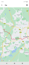
Nottingham to Ilkeston, 10 miles. A fabulous walk on what felt like the first day of spring - a much-needed tonic. From the railway station, I set out through what remains of Broadmarsh, past Nottingham Castle and the Park estate (v posh) to Lenton, then beside the River Leen and Queens Med into Wollaton Park, before leaving the city at Bramcote. I headed across Trowell Moor, over the M1, to skirt the old Nottingham Canal before crossing into Derbyshire at the very end of the walk beside Ilkeston station, right on the edge of the town.

THC
 

Attachments

  • IMG_20250228_123951682.jpg
    IMG_20250228_123951682.jpg
    2.7 MB · Views: 10
  • IMG_20250228_125331585_HDR.jpg
    IMG_20250228_125331585_HDR.jpg
    3.6 MB · Views: 7
  • IMG_20250228_155907810.jpg
    IMG_20250228_155907810.jpg
    4.3 MB · Views: 9
  • Screenshot_20250228-155419.png
    Screenshot_20250228-155419.png
    536.9 KB · Views: 10

ChrisC

Established Member
Joined
7 Oct 2018
Messages
2,253
Location
Nottinghamshire
Nottingham to Ilkeston, 10 miles. A fabulous walk on what felt like the first day of spring - a much-needed tonic. From the railway station, I set out through what remains of Broadmarsh, past Nottingham Castle and the Park estate (v posh) to Lenton, then beside the River Leen and Queens Med into Wollaton Park, before leaving the city at Bramcote. I headed across Trowell Moor, over the M1, to skirt the old Nottingham Canal before crossing into Derbyshire at the very end of the walk beside Ilkeston station, right on the edge of the town.

THC
That’s certainly a different and very varied route. I think I’ve walked most sections of your walk but never as a through walk from Nottingham to Ilkeston. The Park Estate is a very interesting area of Nottingham and is well worth exploring for a couple of hours, especially the entrance to it by the tunnel from Derby Road. I know Wollaton Park very well and it really is like being right out in the countryside, yet within the Nottingham City boundary. There is a very extensive network of footpaths just to the north of Trowel Moor which I have often walked and both the Nottingham Canal and Erewash Canal are great for walking beside. Have you ever visited and walked across the magnificent Bennerley Viaduct just north of Ilkeston Station? You missed a treat by not visiting the viaduct if you have never been.

I did a walk on Wednesday just to the west of Ilkeston and it really did feel like spring had arrived. My walk was only around 5 miles in length and was from Straws Bridge, through nature reserves, out towards Mapperley Village and into the huge area which is now Shipley Country Park including a section of the Nutbrook Trail. It’s much more rural to the west of Ilkeston although parts of the area is land reclaimed following opencast coal mining.
 

THC

Member
Joined
21 Sep 2009
Messages
718
Location
Stuck on the GEML
That’s certainly a different and very varied route. I think I’ve walked most sections of your walk but never as a through walk from Nottingham to Ilkeston. The Park Estate is a very interesting area of Nottingham and is well worth exploring for a couple of hours, especially the entrance to it by the tunnel from Derby Road. I know Wollaton Park very well and it really is like being right out in the countryside, yet within the Nottingham City boundary. There is a very extensive network of footpaths just to the north of Trowel Moor which I have often walked and both the Nottingham Canal and Erewash Canal are great for walking beside. Have you ever visited and walked across the magnificent Bennerley Viaduct just north of Ilkeston Station? You missed a treat by not visiting the viaduct if you have never been.

I did a walk on Wednesday just to the west of Ilkeston and it really did feel like spring had arrived. My walk was only around 5 miles in length and was from Straws Bridge, through nature reserves, out towards Mapperley Village and into the huge area which is now Shipley Country Park including a section of the Nutbrook Trail. It’s much more rural to the west of Ilkeston although parts of the area is land reclaimed following opencast coal mining.
I have family in Heanor and north Nottingham and so have been fortunate enough to walk many of the local footpaths over the years, including the Cromford, Erewash and Nottingham Canal towpaths throughout, the Erewash Valley Trail and over Bennerley Viaduct on several occasions. The first time I did it, not long after it opened to walkers, was a really windy day and I feared for my safety! Never been up there since in anything more than a mild breeze.

THC
 

CaptainHaddock

Established Member
Joined
10 Feb 2011
Messages
2,713
That’s certainly a different and very varied route. I think I’ve walked most sections of your walk but never as a through walk from Nottingham to Ilkeston. The Park Estate is a very interesting area of Nottingham and is well worth exploring for a couple of hours, especially the entrance to it by the tunnel from Derby Road. I know Wollaton Park very well and it really is like being right out in the countryside, yet within the Nottingham City boundary. There is a very extensive network of footpaths just to the north of Trowel Moor which I have often walked and both the Nottingham Canal and Erewash Canal are great for walking beside. Have you ever visited and walked across the magnificent Bennerley Viaduct just north of Ilkeston Station? You missed a treat by not visiting the viaduct if you have never been.

I did a walk on Wednesday just to the west of Ilkeston and it really did feel like spring had arrived. My walk was only around 5 miles in length and was from Straws Bridge, through nature reserves, out towards Mapperley Village and into the huge area which is now Shipley Country Park including a section of the Nutbrook Trail. It’s much more rural to the west of Ilkeston although parts of the area is land reclaimed following opencast coal mining.
I've done a similar walk to @THC but in reverse, starting at Ilkeston and finishing at Nottingham station but on a different route.

This involves following the Erewash canal North of Ilkeston station, then crossing over Bennerley viaduct and up the ramp into Awsworth. Then on to Kimberley to follow the old Midland railway path into Bulwell, where you can either bail out and get the train or continue along the path by the River Leen to Hyson Green then on through the parks into the city centre. The last few miles are predominantly urban but this is compensated by there being some great real ale pubs on the way, such as the Fox & Crown at Highbury Vale and the Lion at Basford!

Currently however the eastern exit from Bennerley viaduct is blocked off and has been for several months. According to this link there is a new path that goes under the viaduct instead but I haven't managed to walk it yet.


Kite159

Veteran Member
Joined
27 Jan 2014
Messages
22,744
Location
West of Andover
Resumed my canal walking now spring is here with the shortish section of the Leeds & Liverpool canal between Brierfield & Hapton. I was toying with doing something with the Padiham Greenway but I will probably try and link that with an explore at the Martholme Greenway end of the old loop line.

Hapton felt like the most logical place to end that walk due to the canal & railway separating for around 6 miles until it reaches Church & Oswaldtwistle. I suspect my next section will be towards Blackburn but I will need to play with Google maps and estimate the distance in places where it doesn't show the towpath.

Afterwards I jumped off at Bamber Bridge to walk towards Preston via a mixed used path in woodland (part of the 'Central Parks?') then the Old Tram Road (which seems to be closing this month for path reconstruction) and the old West Lancs railway towards Preston detouring at Whitehouse Junction for the former link to the disused Preston - Southport line. Just to pass the time and make use of the sunshine.
 

iknowyeah

Member
Joined
11 Aug 2016
Messages
185
I'm a very fairweather hiker so not done any in months, however I have a few on my list to do soon.

One is the Broadbottom bluebell fields once spring hits in the next few weeks. I'm planning to try and do this early and then head up to Glossop to add a few more miles through the moors.

Had a fantastic one last year that ended badly as I can't do cable cars, but the base up to Velika Planina in Slovenia. Beautiful trip, then a long slog down through a snowy, impassible road.

Most of mine now are in the Alps but still try as many local ones in the Peaks as I can
 

Attachments

  • PXL_20240320_140032753.jpg
    PXL_20240320_140032753.jpg
    3.2 MB · Views: 8
  • PXL_20240320_124401840.jpg
    PXL_20240320_124401840.jpg
    4.9 MB · Views: 8

johnnychips

Established Member
Joined
19 Nov 2011
Messages
3,823
Location
Leeds
Continuing my travels on the Aire, two weeks ago I walked from my home in the city westwards. I was wanting to walk near the river rather than the Leeds-Liverpool canal, but this was initially difficult. The canal was pleasant but really busy with dogs, walkers and bikes. However, I left the canal and walked by the river from Calverley to Apperley Bridge, back on the canal, which was much quieter by then. After that I regained the river near Baildon and continued to Saltaire, which looked magnificent. I did manage to get to Bingley on the river after getting a bit lost, to the smallest Wetherspoons I have been in for an Old Peculier.

Today I took the Aireline 60 back to Bingley, my intention to continue by the river as much as possible. This meant a steep climb out of the valley to Thwaites as there was no riverside path. A descent to the edge of Keighley put me back on the river. What I thought was an underpass for the A650 wasn’t, so a brambly scramble up and down the embankment wasn’t pleasant. Eventually I got to Kildwick and left the river to a point above Glusburn, where the photo was taken.
The walk on the Aire from there was delightful. But I didn’t realise the river doesn’t go through Skipton, so I pressed on to Carleton and Gargrave, where both pubs were heaving.

So now I have two legs left: the source to Gargrave and Snaith to the confluence with the Ouse.
1741470498031.jpeg
 

Cletus

Established Member
Joined
11 Dec 2010
Messages
2,397
Location
Dover
Walked the Harborne Walkway in Birmingham at the weekend.


Also some (mainly) canal walking:-
Tame Bridge station to Hamstead station
Yardley Wood station to Kings Norton station
Bearley station to Wilmcote station
 

THC

Member
Joined
21 Sep 2009
Messages
718
Location
Stuck on the GEML
Braintree to Lavenham, 24 miles. I started out with Sudbury in mind, just over the border in Suffolk, but after clearing the Hedinghams ten miles in by midday I went for broke. On through Gestingthorpe - a rare Viking place name this far south - and a swerve past the site of Borley Rectory, in its time reputedly the most haunted house in England, led me over the Stour into Long Melford with thoughts of Sudbury far behind. I left the two-mile main street before seeing too much of it, heading up the old railway walk to the back road into Lavenham. My bus never showed up so I had to wait over an hour for the next one, but spending that time in Lavenham on a sunny afternoon is no hardship at all.

THC
 

Attachments

  • IMG_20250329_075028134_BURST000_COVER.jpg
    IMG_20250329_075028134_BURST000_COVER.jpg
    4.3 MB · Views: 14
  • IMG_20250329_141724267.jpg
    IMG_20250329_141724267.jpg
    3.6 MB · Views: 12
  • IMG_20250329_165229492_HDR.jpg
    IMG_20250329_165229492_HDR.jpg
    3.6 MB · Views: 16
  • Screenshot_20250329-155108.png
    Screenshot_20250329-155108.png
    525.5 KB · Views: 16

Top