Our new ticketing site is now live! Using either this or the original site (both powered by TrainSplit) helps support the running of the forum with every ticket purchase! Find out more and ask any questions/give us feedback in this thread!
My most recent walk was a small hill called Nicky Nook near Garstang (Scorton) with excellent views over Fylde, Morecambe Bay and the Bowland Fells in the immediate area.
It explains the slight kink in the M6 just before it crosses the Wyre.
Nicky Nook is a 5 mile round walk from Scorton village, up and over the M6 until the lane ends at a T-Junction just where the Nicky Nook paths shoots straight up into the moors all the way to the trig point. You could turn back or head over and down to Grizedale reservoir and head back down the valley and turn right at the first moment back to the road you just turned off.
Did the "Liverpool Loop" line yesterday, starting off at Hunts Cross towards Halewood Park (doing a little loop to do the other side of the railway triangle) along the tarmac mixed use path towards Fazakerley. Busy in places with other walkers/cyclists, only former station still in existence was at West Derby (all the other stations platforms have gone, or are massively overgrown)
An enjoyable walk with the changing scenery of the Liverpool suburbs, ended up doing just over 14 miles.
I did a good walk from Kirkby Lonsdale yesterday 23 Jan., starting at Devil's Bridge, up through the caravan park and across fields and by lanes to Fellfoot Road, a bridleway. Noticed some peculiar large boulders in the corners of 2 fields, each enclosed in a stone wall, about 8 feet square, with a stile into the enclosure. What can these be? Glacial erratics, perhaps, but why walled in like this? Then left the bridleway and cut across park-like fields with impressive specimen trees past several fine mansions, e,g. Whelprigg, to Barbon. At one point had to fend off a horse that wanted to come through a gate we needed to open. At Barbon we had lunch in the churchyard, where there are plenty of benches and a picnic table, and also noticed what was still to be seen of the old railway alignment: an 8 ton limit bridge carrying a green track over the old cutting, otherwise mostly built on (and not permitted for walking where it isn't). We then walked back across a golf course, and along the Barbon Beck, towards Casterton, deviating from our planned route at one point because the path through woods was blocked by fallen trees. There are some maddening paths in this area which would allow many convenient walks if they were rights of way, e.g. the Underley School bridge across the Lune.
== Doublepost prevention - post automatically merged: ==
My most recent walk was a small hill called Nicky Nook near Garstang (Scorton) with excellent views over Fylde, Morecambe Bay and the Bowland Fells in the immediate area.
It explains the slight kink in the M6 just before it crosses the Wyre.
Nicky Nook is a 5 mile round walk from Scorton village, up and over the M6 until the lane ends at a T-Junction just where the Nicky Nook paths shoots straight up into the moors all the way to the trig point. You could turn back or head over and down to Grizedale reservoir and head back down the valley and turn right at the first moment back to the road you just turned off.
You can see a map of the area in the attachment to my post no. 125 in this thread. I agree, it's a fine place for a walk.
Yesterday (29 Jan.) I did the other half of my recce at Colne, walking from the station to Foulridge, round 2 sides of the larger reservoir, across the road, and then across the smaller reservoir by a causeway, where I got splashed by waves whipped up by the strong wind, then down to Christ Church on the Keighley road, where I had time for a bite to eat on a bench in the churchyard before catching the 14:00 M4 bus at the stop opposite, where I had finished the previous half-recce 2 weeks earlier.
Today 12 February I did an exhilarating walk on my own in a howling gale and driving rain on Kirkby in Furness fell. From the station (arr 11.22) I walked up the lane and then turned right up a footpath marked for the A595, to look at the interesting model buildings crafted in slate in a garden at Bell Hall, well worth seeing. From the A595 I then walked up the track of the old slate tramway to the lane that comes up steeply from Chapels, turned right and went past Longlands caravan site to the fell gate which gives access to the moorland and windfarm. I followed the track as far as the second wall corner (blundering by taking the path at the first wall corner by mistake, but soon realised where I had gone wrong). This brought me to the lane from Ulverston to Kirkby, which I crossed, continuing along a broad grassy track (very wet with fords) until I reached a point where I could make a zig zag descent to Gargreave, a fold of cottages. I crossed the A595, walked through fields until a footbridge and then turned right and crossed more muddy fields to the hamlet of Soutergate. I then headed for the coast but turned right across fields to Sandside, and then left and across the railway for a short section along the shore to Kirkby in Furness station. A delightful walk, in spite of the weather. Railway photographers could get good shots of the trains crossing the Duddon Moss between Foxfield and Kirkby from the bridleway that goes up from the fell gate to Horse Head.
Following the discussion in January, we took advantage of the early appearance of some good weather to do stage one of the Pewsey to Reading walk on Saturday and this stage is actually 10 miles ( the remaining four stages should be 8, 9, 8 and 7 miles respectively ). This took us 6½ hours. we did have a bit of fun on the way down as the Berks and Hants was shut from 09.00 to 11.00 due to a signaller being off sick and the relevant panel could not be covered - awkward when we were aiming at the 08.35 off Paddington! Saw just in time what was happening and managed to get the 08.07 to Newbury and GWR very efficiently sorted us out with a taxi from there to Pewsey and that was just as well; the 10.35 was delayed and had we waited for that, we would have very probably run out of daylight while still on the towpath between Crofton and Bedwyn, which would have been rather awkward. Unfortunately a second two hour closure of the line between 14.00 and 16.00 meant no photos of trains on the Crofton stretch - rather annoying as the weather and light were perfect for that purpose in that area at the time. We reached Bedwyn just ten minutes before the 16.41 to Paddington - which was also the first train after the second closure.
I did a good walk from Kirkby Lonsdale yesterday 23 Jan., starting at Devil's Bridge, up through the caravan park and across fields and by lanes to Fellfoot Road, a bridleway. Noticed some peculiar large boulders in the corners of 2 fields, each enclosed in a stone wall, about 8 feet square, with a stile into the enclosure. What can these be? Glacial erratics, perhaps, but why walled in like this? Then left the bridleway and cut across park-like fields with impressive specimen trees past several fine mansions, e,g. Whelprigg, to Barbon. At one point had to fend off a horse that wanted to come through a gate we needed to open. At Barbon we had lunch in the churchyard, where there are plenty of benches and a picnic table, and also noticed what was still to be seen of the old railway alignment: an 8 ton limit bridge carrying a green track over the old cutting, otherwise mostly built on (and not permitted for walking where it isn't). We then walked back across a golf course, and along the Barbon Beck, towards Casterton, deviating from our planned route at one point because the path through woods was blocked by fallen trees. There are some maddening paths in this area which would allow many convenient walks if they were rights of way, e.g. the Underley School bridge across the Lune.
Did a linear walk a few days ago for a local walking club. Walked mainly along the Irwell valley from Manchester Victoria to Radcliffe (10 miles) and returned by Metrolink Tram. Mostly fairly easy walking along riverside paths and included a section of old railway from Clifton to Radcliffe (Outwood trail)
Did a couple walks this last weekend
Saturday from Mossley station towards Manchester city centre following the Huddersfield Narrow Canal & Ashton Canal. Around 12 miles
Changes from rural woodland to residential, industrial (both current & old), a nice varied route. Some low bridges along the way, only time away from the towpath was in Ashton where it goes into a tunnel underneath an Asda.
Then yesterday (Sunday) I walked from Garforth towards Castleford following part of the former branch line, detouring to visit the St. Aidan's RSPB reserve (beautiful lake)
After Allerton Bywater when the railway path ends, I took a footpath which went via RSPB Fairburn Ings (from Newton Lane) reaching the old viaduct over the River Aire (then towards Castleford via the canal towpath & roads). That was just over 11 miles according to my Strava app
Has anyone took the following walk and can tell me if walking the blue path from Duncraig to Plockton station will take less than an hour for a reasonably fit person and also if it is a trainers or boots type of walk?
What's the distance? If it's best part of four miles, would probably allow an hour and a half. Depends on terrain, height gain on the route, your typical walking speed and general fitness. Somewhat less than four miles should obviously be quicker. Your mileage may vary.
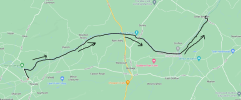
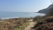
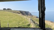
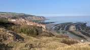
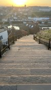
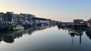
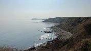
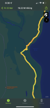
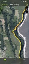
(Just outside) Scarborough to Whitby again last Friday, a distance of just shy of twenty miles along the Cleveland Way. The highlight was of course the hearty fish and chips in Whitby after. Just over six hours, 2,678ft elevation gain, and 3,032Kcal burned.
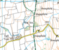
The only diversion I know was coming out of Robin Hoods Bay at Mount Pleasant North, but that was just one minute. I’ll post a photo of the route I took below at Hayburn Wyke and let you judge as I’m not too sure:
When I last did the section in 2018, wasn't previously aware of the extra mileage of the (temporary?) Hayburn Wyke diversion, and this resulted in having to "speed march" the final (two miles?) road section from Scalby Mills up to Scarborough station so as to ensure I made my pre-booked First Class advance back home (which I did with just 30 mins to spare).
Has anyone took the following walk and can tell me if walking the blue path from Duncraig to Plockton station will take less than an hour for a reasonably fit person and also if it is a trainers or boots type of walk?
We walked from Plockton village to Duncraig Station and back again in 2018 as part of our exploration of the Scottish railways. The walk along the road from the village to the start of the path is quite steep uphill. There are also many paths, so route finding is not trivial. We took about 3.5 hours for the round trip, but at quite a leisurely pace and a break at Duncraig Station and for gathering mushrooms. A hour for one way would be just about possible, but tight in my opinion.
In terms if footwear, anything but the most inappropriate shoes should be fine.
Your advice was good. I opted for boots as I knew snow and rain would be expected. It was wet in many places but not so muddy. Expect plenty of wet rocks underfoot. It is an up and down path all the way between stations but there wasn't so many paths to choose and there is a fingerpost part way through to direct you.
It's a cracking walk.
Has anyone took the following walk and can tell me if walking the blue path from Duncraig to Plockton station will take less than an hour for a reasonably fit person and also if it is a trainers or boots type of walk?
Have you tried plotting the route into the one of the more specialist apps such as Komoot or OS Maps (both are available via the web). You’ll need to register but they take not only distance but also elevation gain into account. Komoot is very good as it gives a break down of the types of surface you’ll be walking along (eg tarmac, gravel etc and is especially popular with cyclists for this reason). Although there can always be errors with these things once you’ve plotted the route into both you’ll have a pretty good idea how long it’ll take, and a rough idea on the surface.
It was about 30 minutes and about 1 mile. I was stopping for photos every so often and being ginger with footing on one particular downhill section. If it was dry and I was in a rush, maybe 20 mins.
The ‘OS Maps’ app. You can either pay for a subscription (about £30 per year) which gives you access to the whole of Great Britain, or buy a paper 25k or 50k map which will give you a code for a digital version of that particular map.
Get inspired & explore the outdoors with unlimited maps across multiple devices. Find & create routes for walking, hiking, running, cycling & more. Try it for free.
I did the Middlewood Way yesterday (Macclesfield towards Rose Hill), quite a nice route. Was expecting it to be muddier than it was, but other than a few short sections (where it gets narrow under bridges) it was fine.
Even got lucky with the timings at the Rose Hill end as the train was rolling in when I came across the car park.
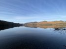
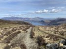
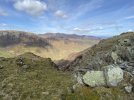
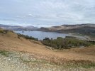
Yes, it was a beautiful frosty morning at the outset and all peaks both in the Lakes and Pennines around the A66 were capped with snow. That said, I’ve still managed to get sun burnt today (not badly, and I go brown after the red phase is done with)
We are aware of an issue with emails from the Forum to Microsoft-based email accounts (hotmail/outlook/live.com email addresses). This is being looked into currently, thanks for your patience meanwhile.








www.geograph.org.uk


 (not badly, and I go brown after the red phase is done with)