Our new ticketing site is now live! Using either this or the original site (both powered by TrainSplit) helps support the running of the forum with every ticket purchase! Find out more and ask any questions/give us feedback in this thread!
The nearer car has been described as a Morris 10, which went out of production in 1948, replaced by the quite different Morris Oxford. KJW numbers were issued in Wolverhampton between July 1952 and June 1953, so one or the other of these two points looks incorrect.
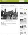
There are many things about this scene that don’t seem quite right,
why the wicket gates, there are no pavements for pedestrians or any sign that it might see pedestrian traffic.
why the reflective posts by the roadside, I don’t see a hazard.
most level crossing gates have a circular red target in the centre but not here.
we do not know what is behind the photographer, might be a new housing development.
why, at a time when photography was an expensive hobby was the photo taken.
There are many things about this scene that don’t seem quite right,
why the wicket gates, there are no pavements for pedestrians or any sign that it might see pedestrian traffic.
why the reflective posts by the roadside, I don’t see a hazard.
most level crossing gates have a circular red target in the centre but not here.
we do not know what is behind the photographer, might be a new housing development.
why, at a time when photography was an expensive hobby was the photo taken.
Were red targets used in locations where the gates were protected by signals? Does their absence suggest that there is a signal box just out of shot and the gates are within station limits?
== Doublepost prevention - post automatically merged: ==
The nearer car has been described as a Morris 10, which went out of production in 1948, replaced by the quite different Morris Oxford. KJW numbers were issued in Wolverhampton between July 1952 and June 1953, so one or the other of these two points looks incorrect.
I agree that there is probably a road joining from the left immediately after the crossing. The crossing widens significantly towards that corner - the far wicket gate is way out of line - and there is road surface visible between the bars of the gates where it would otherwise be verge.
It's a shame we can't see more of the third car which is hidden by the nearside gate post (apart from its offside rear wing). Is it on the road, or parked (rather unwisely) just beyond a junction?
There are many things about this scene that don’t seem quite right,
why the wicket gates, there are no pavements for pedestrians or any sign that it might see pedestrian traffic.
The posts with reflectors help to line traffic up with the crossing, particularly in the absence of a kerb and possibly in a snowfall. May also be to deter parking on the verge on the approach to the crossing?
There were several variations in targets - not just round ones. It looks to me, although the gates are some distance away, that in this case they may have been square?
we do not know what is behind the photographer, might be a new housing development.
why, at a time when photography was an expensive hobby was the photo taken.
We've established that we're in the post-WW2 era. Photography became much cheaper after the war, particularly when stocks of spare 35mm and other film became available. I was taking my first photos around 1954 when I was eight years old, albeit on 120 size film and with the help of relatives.
A bit of gentle googling tells me that my post #63 isn't quite right. The BoT required targets in all instances to be displayed to road users when the gates were across the carriageway, though they weren't needed to warn trains if the crossing was signal protected. The same source suggests that square targets were standard practice on the NER.
Squad targets standard on the NER, and possibly the LNER?
pure speculation but I am leaning towards the old midland and great northern joint, and possibly a connection with the vastly increased road traffic for the airfields in east anglia needing a new crossing to be created
added but was not a lot of the joint line single track
Are we sure it's a crossing keeper's cottage? It could be part of a station building of some sort.
The home semaphore signal suggests there's a signal box nearby: how far from a box can a mechanically operated signal be located? I'm struck by looking at the North Staffs line from Stoke to Willington how many level crossings in the countryside have little signal boxes and not crossing keepers cottages. The cottages - or at least those remaining - tend to be in or near built up areas where there are several crossings or a closed station nearby. Where presumably the signal boxes were.
Squad targets standard on the NER, and possibly the LNER?
pure speculation but I am leaning towards the old midland and great northern joint, and possibly a connection with the vastly increased road traffic for the airfields in east anglia needing a new crossing to be created
added but was not a lot of the joint line single track
Are we sure it's a crossing keeper's cottage? It could be part of a station building of some sort.
The home semaphore signal suggests there's a signal box nearby: how far from a box can a mechanically operated signal be located? I'm struck by looking at the North Staffs line from Stoke to Willington how many level crossings in the countryside have little signal boxes and not crossing keepers cottages. The cottages - or at least those remaining - tend to be in or near built up areas where there are several crossings or a closed station nearby. Where presumably the signal boxes were.
Many crossings had non-block signals worked by the keeper from a ground frame. Often there were just distance with the target on the gate serving as the stop signal, but poor sighting could explain the stop signal.
I'm beginning to wonder if we're looking at a station that has it's platforms staggered. hence the need for the wicket gates?
The posts with reflectors help to line traffic up with the crossing, particularly in the absence of a kerb and possibly in a snowfall. May also be to deter parking on the verge on the approach to the crossing?
There were several variations in targets - not just round ones. It looks to me, although the gates are some distance away, that in this case they may have been square?
We've established that we're in the post-WW2 era. Photography became much cheaper after the war, particularly when stocks of spare 35mm and other film became available. I was taking my first photos around 1954 when I was eight years old, albeit on 120 size film and with the help of relatives.
The problem is that having similar bargeboards is not enough as this general style was used by a number of railways: they need to be identical. If they are identical then it might be the actual cottage or another one of a batch that were put up by the same company or contractor. The nearest I have found to the original photo, although not identical, was the Great Northern Railway which used a number of such styles. However, that merely makes me think that the GNR is the best railway to start with if someone wants to do an exhaustive search, although I don’t know how that could be done.
The original pic (early post war) shows the ridge as plain tiled - no fancy tiles along the ridge with decorative tops. The Staffs past track image (dated 1953) shows old ridge tiles with fancy ridge pattern, albeit some broken - so you would expect them to have been there c1950 for example, and they aren't
the modern google street view image has plan modern ridge tiles suggesting the ridge has been re-tiled since the staff past track image was taken.
It certainly is a LNWR design crossing cottage. There were several crossings between Northampton and Market Harborough: Broughton, Stratton, Pitsford and Draughton all spring to mind but I can't find photos on the internet that match entirely: the crossings are skewed or the cottage is the wrong way round. The photo at Harborough is very similar but from memory the area near that crossing was always more built up.
The cottage is a mirror image! There's a Geograph photo from 2000 when it (at Little Bowden Crossing, confusing though that may be) still had its barge boards ... and guess what they look exactly like. So the two must have been built as part of a single railway building contract. https://s0.geograph.org.uk/geophotos/05/63/93/5639327_be265b8e.jpg[Tim Glover]
The cottage is a mirror image! There's a Geograph photo from 2000 when it (at Little Bowden Crossing, confusing though that may be) still had its barge boards ... and guess what they look exactly like. So the two must have been built as part of a single railway building contract. https://s0.geograph.org.uk/geophotos/05/63/93/5639327_be265b8e.jpg[Tim Glover]
I fancy Lamport station crossing. There is a small building shown on the station side in this 1958 map (1:10,560 NLS), but it's gone by 1969. There is a signal box immediately off the picture on the other side. Whether you think it would be visible depends on how you understand the area marked off at the edge of the road: if it's the grass with reflector posts on it then there's room.
== Doublepost prevention - post automatically merged: ==
You could try contacting the Northampton & Lamport Railway - someone there should know a lot about the line and any pictures of it.
I don’t think it’s this location but the crossing keepers house pictured here has similar features. Tall looking telegraph poles too.
Pitsford and Brampton
Explore a place in a more immersive way in Google Maps.
maps.app.goo.gl
== Doublepost prevention - post automatically merged: ==
I should add that this is not the one in the OP's picture, it's another clone. The road at Boughton is highly skewed, which is just visible in the Pinterest picture but concealed by foreshortening.
As others have already identified, it does look remarkably like crossing cottages on the Stoke-Derby line (especially the barge-boards), although the one in the photograph does not have the decorative (darker) diagonal brickwork detail.
Looking again at the original image, it looks like the crossing is quite skewed, as in some way off being at right angles with the road. The nearest gate post on the left is the wicket gate post, the crossing gate post being further behind, and (to my eye) more distant than its opposite number on the right (by the cottage). This would also explain the apparent angle (skewed) of the left hand gate. This is not apparent if just looking at the right hand gate in isolation. Still doesn't help to identify the actual place though - Doing a google earth along many lines (open and closed) in the area, I think too much has changed over the years to make this identifiable via that method?
Further edit: having said above, the signal arm would seem to suggest the rail/road angle is nearer to right angles. Deceptive!
== Doublepost prevention - post automatically merged: ==
I noticed this on Google a short while before you mentioned it, but had dismissed it for some reason. Have just taken a closer look, the road/rail angle is about that which I was trying to get at above (a slight skew), and zooming in close there are remnants of building foundations in the undergrowth (where the cottage would have been if this were the original picture location). Next to said foundations and beside the track there is also a brick foundation remnant that could have been the base for a signal post. What do others think? This is Leigh Crossing (west of Uttoxeter) on Dodsleigh Lane. The fencing doesn't necessarily match, but it has been a few years since the original picture was taken!
I fancy Lamport station crossing. There is a small building shown on the station side in this 1958 map (1:10,560 NLS), but it's gone by 1969. There is a signal box immediately off the picture on the other side. Whether you think it would be visible depends on how you understand the area marked off at the edge of the road: if it's the grass with reflector posts on it then there's room. View attachment 167035
== Doublepost prevention - post automatically merged: ==
You could try contacting the Northampton & Lamport Railway - someone there should know a lot about the line and any pictures of it.
Here is an undated picture of Lamport station [from ebay]. It has the signal! http://tiny.cc/43ipzz
And, I believe the station building is shown in this circa 2002 picture [also from ebay] http://tiny.cc/x3ipzz
And one from facebook stated 1953, there seems to be a small building at the far end of the platform:
We are aware of an issue with emails from the Forum to Microsoft-based email accounts (hotmail/outlook/live.com email addresses). This is being looked into currently, thanks for your patience meanwhile.





 - Doing a google earth along many lines (open and closed) in the area, I think too much has changed over the years to make this identifiable via that method?