• Our new ticketing site is now live! Using either this or the original site (both powered by TrainSplit) helps support the running of the forum with every ticket purchase! Find out more and ask any questions/give us feedback in this thread!

Trivia: Railway Stations in two different counties?

Status
Not open for further replies.

MedwayValiant

Member
Joined
8 Jan 2013
Messages
390
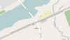
Another one for the close-to-another-county list; Roydon in Essex. The County boundary is the River, which runs immediately adjacent to the station. Therefore the village is in Essex and less than 30s walk from the Station which is in Herts

In the same general area, how about Sawbridgeworth?

The town is in Hertfordshire, but is some or all of the railway station in Essex?
 
Sponsor Post - registered members do not see these adverts; click here to register, or click here to log in
R

RailUK Forums

Old Yard Dog

Established Member
Joined
21 Aug 2011
Messages
1,823
Hooton is in Cheshire but is treated as if it were in Merseyside for fare setting purposes.
 

Harbornite

Established Member
Joined
7 May 2016
Messages
3,627
I thought of another one that I might as well include: Dovey Junction. It is very close to where the borders of Cardiganshire, Merionethshire and Montgomeryshire (Powys, Gwynedd and Ceredigion) meet.

doveymapnew.jpg


http://2.bp.blogspot.com/-jfdSL26KzlU/Ug1AjvB0rmI/AAAAAAAA0Fc/dOTXQedzeM8/s1600/doveymapnew.jpg
 
Last edited:

Surreytraveller

On Moderation
Joined
21 Oct 2009
Messages
3,905
At Birkbeck station I am unsure whether the boundary between Greater London and Kent runs through the station or along the boundary fence of the station/tramlink stop...?

Thr boundary between Kent and Greater London is miles away from Birkbeck. It is well inside Greater London. Unless you're thinking of the boundary between the London Boroughs of Croydon and Bromley? Which isn't far away.

But Knockholt Station I believe intersects the boundary between Greater London and Kent?
 
Last edited:

Mikey C

Established Member
Joined
11 Feb 2013
Messages
8,269
Thr boundary between Kent and Greater London is miles away from Birkbeck. It is well inside Greater London. Unless you're thinking of the boundary between the London Boroughs of Croydon and Bromley? Which isn't far away.

But Knockholt Station I believe intersects the boundary between Greater London and Kent?

According to Wikipedia for Knockholt station,
"The boundary is the farm bridge at the southern end of the platforms."

Two stations on the Hainault Loop of the Central Line are right on the border between London and Essex. Both Roding Valley and Grange Hill are just on the Essex side
 

thenorthern

Established Member
Joined
27 May 2013
Messages
4,714
If there are any stations with a river running under them I think that would help as many county boundaries are rivers.

If historic counties count I think both London Blackfriars and London Cannon Street stations were on a historic county border as I am sure the Thames marked a county border before Greater London was founded. Technically both these stations are on county borders as City of London is a Ceremonial County in its own right separate from Greater London.

I am sure that Glasgow Central as well would fit this criteria as the Clyde marked a border not sure which one and one of the platforms extends quite far over the Caledonian Railway Bridge.
 
Joined
9 Apr 2016
Messages
1,909
Thank you for all of your further replies. Its been very helpful. I didnt realise that quite so many stations were in two seperate counties (or very close to two seperate counties). There must be lots of passengers that use many of these stations but dont realise that they are in two different counties.

Sawbridgeworth is in only one county but is only less than a ten second walk from the border. While Knockholt is also only in one county but is again less than a ten second walk from the border. With both Sawbridgeworth and Knockholt the boundary is almost immediately after you leave the stations but the stations themselves are only in one county.

Ashurst is extremely close desite only being in one county as it is only about a three to four second walk from the border. Grange Hill (LU) and Roding Valley (LU) also appear to be extremely close (looks like the border is almost as soon as you exit these stations).

Doing some further research though it appears that Fishersgate and Roydon are actually in two different counties.

Birkbeck is indeed definitely in Greater London and is quite far away from the Kent border.

Here are the updated lists so far:

So far these stations are in two different counties:
• Dean
• Earlswood
• Fishersgate
• Ilkeston
• Roydon
• Strines

So far these stations are entirely in one county but are less than a 60 second walk from the border:
• Ashurst
• Ashwell & Morden
• Blackwater
• Dovey Junction
• Eastham Rake
• Farnborough North
• Grange Hill (London Underground Station)
• Kings Sutton
• Knockholt
• Middlewood
• New Mills Newtown
• North Camp
• Roding Valley (London Underground Station)
• Rowlands Castle
• Sawbridgeworth
• Shippea Hill
• Stamford
• Water Orton
• Whitlocks End
• Wythall

So whilst there are only 6 so far that are in two different counties there are 20 so far that are less than a 60 second walk away from the border. Let me know if i have missed out any.

Im sure there must be some others in two different counties so i will keep searching. It would be interesting if there is a station in three seperate counties but that does seem unlikely? I guess Dovey Junction is the closest?

That www.streetmap.co.uk website seems to be the best site so far for finding out the county borders with 1:50000 being the clearest. Also that quiz website looks interesting. I will have to have a go on soms of those quizzes.

 

steamybrian

Established Member
Joined
26 Nov 2010
Messages
2,002
Location
Kent
Thr boundary between Kent and Greater London is miles away from Birkbeck. It is well inside Greater London. Unless you're thinking of the boundary between the London Boroughs of Croydon and Bromley? Which isn't far away.

At Birkbeck it is on the boundary between London postal districts (SE20) and Kent (Beckenham)
 

Dr Hoo

Established Member
Joined
10 Nov 2015
Messages
5,681
Location
Hope Valley
I think that Stamford is unique in being very close to the meeting point of FOUR counties (Lincolnshire, Cambridgeshire, Rutland and Northamptonshire). The point is where the Leicester to Peterborough route passes under the A1, just under a mile west of the station.

In the days when trains had opening windows one could theoretically (and illegally) throw an item from a train that was half in Northamptonshire and half in Cambridgeshire and the trajectory would take it over part of Rutland before landing in Lincolnshire.
 

Philip C

Member
Joined
21 Feb 2013
Messages
407
Here are the updated lists so far:

So far these stations are in two different counties:
• Dean
• Earlswood
• Fishersgate
• Ilkeston
• Roydon
• Strines

Careful examination of the 1:25000 OS maps and the google aerial photos leaves me persuaded that neither Fishersgate nor Strines actually straddle county boundaries appearing to lie wholly within West Sussex and Greater Manchester respectively. Perhaps someone with access to more detailed maps might disagree. Reliance on 1:50000 mapping is inadvisable due to the use of a standard sized conventional sign overlaid by boundary lines drawn on a different basis. What I have done is to establish the location of the boundary from 1:25000 mapping (this generally shows fence lines) and relate this to the aerial evidence for placement of the station.

In the case of Ilkeston the newness of the station limits evidence of the station's 'spread'. The county boundary appears to place the whole of the previous formation in Derbyshire. The issue is whether the new station has spread beyond (and to the east of) the old formation. Many will be familiar with the location and will instantly know the answer.

In the case of Roydon the boundary follows the down-side boundary of the railway apparently placing all trackage and platforms in Essex. At 1:25000 there appears to be a grey mark in the B181 immediately north of the entrance to the Briggins House drive. If this is, as I suspect, an indication of the boundary line then it would appear that the station car park is also within Essex and that this is also a "single county station".

If I am right in my conclusions (and I would be pleased to know the truth one way or the other) then only Dean and Earlswood (not Surrey) plus possibly Ilkeston should be on your list. Sorry.

Many boundaries are very old (though Strines Station was clearly wholly within Derbyshire in 1960) and I suspect that the railway companies found it convenient to avoid building stations athwart boundaries thus simplifying planning consents in the future. Thus when lines were built boundaries would have been adjusted. In the case of Roydon and Ilkeston the boundaries clearly follow the railway (and at the side not down the middle) - it is inconceivable that the railways were placed to follow conveniently aligned pre-existing boundaries isn't it? With this adjustment to boundaries to accommodate many railways stations really sitting on boundaries would be very rare.

As for the second list it is all a matter of how fast you walk (and what walls you are prepared to climb!).
 
Joined
9 Apr 2016
Messages
1,909
At Birkbeck it is on the boundary between London postal districts (SE20) and Kent (Beckenham)

Ok. Thanks. So it is the postal borders rather than the county borders.

I think that Stamford is unique in being very close to the meeting point of FOUR counties (Lincolnshire, Cambridgeshire, Rutland and Northamptonshire). The point is where the Leicester to Peterborough route passes under the A1, just under a mile west of the station.

In the days when trains had opening windows one could theoretically (and illegally) throw an item from a train that was half in Northamptonshire and half in Cambridgeshire and the trajectory would take it over part of Rutland before landing in Lincolnshire.

Thanks for the info. Thats a very good point. Very interesting. Could this be the only place in the UK where four counties borders meet? So i presume that you could go there and stand in all four counties at the same time. Unless the exact point is in a private field?

Careful examination of the 1:25000 OS maps and the google aerial photos leaves me persuaded that neither Fishersgate nor Strines actually straddle county boundaries appearing to lie wholly within West Sussex and Greater Manchester respectively. Perhaps someone with access to more detailed maps might disagree. Reliance on 1:50000 mapping is inadvisable due to the use of a standard sized conventional sign overlaid by boundary lines drawn on a different basis. What I have done is to establish the location of the boundary from 1:25000 mapping (this generally shows fence lines) and relate this to the aerial evidence for placement of the station.

In the case of Ilkeston the newness of the station limits evidence of the station's 'spread'. The county boundary appears to place the whole of the previous formation in Derbyshire. The issue is whether the new station has spread beyond (and to the east of) the old formation. Many will be familiar with the location and will instantly know the answer.

In the case of Roydon the boundary follows the down-side boundary of the railway apparently placing all trackage and platforms in Essex. At 1:25000 there appears to be a grey mark in the B181 immediately north of the entrance to the Briggins House drive. If this is, as I suspect, an indication of the boundary line then it would appear that the station car park is also within Essex and that this is also a "single county station".

If I am right in my conclusions (and I would be pleased to know the truth one way or the other) then only Dean and Earlswood (not Surrey) plus possibly Ilkeston should be on your list. Sorry.

Many boundaries are very old (though Strines Station was clearly wholly within Derbyshire in 1960) and I suspect that the railway companies found it convenient to avoid building stations athwart boundaries thus simplifying planning consents in the future. Thus when lines were built boundaries would have been adjusted. In the case of Roydon and Ilkeston the boundaries clearly follow the railway (and at the side not down the middle) - it is inconceivable that the railways were placed to follow conveniently aligned pre-existing boundaries isn't it? With this adjustment to boundaries to accommodate many railways stations really sitting on boundaries would be very rare.

As for the second list it is all a matter of how fast you walk (and what walls you are prepared to climb!).

Thanks for that. Much appreciated. With Fishersgate though you might be right but it really seems to be in both East Sussex and West Sussex. From looking at the map and the locations of the county border signs it gives me the impression that about 80% of the platforms are in West Sussex but that 20% of the platforms and both the station entrances are in East Sussex. Its clearly mostly in West Sussex though. Another thing is that the National Rail website says that Fishersgate is in East Sussex which makes it even more confusing. So im not sure.

I can see what you mean about Roydon and Strines though. Having a closer look i definitely agree that the border is along the boundary of the railway rather than at the stations. It is indeed harder to tell with Ilkeston.

With the second list i meant that it would be about a 60 second walk if you can walk. But i realise that some of them have fences and fields and rivers in the way. Although with the majority of them you can walk.

So i guess that so far only Dean and Earlswood are definitely confirmed as being in two different counties.

It is indeed clearly much more convinient to have a railway station in just one county. I imagine it can get complicating sometimes for the railway companies dealing with two different County Councils about the same station.
 

Phil.

Established Member
Joined
10 Oct 2015
Messages
1,323
Location
Penzance
Thank you for all of your replies.

So it seems like so far there is:

• Dean (in both Hampshire and Wiltshire).
• Earlswood (in both Warwickshire and West Midlands).
• Ilkeston (in both Derbyshire and Nottinghamshire).

Other than that the closest i can find is:

• Ashurst (entirely in Kent but less than 60 seconds walk from East Sussex).
• Fishersgate (entirely in West Sussex but less than 60 seconds walk from East Sussex).
• Shippea Hill (entirely in Cambridgeshire but less than 60 seconds walk from Suffolk).

I will keep looking to see if i can find any more railway stations that are in two different counties other than the current three (Dean / Earlswood / Ilkeston).

I have always thought that England / Wales / Scotland / Northern Ireland were more like states or provinces rather than countries. For example when you look on world maps or an atlas or a list of countries it normally just shows the UK. I dont see how you can have a country within a country.

This is how.
http://www.historic-uk.com/HistoryUK/HistoryofBritain/The-UK-Great-Britain-Whats-the-Difference/
 

thenorthern

Established Member
Joined
27 May 2013
Messages
4,714
Just looking at the map and Tower Hill seems to be on the border between City of London and Greater London as does Barbican although it lost its national rail services recently.

Charcency Lane is on the border as well.
 

edwin_m

Veteran Member
Joined
21 Apr 2013
Messages
28,691
Location
Nottingham
In the case of Ilkeston the newness of the station limits evidence of the station's 'spread'. The county boundary appears to place the whole of the previous formation in Derbyshire. The issue is whether the new station has spread beyond (and to the east of) the old formation. Many will be familiar with the location and will instantly know the answer.

The 25000 OS map shows the boundary as the eastern edge of the rail formation. According to previous discussion on the forum, the station is (mostly?) in Derbyshire but the car park, east of the railway, is in Nottinghamshire.
 

Bookd

Member
Joined
27 Aug 2015
Messages
445
In London there is an argument that Greater London is purely administrative, and the ancient county boundaries still exist (take cricket allegiances as an example).
On that basis the rebuilt Blackfriars station has one entrance in Middlesex and one in Surrey.
--- old post above --- --- new post below ---
Further to my previous post Middlesex still has a County Court, in the County Town (Brentford).
 

steamybrian

Established Member
Joined
26 Nov 2010
Messages
2,002
Location
Kent
Can Heritage Railways be included..
On the Spa Valley Railway..
High Rocks station is just in East Sussex whilst the county boundary with Kent is a few yards north of the railway boundary fence.
 

Surreytraveller

On Moderation
Joined
21 Oct 2009
Messages
3,905
In London there is an argument that Greater London is purely administrative, and the ancient county boundaries still exist.

Only by those living in Croydon who think they live in Surrey, or those in Beckenham who think they live in Kent.
--- old post above --- --- new post below ---
At Birkbeck it is on the boundary between London postal districts (SE20) and Kent (Beckenham)

Postal Districts don't follow administrative boundaries. Tatsfield's postal county is Kent, but it has always been in Surrey. The Post Office no longer uses counties anyway.
 

NorthernSpirit

Established Member
Joined
21 Jun 2013
Messages
2,274
Many boundaries are very old (though Strines Station was clearly wholly within Derbyshire in 1960) and I suspect that the railway companies found it convenient to avoid building stations athwart boundaries thus simplifying planning consents in the future.

I was in Strines on Sunday, near to the entrance of platform 2 there's a Derbyshire CC sign stating something about off roading. So in effect going by this sign, Strines is only just within the GM area.

Anohter one, and I'm probably wrong is Broadbottom.
 

Philip C

Member
Joined
21 Feb 2013
Messages
407
The 25000 OS map shows the boundary as the eastern edge of the rail formation. According to previous discussion on the forum, the station is (mostly?) in Derbyshire but the car park, east of the railway, is in Nottinghamshire.

Thanks for the clarification.
 

johnnychips

Established Member
Joined
19 Nov 2011
Messages
3,826
Location
Leeds
I was in Strines on Sunday, near to the entrance of platform 2 there's a Derbyshire CC sign stating something about off roading. So in effect going by this sign, Strines is only just within the GM area.

Anohter one, and I'm probably wrong is Broadbottom.

Broadbottom, and its station, is wholly within Tameside MB in Greater Manchester. The village is separated from Charlesworth in Derbyshire by the River Etherow, which the railway crosses by a viaduct about half a mile east of the station. However its old full name used to be "Broadbottom for Mottram and Charlesworth".
 
Last edited:

Philip C

Member
Joined
21 Feb 2013
Messages
407
I was in Strines on Sunday, near to the entrance of platform 2 there's a Derbyshire CC sign stating something about off roading. So in effect going by this sign, Strines is only just within the GM area.

Anohter one, and I'm probably wrong is Broadbottom.

My take on Strines (which is open to correction) is that the field behind the Chinley bound platform is in Derbyshire, as is the wooded land immediately to the north-east of the road junction to the east of the road tunnel under the railway in Station Road, Strines. It is on that land that the Derbyshire CC sign is placed I believe. I therefore concur with your comment that the station is only just within the GM area. Someone with access to a better map than 1:25000 may be able to establish that the bottom of the steps/slope leading from Platform 2 is actually in Derbyshire but I don't favour that conclusion.

Unfortunately the county boundaries in this area appear to have moved (in 1974?) rendering the Six Inch Maps available through the National Library of Scotland both fascinating and unhelpful!

Broadbottom is within Greater Manchester by something of the order of 150yds.
 

Buttsy

Established Member
Joined
20 May 2011
Messages
1,374
Location
Hanborough
Didcot, Appleford and Radley stations used to be in Berkshire but are now in Oxfordshire, but I know that's not what the OP was after. :D
 

transmanche

Established Member
Joined
27 Feb 2011
Messages
6,021
If there are any stations with a river running under them I think that would help as many county boundaries are rivers.
Wylam fits nicely into this category. The border between Tyne & Wear and Northumberland follows the course of Stanley Burn, which passes under the Carlisle-bound platform.
 

Attachments

  • Screen Shot 2016-07-19 at 20.14.17.png
    Screen Shot 2016-07-19 at 20.14.17.png
    155.9 KB · Views: 25

greatkingrat

Established Member
Joined
20 Jan 2011
Messages
3,305
Roding Valley on the LU Central Line is on the boundary between London and Essex.
 

Rail Ranger

Member
Joined
20 Feb 2014
Messages
1,133
Tutbury & Hatton station (reopened in 1989) serves the villages of Tutbury (in Staffordshire) and Hatton (in Derbyshire).
 

greaterwest

Established Member
Joined
23 Nov 2014
Messages
1,615
Hinton Admiral is on the Hampshire/Dorset border
Blackwater, Farnborough North and North Camp are a very short walk away from the Surrey/Hampshire border (I think these may have been mentioned already?)
Looking at Google Maps, Yeovil Junction is also on the Dorset/Somerset border.
 

Timster83

Member
Joined
10 Dec 2012
Messages
55
Croftfoot Station (Glasgow) is in both the City of Glasgow and South Lanarkshire. When I travel to work in the morning, I leave from the Glasgow side. But when I return home I get off on the South Lanarkshire side. The station itself has a City of Glasgow postcode (G42).

http://imgur.com/zbVO5y7
 
Joined
9 Apr 2016
Messages
1,909
Thank you. So it appears that Croftfoot / Dean / Earlswood / Wylam are the only ones that are definitely in two counties. Fishersgate looks like it probably is as well. Strines might possibly be as well. I think that i will have to do some more research on those borders to confirm.

Hinton Admiral is only a few seconds walk from the border but the railway station appears to be entirely in one county. Yeovil Junction is again entirely in one county but only a few secinds walk from the border.

Just to confirm with Croftfoot are City Of Glasgow and South Lanarkshire actually counties? Or are they just districts or boroughs? I am not that familiar with Scottish counties.
 

delt1c

Established Member
Joined
4 Apr 2008
Messages
2,182
Thanks for the info. Wasnt aware of that. Although England and Wales are the same country (United Kingdom). I dont think that they are two seperate countries.
Country and Kingdom 2 different things. Wales is a seperate proud country , check before posting such stupid statements
 
Status
Not open for further replies.

Top