Are you referring to the modern day platform 6, which I believe was previously designated as platform 4 prior to Crewe station's modernisation.
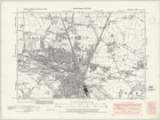
So, essentially, what you're after is a 1930's era layout of the trackwork through Crewe station, which you can't really ascertain just by looking at old OS maps - such as the one below - which tend to just show the Crewe station roof, so obscuring much of the detail.