BRX
Established Member
- Joined
- 20 Oct 2008
- Messages
- 4,477
London Bridge isn't on the Sutton loop though...


Blackfriars bays and London Bridge?
Wouldn't that cause a conflict on through services?
London Bridge isn't on the Sutton loop though...
It's a shame for those of us living on the Sutton loop that the through-services to St Pancras and beyond will cease... but on the other hand, presumably the much increased frequency through central London will mean that when you get off the train at Blackfriars, you'll not have to wait very long for the next through-train to appear.
Will the new signalling mean that the travel times between Blackfriars and St Pancras are improved, or just the frequency?
I reckon it'll still be terribly slow. Shame as there's so much timetable slack.
I remember when Farringdon to West Hampstead was timetabled at 10 mins, it's now 13. And doesn't need to be.
The 4-5 mins from City Thameslink to Farringdon in the peaks is ridiculous too!
Would like them to use platforms 3-4 at Kentish Town better for faster trains.
It's not about a direct Blackfriars to London Bridge service. What the proposal is is to run Blackfriars to London Bridge via Sutton. Just like weekends now expect Herne Hill trains go to the bays at Blackfriars.
Well it a train every 2.5 mins those on the front of the train will catch a different service through the Core to those on the back!
As for travel time between stations, in the Core yes. The trains will be automatic driven so can account for factors drivers can't currently, ie they know where the train ahead is and what the max speed they can do. Plus the new trains will be faster then the 319's, look at the leap between the 319 and 377 and then another 10 year leap forward for the new stock.
Passenger loading means some trains need the extra time in running to accommodate the masses leaving the train. City is a go example where people regularly queue between carriages so they can walk out of the rear doors nearest their exit, even tho they queue past unused doors!
However I'm sure there is time tabling slack as well.
Something you forget there tho is these trains are arriving at places are mixing with different services all over the place meaning this extra time is also to do with performance pollution as well. Might not suit currently to have trains hitting London Bridge at certain times now so they give them extra time in the Core to allow smoother run. Otherwise you'd get big sit downs at Blackfriars, especially south bound. Difference with the final timetable is all timetables where the Thameslink run will be worked to accommodate the Thameslink trains, not Thameslink trans timed to accommodate them.
Blackfriars bays and London Bridge?
Wouldn't that cause a conflict on through services?
All interesting stuff; thanks for posting.
Regarding the timetabling slack... having sit-downs at Blackfriars (rather than padding out through the core) would make sense for those changing onto/off Sutton loop services. It would make sense to get southbound services there as soon as possible rather than hanging about in the tunnels whilst a sutton connection that people could otherwise have made sets off.
Round the Wimbledon Sutton loop - sorry if that wasn't obvious...
So:
Blackfriars - Streatham - Wimbledon - Sutton - Mitcham - Streatham - London Bridge
So:
Blackfriars - Streatham - Wimbledon - Sutton - Mitcham - Streatham - London Bridge
or
Blackfriars - Streatham - Wimbledon - Sutton - West Croydon - several routes - London Bridge
???
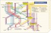
The former, here's the proposed diagram from the South London RUS:
Am I right to understand that frequency at Herne Hill/Loughborough Junction/Elephant & Castle (ie in between Tulse Hill and Blackfriars) would decrease compared to at present, under that arrangement?
Am I right to understand that frequency at Herne Hill/Loughborough Junction/Elephant & Castle (ie in between Tulse Hill and Blackfriars) would decrease compared to at present, under that arrangement?


I'm surprised that stations between New Cross Gate and Norwood Junction are not included, currently 2tph run from Caterham to London Bridge, surely the 2tph St. Albans or WGC services could stop there, replacing the Southern Metro stoppers which in any case would have to go because of the reduction of terminating platforms at London Bridge?
I'm surprised that stations between New Cross Gate and Norwood Junction are not included, currently 2tph run from Caterham to London Bridge, surely the 2tph St. Albans or WGC services could stop there, replacing the Southern Metro stoppers which in any case would have to go because of the reduction of terminating platforms at London Bridge?
Im a little confused about the rail alignment in the Bermonsey area. I know that a fly under will be constructed to get the Charing Cross line onto the southern side of the Thameslink lines, but whats going on with the Down Slow BML line? How will it get to the otherside of the fast down?
Most likely the gap will be covered by London Overground and any Southern service travelling from the Mole Valley to London Bridge via Forest Hill and/or London Vic - London Bridge via Crystal Palace.
Or maybe they'll run a London Bridge > London Bridge service via Crystal Palace (not sure what that would solve though)
Am I the only one who thinks that it is unusual that Tonbridge apparantly warrants 4tph in peak periods and none off peak?
I'm surprised that stations between New Cross Gate and Norwood Junction are not included, currently 2tph run from Caterham to London Bridge, surely the 2tph St. Albans or WGC services could stop there, replacing the Southern Metro stoppers which in any case would have to go because of the reduction of terminating platforms at London Bridge?
I don't see anything on the map to indicate it's EMT's map, it's probably an attachment for a report on TL service proposals which was sent to all concerned parties for comment, then accidentally put in a publicly accessible folder.At the end of the day nothing is set in stone yet, especially calling patterns. The map that started this is from East Midlands Trains. They have nothing to do with the Thameslink Programme. They are guessing at the calling points so don't take anything they put up as fact because it isn't.
I don't see anything on the map to indicate it's EMT's map, it's probably an attachment for a report on TL service proposals which was sent to all concerned parties for comment, then accidentally put in a publicly accessible folder.
The address of EMT sorta gives it away of as a EMT thing. Trust me it's not offical or I'd have received it.
As for the map, well it seems to have been made by EMT by the address. Currently the future path of service is thought to be this, but not guarantees it will be
The document bottom left title includes 'NRT'. That could quite easily stand for Network Rail Thameslink. Suggesting it is somehow not official because it was found on EMT's website is pure guesswork on your part and I suggest you know it.
Unless you are a member of FCC or NR higher management I suspect your comment "Trust me it's not offical or I'd have received it" is fiction as well.
I'm not going to state which one I am but you do agree my statement is true then.
The document bottom left title includes 'NRT'. That could quite easily stand for Network Rail Thameslink. Suggesting it is somehow not official because it was found on EMT's website is pure guesswork on your part and I suggest you know it.
Unless you are a member of FCC or NR higher management I suspect your comment "Trust me it's not offical or I'd have received it" is fiction as well.
I agree with this comment - and call upon class377/5 to justify your points with evidence rather than messroom rhetoric or stop giving the impression you are the MD of Thameslink 2000. Ta.
I was trying to give insight but hey if you want to believe that bordering TOC's have info more than people working on the project then believe away.