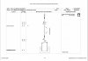
I was also interested in what's going on here and have been having a look at the planning application for the redevelopment of the site, which was approved in October 2016. A map of the proposals is attached below - it indicates "reconfigured rail lines" at the north and south edges of the site.
In the planning commitee report the development is described as:
Change of use from B2 Industrial use in the form of redundant steelworks to port related uses (sui generis) including demolition of buildings (except for the former military hospital, former fitness centre, former billet packing building, former stores and stores maintenance building and part of main former Thamesteel building), construction of new paved surfaces and a new vehicle access and bridge spanning the A249 to the existing Port to the west, reconfiguration of railhead, boundary treatment and landscaping and associated works (amended description).
The modified railhead(s) are mentioning at a few other points in the report:
2.5 Existing rail sidings would be modified and extended to provide a railhead to facilitate onward transportation of vehicles and other imports by rail to UK destinations rather than by road as currently happens.
8.14 The impact on the highway network will be significantly relieved as a result of the railhead development and emphasis on rail freight transportation. National Rail has not objected to the proposals subject to compliance with their requirement. The proposed new road bridge, linking the site to dock storage land within the control of the applicant falls under the jurisdiction of Highways England who have not raised objection subject to legal agreement under the Highways Act. Kent County Council Highways and Transportation has not raised objection subject to imposition of condition requiring the road overbridge to be completed and commissioned prior to first use of the site.
It mentions a specific Swale Local Plan policy: "T6 Maximising the Use of the Railways and Waterways for Commercial Purposes"
The application included a transport statement; some excerpts from that:
4.7 The main steelworks buildings to the front of the site will be retained to serve as multi-user covered storage space with rail connectivity targeting the forest product and steel commodity sectors. A multi-user open storage area will be provided to the east of the covered storage buildings.
4.9 The existing rail head will be reconfigured for automotive distribution on the east side of the site, and a new link bridge over the A249 Brielle Way will be constructed on the west side of the site so as to connect the application site with the adjacent port area. The new bridge will significantly reduce the impacts of the development on the adjoining highway by effectively by-passing car and HGV vehicle trips between the port and the application site.
As per comments above, it will remain to be seen whether the inclusion of the railheads in the planning application is just to do with complying with planning policies or whether it reflects a serious intention to actually use them. Looking through the planning decision, I couldn't see any special conditions that place a requirement for them to be kept fully functional or anything like that.
The announcement that Liberty Steel are to reinstate part of the steelworks seems to be around the same time the planning permission was approved and I'm not quite clear how that meshes in with the plans contained in the planning application - whether it changes anything and whether that part of the steelwork will be adjacent to or served by the reinstated rail lines.
There's also a 20-year masterplan for the whole port area (I'm not clear if this has been finalised yet or not?) and this mentions an intention to make more use of the railheads, as quoted in the transport statement:
Modal Shift of Commodities
6.15 At present, the majority of commodities are brought in and out of the Port by
road. When considering the Port demand forecasts and land strategy highlighted in
Chapters 4 and 5, modal shift has been considered in terms of the transport of
commodities.
6.16 As the Port currently operates by water and road, the main method of
improving multi modality and encouraging sustainable transport solutions is
introducing rail to the Port. The location of this has been described within Chapter
5. The introduction of rail access to the Port would allow for two-way automotive
flows by rail, as well as transporting scrap metal, aggregates and forest products via
rail.
Finally: there are a few news articles mentioning an intention (part of the 20 year masterplan?) to provide a "rail link" between Sheerness and Liverpool (also owned by Peel Ports). Not sure what that's about; perhaps others know more.