Legolash2o
Member
- Joined
- 27 Sep 2018
- Messages
- 687
Ab-so-lute-lyIt's great that Scotland are delivering on what they said.
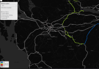
Ah right, now I'm with you. It's a bit of the process I didn't have exposure to when I worked with gauging. Expect some of those restrictions to disappear slowly before the proper clearances go into NESA.The Gauging Certificates (or Certification of Gauging Compatibility) are created from assessments that determine the maximum loading gauge for a route. They include the ELR, junctions, mileages, any restrictions and the reason (i.e. signal, bridge or tunnel).
The Freight Access Coordinators then use the certificates, with some complex magic to determine maximum heights per wagon in the RT3973 CON forms.
Eventually Gauging Certificates go into NESA after some time.
The maps are something I maintain.Am I right that these maps are basically NR updating their asset register, so to speak. Much of the enhanced clearances are a byproduct of the egip electrification. Have there been any recent interventions purely to enable better freight access?
It's a combination of factors - not the least that recent enhancements will mean the data is now much closer to present and therefore has less 'creep' added (as data gets older, essentially the margin of error gets wider).The maps are something I maintain.
I'm not sure if they've done freight specific interventions but I suspect you're right about the byproduct of the egip electrication. It also looked like they are using different simulation technique when looking at the certificates themselves. If I remember correctly, there was talk of using more probabilistic gauging which is less conservative with clearances than absolute.