• Our new ticketing site is now live! Using either this or the original site (both powered by TrainSplit) helps support the running of the forum with every ticket purchase! Find out more and ask any questions/give us feedback in this thread!

Route Coverage UK Map v1 released

Status
Not open for further replies.

heart-of-wessex

Established Member
Joined
11 Jun 2005
Messages
3,087
Location
Trowbridge
Hello,

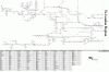
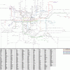
Before I start sending this to other places in the next few days, I thought I would post an exclusive release of my UK coverage map. Now you maybe wondering what is this? Well you may remember a tube coverage map v1 and network west v1 I did last year, or before that. Well, since early last year I started my biggest coverage map project, the UK map. And a year later, it is finished!

It features:

- all passenger lines, some cities are to be released at some point as insets, this is to reduce the map size. London and the South West are not included as I have done maps for these already

- Freight lines, some are included especially through lines, and the odd terminal one, but if you want to request a few freight lines, I might consider updates for this.

- Eurostar, includes the old and new lines, and carries right through to Brussels, Paris, Avignon for those who have maybe done the eurostar.

- Both ends of the Le Shuttle route is included, along with the tunnel.

- West Wales now has the Swansea District and Heart of Wales lines added, as this was not in the Network west map.


Sorry if there are any spelling errors or lines missing, as you can imagine, one person doing a map, it can be easy to miss things.


If I have some time here and there, I am considering updating the Tube map to include a few SWT lines that need adding near Woking and maybe updating the Network West Map.


Any comments, suggestions, reports etc feel free to reply or PM me.

Below attached is the UK map, plus the tube and network west map V1 for those who don't know of it:

Alternatively, visit the website
http://tracklinemaps.uklines.net/
 

Attachments
  • UKmapV1.GIF
    308.7 KB · Views: 204
  • tubecoveragemap1.GIF
    tubecoveragemap1.GIF
    238.3 KB · Views: 91
  • Networkmapwest V1.GIF
    Networkmapwest V1.GIF
    118.7 KB · Views: 71
Last edited by a moderator:
Sponsor Post - registered members do not see these adverts; click here to register, or click here to log in
R

RailUK Forums

Mojo

Forum Staff
Staff Member
Administrator
Joined
7 Aug 2005
Messages
21,173
Location
0035
Very good, I think this'll be real helpful! You might want to add Aylesbury Vale Parkway, which is between Aylesbury and Quainton Road on the line you've currently got marked as freight only. This is on both UK and your London Map (which doesn't include the freight line). Also, on London Map, extension from King George V to Woolwich Arsenal.

Thanks
 

Mojo

Forum Staff
Staff Member
Administrator
Joined
7 Aug 2005
Messages
21,173
Location
0035
Just click the thumbnail to make it bigger, then click the image in the Lightbox to see the full image in a new window.
 

heart-of-wessex

Established Member
Joined
11 Jun 2005
Messages
3,087
Location
Trowbridge
Thank you guys, I hoped the 100s of weeks and hours has come to use :)

Mojo - My fault, I forgot about that :oops: and as for the tube map, that is actually the original map I did a couple of years ago, I though I would re-upload for those who may have joined in the past year and not seen this. I might need a website for this otherwise the post will fall down to the back room and new people would not know of such maps.

Also mojo, that is why I added at the end of my first post:

If I have some time here and there, I am considering updating the Tube map to include a few SWT lines that need adding near Woking and maybe updating the Network West Map.

Thank you for the point out of what I missed though, very much appreciated :)
 

yorkie

Forum Staff
Staff Member
Administrator
Joined
6 Jun 2005
Messages
78,256
Location
Yorkshire
Looks good!

A few questions/oddities/ideas for improvements:-

But why is there some freight only bit north of Peterborough just north of the junction for the Spalding line - is this Tallington crossovers? It's way too far south for Stoke Jn which isn't freight only by any means (it's hourly). I am not sure why Tallington crossovers get some special treatment though, although it would be rare to cross over there on a passenger train as they're all booked to cross at Stoke...

Another oddity is that it's quite rare (I believe) to get a passenger train on the Up platform at Aviemore, but this isn't indicated as freight only. But it looks like you have to do that to fill that part in. Yet you can go past Ulleskelf on the Down Leeds a long way from the platform yet that 'counts' as doing the lot.

Lancaster is missing.

At Dunbar, you appear to have to go non-stop and call there to count the lot, yet at Hitchin (to use one example at random on the same route) you don't. But the platform at Dunbar is no further from the main line as either platform at Hitchin is from the main line.

At Crewe, you can either be on a stopper or a fast train to count the entire station, it seems odd that going through this vast station once counts the whole lot as done but with obscure Scottish stations you have to go into every platform. Also the independent lines are not shown at Crewe.

You even have to be looped at that random loop between RAN and BRO to count the WHL; that's gonna take some doing. There are no booked passenger turns for this I believe. Yet there is no requirement for any other loop that I can think of.

At Healey Mills you have to go both directions to count the whole line, which is fair enough as there's a yard in the middle. But the deviations at Silkstream Junction and north of Watford Junction are not included, despite these deviations being far greater than at Scottish stations where 2 lines are adjacent to each other but you have to go in both platforms for them to count.

There's a lot missing at Willesden and Acton areas.

Still it is very good, just a few inconsistencies to iron out! :)
 
Last edited:

yorkie

Forum Staff
Staff Member
Administrator
Joined
6 Jun 2005
Messages
78,256
Location
Yorkshire
Crewe is easy to tick off, but Oxford would take some doing! But there's no difference - except instead of a platform island either side of the through lines at Oxford, Crewe has several.

So as it is I can tick off Crewe entirely, but not Oxford, despite having been in all the platforms at Oxford but not all at Crewe.
 

heart-of-wessex

Established Member
Joined
11 Jun 2005
Messages
3,087
Location
Trowbridge
Looks good!

A few questions/oddities/ideas for improvements:-

But why is there some freight only bit north of Peterborough just north of the junction for the Spalding line - is this Tallington crossovers? It's way too far south for Stoke Jn which isn't freight only by any means (it's hourly). I am not sure why Tallington crossovers get some special treatment though, although it would be rare to cross over there on a passenger train as they're all booked to cross at Stoke...

I included the line north of peterborough of the stamford line which carries on as slow lines I think. I only included it in case people have scratched it in. I myself done that link line on the East Coast Deviation railtour last year.

Another oddity is that it's quite rare (I believe) to get a passenger train on the Up platform at Aviemore, but this isn't indicated as freight only. But it looks like you have to do that to fill that part in. Yet you can go past Ulleskelf on the Down Leeds a long way from the platform yet that 'counts' as doing the lot.

I have no idea about Aviemore unfortunately, in the maps I have, it simply says its a passing loop, and wiki say's there's 3 platforms in use, sorry for the mis-information. If anyone can confirm this, feel free to so I can make some modifications.

Lancaster is missing.

:oops:

At Dunbar, you appear to have to go non-stop and call there to count the lot, yet at Hitchin (to use one example at random on the same route) you don't. But the platform at Dunbar is no further from the main line as either platform at Hitchin is from the main line.

I was deciding weather to add through lines and slows/fasts for this reason. Instead i kept some areas simple like rail maps. Of course, this could be modified in future versions

At Crewe, you can either be on a stopper or a fast train to count the entire station, it seems odd that going through this vast station once counts the whole lot as done but with obscure Scottish stations you have to go into every platform. Also the independent lines are not shown at Crewe.

As above crewe was made as a simple version, I could of course try and make some modification somewhere...

You even have to be looped at that random loop between RAN and BRO to count the WHL; that's gonna take some doing. There are no booked passenger turns for this I believe. Yet there is no requirement for any other loop that I can think of.

Again, from research all i know is there is a loop, is this actually locked out of use, or maybe once operational a couple of years ago?

At Healey Mills you have to go both directions to count the whole line, which is fair enough as there's a yard in the middle. But the deviations at Silkstream Junction and north of Watford Junction are not included, despite these deviations being far greater than at Scottish stations where 2 lines are adjacent to each other but you have to go in both platforms for them to count.

Like the loop stations, I may actually add some of those in at least.

There's a lot missing at Willesden and Acton areas.

In the tube map? What is missing that could be added? If it is freight yards, that would be why, as the tube one (my first production) was intended to be tube only, then branched out to be passenger and then just a handful of freight lines here and there, with more added if requested

Still it is very good, just a few inconsistencies to iron out! :)


Thank you for taking the time to see what is missing :)

And to save an extra post, thank you Jordy for pointing out Newark north gate is missing, another fix to add.


Also a note to anyone who may see that it looks like you could walk from one station to another, when in reality it takes hours, the map isn't to scale of any sort. It is drawn to be as close as I could make it, lining up each line with everything else is a nightmare, and remember I have no idea about how to draw maps in any technical term nor do I know how to draw one properly. I just try to do my best :P

Thank you again for reporting the errors, looks like there could be a home for these maps.


And if anyone asks, you can start filling in the map if you like. The patches will be released with the fixed area included only, so you can drag and drop it into the map, an idea someone suggested years ago. Of course, the full map will be available with all patches added for those who haven't made a start.


Thanks again!


James.
 

yorkie

Forum Staff
Staff Member
Administrator
Joined
6 Jun 2005
Messages
78,256
Location
Yorkshire
I included the line north of peterborough of the stamford line which carries on as slow lines I think. I only included it in case people have scratched it in. I myself done that link line on the East Coast Deviation railtour last year.
True it does, but there are many other 4 track areas not denoted. Also the 4-tracking continues to Stoke which is near Grantham, and Norwich-Liverpool services are booked on the slows.
I have no idea about Aviemore unfortunately, in the maps I have, it simply says its a passing loop, and wiki say's there's 3 platforms in use, sorry for the mis-information. If anyone can confirm this, feel free to so I can make some modifications.
Pretty sure all platforms are in use (one is for the Strathspey Railway though!) but they really try to use the main one. I think Kingussie may be the same. I'm just not sure why the platforms are there to be scratched in at obscure places but not main places.
I was deciding weather to add through lines and slows/fasts for this reason. Instead i kept some areas simple like rail maps. Of course, this could be modified in future versions
I'm not sure the answer to that - it's got to be a personal decision by you. But what I would say is if it's complex in rural areas showing all loops but then simple on main lines then it's confusing.
As above crewe was made as a simple version, I could of course try and make some modification somewhere...
Hmm I wonder if they're best all simple, but really that's a decision you have to make and I don't want to force it on you.

Again, from research all i know is there is a loop, is this actually locked out of use, or maybe once operational a couple of years ago?
I think there is a loop yes, but no pax trains booked there - it makes sense for pax trains to pass at stations so they can stretch their legs.

Like the loop stations, I may actually add some of those in at least.
Hmm maybe. I'm not saying you should (or shouldn't!), but it's a matter of where do you stop, and that's a tricky one.

In the tube map? What is missing that could be added? If it is freight yards, that would be why, as the tube one (my first production) was intended to be tube only, then branched out to be passenger and then just a handful of freight lines here and there, with more added if requested
In the London map yes, for examples look at SimSig NLL and you'll see what I mean, but to name just one: you can get from GWML to NLL and this isn't shown. Many people will have scratched that on railtours

Thank you for taking the time to see what is missing :)
no probs!
Also a note to anyone who may see that it looks like you could walk from one station to another, when in reality it takes hours, the map isn't to scale of any sort. It is drawn to be as close as I could make it, lining up each line with everything else is a nightmare, and remember I have no idea about how to draw maps in any technical term nor do I know how to draw one properly. I just try to do my best :P
Well to be honest it's going to be almost impossible to make it to scale and it doesn't seem to be the purpose so I would have no complaints there.
Thank you again for reporting the errors, looks like there could be a home for these maps.
Yes definitely, but the question I'd ask is:
- is it serving a Quail-like purpose of allowing people to scratch each individual bit of track they do? or;
- is it more basic than this, only showing routes, where simply doing the route once (in any direction) means it's done.

At the moment it is serving the former purpose for the remote Scottish lines, and the latter purpose in most areas.

I'd decide which direction you want to go in, and then try to make all areas consistent with whichever approach you choose.
 

Techniquest

Veteran Member
Joined
19 Jun 2005
Messages
21,830
Location
Nowhere Heath
James is asleep and I'm awake, so I'll not tread on his toes with an answer to you yorkie, but James has tried to make it much like the Baker, which in my opinion is the best way to go. Some bits like New England North are there because he's done it (I haven't, which I'm jealous of as I'm the track basher here!) and it features in the Baker. 4-tracking to Grantham or wherever (I'm not going to pull out the Quail to find out) isn't featured in there so it isn't included.

Dunbar is a PITA, because of it being on a loop off the mainline. I finally did it and the associated crossovers last summer, and I'm yet to have a very detailed look at all three maps so the things you've pointed out I've yet to find.

What I do know is that what I've seen of James' work on this map of late is stunning. Much dedication has been put into getting it into a finished state which I appauld him for.

As for it being part Quail, part Baker-style, most of it is represented as per the Baker although when I conclude a detailed pouring over it later I will offer further judgement.

In the meantime, you may be interested to know a Quail-like version will eventually be made...I can say no more than that, but it's in a pipeline and *may* have some developments mentioned later this year...:idea:

Now to save a copy of each map to my flash drive so I can finish the rest of the week getting it done! Thank you James for making the maps, I've been looking forward to the finished product for some time and I know full well the effort that's gone into them!
 

90019

Established Member
Joined
29 May 2008
Messages
6,890
Location
Featherstone, West Yorkshire
I have no idea about Aviemore unfortunately, in the maps I have, it simply says its a passing loop, and wiki say's there's 3 platforms in use, sorry for the mis-information. If anyone can confirm this, feel free to so I can make some modifications.

There are 3 platforms in use, but one of them is for the Strathspey railway, the other two are mainline.
 

Broken Viking

On Moderation
Joined
23 Oct 2006
Messages
1,666
Location
some place west of France
Hail, HeartOfWessex! <D
Before I start sending this to other places in the next few days, I thought I would post an exclusive release of my UK coverage map. Now you maybe wondering what is this? Well you may remember a tube coverage map v1 and network west v1 I did last year, or before that. Well, since early last year I started my biggest coverage map project, the UK map. And a year later, it is finished!
That is a very, very nice piece of work there mate! <D

As it is, I've also been planning to create a similar map of my own (Showing all individual roads, junctions etc.) for the last year or so...But if it took ye a year to craft this one, then I dread to think how long a map showing every individual road, junction and platform on the network would take to draft up! :shock::D

A couple of comments/questions about it, if I may: :)
  • Assuming that every individual line on the map is supposed to be an individual road (As opposed to each parallel pair of lines indicating an actual line) I can see a few bits that I know to be four roads wide looking like two roads on the map. Are ye also aiming to show individual roads in this design, or am I mis-interpereting the design of thy map?
    .
  • The most useful form of coverage map would be one that shows every line/road on the network in a single image, rather than using inserts for cities like Manchester and Birmingham. Might a future version of the map include the southern and Western regions, plus all of the cities as part of a single main "all line" map, or would this create a map far too big to be handled by most computers?
    .
  • Finally: I noted what ye said above about the map not being to scale at all, but - Recalling facts posted in another topic (In the games forum I think) - Mallaig and Kyle of Localsh look to be a very long distance away from each other, although I believe the actual Crows distance is somewhere in the region of 8-10 miles, and could probabally be walked by most people in a few hours to help them close the Hebredian "loop". Stretching the line from Inverness to the west so that Kyle is directly above Mallaig and adding a note about the short distance between the two could be a handy modification...Assuming of course that my information on the distance between both stations is correct. :)
Anyhow...Like I said above, this map of yours is an excellent piece of work in my opinion, and - Referring to my similar project outlined above - Saves me a lot of time as ye've already done something that I was planning to do myself! :D
Now I can turn my attentions to creating a "schematic" version of the previous coverage map that we've been using up to now (I personally find "schematic" maps like yours much easier to use than "real" maps that show every twist and curve as they exist on the ground) and that should save me a helluva lot of time sat in front of the PC! 8)

Farewell for now, and many thanks again for sharing thy excellent creation! <D
>> Death <<
 

me123

Established Member
Joined
9 Jul 2007
Messages
8,510
I like it, but I've got a few wee suggestions:
  • Huntly is not spelled Huntley
  • Wemyss Bay and Gourock are awfully close; it could look a bit clearer if you spread them apart a bit. (It would also be more geographically accurate).
  • Glasgow area would be best IMO to include the "SPT map area".
  • You appear to have missed out Girvan station!
 

Mintona

Established Member
Joined
8 Jan 2006
Messages
3,592
Location
South West
I can't get from Bristol Parkway to Wales on the West map (probably a good thing)

Or Gloucester to Cheltenham

And Droitwich isn't on the line you've put it on. You've put it where Bromsgrove is.
 

heart-of-wessex

Established Member
Joined
11 Jun 2005
Messages
3,087
Location
Trowbridge
Oh dear, more errors on the map than I thought :oops: :lol:

I can't look at the map at the moment, my slow work computer wont take it, so I'll have a look when I get home and see what mintona is moaning about :P (just kidding).

Death - Thank you very much :). Each line on the map generally means two tracks but is also used for single lines. If there is 4 tracks, this is sometimes shown with two parallel lines, but only in a couple of areas.

As for the insets, I decided to add that in as I didn't know how big the map would end up being if i didn't do such, so I wasn't going to take the risk.

Me123 - Will look at these errors later, as for the distances I may leave it anyway.


Just to clarify for everone, this is basically a 'basic' map rather than a quail, so slow/fast lines, distances, positions isn't really the aim of the map, but extra lines are generally added here and there if I knew at the time I could fit it in.

As I say above, these can be fitted in places so look out for fast/slow line upgrades to the map.
 

Techniquest

Veteran Member
Joined
19 Jun 2005
Messages
21,830
Location
Nowhere Heath
Got around to colouring in my copy of the three maps earlier this morning, I was surprised at how much I still need to do and how short a time it took to do (I was expecting to be finishing it tonight!), but aside from being unsure on one bit in NW Kent I managed to do it all from memory! :o

Death, expect a PM from me later on re: maps.:)
 

heart-of-wessex

Established Member
Joined
11 Jun 2005
Messages
3,087
Location
Trowbridge
and by the way death, I left the london and west out only because it has been done already.

I might completely re-draw the london map and have it as a quail map (maybe cutting off the trillion of yard lines and focus on individual lines instead)

would anyone be insterested in seeing a new improved version like this? at least its a small area and wouldn't be stupidly large.
 

yorkie

Forum Staff
Staff Member
Administrator
Joined
6 Jun 2005
Messages
78,256
Location
Yorkshire
Dunbar is a PITA, because of it being on a loop off the mainline. I finally did it and the associated crossovers last summer,...
Hmm but it's the same as Hitchin (to use one example out of many), if you demolished one of the platforms at Hitchin it would be identical.

I don't get this logic that where you have 2 through lines, and 1 platform loop serving both directions, the platform loop has to be done seperately and in addition to passing through. Yet where you have multiple platforms either side of through lines, just passing through means the whole lot is ticked off.

I also don't get the logic of passing through Crewe and then the whole station is ticked off, yet to tick off random Scottish shacks with 2 platforms on otherwise single lines, you have to enter both platforms.
 

heart-of-wessex

Established Member
Joined
11 Jun 2005
Messages
3,087
Location
Trowbridge
Hence its a basic map :P

Dunbar of course has no through lines so to speak, the platform being on a up & down line, so is a bit different to a through line station. Oxford has loops and a through road, this was actually copied over from the network west map, mainly as that area needed re-doing with the freight lines. The original oxford in the network west map was just a trial to see if station loops could be drawn in and not take up a lot of space. The Healey Mills single lines are far apart and was simply added in anyway, even though there are a million places like this, but most the time they aren't actually divided by anything.
 

me123

Established Member
Joined
9 Jul 2007
Messages
8,510
Hmm but it's the same as Hitchin (to use one example out of many), if you demolished one of the platforms at Hitchin it would be identical.

Err...no. Dunbar is effectively a platform a passing loop on the East Side of the ECML. On the other hand, Hitchin is a pair of platforms on the Slow Lines of the ECML. Even if you demolished one, it wouldn't be the same, because you can't approach the platform from both directions as you can at Dunbar.

I also don't get the logic of passing through Crewe and then the whole station is ticked off, yet to tick off random Scottish shacks with 2 platforms on otherwise single lines, you have to enter both platforms.

Despite my above tediousness, I'll fully agree with that. I'd either not use them at all or include every line in the country. The latter seems a bit of a pointless task, so I'd omit them personally. Obviously, it's up to the author, but if I were to use the map as it is I'd probably just "cheat" and do the whole lot.

As an example, I know that Platform 2 at Huntly is only used twice a day. All other services use Platform 1 in both directions. I'm sure this is the case on many other remote Scottish stations; I'd imagine in some cases that platforms aren't used at all! I can't really see an enthusiast from London going all the way up to Huntly to scratch off Platform 2!
 

heart-of-wessex

Established Member
Joined
11 Jun 2005
Messages
3,087
Location
Trowbridge
well not being funny, if there's a line that's impossible to do on my map, good luck with the bakers!! Anyone for a SWT 455 to Chessington South Headshunt freight line? :P

With thanks to Jordy for his excellent work, I now have a basic site :D

http://tracklinemaps.uklines.net/

Going to start patching up the map and include some patches for you lot, so don't worry if you have filled it all in, as I have said, the patches are separate sections that have the modified section only in


Thanks again for all your comments and interests, thanks to me123 for clearing up the dunbar comment! :)
 

yorkie

Forum Staff
Staff Member
Administrator
Joined
6 Jun 2005
Messages
78,256
Location
Yorkshire
As for Dunbar, I'm not convinced that the fact that a platform is bi-di means it needs to be scratched. Peterborough also has bi-directional platform loops both sides of the main lines, so why does it narrow to one line instead of branch to three for consistency with Dunbar?
 

heart-of-wessex

Established Member
Joined
11 Jun 2005
Messages
3,087
Location
Trowbridge
By the way yorkie, you said:

In the London map yes, for examples look at SimSig NLL and you'll see what I mean, but to name just one: you can get from GWML to NLL and this isn't shown. Many people will have scratched that on railtours

Someone needs to go to specsavers :P

Take a look at the tube map again and you'll see a passenger line from Acton to Willesden and onto to NLL. This, of course, was drawn at the time passenger services used this.
--- old post above --- --- new post below ---
Rigth chaps,

For those who needs a patch fix go to the site

http://tracklinemaps.uklines.net/

go to the bottom in 'Updates' and there's a patch.zip (v1.1) for the map that fixes the various errors that were reported. Thanks guys for the reporting!
 

yorkie

Forum Staff
Staff Member
Administrator
Joined
6 Jun 2005
Messages
78,256
Location
Yorkshire
Correction: A link from the WCML to NLL not shown (to clarify: Willesden Jn to Mitre Bridge Jn; used by SN trains), although that has nothing to do with tubes!

Also Bakerloo trains run on the DC lines. Ditto Rickmansworth-Harrow, where the Chiltern run on the Met. Rayners Lane and Uxbridge is shared . Also the Met is shown as only using the slow lines.

I'm also a bit confused about what that stub at Baker Street is showing? It appears to be showing Platform 1, but I'm not sure what's special about Platform 1.

Edit: a few more... it seems strange that the slow & fast lines are only shown separately out of Paddington and not elsewhere, (except for a few selected places in patches, the oddest of which is Hackney Downs to Bethnal Green but not on the approaches to Liverpool Street)

A lot of flyovers are shown including ones that don't take you to a different line, but just over a set of lines (e.g. over fast lines) such as at Welwyn and Ilford, but notable flyovers that are not shown include Silkstream Jn, Alexandra Palace, Finsbury Park, Belle Isle, and Euston.

BTW there are platforms at Ealing Broadway, Langley, Iver, etc etc on the fast lines

Camden Town looks a lot simpler than, say, Hertford North, and that isn't the case.

Poplar appears to suggest a high/low level station but that isn't the case.

That's all I have time for tonight, if you would like me to find more examples let me know.
 
Last edited:

heart-of-wessex

Established Member
Joined
11 Jun 2005
Messages
3,087
Location
Trowbridge
You may have found the map looking some what like a hybrid, mix and match of god knows what, and yes it is. Two and Four tracks were added to see how much space would be used if everywhere was like it, and some like you mentioned is a bit wrong.

Being my first map it was intended to be tube only, then I thought I would add the GOBLIN, WLL, NLL and Thameslink like the tube map did/does. However after all that I decided to throw in NR lines in the area anyway.

As mentioned, the map is out of date and at the moment is under a complete overhaul..am I re-drawing the whole thing I hear you ask? Yes, indeed.

The tube map will now be to quail standards, so expect some more errors of god knows what :lol: Again, this time, every crossing is included, none of this I'll add a loop at the station to see what it looks like stuff that no-one seems to like. Scale is not added, not faffing around with mileposts ect, this is a map scratcher quail, so individual lines only


Yorkie:

The spur thing at Baker street you may be thinking of is the two bay platforms that the met use on terminating services.
 

dan_atki

Established Member
Joined
1 Nov 2006
Messages
1,879
I can't see the UK diagram! <(

The ones I can see look excellent, though!

Just click the thumbnail to make it bigger, then click the image in the Lightbox to see the full image in a new window.

It's not so much the forum software's fault as it is Internet Explorer's.

Internet Explorer will not display large dimensioned gif files for some unknown reason, but it uses weird rules no-one can understand to determine if the gif is too big, as seen here: http://social.msdn.microsoft.com/fo.../thread/16e6a84c-dd73-4ca1-9a57-fe4f44582d69/

The gif opens fine in other browsers, though, as does going onto the heart-of-wessex's site and right clicking the UK map link and selecting 'Save Target As...'.
 

Techniquest

Veteran Member
Joined
19 Jun 2005
Messages
21,830
Location
Nowhere Heath
Surprised no-one else commented but there was a loop missing on the Worcester to Oxford line. Which was added last night :)

As James says, the Tube map is getting Quail-ised in terms of track layout and work has begun. I look forward to assisting with it where I can :)
 
Status
Not open for further replies.

Top