• Our new ticketing site is now live! Using either this or the original site (both powered by TrainSplit) helps support the running of the forum with every ticket purchase! Find out more and ask any questions/give us feedback in this thread!

Quail-ised UK Route Map, V1, Section 1 - first draft complete

Status
Not open for further replies.

Techniquest

Veteran Member
Joined
19 Jun 2005
Messages
21,830
Location
Nowhere Heath
Hi all,

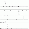
Well it's taken me since 0135 on the 26th of April to get this far (no work done on it for 36 hours in that time mind), but I finally reached Plymouth on my ever-developing Quail-ised UK route map.

So I attach the first draft of it. Note that currently freight-only lines do not feature on this map, this is due to the huge amount of time the Cornish area was taken as it is, so the decision was cast to plod on with the passenger lines first. Goods loops do not currently feature (such as the one at Keyham), however the crossover is in place ready for these to eventually be added.

Mileages, scale and bridge/crossing names also do not feature currently, with scale being left out of the equation due to the sheer difficulty in doing so. However, distances are roughly based on those in the Western Track Maps book. Station platform lengths are, generally, standardised to make these easier to do. St. Erth, Truro, Plymouth and Penzance are four key exceptions so far.

You will also notice that I have gotten as far as Plymouth, with the line ending in the Laira area. This is to enable me to split the map into multiple sections, grouping these together roughly by the old BR regions eventually.

Anyway, the basic premise of the Quail is in place. Constructive criticism and general pointers will be welcome, but like I say goods/passenger loops and freight-only lines will eventually be added (hence the large white spaces on most of the attached map).

Here it is then:
 

Attachments

  • UK_map_Quail_v1_started_0135_26042009_GIF.GIF
    UK_map_Quail_v1_started_0135_26042009_GIF.GIF
    38.2 KB · Views: 84
Sponsor Post - registered members do not see these adverts; click here to register, or click here to log in
R

RailUK Forums

Mojo

Forum Staff
Staff Member
Administrator
Joined
7 Aug 2005
Messages
21,172
Location
0035
That's good too! So many maps to look at!

Just a few things, you've missed the station name at Coombe Junction and also Penryn now has a passing loop. Unlike a conventional one, it is one long platform with a crossover part the way along.
 

Broken Viking

On Moderation
Joined
23 Oct 2006
Messages
1,666
Location
some place west of France
Well it's taken me since 0135 on the 26th of April to get this far (no work done on it for 36 hours in that time mind), but I finally reached Plymouth on my ever-developing Quail-ised UK route map.

So I attach the first draft of it. Note that currently freight-only lines do not feature on this map, this is due to the huge amount of time the Cornish area was taken as it is, so the decision was cast to plod on with the passenger lines first. Goods loops do not currently feature (such as the one at Keyham), however the crossover is in place ready for these to eventually be added.
That's a great bit of work there if I may say so, Julian! I must admit that I havn't covered these lines yet (Should hopefully be done next Wednesday! :)) but looking at thy map, I've already managed to get a really good impression of the layout and nature of the lines down there! 8)

Indeed, this has already proven useful to me just now in preparing for my ALR as I'll be making an 8-minute change at Plymouth from AXC to FGW services. Although I'd assumed Plymouth to be the average 2-4 platform station, thy plan tells me that it's actually laid out in a similar way to Reading...Thus I'll probabally come in on Plat 2, and my connecting service will most likely come in on 4 or 5! <D

Aye...As it was, I was giving some thought earlier as to creating maps using automated methods and offset lists of line objects that would compute a road diagram - Straight-lined, a bit like thine above - Using lists of line-related data (I.E: Four aspect signal at 35mi 42ch, two aspect at 37mi 56ch, etc.) I don't know if this'll ever materialise or not, but if it does I'll send ye a copy and see if that helps with the Quailing! Someone'll still have to "tack" all of the maps together by hand, though... :shock::)

Anyhow, there are a few little bits that I spotted whilst looking at it:
  • Some platforms are missing their numbers or appear to be numbered oddly. Although these aren't at all relevant at small stations like Gunnislake, they might be useful to have at larger stations. Spotted instances include Plymouth, St. Budeaux, and Liskeared.
  • Arrangement at Liskeard: Having platform 3 "behind" platform 4 like that is rather unusual. Are there feeder lines running between the main and branch lines at that station that havn't been put on the map yet, or is the Lavvy branch really isolated like that? :shock:
  • Newquay is drawn in such a way that suggests two platforms there, but only one road runs into the station. Is that a double-sided bay platform, or was the second road a victim of Beeching's "master" plan?
  • By the by, I have a feeling ye might've caught the letter E by mistake when typing the last station on the branch from Liskeard - It's a three-letter name, if my memory serves me well! :lol::razz:;)
Farewell for now, and thats an excellent start on the UK-wide Quail there Julian! I'll try and lend a claw or two with it shortly after I've returned from my 7-day ALE MegaBash if ye need one! <D
>> Death <<
 

Techniquest

Veteran Member
Joined
19 Jun 2005
Messages
21,830
Location
Nowhere Heath
Just a quick post for now as I've got to dash out (full reply to come later), but thanks for the positive feedback gents.

Mojo: Any idea where Penryn's new loop is to be seen on the Internet? I doubt Google Maps has updated itself yet to see the new loop. I did know of a loop recently installed on that line, but I have to admit I hadn't heard where! Any photos of Penryn as it now is would be welcome.

JonG: Thanks! :D

Death: Thanks for your post, nice to see a fellow cartographer is in approval of my work so far! Full reply will come later in response though, as some of it needs a look at the map again to find the errors listed.

At least posting it before you left has helped you plan a tight connection there! A +3 connection is just about doable at Plymouth, so you should be A-OK. Sit yourself around halfway along the train coming into Plymouth to ensure you're close to the subway and be ready to alight (so coach D/E on a HST I'd imagine is best).:)

Until later,

Julian, cartographer of the Quailised UK map :D
 

Mojo

Forum Staff
Staff Member
Administrator
Joined
7 Aug 2005
Messages
21,172
Location
0035
Mojo: Any idea where Penryn's new loop is to be seen on the Internet? I doubt Google Maps has updated itself yet to see the new loop. I did know of a loop recently installed on that line, but I have to admit I hadn't heard where! Any photos of Penryn as it now is would be welcome.
There are photos on Wikipedia, photos and a leaflet on Network Rail and also on Cornwall Council.

It seems like a better idea than reinstating the old platform which would presumably have required a footbridge with ramps or lifts although how it cost £7.8m I would love to know!
 

Techniquest

Veteran Member
Joined
19 Jun 2005
Messages
21,830
Location
Nowhere Heath
Interesting, although sadly it doesn't show where the loop ends. I would assume it's end point is just around the corner.

Either way, it's required track for me down there now so an excuse to do that bit when I'm next down there!

Thanks for the links Mojo.:)
--- old post above --- --- new post below ---
That's a great bit of work there if I may say so, Julian! I must admit that I havn't covered these lines yet (Should hopefully be done next Wednesday! :)) but looking at thy map, I've already managed to get a really good impression of the layout and nature of the lines down there! 8)

Thanks Death, most appreciated. If it wasn't so hot and sunny outside, I'd be working on the map a bit more, but as it is so summer-like outside, I will be going back out in it for a while soon! So apologies, but the map is on standby whilst the warmest day in the last few weeks is out to play!

Death said:
Indeed, this has already proven useful to me just now in preparing for my ALR as I'll be making an 8-minute change at Plymouth from AXC to FGW services. Although I'd assumed Plymouth to be the average 2-4 platform station, thy plan tells me that it's actually laid out in a similar way to Reading...Thus I'll probabally come in on Plat 2, and my connecting service will most likely come in on 4 or 5! <D

As mentioned in my previous and rushed response, I'm glad to see it's already becoming useful. I've no idea what traction you'll be arriving on with AXC, but on the assumption it's a Voyager, the middle two coaches will be the best to go for. Coach D/E on a HST will be the best I should think. I am also assuming your FGW service will originate at Plymouth, which from experience should be from platform 6, however this will depend on which platform the AXC service arrives on, as these services when terminating in Plymouth often use platform 5 or platform 6, which will make an interchange even easier!

Death said:
Aye...As it was, I was giving some thought earlier as to creating maps using automated methods and offset lists of line objects that would compute a road diagram - Straight-lined, a bit like thine above - Using lists of line-related data (I.E: Four aspect signal at 35mi 42ch, two aspect at 37mi 56ch, etc.) I don't know if this'll ever materialise or not, but if it does I'll send ye a copy and see if that helps with the Quailing! Someone'll still have to "tack" all of the maps together by hand, though... :shock::)

This sounds interesting, I must say. One thing I have given consideration is putting signals in where they are known to me. For example, Trowbridge when it is reached will definately have signals at the platform ends because these are the easiest for me to get numbers for. If I remember to do so this weekend, I'll note down signal numbers at key locations, however this is not guarenteed. As I say, I'm giving consideration to this idea but it will add several months of exploring and possibly even relying on other members of the forum helping with that from their local area. Unless someone happens to know where signalling diagrams can be found?

Death said:
Anyhow, there are a few little bits that I spotted whilst looking at it:
  • Some platforms are missing their numbers or appear to be numbered oddly. Although these aren't at all relevant at small stations like Gunnislake, they might be useful to have at larger stations. Spotted instances include Plymouth, St. Budeaux, and Liskeared.
Plymouth does indeed appear to be a bit bizarre. The numbering as it is, on my assumptions, originates from when the bay platforms 1 and 2 were also numbered. The fourth bay in Plymouth is a Dock Siding IIRC.

St. Budeaux is another strange one, however Ferry Road is the mainline stations whilst the other one is the Gunnislake branch platform. It's not overly clear on the map I've produced, granted, but it was one of those difficult to add without confusing the hell out of everyone places.

Death said:
  • Arrangement at Liskeard: Having platform 3 "behind" platform 4 like that is rather unusual. Are there feeder lines running between the main and branch lines at that station that havn't been put on the map yet, or is the Lavvy branch really isolated like that? :shock:
Liskeard is one of those strange places. It does indeed have platform 3 at right angles to the mainline. It curves around pretty sharply too (which I've attempted to replicate and if I'm honest looks reasonably accurate) for the dive under the mainline to curve back around to Coombe Junction (on which note, thanks for noticing that one Mojo, I was in such a rush to get to Plymouth yesterday I hadn't noticed that missing name!) where some passenger trains reverse (others reverse at the actual junction) before heading to the coast.

Death said:
  • Newquay is drawn in such a way that suggests two platforms there, but only one road runs into the station. Is that a double-sided bay platform, or was the second road a victim of Beeching's "master" plan?
Newquay was drawn in such a fashion because, as you correctly point out, only one road enters the station. It's been several years since the other track was pulled up, but since Newquay is represented as I have drawn it in the Western Track Maps production then it felt right to not only produce it in similar fashion but have it serve as a reminder that Newquay was once a much bigger station than it is now.

Death said:

  • By the by, I have a feeling ye might've caught the letter E by mistake when typing the last station on the branch from Liskeard - It's a three-letter name, if my memory serves me well!:lol::p<D
  • Farewell for now, and thats an excellent start on the UK-wide Quail there Julian! I'll try and lend a claw or two with it shortly after I've returned from my 7-day ALE MegaBash if ye need one! <D
>> Death <<

I ought to point out the quote above is slightly changed from your original post primarily because it messed it up when trying to split the bullet points up for easier reference.

Anyway, yes it is a strange name but there we go! If only the Victorians knew...:lol:

Enjoy your 7-day MegaBash, I am just a bit envious! ;)<D

Until then,

Julian, enjoying 20C+ weather in Wiltshire! :D
 
Status
Not open for further replies.

Top