
-
Our new ticketing site is now live! Using either this or the original site (both powered by TrainSplit) helps support the running of the forum with every ticket purchase! Find out more and ask any questions/give us feedback in this thread!
You are using an out of date browser. It may not display this or other websites correctly.
You should upgrade or use an alternative browser.
You should upgrade or use an alternative browser.
Oxford Corridor Phase 2 & Platform 5 updates
- Thread starter Benjwri
- Start date
Sponsor Post - registered members do not see these adverts; click here to register, or click here to log in
R
RailUK Forums
My World Through a Lens has recorded some footage of the ongoing works.
30 January, via the northern walkway (two days before the possession)
2 February, via the temporary station passage (day two of the possession)
Tomorrow looks like the sunniest + driest day of the bunch, and if works are on schedule it'll also be when they wheel the central piece of the new southern abutment into place.
== Doublepost prevention - post automatically merged: ==
Paid a visit on Wednesday and said box was already in place - judging by Network Rail's OC Facebook feed the 15-minute movement of it took place on Tuesday. From what I could make out the smaller boxes on both sides were also already in place.
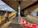
During these works Oxford station is essentially split into four segments - the westbound walkway diversion, the eastbound walkway diversion, access to Platforms 1&2 via the secondary (northern) gateline, and the main station building which (platform access aside) is still open.
Whilst travelling on a rail replacement coach from Banbury to Oxford we passed a couple of same-direction flatbed trucks carrying big pieces of concrete along the M40. No pictures but it's possible they were on delivery runs to the worksite.
Walking along Osney Bridge to see the separate works there I couldn't find any sign of SSE on site.
[N.B. The SPMT on site belongs to Mammoet (how appropriate!)]
== Doublepost prevention - post automatically merged: ==
Installation of the new bridge decks should be underway by now.
30 January, via the northern walkway (two days before the possession)
2 February, via the temporary station passage (day two of the possession)
Tomorrow looks like the sunniest + driest day of the bunch, and if works are on schedule it'll also be when they wheel the central piece of the new southern abutment into place.
== Doublepost prevention - post automatically merged: ==
Paid a visit on Wednesday and said box was already in place - judging by Network Rail's OC Facebook feed the 15-minute movement of it took place on Tuesday. From what I could make out the smaller boxes on both sides were also already in place.
During these works Oxford station is essentially split into four segments - the westbound walkway diversion, the eastbound walkway diversion, access to Platforms 1&2 via the secondary (northern) gateline, and the main station building which (platform access aside) is still open.
Whilst travelling on a rail replacement coach from Banbury to Oxford we passed a couple of same-direction flatbed trucks carrying big pieces of concrete along the M40. No pictures but it's possible they were on delivery runs to the worksite.
Walking along Osney Bridge to see the separate works there I couldn't find any sign of SSE on site.
[N.B. The SPMT on site belongs to Mammoet (how appropriate!)]
== Doublepost prevention - post automatically merged: ==
Installation of the new bridge decks should be underway by now.
Attachments
-
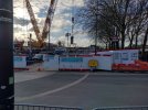 Botley Road bridge, from Frideswide Square.jpg821.7 KB · Views: 102
 -
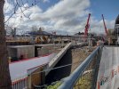 Botley Road bridge, from the bicycle park (#1).jpg748.2 KB · Views: 91
 -
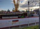 Botley Road bridge, from the bicycle park (#2).jpg626.2 KB · Views: 89
 -
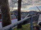 Botley Road bridge, from the bicycle park (#3).jpg608.2 KB · Views: 95
 -
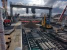 Botley Road bridge, from the simultaneously open-&-closed portion of Platform 3.jpg795.3 KB · Views: 97
 -
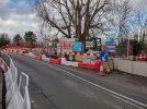 East end of Osney Bridge.jpg1.1 MB · Views: 97
 -
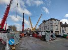 Open-gate view of Botley Road bridge from the west.jpg559.9 KB · Views: 94
 -
 Spectators.jpg838.1 KB · Views: 95
 -
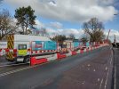 West end of Osney Bridge.jpg831.2 KB · Views: 98
 -
 Westbound passage on the left, eastbound passage on the right.jpg738.3 KB · Views: 102
Last edited:
Snow1964
Established Member
Have come across a couple of videos of the new Botley Road bridge at Oxford, which is now in place, and work to replace tracks is commencing.
Doesn't appear to be any sign of the extra span for the additional platform yet.
Doesn't appear to be any sign of the extra span for the additional platform yet.
zwk500
Veteran Member
There's some great footage (daily updates) being posted by the Oxfordshire Connect facebook page as well, showing the bridge deck now completely in place and waterproofing underway on thursday.

 www.facebook.com
Oxfordshire Connect | London
Oxfordshire Connect, London. 1,137 likes · 1,505 talking about this. We’re expanding Oxford railway station to enable an increase in train services as part of East West Rail *This account is only...
www.facebook.com
Around 2 minutes in when you first get a good look, you can see the two smaller spans either side of the main bridge. But they just look like concrete slabs. Understandably they’ve concentrated on getting the main one completed to run trains on Monday.Have come across a couple of videos of the new Botley Road bridge at Oxford, which is now in place, and work to replace tracks is commencing.
Doesn't appear to be any sign of the extra span for the additional platform yet.
Snow1964
Established Member
I did notice those, no parapets. Presumably for the extended station.Around 2 minutes in when you first get a good look, you can see the two smaller spans either side of the main bridge. But they just look like concrete slabs. Understandably they’ve concentrated on getting the main one completed to run trains on Monday.
As there is one on each side, is the plan to add south facing bay or to demolish part of station building and link up the bay platforms at northern end as additional through platforms. Or is it simply a wide pedestrian bridge from car park
There is an aspiration to rebuild the station and make platform 2 a through platform instead of being a bay. So the bridge will be wide enough for a track and a pedestrian crossing. But it will start off life as merely a very wide pedestrian bridge, replacing the one that was removed at the start of the works.I did notice those, no parapets. Presumably for the extended station.
As there is one on each side, is the plan to add south facing bay or to demolish part of station building and link up the bay platforms at northern end as additional through platforms. Or is it simply a wide pedestrian bridge from car park
Looks like tracks are virtually relayed over the new bridge, so should be fine for Monday morning opening
The northern side walkway had now reopened under the bridge and temporary floating bridges over rails have been removed.
The southern side walkway is also in place but I don't think will be used until August.
The span which will be a footpath to connect to Becket Street carpark is still being worked on.

The northern side walkway had now reopened under the bridge and temporary floating bridges over rails have been removed.
The southern side walkway is also in place but I don't think will be used until August.
The span which will be a footpath to connect to Becket Street carpark is still being worked on.
swt_passenger
Veteran Member
- Joined
- 7 Apr 2010
- Messages
- 34,252
In the PWI video (linked in post # 268), the narrator said that the separate eastern rail deck would be used as a temporary footbridge, until the station masterplan provided another dedicated pedestrian bridge. Have they decided to combine them on the same set of abutments now?There is an aspiration to rebuild the station and make platform 2 a through platform instead of being a bay. So the bridge will be wide enough for a track and a pedestrian crossing. But it will start off life as merely a very wide pedestrian bridge, replacing the one that was removed at the start of the works.
Last edited:
Oxfordblues
Member
- Joined
- 22 Dec 2013
- Messages
- 1,118
Yes, they're well ahead of the game today with a rail-mounted crane crossing the bridge this afternoon. I'm one of the cynics who thought they wouldn't possibly get the job done in just 8 days, but I've been proved totally wrong! Tomorrow (Sunday) will be for any snagging and tidying-up and it was wise to have it as an extra day for contingency. Monday's 4E91 02:48 MCT-Leeds looks likely to be the first train, OXF 05/10.
If you look at the drone footage linked above it is the same wdlidth as the western one and not wide enough to do both.In the PWI video (linked in post # 268), the narrator said that the separate eastern rail deck would be used as a temporary footbridge, until the station masterplan provided another dedicated pedestrian bridge. Have they decided to combine them on the same set of abutments now?
The new extra footbridge bridge would be higher than the other decks due to the toad level being higher at that point.
But it is in use, to hold the bridge spans up! Hence it had to be in place, whether used as a walkway or not.The southern side walkway is also in place but I don't think will be used until August.
zwk500
Veteran Member
Network Rail's documentation has a bit better explanation: https://docs.planning.org.uk/20210802/8/QWC16OMF14300/9qlkl4vp1g5j00e7.pdfIn the PWI video (linked in post # 268), the narrator said that the separate eastern rail deck would be used as a temporary footbridge, until the station masterplan provided another dedicated pedestrian bridge. Have they decided to combine them on the same set of abutments now?
2.32 In addition as well as a change and evolution to the station we have changed the footbridge design over Botley Road as the existing footbridge needs to be demolished and replaced as with the new road layout and new 4m cycle/ pedestrian route either side of the road means that the existing bridge would not be wide enough to be reused. The original design submitted for preapplication feedback showed the below layout for a new footbridge and passive provision (pink outline on the left image) for future bridge to accommodate another railway track on it with the new footbridge to the side of it.
2.33 ... However as the Council have aspirations for a “landmark” footbridge to be installed in this approximate location much wider than the footbridge proposed by Network Rail as part of the future station masterplan proposals if the original design as shown below was installed as part of the Oxford phase 2 project this would remove the ability to install something different later.
2.34 If the Councils aspired Landmark bridge does not come forward when Oxford Phase 3 works do, we will propose a footbridge similar to the above as part of the railway station and capacity scheme.
2.35 The proposed rail span is as the below section. The proposal would be to provide the footway at bottom ballast level, directly onto the bridge deck (with some interim waterproofing and non-slip surfacing). An additional pair of handrails would be provided at the inner ends of the higher level deck, to prevent pedestrians from climbing onto the upper level.
In summary: The original footbridge needed to be demolished to facilitate the new road & cycle/pedestrian width. Network Rail wanted to replace mostly like-for-like, but the council have aspirations for a 'landmark' footbridge on the site of the original footbridge. Therefore, to allow the council to use the site, NR will install a temporary walkway on the bridge deck earmarked for the rebuilding of platform 2.
If the council have not built their new "landmark" footbridge before NR need their bridge back, NR plan to build what they would have built in the first place to maintain the connectivity.
swt_passenger
Veteran Member
- Joined
- 7 Apr 2010
- Messages
- 34,252
Thanks for finding that document, I’d tried and failed to find something relevant, but there’s a lot to scan through. The drawings also make it fairly clear the slabs that are now visible, resting on the two sets of single track bridge abutments, are just a small part of what will be fitted.Network Rail's documentation has a bit better explanation: https://docs.planning.org.uk/20210802/8/QWC16OMF14300/9qlkl4vp1g5j00e7.pdf
In summary: The original footbridge needed to be demolished to facilitate the new road & cycle/pedestrian width. Network Rail wanted to replace mostly like-for-like, but the council have aspirations for a 'landmark' footbridge on the site of the original footbridge. Therefore, to allow the council to use the site, NR will install a temporary walkway on the bridge deck earmarked for the rebuilding of platform 2.
If the council have not built their new "landmark" footbridge before NR need their bridge back, NR plan to build what they would have built in the first place to maintain the connectivity.
Last edited:
Falcon1200
Established Member
If the council have not built their new "landmark" footbridge before NR need their bridge back
Wonder what the Council mean by a 'landmark' bridge? Modelled on the Forth or Golden Gate bridges perhaps, or as this is ex-GWR territory, the Royal Albert Bridge.....
zwk500
Veteran Member
No idea but NR were proposing a fairly utilitarian truss bridge, so presumably the council are hoping somebody will come along that can be cajoled into paying for a bridge that doesn't look like it was craned off the back of a lorry. Quite possibly they want something sleek and metal, a bit like this bridge over the Floating Harbour in Bristol: https://en.wikipedia.org/wiki/Meads_Reach_Bridge (although hopefully without the perforated deck!)Wonder what the Council mean by a 'landmark' bridge? Modelled on the Forth or Golden Gate bridges perhaps, or as this is ex-GWR territory, the Royal Albert Bridge.....
All round it's a bit of joined-up thinking from both parties (astonishing in modern Britain). NR need to build the eastern span now anyway because it's part of the road rebuild, they save themselves the cost of an immediate replacement footbridge, the site is left open for the Council to develop a plan for, and when the time comes to take the eastern span back for the railway use, they can build either the new 'landmark' bridge or the more direct replacement off-line and only need to diver the footpath once, rather than have another temporary arrangement.
It's not clear what would happen that in the event the 'landmark' bridge was completed quite a while before NR are thinking about rebuilding platform 2, whether the footpath over the eastern span would remain and for a while there'd be 2 bridges, or if they'd just move the footpath and have done with it. Probably a bridge to be crossed later, as it were!
Neen Sollars
Member
- Joined
- 21 Jul 2018
- Messages
- 342
Super You Tube flyover of all of Oxford railway station by Regina Olphert. I watched it on mute. Weekend work nearly completed.
However as always many more questions follow. When is Platform 5 construction work due to start? Platform 4 will be widened? New bridge over Sheepwash required? Rear access to row of terraced houses closest to the sheepwash will be lost? Will Platform 5 and its new North (?) entrance station building be constructed before the southern side?
Edit: On closer inspection, looks like existing footpath from student accommodation could be maintained alongside the new railway line. Seems the rear of the terrace houses have no "official" access to what appears to be railway land at the rear of platform 4?
Last edited:
swt_passenger
Veteran Member
- Joined
- 7 Apr 2010
- Messages
- 34,252
The chap doing that video, (and it‘s also obvious in his earlier work), seems to have not known that back in 2024 Network Rail confirmed that although design work on P5, the western entrance, and the new Sheepwash channel bridge would continue, the physical work would not start until later in 2026.Super You Tube flyover of all of Oxford railway station by Regina Olphert. I watched it on mute. Weekend work nearly completed.
However as always many more questions follow. When is Platform 5 construction work due to start? Platform 4 will be widened? New bridge over Sheepwash required? Rear access to row of terraced houses closest to the sheepwash will be lost? Will Platform 5 and its new North (?) entrance station building be constructed before the southern side?
Edit: On closer inspection, looks like existing footpath from student accommodation could be maintained alongside the new railway line. Seems the rear of the terrace houses have no "official" access to what appears to be railway land at the rear of platform 4?
It was never in the scope of this week’s work to demolish any station structures on the P5 site, or lay any additional track over the new western bridge span. The rest of the new bridge works can fairly obviously be done once the railway is reopened.
A side point, the new Western entrance to the station is to be broadly where the YMCA building was demolished.
No pretty much the same width as now away from the buildings (the existing buildings will get demolished as the P5 track will go though them). There won't be much facilities wise at platform level.Platform 4 will be widened?
New bridge deck for new road alignment slight further to the west, the Nursery was already demolished to the North-West corner of the bridge to enable thisEdit: On closer inspection, looks like existing footpath from student accommodation could be maintained alongside the new railway line.
Neen Sollars
Member
- Joined
- 21 Jul 2018
- Messages
- 342
Thanks for the reponses, situation much clearer on further viewing. Rebuild of Oxford station will be an interesting watch whenever it happens.
Bridge replacement complete as per Network Rail presser, though no timelapse footage yet.
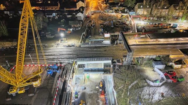
 www.networkrailmediacentre.co.uk
The barriers I took a picture of last Wednesday (removed from my previous post) are actually for the trackside walkways on the bridge, not the pedestrian walkways underneath it as I previously thought.

Trains through Oxford running as normal following successful bridge replacement
Trains are running through Oxford as normal this morning after Network Rail successfully completed the latest phase of the Oxfordshire Connect programme with the replacement of the Botley Road rail bridge.
www.networkrailmediacentre.co.uk
The barriers I took a picture of last Wednesday (removed from my previous post) are actually for the trackside walkways on the bridge, not the pedestrian walkways underneath it as I previously thought.
Has anyone come across any details of the internal structure of the bridge decks? I don't recall anything other than the section drawing of the "P2" span in the planning documents (linked in post #703), and what's now there does not look the same as that. They all look remarkably shallow, given the bending strength and rigidity required to carry trains.
swt_passenger
Veteran Member
- Joined
- 7 Apr 2010
- Messages
- 34,252
There’s a long section at 33 minutes into the previously mentioned PWI video, (liked in post #268). That’s the easiest to find that I’ve seen. It shows how the east bridge for P2 will have an extra temporary set of inboard guardrails. I’m still thinking there’s more concrete beams yet to be placed either side of what’s there now?Has anyone come across any details of the internal structure of the bridge decks? I don't recall anything other than the section drawing of the "P2" span in the planning documents (linked in post #703), and what's now there does not look the same as that. They all look remarkably shallow, given the bending strength and rigidity required to carry trains.
What is there of the P2 and P5 will just serve as the base for lots of rebar and in-situ cast concrete without the need for any substantial cranes etc. (thus resulting in zero risk of big crane toppling on to live tracks). Unlike the main 4 track span there is far less time pressure to get the track open again.
swt_passenger
Veteran Member
- Joined
- 7 Apr 2010
- Messages
- 34,252
That makes sense looking at it magnified. Is that what the civil engineers call permanent formwork?What is there of the P2 and P5 will just serve as the base for lots of rebar and in-situ cast concrete without the need for any substantial cranes etc. (thus resulting in zero risk of big crane toppling on to live tracks). Unlike the main 4 track span there is far less time pressure to get the track open again.
That's essentially the same section drawing - even the same ... recognisable ... colours.What is there of the P2 and P5 will just serve as the base for lots of rebar and in-situ cast concrete without the need for any substantial cranes etc. (thus resulting in zero risk of big crane toppling on to live tracks). Unlike the main 4 track span there is far less time pressure to get the track open again.
Having looked at the drone photos in NR's news release (at full resolution), it is clear that the six slabs now in place (two for P5 and P2, and four within the main bridge) are the sole structural elements of the deck. There are beams at each side that are deeper, but there is nothing to couple support from them across to the two central deck slabs (A3 and A4; you can see the markings in one of the photos). I can't see a way to demonstrate that with a few snapshots from those photos; you'll have to go and look for yourself.
Taking measurements off the drawing in the planning statement, you can work out the depth of each layer:
deck slab: 475.
waterproofing: 25
ballast up to sleeper base: 210
track to railhead: 363 (from abutment 1073)
beam to the side (from abutment): 1406
As there's been no reinforced concrete on the slabs in the main bridge, it would be odd to put any on the two side spans. And in any case why put reinforcement, which works in tension, above the slab which is what resists compression? It could not add bending strength or rigidity. And the two two side spans are already slightly higher than the main bridge (for road clearance); adding more depth would raise them much higher so they would not line up with the main lines at the junction or across the platforms.What is there of the P2 and P5 will just serve as the base for lots of rebar and in-situ cast concrete without the need for any substantial cranes etc. (thus resulting in zero risk of big crane toppling on to live tracks). Unlike the main 4 track span there is far less time pressure to get the track open again.
So I wonder what gives the three "planks" in each slab their strength and rigidity - carbon fibre?

59CosG95
Established Member
Interesting tidbit I saw from drone pictures posted to Network Rail's website - OLE structures in use for a temporary cable bridge! Said supports are highlighted in green below.

The supports were, sadly, never going to be anything but temporary - the pair at the south end don't quite line up, and the masts are too short to take a portal boom (besides which, they're the wrong shape of mast to take the big monoboom anchors). The ones north of the bridge were even shorter still.
That said, a lovely piece of innovation!
The supports were, sadly, never going to be anything but temporary - the pair at the south end don't quite line up, and the masts are too short to take a portal boom (besides which, they're the wrong shape of mast to take the big monoboom anchors). The ones north of the bridge were even shorter still.
That said, a lovely piece of innovation!
Bridge replacement timelapse is now up on the OC Facebook page.
 www.facebook.com
1.2K views · 21 reactions | - The new Botley Road rail bridge is now in place, following an intensive 8‑day programme of work at Oxford Station. This phase involved 24/7 activity on site to remove the old bridge and install a wider, more m
- The new Botley Road rail bridge is now in place, following an intensive 8‑day programme of work at Oxford Station. This phase involved 24/7...
www.facebook.com
Heavy lifting: We used 5 cranes and a 48-wheeled transporter to move the 400+ tonne central box structure.
The build: 3 new bridge spans installed and 200 metres of track reinstated.
Clearance: 2,000 tonnes demolished and 2,500 tonnes of waste removed from site.
The team: 200 colleagues and partners working in shifts to deliver 25,000 hours of work.
Is A6 a future alignment / road for the new through P2?Interesting tidbit I saw from drone pictures posted to Network Rail's website - OLE structures in use for a temporary cable bridge! Said supports are highlighted in green below.
View attachment 197768
The supports were, sadly, never going to be anything but temporary - the pair at the south end don't quite line up, and the masts are too short to take a portal boom (besides which, they're the wrong shape of mast to take the big monoboom anchors). The ones north of the bridge were even shorter still.
That said, a lovely piece of innovation!
swt_passenger
Veteran Member
- Joined
- 7 Apr 2010
- Messages
- 34,252
Yes, but initially it will carry a footbridge to/from the carpark. There’s a detailed discussion about it starting at post #703.Is A6 a future alignment / road for the new through P2?