• Our new ticketing site is now live! Using either this or the original site (both powered by TrainSplit) helps support the running of the forum with every ticket purchase! Find out more and ask any questions/give us feedback in this thread!

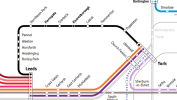
New Northern map

Mcr Warrior

Veteran Member
Joined
8 Jan 2009
Messages
17,150
It's a little misleading to say Piccadilly to Victoria is a nine minute connection. The journey may take nine, but you could have to wait twelve minutes for the next service.
Indeed, although, to be fair, what it does say is... "Metrolink tram connection journey time 9 min".
 
Sponsor Post - registered members do not see these adverts; click here to register, or click here to log in
R

RailUK Forums

DynamicSpirit

Established Member
Joined
12 Apr 2012
Messages
9,211
Location
SE London
Indeed, although, to be fair, what it does say is... "Metrolink tram connection journey time 9 min".

Although more seriously, it omits the rather crucial information that your rail tickets aren't valid on the tram so you have to buy a separate ticket.
 

Mcr Warrior

Veteran Member
Joined
8 Jan 2009
Messages
17,150
Although more seriously, it omits the rather crucial information that your rail tickets aren't valid on the tram so you have to buy a separate ticket.
That's not necessarily automatically always the case. Sometimes, they are valid! E.g. a journey from Cheadle Hulme to Rochdale.
 

janb

Member
Joined
16 Jul 2008
Messages
833
Re it's creator, the following is taken from Roger French's recent Alex Hornby piece,

You get an idea of the scale of Northern’s operations by studying the excellent network map recently redesigned in colour by another bus to train career convert, Matt Harrison, who’s done an excellent job making the network easy to understand.
 

Trainguy34

Established Member
Joined
29 Apr 2023
Messages
1,227
Location
Kent
Does anyone know of a software that could be used to create a map similar to this, am hoping to create one for Canterbury bus routes.
 

YorksLad12

Established Member
Joined
5 Feb 2020
Messages
2,697
Location
Leeds
Does anyone know of a software that could be used to create a map similar to this, am hoping to create one for Canterbury bus routes.
I use Inkscape for mine. It's not an easy package if you've never drawn anything - a bit like Adobe Illustrator in terms of levels of complexity - but worth it if you want to put the time in. And it's donationware, not a cloud package.
 

pokemonsuper9

Established Member
Joined
20 Dec 2022
Messages
4,582
Location
Greater Manchester
I've noticed this map has started to appear at some stations, I haven't had a full chance to look at it yet but the flaws do not appear to have been fixed.
 

61653 HTAFC

Veteran Member
Joined
18 Dec 2012
Messages
19,347
Location
Yorkshire
I've noticed this map has started to appear at some stations, I haven't had a full chance to look at it yet but the flaws do not appear to have been fixed.
There's also a fair bit that'll need completely redrawing in a few years. The Mirfield to Wakefield line will need to include Ravensthorpe, and there doesn't look as if there's space to add the stations (and their names) in for White Rose or Elland.
 

YorksLad12

Established Member
Joined
5 Feb 2020
Messages
2,697
Location
Leeds
There's also a fair bit that'll need completely redrawing in a few years. The Mirfield to Wakefield line will need to include Ravensthorpe, and there doesn't look as if there's space to add the stations (and their names) in for White Rose or Elland.
White Rose will replace Cottingley, and there’s space for Elland if you slide Brighouse down a bit. Having done my own maps the last few years, you always look ahead

Ravensthorpe would be a bit more difficult, but since the map doesn’t obey the “opposite angle” rule for lines and dots (such as at Mirfield) and since dots can be grouped in different ways, it should be doable too with a bit of shuffling around.
 

61653 HTAFC

Veteran Member
Joined
18 Dec 2012
Messages
19,347
Location
Yorkshire
White Rose will replace Cottingley, and there’s space for Elland if you slide Brighouse down a bit. Having done my own maps the last few years, you always look ahead

Ravensthorpe would be a bit more difficult, but since the map doesn’t obey the “opposite angle” rule for lines and dots (such as at Mirfield) and since dots can be grouped in different ways, it should be doable too with a bit of shuffling around.
Wasn't there some discussion about Cottingley being retained with a parliamentary type service to avoid going through the closure process, at least for a time? Things may well have moved past that now though.
The Ravensthorpe thing is more about having to redraw the "other operators services" line, as it currently heads off in a different direction from Mirfield. If the Ravensthorpe 'dot' stays where it is rather than moving a little closer to Mirfield (as the real life station will, funnily enough) then that line will end up being a bit of a mess.
 

skyhigh

Established Member
Joined
14 Sep 2014
Messages
6,842
Wasn't there some discussion about Cottingley being retained with a parliamentary type service to avoid going through the closure process, at least for a time? Things may well have moved past that now though.
Maybe, quite a long time ago now though - the ORR ratified the closure of Cottingley in Feb 2023. It's only still open because White Rose isn't finished.
 

pokemonsuper9

Established Member
Joined
20 Dec 2022
Messages
4,582
Location
Greater Manchester
Why isn't Ince shown as a stop on the Southport services?
Reviewed all of my previous notes against the new map, this is the only one changed.

With Deighton and Ravensthorpe now closed for a while, as well as no service via the Bradley Junction curve, that area probably could have done with a re-work, especially since I think both of those are long-term (several years).
 

1D53

Established Member
Joined
2 Apr 2006
Messages
2,884
Ravensthorpe doesn't close till December. Bradley Curve retains some service, albeit limited.
 

pokemonsuper9

Established Member
Joined
20 Dec 2022
Messages
4,582
Location
Greater Manchester
There's a new version of the map online (it's dated November so it might've been there a while).
Not sure if this new version is at stations, I haven't looked at my local one since October.
Original - https://www.northernrailway.co.uk/sites/default/files/2025-05/colour-coded-northern-network-map.pdf
New - https://www.northernrailway.co.uk/sites/default/files/2025-11/Northern Network Dec 2025 WEB.pdf

Changes I've noticed
- As above, Ince now has the stops on the Southport services
- Merseyrail is now yellow
- More TPE lines are shown (e.g. Hazel Grove - Chinley)
- TPE main line made a main line from Manchester to York.
- TfW curve (Chester - Runcorn) now shown
- Sheffield trams symbol at Sheffield, Meadowhall, and Rotherham (and icon reference included in the key)
- Mill Hill and Cherry Tree were the wrong way around
- Ravensthorpe and Deighton cloesd
- Salwick has a limited service dot
- Normanton now has limited service dot on the fast trains
- Cumbrian coast line now continues to Lancaster
- Blackpool North now has a tram symbol
- Several colours changed making neighbouring lines more distinct
- Limited service dots added at some stations between Hexham and Newcastle on the Carlisle - Middlesbrough line, which has been moved back from Nunthorpe and no longer has many stops between Newcastle and Stockton
- Carlisle - Nunthorpe / - Morpeth - (limited) Chathill split into Carlisle - Middlesbrough and Newcastle - Morpeth - (limited) Chathill
- Blyth Bebside open
- Newcastle - Darlington limited service turned into a branch of Bishop Auckland - Saltburn
- Stockton - Eaglescliff curve no longer shown
- Hexam - Whitby split into Hexham - Newcastle, Newcastle - Nunthorpe - (limited) Great Ayton, Middlesbrough - Whitby.
- Weardale railway now shown
- Wressle now has limited service dot
- Leeds - Castleford - Knottingley - (limited) Goole separated from Leeds - (via Wakefield) Kottingley
- Cottingham no longer shown as limited service for Scarbrough - Hull - Sheffield, and Thorne North, Hatfield & Stainforth, and Kirk Sandall now shown as limited.
- GC line Wakefield - Pontefract Monkhill - Doncaster now shown
- Potefract Baghill moved to a more realistic location
- New fast service Leeds - Sheffield now shown
- Newark Northgate now shown
- Longport now shown as limited stop
- Sankey for Penketh now shown as limited stop
- Windermere/Barrow - Manchester Airport now doesn't have a dot at Salford Crescent
- Liverpool/Wigan North Western - Manchester Victoria now shown as limited service
and many slight changes to the layout.

I think I got everything.
Quite a lot of improvements, but my below points remain accurate (with a little added in bold):
Why is there no seperation between the Sheffield-manchester (fast) and New Mills - Manchester (stopping)?
Why isn't the service from Chinley via Stockport that runs once or twice a day shown?
Why does Clifton (2tpd) get its dot but there's no dot for Farnworth (3tpd) or Moses Gate (1tpd) on the Rochdale-Blackburn/Clitheroe.
Why isn't the few TPD from Stalybridge or to Leeds from Wigan North Western shown (ok this one really isn't that significant and would be a pain to add)?
Why is Dinting after its triangle, if it was on the triangle, it'd hide that it's not showing as a limited service for direct Hadfield-Manchester?
Why doesn't Shipley have a dot for trains from Bradford?
Why don't Walsden and Moorside show limited peak time service for Headbolt Lane - Blackburn?
Why isn't Hindley an interchange? (but Dewsbury and Alderley Edge are)
And new point:
Nottingham doesn't have a tram icon (like Blackpool now does)
 

Howardh

Established Member
Joined
17 May 2011
Messages
9,770
There's a new version of the map online (it's dated November so it might've been there a while).
Not sure if this new version is at stations, I haven't looked at my local one since October.
Original - https://www.northernrailway.co.uk/sites/default/files/2025-05/colour-coded-northern-network-map.pdf
New - https://www.northernrailway.co.uk/sites/default/files/2025-11/Northern Network Dec 2025 WEB.pdf

Changes I've noticed
- As above, Ince now has the stops on the Southport services
- Merseyrail is now yellow
- More TPE lines are shown (e.g. Hazel Grove - Chinley)
- TPE main line made a main line from Manchester to York.
- TfW curve (Chester - Runcorn) now shown
- Sheffield trams symbol at Sheffield, Meadowhall, and Rotherham (and icon reference included in the key)
- Mill Hill and Cherry Tree were the wrong way around
- Ravensthorpe and Deighton cloesd
- Salwick has a limited service dot
- Normanton now has limited service dot on the fast trains
- Cumbrian coast line now continues to Lancaster
- Blackpool North now has a tram symbol
- Several colours changed making neighbouring lines more distinct
- Limited service dots added at some stations between Hexham and Newcastle on the Carlisle - Middlesbrough line, which has been moved back from Nunthorpe and no longer has many stops between Newcastle and Stockton
- Carlisle - Nunthorpe / - Morpeth - (limited) Chathill split into Carlisle - Middlesbrough and Newcastle - Morpeth - (limited) Chathill
- Blyth Bebside open
- Newcastle - Darlington limited service turned into a branch of Bishop Auckland - Saltburn
- Stockton - Eaglescliff curve no longer shown
- Hexam - Whitby split into Hexham - Newcastle, Newcastle - Nunthorpe - (limited) Great Ayton, Middlesbrough - Whitby.
- Weardale railway now shown
- Wressle now has limited service dot
- Leeds - Castleford - Knottingley - (limited) Goole separated from Leeds - (via Wakefield) Kottingley
- Cottingham no longer shown as limited service for Scarbrough - Hull - Sheffield, and Thorne North, Hatfield & Stainforth, and Kirk Sandall now shown as limited.
- GC line Wakefield - Pontefract Monkhill - Doncaster now shown
- Potefract Baghill moved to a more realistic location
- New fast service Leeds - Sheffield now shown
- Newark Northgate now shown
- Longport now shown as limited stop
- Sankey for Penketh now shown as limited stop
- Windermere/Barrow - Manchester Airport now doesn't have a dot at Salford Crescent
- Liverpool/Wigan North Western - Manchester Victoria now shown as limited service
and many slight changes to the layout.

I think I got everything.
Quite a lot of improvements, but my below points remain accurate (with a little added in bold):

And new point:
Nottingham doesn't have a tram icon (like Blackpool now does)

Great stuff!
While it shows non-Northern routes across the Pennines (TPE) it doesn't show other non-Northern routes which do exist, eg Preston>Manchester>Airport (TPE) even though the Northern routes are shown (obvs!) and the Avanti lime merges into the green BPN>Liverpool Northern line. Then kinda disappears after Preston!
Not complaining, just a bit of an oddity, I love the map and hope it's posted at all stations.
However, under GBR will this be redundant or will these companies continue as they are?
 

Andyh82

Established Member
Joined
19 May 2014
Messages
4,545
It’s also available in fold out printed form from stations, alongside those various leaflets they’ve started doing promoting various destinations/routes they serve
 

pokemonsuper9

Established Member
Joined
20 Dec 2022
Messages
4,582
Location
Greater Manchester
Avanti lime merges into the green BPN>Liverpool Northern line. Then kinda disappears after Preston!
Yep, smoothly merges into the Northern service and then appears at Oxenholme out of a different line.
Preston>Manchester>Airport (TPE)
Apart from Gatley, Deansgate, and Chorley, the Windermere - Airport is the same as the TPE - Scotland as far as Oxenholme, and I don't think we need more lines through Castlefield
However, under GBR will this be redundant or will these companies continue as they are?
I don't think we can really know yet (and it's probably for another thread).
I can see in the short term merges happening (E.g. TPE + Northern, c2c + Greater Anglia) and leading to combined maps.
Longer term this map will have changed to an unrecognisable form as new stations and services we can only draw in crayon appear.
it doesn't show other non-Northern routes which do exist, eg
However it does show a couple.
ECML, GC Bradford - ECML, WCML, Liverpool - Frodsham/WCML
It’s also available in fold out printed form from stations, alongside those various leaflets they’ve started doing promoting various destinations/routes they serve
Ooh, I might have to see if I can pick one of those up next time I'm in Central Manchester (I doubt the smaller stations will have any).
I can correct the errors myself!
 

DelW

Established Member
Joined
15 Jan 2015
Messages
5,934
It’s also available in fold out printed form from stations, alongside those various leaflets they’ve started doing promoting various destinations/routes they serve
It's good that Northern is still providing information on paper, not just expecting everyone to work from an online journey planner. I think this map is very useful for seeing how Northern's services are structured, and for planning leisure trips where the destination may be chosen based on how easy it is to get there, rather than having to reach a specific place.

Does Northern still produce printed timetables, or pdfs of tabulated services? If so, it might be helpful to add to the map the appropriate timetable number for each route colour.

Well done to Northern for maintaining and updating it.
 

Farigiraf

Member
Joined
23 Jul 2023
Messages
1,135
Location
Bridge on the River Cam
It's surprising how well they've managed to keep it accurate while not creating too much confusing 'spaghetti'. Great that it's being put up at stations and also available in paper form - copying the successful methods of the tube map.

Other than the errors that @pokemonsuper9 spotted (many of which might actually make it more confusing if implemented, but they're errors nonetheless), the only inaccuracies I found were that Eastrington isn't shown as limited service and that Broomfleet isn't shown as limited service on the York-Bridlington line.

Compare this with something like the NR website's new maps (which are riddled with inaccuracies and are quite hard to read as well - you need to zoom in so much to see station names) - it's night and day.
 

Mcr Warrior

Veteran Member
Joined
8 Jan 2009
Messages
17,150
Minor observation: Ardwick is also a limited service stop on the (yellow) line heading out to New Mills Central, isn't it?
 

ainsworth74

Forum Staff
Staff Member
Global Moderator
Joined
16 Nov 2009
Messages
31,067
Location
Redcar
Compare this with something like the NR website's new maps (which are riddled with inaccuracies and are quite hard to read as well - you need to zoom in so much to see station names) - it's night and day.
I do think, for all the justified (and unjustified :lol: ) grief we give Northern, that they deserve some credit for this map. It's by no means perfect but considering the complexity of their network they've done a very good job overall producing something that contains a lot of information but without making it messy and also making sure that it's, apart from a few edge cases here and there, accurate.
 

Andyh82

Established Member
Joined
19 May 2014
Messages
4,545
I wonder if they could change the lines to represent an hourly service, so duplicate the lines if the service is more frequent, like that map generated by a user that someone made before Covid

In the majority of cases the lines do represent an hourly service so it wouldn’t be much of a change but there are various places where it’s more frequent. Either that or change the thickness of the line, or the style of the line?

In regards to other leaflets Northern are issuing, it’s clearly Alex Hornby’s influence as the design of them are vary similar to the sort of leaflets Transdev do across Yorkshire and Lancashire. The city centre maps included are pretty much the same.
 

pokemonsuper9

Established Member
Joined
20 Dec 2022
Messages
4,582
Location
Greater Manchester
I wonder if they could change the lines to represent an hourly service, so duplicate the lines if the service is more frequent,
I think that would be very difficult on the current map, and would bring new issues to light (e.g. the weird service pattern for Blackpool - Liverpool (1tph) services compared to Wigan - Liverpool (2tph) which have several variations of stopping patterns at peak times but they are all neatly hidden together as 1 line on this map.
And the Ilkley/Skipton/Bradford area would take up so much more space if the 1 line was split into 6.
 

Andyh82

Established Member
Joined
19 May 2014
Messages
4,545
Does anyone know how many different versions of the new Northern city or route guides have been produced

I’ve seen ones for Leeds, Manchester, Blackpool, Sheffield & the Hope Valley Line, and the Wharfedale Line
 

mattpharrison

Member
Joined
11 Sep 2013
Messages
23
Location
Manchester
There's a new version of the map online (it's dated November so it might've been there a while).
Not sure if this new version is at stations, I haven't looked at my local one since October.
Original - https://www.northernrailway.co.uk/sites/default/files/2025-05/colour-coded-northern-network-map.pdf
New - https://www.northernrailway.co.uk/sites/default/files/2025-11/Northern Network Dec 2025 WEB.pdf

Changes I've noticed
- As above, Ince now has the stops on the Southport services
- Merseyrail is now yellow
- More TPE lines are shown (e.g. Hazel Grove - Chinley)
- TPE main line made a main line from Manchester to York.
- TfW curve (Chester - Runcorn) now shown
- Sheffield trams symbol at Sheffield, Meadowhall, and Rotherham (and icon reference included in the key)
- Mill Hill and Cherry Tree were the wrong way around
- Ravensthorpe and Deighton cloesd
- Salwick has a limited service dot
- Normanton now has limited service dot on the fast trains
- Cumbrian coast line now continues to Lancaster
- Blackpool North now has a tram symbol
- Several colours changed making neighbouring lines more distinct
- Limited service dots added at some stations between Hexham and Newcastle on the Carlisle - Middlesbrough line, which has been moved back from Nunthorpe and no longer has many stops between Newcastle and Stockton
- Carlisle - Nunthorpe / - Morpeth - (limited) Chathill split into Carlisle - Middlesbrough and Newcastle - Morpeth - (limited) Chathill
- Blyth Bebside open
- Newcastle - Darlington limited service turned into a branch of Bishop Auckland - Saltburn
- Stockton - Eaglescliff curve no longer shown
- Hexam - Whitby split into Hexham - Newcastle, Newcastle - Nunthorpe - (limited) Great Ayton, Middlesbrough - Whitby.
- Weardale railway now shown
- Wressle now has limited service dot
- Leeds - Castleford - Knottingley - (limited) Goole separated from Leeds - (via Wakefield) Kottingley
- Cottingham no longer shown as limited service for Scarbrough - Hull - Sheffield, and Thorne North, Hatfield & Stainforth, and Kirk Sandall now shown as limited.
- GC line Wakefield - Pontefract Monkhill - Doncaster now shown
- Potefract Baghill moved to a more realistic location
- New fast service Leeds - Sheffield now shown
- Newark Northgate now shown
- Longport now shown as limited stop
- Sankey for Penketh now shown as limited stop
- Windermere/Barrow - Manchester Airport now doesn't have a dot at Salford Crescent
- Liverpool/Wigan North Western - Manchester Victoria now shown as limited service
and many slight changes to the layout.

I think I got everything.
Quite a lot of improvements, but my below points remain accurate (with a little added in bold):

And new point:
Nottingham doesn't have a tram icon (like Blackpool now does)
You've done a better job of outlining the changes/improvements to the map than even I could, as the designer!

Thank you to everybody on the thread for your suggestions, changes, improvements - they are all very gratefully received and as referenced above, they are actioned!
 

pokemonsuper9

Established Member
Joined
20 Dec 2022
Messages
4,582
Location
Greater Manchester
There's a new version of the map, just Northumberland Park opening.

Does anyone know of a link I can bookmark that will always give me the most up to date version?
 

Welshy1717

Member
Joined
24 Feb 2025
Messages
19
Location
wellingborough
It is my greatest plan to dive into the complex network map of the NORTHERN network, running services & routes all over Yorkshire.

When I look at the network map, i always think....... London underground network.
NORTHERN network.png

So i am thinking a short small journey for my first time....... from Sheffield, as i in east midlands.

Sheffield to Hudderfield
Sheffield to Hudderfield .png
Leeds to York
leeds to york.png
 

Attachments

  • leeds to york.png
    leeds to york.png
    78.8 KB · Views: 20

Top