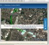
I do wonder what the meaning behind this is. It seems to be put there by Google. Could it be that ATOC haven't paid Google for what they should have? What was wrong with the .pdf maps anyway? And are they not paying Google when they should be perhaps?

-
Our new ticketing site is now live! Using either this or the original site (both powered by TrainSplit) helps support the running of the forum with every ticket purchase! Find out more and ask any questions/give us feedback in this thread!
You are using an out of date browser. It may not display this or other websites correctly.
You should upgrade or use an alternative browser.
You should upgrade or use an alternative browser.
National Routeing Guide maps - 'for development purposes only'
- Thread starter mikeg
- Start date
- Status
- Not open for further replies.
Sponsor Post - registered members do not see these adverts; click here to register, or click here to log in
R
RailUK Forums
It is either a billing or API Error see https://developers.google.com/maps/...&utm_medium=degraded&utm_campaign=keyless#apiI do wonder what the meaning behind this is. It seems to be put there by Google. Could it be that ATOC haven't paid Google for what they should have? What was wrong with the .pdf maps anyway? And are they not paying Google when they should be perhaps?
Google Maps used to be free to embed, then they introduced billing for it a few months ago. A lot of sites haven't yet implemented the billing code, so the watermark appears.
Eventually they'll be blocking access to Google Maps without using the billing code, but for now they still allow it but make it difficult to use with the watermark.
Eventually they'll be blocking access to Google Maps without using the billing code, but for now they still allow it but make it difficult to use with the watermark.
Thanks for the info. At least for atoc's sake Google haven't taken the same attitude as northern for this lack of billing. It just smacks of incompetence and indifference that they can't maintain the site that determines the validity of my ticket in this manner. But then this is the RDG/ATOC!

Royston Vasey
Established Member
It doesn't work anyway. Tried it for Oxford to Cambridge last week and it would only show me the route via Paddington whatever I clicked. Then crashed.

ASharpe
Member
I noticed this in an internal system at my work the other day; but as I'm the only person who uses that feature it kind of fell on deaf ears.
I suppose google need to make a profit somewhere and they have been good enough to continue to provide functionality but with a warning.
I suppose google need to make a profit somewhere and they have been good enough to continue to provide functionality but with a warning.

kieron
Established Member
I suppose the problem was that they're something which needed to be updated from time to time, but weren't used by the industry. It's easier if you only have one set of maps to work with.What was wrong with the .pdf maps anyway?
There are copies of the ones they published on farehistory.info, and I have an updated version here.
As well as the issue with data.atoc.org, nationalrail.co.uk have a notice suggesting that Microsoft have degraded their map interface in a bid to get (more?) money from them. As the map zooms out if I press either of the + and - buttons (at least from where I took the screenshot), I think the map integration may still need a little work.
Attachments
- Status
- Not open for further replies.