
• Our new ticketing site is now live! Using either this or the original site (both powered by TrainSplit) helps support the running of the forum with every ticket purchase! Find out more and ask any questions/give us feedback in this thread!

Mistakes in old maps

Status
Not open for further replies.

jadmor

Member
Joined
26 Nov 2013
Messages
154
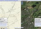
I was browsing through one of the NLS collections showing lines around Cowdenbeath and Lumphinnans and noticed an interesting omission; the main line running north from Cowdenbeath New had a junction linking to the old line running towards Thornton Junction, built as part of the Forth Bridge connecting works, and this is omitted from the map, even though it shows revisions from 1895 onwards.
it is not the first time I have spotted an error( Jowett's hand drawn atlas gets the junctions at Germiston wrong) but it is the first time I have spotted an error in an Ordnance Survey map.

Can posters think of any other examples?
 

Attachments

  • IMG_1385.jpeg
    IMG_1385.jpeg
    1 MB · Views: 48
Sponsor Post - registered members do not see these adverts; click here to register, or click here to log in
R

RailUK Forums

Sir Felix Pole

Established Member
Joined
21 Oct 2012
Messages
2,164
Location
Wilmslow
One example I can think of is Gunnislake station in Cornwall which is blatantly in the wrong place on the 1972 1 inch 7th series map. (This is before the 1994 move to its current location).

Gunnislake

More typically O.S. maps were not revised that often - or if they were it was only a selected revision - so you do get some glaring inconsistencies as the railway network developed. I quite like the Bartholomew half-inch maps which quite often show 'projected lines' that never actuallly happened. An example is the 1904 Sheffield sheet which shows the Midland Rly's projected line up the Spen Valley and Bradford 'Crossrail'.

Sheffield
 

30907

Veteran Member
Joined
30 Sep 2012
Messages
21,945
Location
Airedale
I was browsing through one of the NLS collections showing lines around Cowdenbeath and Lumphinnans and noticed an interesting omission; the main line running north from Cowdenbeath New had a junction linking to the old line running towards Thornton Junction, built as part of the Forth Bridge connecting works, and this is omitted from the map, even though it shows revisions from 1895 onwards.
it is not the first time I have spotted an error( Jowett's hand drawn atlas gets the junctions at Germiston wrong) but it is the first time I have spotted an error in an Ordnance Survey map.
The map itself is dated 1896 and "resurveyed 1894" - assuming the line you mention was in place by 1894, it is a surprisingly major error. Minor railway-related ones are not unknown.
 

oldman

Established Member
Joined
26 Nov 2013
Messages
1,344
According to RailScot, the new alignment from Cowdenbeath North J. to Lumphinnans Central J. did not open until 1900.
 
Status
Not open for further replies.

Top