Sun Chariot
Established Member
Hoping a reader with local knowledge can guide me on this:
An unexpected bereavement on my wife's side, this week, necessitated a trip to Ebbw Vale. I had not explored the area during my "track bashing" years, as the line was still freight-only.
As we drove through Crumlin, I was struck by the splendour of the two valleys and the huge efforts of the original railway engineers.
I could see the location previously taken up by Crumlin Low Level station. I also tried to spot the location of the former cast-iron viaduct (the highest in the UK at the time); I believe its pier-foundations are still present - but I was unable to see them from the car.
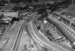
We took the B4471 Crumlin Road around the valley north of Crumlin, rather than the A467. I've tried both roads on Google Maps and I tried to find the public house shown in the photo at the top of Wikipedia's page:

 en.m.wikipedia.org
Alas, no joy. So - can any of you steer me, where the stone / concrete foundations exist? We'll return to Ebbw next week, so I will have a chance to look then.
en.m.wikipedia.org
Alas, no joy. So - can any of you steer me, where the stone / concrete foundations exist? We'll return to Ebbw next week, so I will have a chance to look then.
Many thanks.
An unexpected bereavement on my wife's side, this week, necessitated a trip to Ebbw Vale. I had not explored the area during my "track bashing" years, as the line was still freight-only.
As we drove through Crumlin, I was struck by the splendour of the two valleys and the huge efforts of the original railway engineers.
I could see the location previously taken up by Crumlin Low Level station. I also tried to spot the location of the former cast-iron viaduct (the highest in the UK at the time); I believe its pier-foundations are still present - but I was unable to see them from the car.
We took the B4471 Crumlin Road around the valley north of Crumlin, rather than the A467. I've tried both roads on Google Maps and I tried to find the public house shown in the photo at the top of Wikipedia's page:
Crumlin Viaduct - Wikipedia
Many thanks.
Last edited: