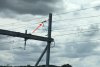
I went for a ride between Paddington and Reading today, and had a chance to see the progress on electrification. As previous posters have remarked, there's a marked difference east vs. west of Maidenhead: east of Maidenhead has almost all of the masts up, most with horizontal booms and many with registration gear. West of Maidenhead, though, it looks like piling is mostly complete but some don't have masts. There are a few masts with horizontal booms near Maidenhead, but not that many.
More surprisingly, though, I noticed about eight or nine signal gantries (at least four down and four up) between MP25 and MP28½ (Maidenhead-Ruscombe) that really don't look high enough for the wires. Indeed, I'm pretty sure the gantries haven't been changed since the days of Reading PSB, though the signals have fresh LED heads. When are these planned to be removed? I'm sure doing so will require a four-line block through the area, which can't be easy to come by...
On a more technical note, the masts west of Airport Junction seem to be employing a new labelling system. East of Airport Junction, you might have
J
19
07
to indicate the 7th mast in the 19th kilometre from Paddington, "J" indicating the main line from Paddington to the west. But the new labels look like:
MLN
31
348
(MLN is the engineer's line reference for Paddington-Penzance.) Given that this mast was right next to the 19½ milepost, and that 19.5 miles = 31.382km, and judging by the spacing of the masts, I think this must mean the mast is 31 kilometres and 348 metres from the datum point (in this case, Paddington). Where there are two masts at the same distance from the datum, a fourth line is used to indicate which line the mast is on, so you might have
MLN
31
348
DM
(This isn't a real example, but I didn't manage to write down a real one with a line abbreviation.)
Can anyone "in the know" confirm if this is to be the new mast labelling standard for all future electrification schemes?

 .
.