• Our new ticketing site is now live! Using either this or the original site (both powered by TrainSplit) helps support the running of the forum with every ticket purchase! Find out more and ask any questions/give us feedback in this thread!

Great Western Electrification Progress

Status
Not open for further replies.

swt_passenger

Veteran Member
Joined
7 Apr 2010
Messages
34,229
When you say the road do you mean the railway?

I thought in context he meant reducing the height of the road across the level crossing, Google does suggest the road rises both sides. Then the railway could be lowered a bit. But it's always likely to introduce problems with drainage, buried services, property access etc etc. Cannot look at things in isolation.

I suppose it might have been mentioned earlier, but is it not a 'closable' level crossing?
 
Last edited:
Sponsor Post - registered members do not see these adverts; click here to register, or click here to log in
R

RailUK Forums

LNW-GW Joint

Veteran Member
Joined
22 Feb 2011
Messages
21,898
Location
Mold, Clwyd
The 85 through Swindon dates from well before the "passengerisation" of the Up Goods at Rushey Platt (late 80s vs mid 00s)

The reason that had been bandied around was it was due to BR cost cutting. Lowering the line speed through the station allowed the point work to be dropped down to a lower maintenance regime, and thus save BR money. When stopping the majority of passenger trains at Swindon became the norm in the late 80s, they couldn't justify maintaining the points for a speed only a small handful of trains attained through the area. 90mph - the speed of the majority of the non-stop (mail) traffic - was still in the higher maintenance tier so 85 was selected.

The /40 came along much later, and could believably be resultant of the subway conditions.

There are plenty of examples of PSRs for the length of a weak structure, but the 85 starts at Highworth on the Down and Rushey Platt on the Up, conveniently where all the Swindon area pointwork starts.

Presumably the 1960s signalling supported 125mph through Swindon, whatever the track people decided later on.
Do we know if the new TVSC signalling still supports 125mph, or is it geared to the present 85mph (signal sighting etc)?
If not it will cost to reinstate the higher speed.
There will also be many more non-stop trains through Swindon in the IEP era.
 
Last edited:

50031

Member
Joined
28 Aug 2013
Messages
176
Presumably the 1960s signalling supported 125mph through Swindon, whatever the track people decided later on.
Do we know if the new TVSC signalling still supports 125mph, or is it geared to the present 85mph (signal sighting etc)?
If not it will cost to reinstate the higher speed.
There will also be many more non-stop trains through Swindon in the IEP era.

Yes, it would seem crazy not to raise the speed limit on such a straight alignment with IEPs non stop every hour
 

veryoldbear

Member
Joined
9 Jul 2017
Messages
20
I thought in context he meant reducing the height of the road across the level crossing, Google does suggest the road rises both sides. Then the railway could be lowered a bit. But it's always likely to introduce problems with drainage, buried services, property access etc etc. Cannot look at things in isolation.

I suppose it might have been mentioned earlier, but is it not a 'closable' level crossing?

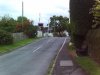
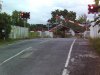
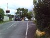
No problem with reducing the height of the road at Stocks Lane. NR just don't want to do it. Better than Google I just popped down the road for some piccies:
 

Attachments

  • SUNP0007.jpg
    SUNP0007.jpg
    133 KB · Views: 115
  • SUNP0008.jpg
    SUNP0008.jpg
    164.7 KB · Views: 106
  • SUNP0013.jpg
    SUNP0013.jpg
    145.2 KB · Views: 102

coppercapped

Established Member
Joined
13 Sep 2015
Messages
3,315
Location
Reading
Could the level of the road not be reduced?

Try thinking this through!

The contact wire over the level crossing has to be a certain minimum height above the rails - this will not vary regardless of whether the road level is where it is now or if it were to be lowered. The gap between the rail and the wire remains the same.

So the rate of change of wire height[1] referred to the top of the rail from the bridge to the level crossing will remain exactly the same.

[1] Change in rail-wire gap/metre run.
 

Roast Veg

Established Member
Joined
28 Oct 2016
Messages
2,319
I think the suggestion was to lower the whole crossing, road and rails together, but keep the wire at the current height.
 

Sean Emmett

Member
Joined
9 Mar 2015
Messages
522
I think the suggestion was to lower the whole crossing, road and rails together, but keep the wire at the current height.
Yes, but as Coppercapped has said, what does that achieve, apart from create a flood risk?!

re Swindon IIRC there was a parcels platform on what was the down loop line which, as others have said, was built over and out to meet the down main, negating need for approach control.

Before my train timing days but I gather there was a 100 PSR at Wootton Bassett in the early HST era, before it got raised to 125.

Speed limits were also higher into and out of PAD, and the IETs will do well to match some of the PAD - RDG times achieved in 1977.
 

JN114

Established Member
Joined
28 Jun 2005
Messages
3,522
Presumably the 1960s signalling supported 125mph through Swindon, whatever the track people decided later on.
Do we know if the new TVSC signalling still supports 125mph, or is it geared to the present 85mph (signal sighting etc)?
If not it will cost to reinstate the higher speed.
There will also be many more non-stop trains through Swindon in the IEP era.

There were changes in '75-76 to support Introduction of HSTs; but generally yes, the 1968 signalling is compliant for 125 operation.

When TVSC took over from Swindon Panel there were no changes to the signalling layout east of Swindon. There was a slight change on the Up approaching Rushey Platt (the addition of a "Wiltshire Distant" to improve the 3 to 4 aspect transition). I'd need to look at the plans in more detail to ascertain if it was compliant for 125. There may also be sighting issues as you mention.
 

JN114

Established Member
Joined
28 Jun 2005
Messages
3,522
Yes, but as Coppercapped has said, what does that achieve, apart from create a flood risk?!

re Swindon IIRC there was a parcels platform on what was the down loop line which, as others have said, was built over and out to meet the down main, negating need for approach control.

Before my train timing days but I gather there was a 100 PSR at Wootton Bassett in the early HST era, before it got raised to 125.

Speed limits were also higher into and out of PAD, and the IETs will do well to match some of the PAD - RDG times achieved in 1977.

Frustratingly the layout approaching Paddington isn't designed for the blanket 40 in force today - until the post-Ladbroke simplification the linespeed into Paddington was 100 for HSTs, HX (and Turbos, although they could only reach 90) right up to Royal Oak.
 

jimm

Established Member
Joined
6 Apr 2012
Messages
5,274
I was quite young at the time (!), but seem to remember it was timetabled at 21 mins for the fastest ones. I think the fastest today are 24 or 25. I guess that's progress!

People who seem to know about these things over on the Great Western Passengers' Forum have said a number of times that the increase in running times between Paddington and Reading is down to the use of the ATP system post-1990.

The 180s were certainly timed for 24 minutes start to stop but all their current duties involve Slough stops - the 15.52 off Paddington was, I think the last non-stop 180 until a timetable change last year (May?) and with a clear run out of London it could sometimes be stopped at the platform in Reading by 16.15.
 

coppercapped

Established Member
Joined
13 Sep 2015
Messages
3,315
Location
Reading
I think the suggestion was to lower the whole crossing, road and rails together, but keep the wire at the current height.

You still haven't understood it. There is a maximum height above rail for the contact wire - otherwise the pantograph won't reach it.

This height, within an inch or so, is reached at the crossing. Dropping the rails will also mean dropping the wire height.

Geometry is obviously an unknown concept. :cry:
 

QueensCurve

Established Member
Joined
22 Dec 2014
Messages
2,195
When you say the road do you mean the railway?

No I meant the road through the level crossing, thereby reducing the gradient in the OHLE.

Try thinking this through!

I resent the sneering tone.

The contact wire over the level crossing has to be a certain minimum height above the rails - this will not vary regardless of whether the road level is where it is now or if it were to be lowered. The gap between the rail and the wire remains the same.

So the rate of change of wire height[1] referred to the top of the rail from the bridge to the level crossing will remain exactly the same.

[1] Change in rail-wire gap/metre run.

If the road were lowered, the rails would have to be lowered too. This, to give the same height of the wire above the rails would reduce the gradient required.

I am not suggesting this is necessarily simple work or ignoring the fact that drains, burried services etc might not have to be altered too, simply that it may be an option to take the matter forward.
 
Last edited:

Feathers44

Member
Joined
12 Aug 2014
Messages
378
No I meant the road through the level crossing, thereby reducing the gradient in the OHLE.

That's what I understood from this thread all along.

Drop the road, drop the rails, drop the overhead (maintaining all of the appropriate clearences), reduce the gradient from low point under bridge to high point over road, reduce whatever the impact of a steep gradient is.

It seems to have taken people a long point to get this!

(...or use third raill and avoid the whole problem :D)
 

QueensCurve

Established Member
Joined
22 Dec 2014
Messages
2,195
Forgive me if this has been considered elsewhere, but I wondered if there had been any discussion of the current works at Bristol Porkway which are, as I understand it, bringing into use the new Platform 1.

Presumably there are changes to Stoke Gifford Junction and I wondered if there was a published track layout.

Also wondering whether Platform 1 will be dedicated to services on the Bristol Temp'tation route and Platform 2 for South Wales. Also what flexibility would exist for trains on either route to use the other platform when operationally required.
 

snowball

Established Member
Joined
4 Mar 2013
Messages
8,144
Location
Leeds
Press release

https://www.networkrail.co.uk/feeds...lott-road-bridge-completed-ahead-of-schedule/

Engineers have completed the partial demolition of Splott Road bridge as work continues to prepare the railway from London to Cardiff for the overhead wires and posts needed to power trains running on electricity.

Network Rail is carrying out essential upgrade work to a number of bridges in Cardiff to raise the structures, which will give clearance for the new equipment to support brand new bi-mode Intercity Express Trains.

Splott Road bridge is being rebuilt in two phases to help maintain traffic flow and pedestrian access and minimise disruption to the local community. Businesses on the bridge remain open during the work.

The carriageway carrying traffic from Adamsdown to Splott has reopened to traffic and the opposite side of the carriageway will now close to allow the second phase of work to begin.

Andy Thomas, Network Rail Wales route managing director, said: “This work, as part of our Railway Upgrade Plan, will ensure that the bridge is fit for modern day city traffic, as well as being able to accommodate the equipment needed to improve the passenger experience.

“Our railway is vital to economic prosperity, linking people, businesses and communities and we would like to thank the local community for their patience during this improvement work.”

Phase one of the project at Splott Road bridge began in February 2017 and the partial demolition was carried out over August bank holiday weekend, when engineers worked day and night to demolish and reconstruct one side of the bridge in preparation for the overhead line equipment needed for new bi-mode trains, which will run on electricity to Cardiff by 2019.

The bridge has reopened with traffic management in place whilst work continues to prepare the second half of the structure for demolition and reconstruction in 2018.

Adamsdown footbridge, known as ‘Black Bridge’, has now reopened to pedestrians following essential upgrade work to raise the structure. The footbridge will be temporarily closed overnight on some Saturdays until mid-autumn 2017. While the majority of the work has been completed at the bridge, these night time closures will allow engineers to complete the project at a time which causes minimum disruption to the local community.

 

3973EXL

Established Member
Joined
2 Feb 2017
Messages
2,741
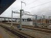
Work continues around Reading:

Two masts adjacent to PL 6, SPS & wiring to finish on one and just wiring on the second.

ATF on the downside, east of the station now fitted to the insulators.

There is a section of ATF missing west of the station on the downside. From the platforms, part way up the flyover adjacent to the Festival line.

Catenary wire up on the Dn West Curve. Up West Curve wired the other week.
Quiet a bit of snagging of the overheads required at Oxford Rd Jn.

No changes just south of Reading West station. There was a planning application posted on Tilehurst Rd bridge for parapet work.

Appeared to be a contractor examining the trees in the station around pile sites.
 

Attachments

  • DSC00097.JPG
    DSC00097.JPG
    181.6 KB · Views: 144
  • DSC00098.JPG
    DSC00098.JPG
    170.6 KB · Views: 141
  • DSC00113.JPG
    DSC00113.JPG
    107.2 KB · Views: 137
  • DSC00102.JPG
    DSC00102.JPG
    248 KB · Views: 161

Jamesrob637

Established Member
Joined
12 Aug 2016
Messages
6,056
Forgive me if this has been considered elsewhere, but I wondered if there had been any discussion of the current works at Bristol Porkway which are, as I understand it, bringing into use the new Platform 1.

Porkway?! I know livestock used to be transported by rail but these days?! :lol:
 
Last edited by a moderator:

Thatcham Xing

Member
Joined
1 Nov 2016
Messages
173
More uprights and cross-beams have appeared in recent weeks between Southcote Junction and Theale, but still a lot of gaps in this area.

Same between Ufton Nervet (new overbridge) and Aldermaston, and Newbury Racecourse and Newbury.
 

3973EXL

Established Member
Joined
2 Feb 2017
Messages
2,741
Summary of work required/in progress from my observations:

Southbury Lane bridge - parapet work.
Twyford ATS - wiring to complete.
Twyford station - painting in progress/up main platform extension started.
Canopy edges to restore.
Twyford West crossovers - four pairs of masts/second pair now wired. Six access platforms in adjacent compound, so not long for the others hopefully.

Butts Hill Road bridge - parapet work.
A4 London Road old span - parapet work.

Kennet Bridge loop - masts same type as Twyford West all wired.

Masts adjacent to Reading PL 6 completed overnight.
 

Attachments

  • DSC00115.JPG
    DSC00115.JPG
    244.3 KB · Views: 100
  • DSC00114.JPG
    DSC00114.JPG
    172.3 KB · Views: 91
  • DSC00118.JPG
    DSC00118.JPG
    159.8 KB · Views: 91
  • DSC00116.JPG
    DSC00116.JPG
    173.8 KB · Views: 94

IrishDave

Member
Joined
30 Jun 2009
Messages
471
Location
Brighton
No I meant the road through the level crossing, thereby reducing the gradient in the OHLE.

If the road were lowered, the rails would have to be lowered too. This, to give the same height of the wire above the rails would reduce the gradient required.

I am not suggesting this is necessarily simple work or ignoring the fact that drains, burried services etc might not have to be altered too, simply that it may be an option to take the matter forward.

Changing the height of road and rail at the level crossing does nothing to solve the problem.

As I understand it, the problem is this: there is a low bridge, at which the pantograph has to be minimally extended, very close to a level crossing, at which the pantograph has to be maximally extended. The "gradient" in the OHLE refers to the change in pantograph extension - here the pantograph must extend (or retract) at a faster rate than is allowed.

The issue isn't the gradient of the OHLE in the sense of its (absolute) slope, but rather the rate of change of (relative) pantograph extension. (Or, to put it another way, the gradient of the OHLE is measured relative to rail height, not relative to sea level.)

Changing the absolute height of the level crossing does not change the extension required of the pantograph, because the wires must be a certain height over the level crossing to allow road vehicles to pass safely underneath - I think that was the point coppercapped was making. I assume that the bridge near the level crossing is not able to be changed for some other reason, but I don't know the details.
 

rwg

New Member
Joined
28 Jul 2017
Messages
3
Dropping the level crossing would allow you to lower the wires and would reduce the problem of the OHLE gradient (less change in height required from the bridge to the crossing), but lowering the crossing means lowering the track and that introduces drainage issues and is of course a large amount of work as the track needs to be lowered over several hundred meters.

There's a lot of basic but good info in the heritage statement attached to the actual planning permission application (http://www.whitehorsedc.gov.uk/java/support/Main.jsp?MODULE=ApplicationDetails&REF=P17/V1154/LB).

I only live a couple of miles from the bridge and have been following this fiasco with growing despair. 99% of those who see the current bridge are those who drive over it, and from that viewpoint it has exactly zero architectural merit. I did comment on the planning application in favour of the rebuild, but oddly I can't see my comment now :( I wonder if it was the only one in favour? My point was that Mr Brunel would have had that bridge down and replaced in the blink of an eye if he thought it was necessary to improve his railway...

cheers,

Robin
 

coppercapped

Established Member
Joined
13 Sep 2015
Messages
3,315
Location
Reading
No I meant the road through the level crossing, thereby reducing the gradient in the OHLE.


I resent the sneering tone.


If the road were lowered, the rails would have to be lowered too. This, to give the same height of the wire above the rails would reduce the gradient required.

I am not suggesting this is necessarily simple work or ignoring the fact that drains, burried services etc might not have to be altered too, simply that it may be an option to take the matter forward.

No it wouldn't. The absolute height above sea level of the rails or the wires is irrelevant - what is important is the change of one relative to the other in the short distance between the bridge and the level crossing.

IrishDave has it spot on.
 

spark001uk

Established Member
Joined
20 Aug 2010
Messages
2,385
No it wouldn't. The absolute height above sea level of the rails or the wires is irrelevant - what is important is the change of one relative to the other in the short distance between the bridge and the level crossing.

IrishDave has it spot on.

Correct. The distance between contact wire and L/C will not change no matter whether you raise or lower the L/C. Therefore the pan's extension will still change by the same amount from bridge to L/C.!

However - lowering the track under the bridge would reduce this change in pan extension. Whether this is an option they're able to consider I don't know, I haven't seen the site.
 

3973EXL

Established Member
Joined
2 Feb 2017
Messages
2,741
For anybody not familiar with the Steventon area, some mileages to give you an overview:

55m 74c A34 bridge

56m 32c points at western end of UR & DGL

56m 38c Steventon bridge

56m 58c Stocks Lane LC

56m 72c Causeway LC
 

QueensCurve

Established Member
Joined
22 Dec 2014
Messages
2,195
Changing the height of road and rail at the level crossing does nothing to solve the problem.

As I understand it, the problem is this: there is a low bridge, at which the pantograph has to be minimally extended, very close to a level crossing, at which the pantograph has to be maximally extended. The "gradient" in the OHLE refers to the change in pantograph extension - here the pantograph must extend (or retract) at a faster rate than is allowed.

The issue isn't the gradient of the OHLE in the sense of its (absolute) slope, but rather the rate of change of (relative) pantograph extension. (Or, to put it another way, the gradient of the OHLE is measured relative to rail height, not relative to sea level.)

Changing the absolute height of the level crossing does not change the extension required of the pantograph, because the wires must be a certain height over the level crossing to allow road vehicles to pass safely underneath - I think that was the point coppercapped was making. I assume that the bridge near the level crossing is not able to be changed for some other reason, but I don't know the details.

I was thinking that, if the level of road and rail could be reduced, the wire could be kept at closer to the level it is under the bridge and its gradient reduced.
 

spark001uk

Established Member
Joined
20 Aug 2010
Messages
2,385
I was thinking that, if the level of road and rail could be reduced, the wire could be kept at closer to the level it is under the bridge and its gradient reduced.

Yes it would make the wire more horizontal, but it wouldn't alter the amount the pan has to extend/retract by, traveling between the two. The only way you'd do that is by lowering the track under the bridge.
 
Status
Not open for further replies.

Top