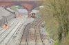
• Our new ticketing site is now live! Using either this or the original site (both powered by TrainSplit) helps support the running of the forum with every ticket purchase! Find out more and ask any questions/give us feedback in this thread!

Filton Bank 4-tracking visualisation

Status
Not open for further replies.
Sponsor Post - registered members do not see these adverts; click here to register, or click here to log in
R

RailUK Forums

swt_passenger

Veteran Member
Joined
7 Apr 2010
Messages
34,239
Is the above drawing absolutely up to date? I thought the extra platform at Filton AW was a side platform, for example...
 

PhilipW

Member
Joined
6 Feb 2008
Messages
761
Location
Fareham, Hants
Is the above drawing absolutely up to date? I thought the extra platform at Filton AW was a side platform, for example...
I thought also than a train could leave the new Platform 1 at Parkway heading towards Temple Meads at the same time as train could leave Platform 2 heading towards Cardiff. That is not what the map indicates.
 

HowardGWR

Established Member
Joined
30 Jan 2013
Messages
4,981
Thanks for the diagram. Some explanation of the TLAs and FLAs would be appreciated, if known. (E.g. TSS). Some, many indeed, of these jobs have already been completed.
 

The_Engineer

Member
Joined
24 Mar 2018
Messages
524
Are the works at Constable Rd and Church Rd (Lawrence Hill) still going ahead given that the electrification has been shelved?

My understanding is that the electrification from Parkway into Temple Meads is deferred to the next control period, because the Filton Bank works need to be finished first. And from this, "Filton Bank Works" includes all provisions that will then permit electrification work to proceed without further asset modification.

I am sure those closer to this project will soon correct me, if indeed I have misunderstood..... :)
 
Last edited:

D1009

Established Member
Joined
22 Feb 2012
Messages
3,166
Location
Stoke Gifford
I thought also than a train could leave the new Platform 1 at Parkway heading towards Temple Meads at the same time as train could leave Platform 2 heading towards Cardiff. That is not what the map indicates.
They already can, and do.
 

Wychwood93

Member
Joined
25 Jan 2018
Messages
693
Location
Burton. Dorset.
Thanks for that.
Are the works at Constable Rd and Church Rd (Lawrence Hill) still going ahead given that the electrification has been shelved?

You wouldn't happen to have a gradient profile would you? Some debate on Nat Pres as to whether there is a dip at the foot of the main climb.
My trusty Ian Allan 'Gradient Profiles' sees a short dip, less than a quarter of a mile, at 1:132 just north of Stapleton Road and then a steady 1:75 climb for just over two miles to a tad north of the former Horfield station.
 

HowardGWR

Established Member
Joined
30 Jan 2013
Messages
4,981
My trusty Ian Allan 'Gradient Profiles' sees a short dip, less than a quarter of a mile, at 1:132 just north of Stapleton Road and then a steady 1:75 climb for just over two miles to a tad north of the former Horfield station.
That would be very helpful in steam days, as that's where they used to attach a banker.
Has no one any idea what those acronyms in the interesting diagram (e.g. RSS) stand for please?
contractor1 perhaps?
 

Hellzapoppin

Member
Joined
16 Jan 2016
Messages
266
RS is Route Section Howard but I can't remember what the SA on the end of it means for the Temple Meads area. I do have it on a drawing on my laptop though so I'll have a look tomorrow and let you know.
 

Henbury Loop

Member
Joined
20 Sep 2015
Messages
187
Location
South Gloucestershire
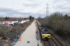
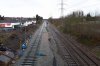
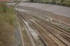
Here are some pictures from Lockleaze Road overbridge during the Easter possession. Interesting to compare it to 2009....
 

Attachments

  • 70804-1.jpg
    70804-1.jpg
    709.3 KB · Views: 243
  • Lockleazeroad24.jpg
    Lockleazeroad24.jpg
    196 KB · Views: 242
  • Lockleazeroad23.jpg
    Lockleazeroad23.jpg
    977.4 KB · Views: 239
  • Lockleaze_Road15.jpg
    Lockleaze_Road15.jpg
    88.7 KB · Views: 256

HowardGWR

Established Member
Joined
30 Jan 2013
Messages
4,981
Here are some pictures from Lockleaze Road overbridge during the Easter possession. Interesting to compare it to 2009....
If I am reading the photos correctly (thanks for those) the one line laid already is the down South Wales /relief and in the middle where there is plastic underlay shewing through, that will be the up relief. I write 'up' and 'down' realising that there was a time when it would have been the other way around possibly (prior to the Badminton route being built). What is it now? It will be 'down' from the Patchway junction, I imagine.
Thanks Hellzapoppin. There was a whole bunch of them on that diagram; SAD, RS6p, RS6d, RSSA, RS7k, SWB, BSW................ My head was spinning after that lot but it is good to see that the last phases are fully planned and at GRIP6, as long as they just carry on in 2019 after this job is completed. Fingers crossed.
 

Hellzapoppin

Member
Joined
16 Jan 2016
Messages
266
RSSA Route Section Special Area.
The RS's with a number are used to identify a specific area of OLE. I think I was done in order to designate an area for contract purposes. The BSW, SWB are standard ELRs.
Hope this helps.
 

Sean Emmett

Member
Joined
9 Mar 2015
Messages
522
My understanding is that the electrification from Parkway into Temple Meads is deferred to the next control period, because the Filton Bank works need to be finished first. And from this, "Filton Bank Works" includes all provisions that will then permit electrification work to proceed without further asset modification.

I am sure those closer to this project will soon correct me, if indeed I have misunderstood..... :)

I'm not so sure! Constable Rd overbridge (3m 29c) was due to be closed from 23 Oct 2017 to 1 Jun 2018 for complete rebuilding / replacement. But not heard of any revised dates for this nor Lawrence Hill OB.

I assume the £33m contract for the 4 tracking included these bridges. What's the current position?
 

HowardGWR

Established Member
Joined
30 Jan 2013
Messages
4,981
RSSA Route Section Special Area.
The RS's with a number are used to identify a specific area of OLE. I think I was done in order to designate an area for contract purposes. The BSW, SWB are standard ELRs.
Hope this helps.
Thank you very much -except, er, 'ELRs'?
 

Hellzapoppin

Member
Joined
16 Jan 2016
Messages
266
Engineers Line Reference Howard, each line has its own unique reference. I think there's been a thread on ELRs already which will explain it in more detail but basically it's as I've said.
Hope this helps
 

HowardGWR

Established Member
Joined
30 Jan 2013
Messages
4,981
Engineers Line Reference Howard, each line has its own unique reference. I think there's been a thread on ELRs already which will explain it in more detail but basically it's as I've said.
Hope this helps
Thanks very much, yes, now I know what it means, I found one or two threads with examples: Here's one -

https://www.railforums.co.uk/thread...een-to-bromsgrove.107512/page-14#post-3348210

The abbreviations are Engineers Line References.
BAG2 is Birmingham NS to Gloucester (2 is west of Kings Norton) - ie Barnt Green-Bromsgrove.
BEA is Barnt Green to Ashchurch (really!) via Evesham - ie the first part of the Redditch branch at Barnt Green.
I presume the professionals like you will have a gazetteer for these, as they don't exactly speak for themselves, do they? :)
 

Henbury Loop

Member
Joined
20 Sep 2015
Messages
187
Location
South Gloucestershire
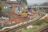
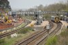
More progress, quite surprised how many of the Orange Army are on this project!

Can somebody tell me, during the upcoming 18th June - 8th July blockade will trains be diverted via The Severn Beach / Henbury Loop lines? (Such as they were in 2004).
 

Attachments

  • 41482577462_2abfffd08a_c.jpg
    41482577462_2abfffd08a_c.jpg
    136.9 KB · Views: 184
  • 41524078041_5eec48baf7_c.jpg
    41524078041_5eec48baf7_c.jpg
    226.5 KB · Views: 170
  • 27653462158_32bfd7a48f_c.jpg
    27653462158_32bfd7a48f_c.jpg
    214.4 KB · Views: 166
  • 27653424058_0c5b894b70_c.jpg
    27653424058_0c5b894b70_c.jpg
    125 KB · Views: 181
  • 41482571222_488f0523bc_c.jpg
    41482571222_488f0523bc_c.jpg
    117 KB · Views: 167
  • 41482554212_cacf145afd_c.jpg
    41482554212_cacf145afd_c.jpg
    211 KB · Views: 161
  • 27653348458_86e3dd46e4_c.jpg
    27653348458_86e3dd46e4_c.jpg
    219.4 KB · Views: 168
  • 41482536812_bea8ee8ccd_c.jpg
    41482536812_bea8ee8ccd_c.jpg
    191.6 KB · Views: 170
  • 27653326998_46b6447903_c.jpg
    27653326998_46b6447903_c.jpg
    236.2 KB · Views: 174

najaB

Veteran Member
Joined
28 Aug 2011
Messages
33,592
Location
Scotland
More progress, quite surprised how many of the Orange Army are on this project!
A question, for anyone who might be in the know, is the 'kink' evident in pictures 4 and 5 a result of the track being skewed towards the centre of the formation at some point or would it always have been like that? If the former, are there any plans to ease the severity of the curve when the new lines are open, if the latter then WTF?!
 

The_Engineer

Member
Joined
24 Mar 2018
Messages
524
A question, for anyone who might be in the know, is the 'kink' evident in pictures 4 and 5 a result of the track being skewed towards the centre of the formation at some point or would it always have been like that? If the former, are there any plans to ease the severity of the curve when the new lines are open, if the latter then WTF?!
It looks as though there used to be a station here - you can see remains of a platform to the right. So, it probably always had that kink to accommodate the platforms. The kink is not very severe anyway - these are telephoto shots that grossly exaggerate what's really there. There does not appear to be any effect on line speed, so why change it?
 

najaB

Veteran Member
Joined
28 Aug 2011
Messages
33,592
Location
Scotland
It looks as though there used to be a station here - you can see remains of a platform to the right. So, it probably always had that kink to accommodate the platforms.
A station wouldn't, in itself, explain the kink since they would've just built the station a dozen yards to the left. Even without the station, some amount of curve would be needed in order to clear the bridge so I'm still wondering if it was built that way.
 

The_Engineer

Member
Joined
24 Mar 2018
Messages
524
A station wouldn't, in itself, explain the kink
Yes it would, there would have been a platform where the open space is between the two pairs of tracks......... And the line continues to curve out after the bridge as the platform would be wider than the bridge pillar.
 

najaB

Veteran Member
Joined
28 Aug 2011
Messages
33,592
Location
Scotland
Yes it would, there would have been a platform where the open space is between the two pairs of tracks......... And the line continues to curve out after the bridge as the platform would be wider than the bridge pillar.
Or, as Wikipedia says: "The line was built by the Bristol and South Wales Union Railway. It was four-tracked until 1984 when it was reduced to double track, with the running lines slewed over to increase line speeds."
 

Wychwood93

Member
Joined
25 Jan 2018
Messages
693
Location
Burton. Dorset.
Or, as Wikipedia says: "The line was built by the Bristol and South Wales Union Railway. It was four-tracked until 1984 when it was reduced to double track, with the running lines slewed over to increase line speeds."
The former station of Horfield - opened in 1927 and closed in 1964. See Bristol Railway archive: http://bristol-rail.co.uk/wiki/Horfield

Edit: https://en.wikipedia.org/wiki/Bristol_and_South_Wales_Union_Railway - "The increased traffic caused the line from Dr Day's Junction to Narroways Hill Junction to be widened to four tracks in 1891."
 
Last edited:

Wychwood93

Member
Joined
25 Jan 2018
Messages
693
Location
Burton. Dorset.
Thanks. That link provides the answer "The station was rebuilt when the line up Filton Bank was quadrupled in the 1930s" - so there was likely some slewing involved but when tracks were added, rather than when they were removed.
I missed that bit! Anyway, quadrupled to Narroways in 1891 and then onwards, including Horfield, in the early 30's - agree that was when the slewing took place.
 

HowardGWR

Established Member
Joined
30 Jan 2013
Messages
4,981
Many thanks Henbury_Loop. I was surprised how much is still to do at Abbey Wood. Regarding the missing station at Horfield, I presume the space will need to be left for either it or another at a nearby location, mentioned earlier in this thread, to be rebuilt as part of the Metro project. (Constable Road or Bonnington Walk, seen in the photos).
 

Sean Emmett

Member
Joined
9 Mar 2015
Messages
522
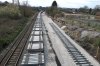
Some rails have been laid on the future relief lines in the Constable Rd area.

The future main lines at Lawrence Hill station have been ballasted for about a quarter mile, but no track yet.
 

Phil G

Member
Joined
16 Oct 2017
Messages
183
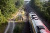
IMG_20180509_160253571_HDR.jpg IMG_20180509_160256142_HDR.jpg IMG_20180509_160314103_HDR.jpg IMG_20180509_160625111.jpg IMG_20180509_160629785.jpg IMG_20180509_160629785.jpg IMG_20180509_160821851.jpg IMG_20180509_160941702.jpg Lots of rail laid now. Good progress on Stapleton road viaduct and as mentioned above ballast at Lawrence hill. A few pics taken this afternoon.
 
Status
Not open for further replies.

Top