
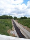
Quick update from Phil Marsh, the first set of new rail's have now appeared at Swanbourne. Hopefully it wont be long before we see the NTC through here then, and onwards to Winslow!

-
Our new ticketing site is now live! Using either this or the original site (both powered by TrainSplit) helps support the running of the forum with every ticket purchase! Find out more and ask any questions/give us feedback in this thread!
You are using an out of date browser. It may not display this or other websites correctly.
You should upgrade or use an alternative browser.
You should upgrade or use an alternative browser.
East-West Rail (EWR): Oxford-Bletchley construction progress
- Thread starter yorkie
- Start date
- Status
- Not open for further replies.
Sponsor Post - registered members do not see these adverts; click here to register, or click here to log in
R
RailUK Forums
Trainee9
Member
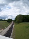
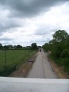
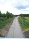
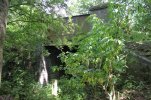
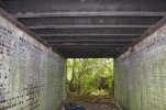
Today I visited the Whaddon Rd to Newton Longville overbridge (1 completed track visible), the Swans way overbridge on the Whaddon-Mursley road (rails and underlay visible), and the overbridge on the Mursley-Little Horwood road (some underlay visible to east). No obvious changes since two weeks ago.
1336= 2nd bridge, E. 1337 = 2nd bridge,W, 1338= 3rd bridge, E, 1339= 3rd bridge, W.
In between these bridges I could see with binoculars what looked like two more overbridges. With the aid of EWR's latest report I have figured out where these are (Salden and another) but not how to get to them.
1336= 2nd bridge, E. 1337 = 2nd bridge,W, 1338= 3rd bridge, E, 1339= 3rd bridge, W.
In between these bridges I could see with binoculars what looked like two more overbridges. With the aid of EWR's latest report I have figured out where these are (Salden and another) but not how to get to them.
Attachments
Last edited:
Neen Sollars
Member
- Joined
- 21 Jul 2018
- Messages
- 342
New video from Chris Woodfield. Great progress at Winslow. Looks as if the station building site foundations are being prepared. Platforms more or less complete.
Thanks. Great footage!New video from Chris Woodfield. Great progress at Winslow. Looks as if the station building site foundations are being prepared. Platforms more or less complete.
Nicholas Lewis
Established Member
Yup cracking should be able to get it open for Dec 23 TTThanks. Great footage!
Wyrleybart
Established Member
Haha - using whose stock ? Did those six 196s move back to Tyseley ?Yup cracking should be able to get it open for Dec 23 TT
I know there build and maintenance of the railway was / is undertaken by EWR contracts rather than Network Rail, but is EWR regarded as a separate TOC when it becomes a commercial operation ?
swt_passenger
Veteran Member
- Joined
- 7 Apr 2010
- Messages
- 34,308
That would be a year earlier than the published plan of ‘by 2025’…Yup cracking should be able to get it open for Dec 23 TT

Elecman
Established Member
Network Rail is one of the EWR AllianceHaha - using whose stock ? Did those six 196s move back to Tyseley ?
I know there build and maintenance of the railway was / is undertaken by EWR contracts rather than Network Rail, but is EWR regarded as a separate TOC when it becomes a commercial operation ?
The Planner
Veteran Member
- Joined
- 15 Apr 2008
- Messages
- 19,734
It won't be Dec 23.
Wyrleybart
Established Member
Thanks "elecman". I just wondered who will own the concession to operate the services. I am guessing GBR will be largely up and running by then, but as in Abellio operating GA I wondered who the candidates might be for whatever EWR is going to be branded.Network Rail is one of the EWR Alliance
swt_passenger
Veteran Member
- Joined
- 7 Apr 2010
- Messages
- 34,308
The DfT were pushing the idea of a new mini-TOC a couple of years ago. Logically I think since they got rid of the idea of through running from the Chiltern route it would be daft if it didn’t go with LNWR.Thanks "elecman". I just wondered who will own the concession to operate the services. I am guessing GBR will be largely up and running by then, but as in Abellio operating GA I wondered who the candidates might be for whatever EWR is going to be branded.
But this is probably off topic, this thread is supposed to be limited to construction issues…
Dr A.Johnston
Member
- Joined
- 6 May 2016
- Messages
- 50
Another update from out good friend Phil Marsh on his twitter site - @Marshrail
A visit 2 days ago to the interchange area at Calvert. GCR platforms now mostly removed. Much integrated progress to be seen.


Much integrated progress to be seen where HS2 will run under EWR.


Well done Phil, Thanks as always
== Doublepost prevention - post automatically merged: ==
A short video from NWP Exploring on You tube
A visit 2 days ago to the interchange area at Calvert. GCR platforms now mostly removed. Much integrated progress to be seen.
Much integrated progress to be seen where HS2 will run under EWR.
Well done Phil, Thanks as always
== Doublepost prevention - post automatically merged: ==
A short video from NWP Exploring on You tube
Last edited:
swt_passenger
Veteran Member
- Joined
- 7 Apr 2010
- Messages
- 34,308
I thought I’d try and identify the EWR features in some of the above photos, that’s photos 5-8 in post #582.
5. Foreground is the new Charndon Lodge road underbridge, taking Gawcott Rd under EWR. Replaces the existing road bridge that the photographer must be standing on. Then in the far background the brick arch is the refurbished Charndon Main Street bridge OXD/29.
6. I think the foreground long concrete structure here, (with the blue colour), will likely be a culvert under EWRand the HS2 sidings. In the middle distance the existing brick arch bridge is Addison Road bridge, OXD/27. I understand that this gets replaced just to the east of the existing alignment, but as HS2 are yet to demolish it, any work on it’s replacement structure will probably be hidden behind it at this stage. In the far distance near the tree line the sloping white concrete bridge is EWR’s new Queen Catherine Rd bridge, OXD/26B. It carries a new road of that name which allows the existing level crossing just beyond to be permanently closed.
7. This is a zoomed in shot of Charndon Main Street, bridge OXD/29, also shown in photo 5.
8. The new bridge where EWR crosses over HS2.
5. Foreground is the new Charndon Lodge road underbridge, taking Gawcott Rd under EWR. Replaces the existing road bridge that the photographer must be standing on. Then in the far background the brick arch is the refurbished Charndon Main Street bridge OXD/29.
6. I think the foreground long concrete structure here, (with the blue colour), will likely be a culvert under EWR
7. This is a zoomed in shot of Charndon Main Street, bridge OXD/29, also shown in photo 5.
8. The new bridge where EWR crosses over HS2.
Last edited:
fishwomp
Established Member
I thought I’d try and identify the EWR features in some of the above photos, that’s photos 5-8 in post #582.
5. Foreground is the new Charndon Lodge road underbridge, taking Gawcott Rd under EWR. Replaces the existing road bridge that the photographer must be standing on. Then in the far background the brick arch is the refurbished Charndon Main Street bridge OXD/29.
6. I think the foreground long concrete structure here, (with the blue colour), will likely be a culvert under both EWR and the HS2 sidings. In the middle distance the existing brick arch bridge is Addison Road bridge, OXD/27. I understand that this gets replaced just to the east of the existing alignment, but as HS2 are yet to demolish it, any work on it’s replacement structure will probably be hidden behind it at this stage. In the far distance near the tree line the sloping white concrete bridge is EWR’s new Queen Catherine Rd bridge, OXD/26B. It carries a new road of that name which allows the existing level crossing just beyond to be permanently closed.
7. This is a zoomed in shot of Charndon Main Street, bridge OXD/29, also photo 5.
8. The new bridge where EWR crosses over HS2. I assume photo 6 must have been taken looking over it?
I posted similar photos a month or so back - not much seems to have changed. Photo 5 is the road underbridge, correct.
Photo 6 - is taken from the next bridge west of photo 5 - that would be a culvert only under EWR.
Photo 7 - is taken from the bridge in photo 5 (east of the underbridge being constructed in 5)
Photo 8 - correct. Photo 6 is not the vantage point, is taken from the current Gawcott Road overbridge.
In the very distance of 8 you can see the white concrete new Steeple Claydon overbridge - and also the same in photo 6 with what must be with a very strong zoom, notice how the two cranes appear almost side by side in 6, but some distance apart in 8..
swt_passenger
Veteran Member
- Joined
- 7 Apr 2010
- Messages
- 34,308
Thanks for the clarification, I think I’ve got it now.I posted similar photos a month or so back - not much seems to have changed. Photo 5 is the road underbridge, correct.
Photo 6 - is taken from the next bridge west of photo 5 - that would be a culvert only under EWR.
Photo 7 - is taken from the bridge in photo 5 (east of the underbridge being constructed in 5)
Photo 8 - correct. Photo 6 is not the vantage point, is taken from the current Gawcott Road overbridge.
In the very distance of 8 you can see the white concrete new Steeple Claydon overbridge - and also the same in photo 6 with what must be with a very strong zoom, notice how the two cranes appear almost side by side in 6, but some distance apart in 8..
 Checking the plant and equipment present 5&6 are now obviously the same area taken from opposite directions. What you’re calling the new Steeple Claydon overbridge is St Catherine’s Road bridge on the TWA drawings.
fishwomp
Established Member
Yes that's right - replacing what was a level crossing at the site of the old station there.Thanks for the clarification, I think I’ve got it now.
Dr A.Johnston
Member
- Joined
- 6 May 2016
- Messages
- 50
A current video from 'The Boy' covering Aerial footage where East-West Rail (EWR) meets High Speed 2 (HS2) at Calvert in Buckinghamshire. This upload just a couple of days ago to YouTube.
fishwomp
Established Member
A current video from 'The Boy' covering Aerial footage where East-West Rail (EWR) meets High Speed 2 (HS2) at Calvert in Buckinghamshire. This upload just a couple of days ago to YouTube.
Thanks for posting. Interesting to see.
I'd not expected the bridge from east of Calvert to Steeple Claydon to be demolished (visible pile of bricks in the first 10 mins). This section looks a lot further behind than the rest of the route. I know it's in the middle so that ought to be expected to some degree, but is it possible that HS2 (who have responsibility for some of this area - and I don't know how much of it) are following a different timetable.
It's sad to see the GCR tracks lifted for HS2 - I know it's inevitable and necessary, but I just fear them not being put back down if it were cancelled, or being cut out as an efficiency. I guess it also means Quainton Road is cut off at the moment from mainline.
Excellent video. In 2014 I took photos of the line from Bicester to Bletchley thinking that work would be starting fairly soon (how wrong I was) At Calvert close to where the Great Central crossed the Varsity line I came across what I assumed would have been a cattle creep under the GC. It was still in very good condition. I am amazed to see it has survived in the video at about 22mins 45 seconds. I guess for not much longer though.
Attachments
swt_passenger
Veteran Member
- Joined
- 7 Apr 2010
- Messages
- 34,308
HS2 are responsible for all the works for quite a distance either side of the point where the lines actually cross. The EWR project’s TWA drawings have a significant gap in this area, because it has always been HS2’s responsibility - they have to hand over about 2.5 km of finished formation for EWR to lay their track on some time next year.Thanks for posting. Interesting to see.
I'd not expected the bridge from east of Calvert to Steeple Claydon to be demolished (visible pile of bricks in the first 10 mins). This section looks a lot further behind than the rest of the route. I know it's in the middle so that ought to be expected to some degree, but is it possible that HS2 (who have responsibility for some of this area - and I don't know how much of it) are following a different timetable.
The demolished bridge that you note is on Addison Rd (EWR bridge OXD/27), I believe it had to be put within the HS2 scope because it also has to be significantly lengthened, (on the north side of the tracks), to pass over the HS2 sidings. The EWR formation is also being raised at that point as it is rising to cross above HS2 and the HS2 depot access curve. I’m not sure but I think there’s a new footbridge east of Addison Rd that is within HS2’s work area too.
The next road bridge to the west over Gawcott Rd (EWR bridge OXD/28) is also down to be demolished by HS2 but this one is replaced by a road underpass. I suspect they are leaving this until later to avoid cutting both north/south routes in the area.
There’s an HS2 drawing in post #317 that effectively shows the area that is HS2 responsibility, although it isn’t labelled explicitly: https://www.railforums.co.uk/thread...truction-progress.216561/page-11#post-5413406
Last edited:
Neen Sollars
Member
- Joined
- 21 Jul 2018
- Messages
- 342
Brilliant thank you. That was the one I was waiting for, explains a lot. At 5.50 you can see where the Aylesbury spur will be. At 20mins you can see an old trackbed used as a road. The old Aylesbury track bed is clearly defined. Little definition of the HS2 track bed around the Calvert waste re-cycling plant. Looks as if the two railways will be close. Would appreciate if the new plans for the future Calvert rail complex could be re-posted, and the HS2 depot plans so as to get a perspective having reference to this excellent aerial footage.A current video from 'The Boy' covering Aerial footage where East-West Rail (EWR) meets High Speed 2 (HS2) at Calvert in Buckinghamshire. This upload just a couple of days ago to YouTube.
The Planner
Veteran Member
- Joined
- 15 Apr 2008
- Messages
- 19,734
Close isn't the word, they will be a handful of metres away from each other from Calvert to Quainton. The new Calvert facilty at Greatmoor opposite the recycling plant is effectively a loop with a set of sidings off it.Brilliant thank you. That was the one I was waiting for, explains a lot. At 5.50 you can see where the Aylesbury spur will be. At 20mins you can see an old trackbed used as a road. The old Aylesbury track bed is clearly defined. Little definition of the HS2 track bed around the Calvert waste re-cycling plant. Looks as if the two railways will be close. Would appreciate if the new plans for the future Calvert rail complex could be re-posted, and the HS2 depot plans so as to get a perspective having reference to this excellent aerial footage.
swt_passenger
Veteran Member
- Joined
- 7 Apr 2010
- Messages
- 34,308
Calvert waste terminal plans are linked from post #337Brilliant thank you. That was the one I was waiting for, explains a lot. At 5.50 you can see where the Aylesbury spur will be. At 20mins you can see an old trackbed used as a road. The old Aylesbury track bed is clearly defined. Little definition of the HS2 track bed around the Calvert waste re-cycling plant. Looks as if the two railways will be close. Would appreciate if the new plans for the future Calvert rail complex could be re-posted, and the HS2 depot plans so as to get a perspective having reference to this excellent aerial footage.
East-West Rail (EWR): Oxford-Bletchley construction progress
Either the newly set up East West Rail Company (Privately owned, Government backed) Government owned
 www.railforums.co.uk
East-West Rail (EWR): Oxford-Bletchley construction progress
There used to be 3 or 4 footpaths crossing the railway between Launton Bridge and the old Launton station. Does the one footbridge serve them all? Looks like it - I can't find a really nice set of docs that were around last year, but this map has the detail: Network Rail rights of way doc
www.railforums.co.uk
Last edited:
Sonik
Member
HS2 are intending to use Calvert as a railhead for Phase 1 track laying.Having listed the above four phases it then seemingly confuses the issue by quoting the EWR Alliance Deputy Director as saying "we have an aggressive track programme in five phases, with the last track to be laid in the HS2 box in 2023."
Is there a published date by which HS2 Ltd are supposed to hand back the EWR alignment ready for tracklaying?
Since the track slabs are coming from Somerset, and the rails will be from Scunthorpe, i'd say it's probably in HS2's own interest to get a shift on. And perhaps explains why the rest of EWR is going like gangbusters.
The Planner
Veteran Member
- Joined
- 15 Apr 2008
- Messages
- 19,734
E-W will have been open for a while before you see any HS2 track or slab trains.HS2 are intending to use Calvert as a railhead for Phase 1 track laying.
Since the track slabs are coming from Somerset, and the rails will be from Scunthorpe, i'd say it's probably in HS2's own interest to get a shift on. And perhaps explains why the rest of EWR is going like gangbusters.
Dr A.Johnston
Member
- Joined
- 6 May 2016
- Messages
- 50
From post #591
original posting (#323)
At my original posting on the link below, i included a powerpoint of a presentaion by HS2 which showed the area plan in basic detail. Hope this link below works.Brilliant thank you. That was the one I was waiting for, explains a lot. At 5.50 you can see where the Aylesbury spur will be. At 20mins you can see an old trackbed used as a road. The old Aylesbury track bed is clearly defined. Little definition of the HS2 track bed around the Calvert waste re-cycling plant. Looks as if the two railways will be close. Would appreciate if the new plans for the future Calvert rail complex could be re-posted, and the HS2 depot plans so as to get a perspective having reference to this excellent aerial footage.
original posting (#323)
fishwomp
Established Member
Replying to myself.. have just read the Modern Railways article on Calvert in June edition.It's sad to see the GCR tracks lifted for HS2 - I know it's inevitable and necessary, but I just fear them not being put back down if it were cancelled, or being cut out as an efficiency. I guess it also means Quainton Road is cut off at the moment from mainline.
1. Currently Quainton Road is still connected to Aylesbury.
2. All tracks north of Quainton Road are lifted.
3. The signal box (cabin?) at Claydon is still operational by appointment (eg. for Quainton Road specials)
4. HS2 is responsible for earthworks in preparation for restoring track to Claydon Jct.
5. Network Rail is committed to returning track as far as the landfill - ~1.5 miles south of EWR.
6. Restoring track from the landfill to EWR is not guaranteed - final decisions and network change still to be agreed...
BanburyBlue
Member
- Joined
- 18 May 2015
- Messages
- 880
We went under EWR at Newton Longville this afternoon, which got me thinking. What intermediate stations, if any, will there be between Bicester and Bletchley?
Just Winslow. But then again there isn't really much between either place.We went under EWR at Newton Longville this afternoon, which got me thinking. What intermediate stations, if any, will there be between Bicester and Bletchley?
The Planner
Veteran Member
- Joined
- 15 Apr 2008
- Messages
- 19,734
Box, if you can call it that, moved down from Claydon to Blackgrove Road ages ago and I think is under consultation to close entirely to be just a train staff operation from AVP.Replying to myself.. have just read the Modern Railways article on Calvert in June edition.
1. Currently Quainton Road is still connected to Aylesbury.
2. All tracks north of Quainton Road are lifted.
3. The signal box (cabin?) at Claydon is still operational by appointment (eg. for Quainton Road specials)
4. HS2 is responsible for earthworks in preparation for restoring track to Claydon Jct.
5. Network Rail is committed to returning track as far as the landfill - ~1.5 miles south of EWR.
6. Restoring track from the landfill to EWR is not guaranteed - final decisions and network change still to be agreed...
- Status
- Not open for further replies.