• Our new ticketing site is now live! Using either this or the original site (both powered by TrainSplit) helps support the running of the forum with every ticket purchase! Find out more and ask any questions/give us feedback in this thread!

Canals and rivers atlas?

Status
Not open for further replies.

Peter Mugridge

Veteran Member
Joined
8 Apr 2010
Messages
17,806
Location
Epsom
Does anyone know if there is a canals and rivers atlas similar to the Baker rail atlas please?

I'm interested in an actual atlas style book that would show the towpaths and river paths including on which side they are as well as the more obvious features like bridges and locks.

Looking on Google, I do find results but on a close examination it's just a large fold out map of the waterways and that's not really what I'm looking for.
 
Sponsor Post - registered members do not see these adverts; click here to register, or click here to log in
R

RailUK Forums

Western Sunset

Established Member
Joined
23 Dec 2014
Messages
3,051
Location
Wimborne, Dorset
I don't think there has ever been a comprehensive, detailed historical atlas of Britain's canals and waterways. Doubtless, there are maps of individual towns, but not one countrywide.

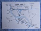
This is something I drew of Derby a couple of years ago; now totally lost and abandoned...
 

Attachments

  • P1090481 (2).JPG
    P1090481 (2).JPG
    800.4 KB · Views: 72

ABB125

Established Member
Joined
23 Jul 2016
Messages
4,334
Location
University of Birmingham
There are a number of online maps if that helps.
 

D6130

Established Member
Joined
12 Jan 2021
Messages
8,998
Location
West Yorkshire/Tuscany
Although not in atlas format per se, the best publications for the sort of details that you are looking for are the Collins Nicholson guides to the waterways in several volumes covering different areas of the country. They include extracts from the relevant 1:25 000 Ordnance Survey maps superimposed with symbols for locks, winding holes, sanitary stations, towpath locations, changeline bridges, canalside pubs, etc....coupled with a detailed description of the route and scenery with relevant historical notes.
 

satisnek

Member
Joined
5 Sep 2014
Messages
1,097
Location
Kidderminster/Mercia Marina
Although not in atlas format per se, the best publications for the sort of details that you are looking for are the Collins Nicholson guides to the waterways in several volumes covering different areas of the country. They include extracts from the relevant 1:25 000 Ordnance Survey maps superimposed with symbols for locks, winding holes, sanitary stations, towpath locations, changeline bridges, canalside pubs, etc....coupled with a detailed description of the route and scenery with relevant historical notes.
Yes, these guides are probably the most comprehensive canal mapping available. I've got a very early edition which used to belong to my parents - the 1:25,000 maps are just poor photocopies and the canal/river is shown as a much thicker blue line than today. They've certainly improved.
This is something I drew of Derby a couple of years ago; now totally lost and abandoned...
That's fascinating!
 

Peter Mugridge

Veteran Member
Joined
8 Apr 2010
Messages
17,806
Location
Epsom
I don't think there has ever been a comprehensive, detailed historical atlas of Britain's canals and waterways. Doubtless, there are maps of individual towns, but not one countrywide.

This is something I drew of Derby a couple of years ago; now totally lost and abandoned...
That's neat.... pretty much exactly the sort of level of detail I'd be looking for....

Although not in atlas format per se, the best publications for the sort of details that you are looking for are the Collins Nicholson guides to the waterways in several volumes covering different areas of the country. They include extracts from the relevant 1:25 000 Ordnance Survey maps superimposed with symbols for locks, winding holes, sanitary stations, towpath locations, changeline bridges, canalside pubs, etc....coupled with a detailed description of the route and scenery with relevant historical notes.
Hmmm.... interesting... I'll see if I can have a nosey at one in a bookshop...
 

zwk500

Veteran Member
Joined
20 Jan 2020
Messages
18,460
Location
Northampton

DelW

Established Member
Joined
15 Jan 2015
Messages
5,959
Many years ago when my friends and I were regular canal goers, there was an annual publication called The Canals Book (plus the year), which had descriptions and maps of all the navigable waterways in a single volume:
20220815_185639.jpg20220815_185711.jpg
The mapping wasn't as good as the Nicholson guides but it was obviously much cheaper, and was adequate for our navigational needs.

I've no idea when it was last published, but you might find a copy in a charity bookshop or similar.
 

John Webb

Established Member
Joined
5 Jun 2010
Messages
3,753
Location
St Albans
The magazine "Waterways World" (waterwaysworld.com) publish in every issue a 'pull-out' section covering a particular canal or part thereof. I think they may then make these available for sale. Another company www.waterwayroutes.co.uk have a range of digital maps advertised in Waterways World; never used them myself so can't comment on their effectiveness. Another potential source may be the Inland Waterways Association at www.waterways.org.uk - they have an extensive on-line bookshop.
 

Peter Mugridge

Veteran Member
Joined
8 Apr 2010
Messages
17,806
Location
Epsom
Thank you, so there are options out there.... just not in a single, complete, convenient atlas.

This is starting to look like an interesting gap in the market...
 

D6130

Established Member
Joined
12 Jan 2021
Messages
8,998
Location
West Yorkshire/Tuscany
About twenty years ago, you could buy the 'Imray's Map of the Inland Waterways'. I don't know whether or not it's still available.
 

Peter Mugridge

Veteran Member
Joined
8 Apr 2010
Messages
17,806
Location
Epsom
About twenty years ago, you could buy the 'Imray's Map of the Inland Waterways'. I don't know whether or not it's still available.
They are, but they're the large fold out maps I mentioned in my opening post... :)
 

swt_passenger

Veteran Member
Joined
7 Apr 2010
Messages
34,252
I have a large size Phillips Navigator Britain road atlas on my boat, I think it’s generally 1.5 mile to the inch, (so almost as good as an OS map), and it‘s coverage of the canals is excellent, definitely showing individual locks and bridges clearly, but I’d have to go and look at it to see what it’s like for marking the towpath side. Likewise I’d be guessing about how detailed the information about rivers is, but I’ll be able to check it out in a few days time.
 
Status
Not open for further replies.

Top