• Our new ticketing site is now live! Using either this or the original site (both powered by TrainSplit) helps support the running of the forum with every ticket purchase! Find out more and ask any questions/give us feedback in this thread!

Bristol area (Narroways Hill - Filton)

Status
Not open for further replies.

DaveHarries

Established Member
Joined
12 Dec 2011
Messages
2,576
Location
England
Hi all,

I have recently noticed that clearence of undergrowth has taken place on the embankments between Narroways Hill junction and Filton Abbeywood and that supplies are being deposited. Presumably a sign that the plan to increase from 2 tracks to 4 is going ahead? Or are they going to electrify this line as well?

Dave
 
Sponsor Post - registered members do not see these adverts; click here to register, or click here to log in
R

RailUK Forums

swt_passenger

Veteran Member
Joined
7 Apr 2010
Messages
34,314
Four tracking has been 'going ahead' since confirmed in the CP5 (2014-19) - this is the advance works for the planned start of May 2015. Completion currently planned for Aug 17.

Yes they will be electrifying as well, not necessarily starting at the same time though.
 

PHILIPE

Veteran Member
Joined
14 Nov 2011
Messages
13,472
Location
Caerphilly
There has been a thread on this but I think it must have been some time ago now since a post that I'm unable to turn it up. Basically re-doubling again and ground work started as already mentioned by previous post..
 
Last edited:

HowardGWR

Established Member
Joined
30 Jan 2013
Messages
4,981
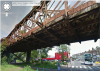
I have wondered whether the old extra bridge, over Stapleton Road and River Frome, dating from the first 1890s quadrupling to Narroways Hill, will need replacing. It looks very neglected.

EDIT: I am going to try and include an image from Google Maps.

data=!3m4!1e1!3m2!1sDQm_51cHvtGrXtwiEscuPw!2e0!4m2!3m1!1s0x48718e3f34e9e2f1:0x144ad8ce51e1669c


That didn't work. I don't seem to be able to achieve this. The URL is

https://www.google.co.uk/maps/place...1s0x48718e3f34e9e2f1:0x144ad8ce51e1669c?hl=en
--- old post above --- --- new post below ---
data=!3m4!1e1!3m2!1sDQm_51cHvtGrXtwiEscuPw!2e0!4m2!3m1!1s0x48718e3f34e9e2f1:0x144ad8ce51e1669c


Another try.
 
Last edited:

MarkyT

Established Member
Joined
20 May 2012
Messages
7,620
Location
Torbay
I have wondered whether the old extra bridge, over Stapleton Road and River Frome, dating from the first 1890s quadrupling to Narroways Hill, will need replacing. It looks very neglected.

It's an inexplicably long structure, seemingly not actually passing over very much below apart from the road and a separate path a little to the north. I wonder if most of it could be replaced by an embankment (with retaining walls as necessary), leaving a very much shorter new bridge over Stapleton Road itself.

Bing Birdseye:
https://www.bing.com/maps/?v=2&cp=skb7xngskfzr&lvl=19.51&dir=85.09&sty=o&form=LMLTCC

BTW where is the river? was it re- channelled under the motorway?
 
Last edited:

Clip

Established Member
Joined
28 Jun 2010
Messages
10,821
I have wondered whether the old extra bridge, over Stapleton Road and River Frome, dating from the first 1890s quadrupling to Narroways Hill, will need replacing. It looks very neglected.

EDIT: I am going to try and include an image from Google Maps.

data=!3m4!1e1!3m2!1sDQm_51cHvtGrXtwiEscuPw!2e0!4m2!3m1!1s0x48718e3f34e9e2f1:0x144ad8ce51e1669c


That didn't work. I don't seem to be able to achieve this. The URL is

https://www.google.co.uk/maps/place...1s0x48718e3f34e9e2f1:0x144ad8ce51e1669c?hl=en
--- old post above --- --- new post below ---
data=!3m4!1e1!3m2!1sDQm_51cHvtGrXtwiEscuPw!2e0!4m2!3m1!1s0x48718e3f34e9e2f1:0x144ad8ce51e1669c


Another try.

If you look at it the outside skeleton seems to be there as some sort of protector to the actual structure as behind it the steel looks to be in ok condition and is a much better colour.


(you can only use image taes if they have certain extensions at the end like .png or.jpg)
 

swt_passenger

Veteran Member
Joined
7 Apr 2010
Messages
34,314
It's an inexplicably long structure, seemingly not actually passing over very much below apart from the road and a separate path a little to the north. I wonder if most of it could be replaced by an embankment (with retaining walls as necessary), leaving a very much shorter new bridge over Stapleton Road itself.

BTW where is the river? was it re- channelled under the motorway?

Looking at the other brick bridge it might have been originally built with a main river channel and secondary arches for seasonal flood conditions.

The river seems to be visible about 200 yards to the north east if you re-orientate it 'north up', there's some sort of weir visible but the river must run in culvert south of there.
 

MarkyT

Established Member
Joined
20 May 2012
Messages
7,620
Location
Torbay
Looking at the other brick bridge it might have been originally built with a main river channel and secondary arches for seasonal flood conditions.

The older brick arch bridge looks to be only about half the total length of the steel bridge, much of which is therefore already alongside the older embankment. Presumably the original river channel approximately followed the footpath.
 

HowardGWR

Established Member
Joined
30 Jan 2013
Messages
4,981
Looking at the other brick bridge it might have been originally built with a main river channel and secondary arches for seasonal flood conditions.

The river seems to be visible about 200 yards to the north east if you re-orientate it 'north up', there's some sort of weir visible but the river must run in culvert south of there.

The river Frome ran in channel from the next northern M32 junction and ran southwards past the Bristol Rovers football ground, where now Tesco and Ikea dominate. Indeed flooding was a constant threat. I think much of the river now runs under the arches of the M32, where that monstrosity is above ground, until the point of going under the railway and then indeed the river culverts until the next southern M32 junction. Very sad, especially if one notes the name of the area (Baptist Mills). A substitution embankment would be unfortunate if it removed a possibility of use of the footpath through to Fox Park (so that won't happen).

Thanks to @Clip about image insertion. Presumably we can't just bung in Google Map / Street View images then?
 

stockport1

Member
Joined
5 Apr 2011
Messages
169
Yes but how?


ctrl + printscreen or alt+printscreen

ctrl+printscreen - grabs full screen content
alt+printscreen - grabs active window only.

then open paint and paste (shift + insert)

(i think..:) my memory is ****)
 
Last edited:

HowardGWR

Established Member
Joined
30 Jan 2013
Messages
4,981
ctrl + printscreen or alt+printscreen

ctrl+printscreen - grabs full screen content
alt+printscreen - grabs active window only.

then open paint and paste (shift + insert)

(i think..:) my memory is ****)

Thanks Stockport1.

Mods, if this is on the money, could it not be posted in FAQ please? I think that posting a screenshot (if that is what it is) is something very useful when describing a location.
 

stockport1

Member
Joined
5 Apr 2011
Messages
169
Thanks Stockport1.

Mods, if this is on the money, could it not be posted in FAQ please? I think that posting a screenshot (if that is what it is) is something very useful when describing a location.

of course thats on a Windows OS.!!

there is also a freeware tool called snagit that allows you to
specify an area of the screen that you wish to grab
 

Oxfordblues

Member
Joined
22 Dec 2013
Messages
1,137
"Requadrification" is I believe the old railway term (or at least "dequadrification" was in the 1970s!) Do we have a separate thread for requadrifications? My nomination would be Dorridge to Tyseley. All the bridges are still there and it would greatly relieve the current congestion.
 

RichmondCommu

Established Member
Joined
23 Feb 2010
Messages
6,906
Location
Richmond, London
Back in my spotting days (late 1970's / early 1980's) I remember four tracks being in place on this route so when were they removed? Were they removed as a result of re-signaling?
 

MarkyT

Established Member
Joined
20 May 2012
Messages
7,620
Location
Torbay
Back in my spotting days (late 1970's / early 1980's) I remember four tracks being in place on this route so when were they removed? Were they removed as a result of re-signaling?

Not a resignalling. It was a 1970s/80s 'rationalisation' under the current PSB control. I also remember 4 tracks from childhood westcounty jaunts, but it had already been dequadrified before I started working for BR in 1983 (possibly just before).
 

BantamMenace

Member
Joined
2 Dec 2013
Messages
573
If construction is planned to start in May surely there should be some design detail available somewhere outlining what is the intended outcome for steel bridge replacement, repair or renewal?
 

D1009

Established Member
Joined
22 Feb 2012
Messages
3,166
Location
Stoke Gifford
I was around when the line was dequadrified, and I'm sure the condition of that bridge was one of the reasons for the dequadrification.
 

contrex

Established Member
Joined
19 May 2009
Messages
1,680
Location
St Werburghs, Bristol
I have wondered whether the old extra bridge, over Stapleton Road and River Frome, dating from the first 1890s quadrupling to Narroways Hill, will need replacing. It looks very neglected.

Network Rail

West of England Area Updates December 2014

http://www.travelwest.info/sites/default/files/documents/MetroWest December.pdf

12-Dec-14

Page 11:

"Dr Days to Filton Abbeywood [sic] Capacity Improvements"

...

New viaduct and enhanced ground level at Stapleton Road

...

Track and Civils contract awarded on programme to Vinci-Taylor Woodrow;
Detailed design works have commenced
Ground investigation works on site
Core works to commence mid 2015
 
Last edited:
Status
Not open for further replies.

Top