I know you all like a challenge!
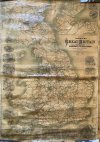
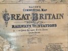
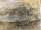
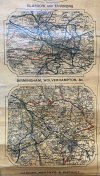
I've come into possession of a large map by G. W. Bacon and Company Limited of 127 The Strand. It shows railways and stations, canals, navigable rivers, roads and steam routes (according to the map).
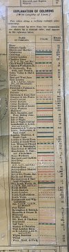
I have no idea of the date, however it must be pre-grouping as the companies are listed as such. Below are a few photo's.
Can anyone shed any light on this?
Cheers
I've come into possession of a large map by G. W. Bacon and Company Limited of 127 The Strand. It shows railways and stations, canals, navigable rivers, roads and steam routes (according to the map).
I have no idea of the date, however it must be pre-grouping as the companies are listed as such. Below are a few photo's.
Can anyone shed any light on this?
Cheers