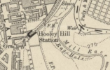
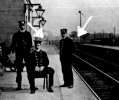
I'm beginning to doubt that is Audenshaw. The bridge is identified as Snipe Bridge, and there picture on Facebook, showing it as an iron plate bridge. The plan shows a dividing girder own the middle, and the platforms do not run across the bridge. So the view can't be in that direction - but that's the way that puts the signal in the same place as the later maps.
If the view is the other way, there should be a a bridge about a platform-length further on (also with a dividing girder). Would that be visible? I think so. And a weak indication: the trees you can see are not on the 25" map, though a lot of others are.
Incidentally, what I think is the original building at the foot of the embankment on the road is still there. So is the Snipe Inn, source of the name, just to the east along the main road.
If the view is the other way, there should be a a bridge about a platform-length further on (also with a dividing girder). Would that be visible? I think so. And a weak indication: the trees you can see are not on the 25" map, though a lot of others are.
Incidentally, what I think is the original building at the foot of the embankment on the road is still there. So is the Snipe Inn, source of the name, just to the east along the main road.