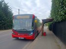
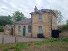
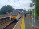
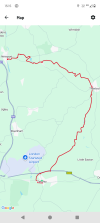
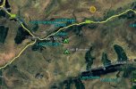
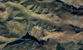
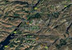
Did you take the alternative route for section 19?Section 18 London LOOP.
View attachment 185697View attachment 185698View attachment 185699View attachment 185700View attachment 185701 View attachment 185702
Images. Map and walk photographs
== Doublepost prevention - post automatically merged: ==
London LOOP Section.19
View attachment 185696 View attachment 185703View attachment 185704View attachment 185705View attachment 185706View attachment 185707
Images. Map and walk photographs
Round the site of RAF Chigwell? Yes I did. Years of growth have made the balloon pads difficult to see, but I did find the Intone stone, and read its mysterious story. It's a bit of a walk down the hill to the tube station.Did you take the alternative route for section 19?
A new map shows 10,000 walking trails across the UK
Slow Ways wants to ‘connect every town, city and national landscape in Britain’ and make rural walking accessible to all
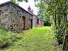
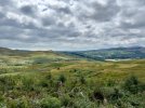
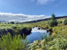
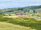
The Solway Coast and indeed the whole of Dumfries and Galloway is a lovely unspoilt area where you can completely get away from the crowds and walk all day hardly seeing anyone. I first discovered it over 40 years ago and have been back many times. The whole area from Dumfries right over to the tip of the Mull of Galloway is worth visiting with some stunning inland scenery as well as the coast. It’s 7 years now since I was last there and I must return soon.Yesterday I walked some of the Solway Coast in Dumfries & Galloway- stunning scenery and during peak tourist season I barely saw a soul!


Could you still see any evidence of the former military railway which ran out along Spurn Head?The Solway Coast and indeed the whole of Dumfries and Galloway is a lovely unspoilt area where you can completely get away from the crowds and walk all day hardly seeing anyone. I first discovered it over 40 years ago and have been back many times. The whole area from Dumfries right over to the tip of the Mull of Galloway is worth visiting with some stunning inland scenery as well as the coast. It’s 7 years now since I was last there and I must return soon.
Last Saturday I walked in a completely contrasting area across on the East Coast of England in East Yorkshire. I did the walk right to the tip of Spurn Point, which is somewhere I have always wanted to go, and so pleased that I have now been before I get too old to be able to walk the distance! There were quite a few people at the Spurn Point Discovery Centre and on the nearby beach but very few people walking further down the point and I didn’t see anyone down the far end beyond the lighthouse.
I started my walk at the Visitors Centre near Kilnsea and headed south. The whole of the Spurn Point area and Nature Reserve is now only accessible on foot. A large section of the road, around half a mile in distance, was washed away during storms a few years ago meaning a section of the walk is quite heavy going through sand and shingle and it can be underwater at high tide. After this section I then continued right down to the lighthouse along the road which runs on the landward side of the spit with views over the Humber marshes towards distant Grimsby and Cleethorpes. It was around 3 miles from the car park to the lighthouse. Beyond the lighthouse to the end of the point is almost another mile is a bit harder going being very up and down through sand hills. I returned to the Visitors Centre walking the whole length of the point on the seaward side along an almost completely deserted sandy beach. The full walk is around 7 miles and took me about 4 hours to complete. It isn‘t a walk to hurry as you need to keep stopping, not just to enjoy the views but also the remoteness and unique area that due to erosion and weather is constantly changing and may not even be there in years to come.
View attachment 186372View attachment 186373View attachment 186374View attachment 186368View attachment 186369View attachment 186370
Now you mention it, yes I did see some rails at some point on my walk. I think it was in the area close to the lighthouse. I must admit I didn’t think much about it as I was concentrating more on the general landscape of the area and the wildlife.Could you still see any evidence of the former military railway which ran out along Spurn Head?
Good effort!Three days, 90 miles, two sore feet...
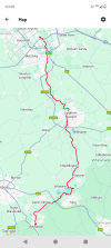
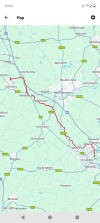
Wendover to Milton Keynes, 28 miles. Day 1 of 3 up the Grand Union canal towpath, the first seven miles along the Wendover arm to Bulbourne before turning up the main line to Marsworth, passing the currently-closed Aylesbury arm, then skirting various villages across the north Buckinghamshire plain to Linslade and Leighton Buzzard. After a few miles of twisting and turning, the canal struck north for Soulbury Three Locks, before passing Fenny Stratford and its 12-inch lock for the final couple of miles to Milton Keynes marina and a very welcome bed for the night.
--
Milton Keynes to Daventry, 36.5 miles. Day 2 of 3 and out with the lark for a full day's walking up the Grand Union. The first eight miles through MK's various suburbs and villages were very pleasant, before I left the new city behind at Wolverton. and headed into Northamptonshire at Cosgrove. The Boat Inn at the canal village of Stoke Bruerne was my lunch stop for a spot of gongoozling and a visit to the canal museum shop to liberate a book or two.
Back on the towpath briefly before heading up and over Blisworth Tunnel, before rejoining it to pass over Weedon, alongside the M1 and West Coast main line railway for a few miles (v noisy). I turned away from the noise at Buckby for the last couple of miles to Braunston tunnel east portal, then took what I thought was the path over the top to find myself inside a locked building site! Once I calmed down I managed to scramble under a fence to freedom and my hotel for the night. I am done. Until tomorrow!
--
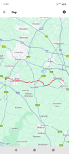
Daventry to Warwick Parkway, 24 miles. The final day of 3 along the Grand Union canal northwards was a day of lock flights. From the summit down to Braunston, the Clapham Junction of its day, to pick up the Oxford Canal for five miles to Napton Junction. From there I took the old Warwick and Napton Canal down Calcutt and Stockton flights, past the staircase at Bascote and the HS2 works before a quick pint at Leamington bridge 40 set me up for the final couple of miles to the old Warwick & Birmingham canal and the start of Hatton lock flight. For today that remains a flight of fancy - it will keep for another day.
THC

My three days were pretty much all on towpath so very hard going underfoot in parts. Some minor blisters in such instances are unavoidable, although it was only after the second day this time round that they were noticeable. I always carry Compeed and put one on as soon as I notice any rubbing but by then it's usually too late. I've tried two pairs of thin walking socks, as that is often touted as a way to avoid blisters, but that hasn't worked. So I limit the blisters wherever I can but not always successfully.Good effort!
On the topic of sore feet, how do you avoid blisters doing such distances? I tend to struggle above 20 miles, although much depends on the type of surfaces travelled.
I have a twist in my gait, which makes me more prone to blisters and having to repair and replace shoes more often.Good effort!
On the topic of sore feet, how do you avoid blisters doing such distances? I tend to struggle above 20 miles, although much depends on the type of surfaces travelled.
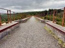
Interesting. The line serving Gatehouse of Fleet featured in the Dorothy L. Sayer's novel "Five Red Herrings" in which various train journeys play a role.Today, I did a 15mi circular around Big Water of Fleet viaduct, including walking some of the old Portpatrick railway trackbed and taking in the old Gatehouse of Fleet station, which coincidentally is nowhere near Gatehouse of Fleet!
I did from SE London to Leamington in two days on a bicycle along the GU towpath back in the early 1960s - my paternal grandmother lived in Leamington. But I admit I came back by train!Three days, 90 miles, two sore feet...
Wendover to Milton Keynes, 28 miles. Day 1 of 3 up the Grand Union canal towpath, the first seven miles along the Wendover arm to Bulbourne before turning up the main line to Marsworth, passing the currently-closed Aylesbury arm, then skirting various villages across the north Buckinghamshire plain to Linslade and Leighton Buzzard. After a few miles of twisting and turning, the canal struck north for Soulbury Three Locks, before passing Fenny Stratford and its 12-inch lock for the final couple of miles to Milton Keynes marina and a very welcome bed for the night.
--
Milton Keynes to Daventry, 36.5 miles. Day 2 of 3 and out with the lark for a full day's walking up the Grand Union. The first eight miles through MK's various suburbs and villages were very pleasant, before I left the new city behind at Wolverton. and headed into Northamptonshire at Cosgrove. The Boat Inn at the canal village of Stoke Bruerne was my lunch stop for a spot of gongoozling and a visit to the canal museum shop to liberate a book or two.
Back on the towpath briefly before heading up and over Blisworth Tunnel, before rejoining it to pass over Weedon, alongside the M1 and West Coast main line railway for a few miles (v noisy). I turned away from the noise at Buckby for the last couple of miles to Braunston tunnel east portal, then took what I thought was the path over the top to find myself inside a locked building site! Once I calmed down I managed to scramble under a fence to freedom and my hotel for the night. I am done. Until tomorrow!
--
Daventry to Warwick Parkway, 24 miles. The final day of 3 along the Grand Union canal northwards was a day of lock flights. From the summit down to Braunston, the Clapham Junction of its day, to pick up the Oxford Canal for five miles to Napton Junction. From there I took the old Warwick and Napton Canal down Calcutt and Stockton flights, past the staircase at Bascote and the HS2 works before a quick pint at Leamington bridge 40 set me up for the final couple of miles to the old Warwick & Birmingham canal and the start of Hatton lock flight. For today that remains a flight of fancy - it will keep for another day.
THC
I once did the West Highland Way. I had a brand new pair of Bridgedale socks. On the first couple of days, I found out the hard way, that new thick fluffy socks are not a good idea if they squish your foot into the boot.On the topic of sore feet, how do you avoid blisters doing such distances? I tend to struggle above 20 miles, although much depends on the type of surfaces travelled.
The towpath from Braunston to Napton Junction is still poor in patches, albeit much improved overall on when I first walked that way twenty years ago. It is however nothing as compared to the horror show that is the Grand Union Leicester line towpath near Welford, where erosion and root systems have combined to make walking it challenging in the extreme.Good walk, especially with the section of towpath on the 'shared' section being quite poor* in places when I walked it last year.
(Mainly Erosion)
God bless the Leicester Arm and all it's rural & remotenessThe towpath from Braunston to Napton Junction is still poor in patches, albeit much improved overall on when I first walked that way twenty years ago. It is however nothing as compared to the horror show that is the Grand Union Leicester line towpath near Welford, where erosion and root systems have combined to make walking it challenging in the extreme.
THC
Shame I didn't know that you were in the area @High Dyke.We could have met for a drink afterwards.Took advantage of good pennine weather to cover another section of the Rochdale Canal. Walked from Littleborough to Todmorden.
View attachment 187055 View attachment 187057 View attachment 187056
Images: route map of walk. The southern portal of Summit Tunnel and Gauxholme viaduct.
Yeah, sorry about that. It was a bit of a short notice plan.Shame I didn't know that you were in the area @High Dyke.We could have met for a drink afterwards.
That really is an excellent, informative walk. I have been right through from Sowerby Bridge to Rochdale but the middle section that you have just done is the most interesting. How they managed to fit a broad canal in together with a river, road/s and a railway into such a narrow valley is a real feat of engineering. One gets such great views of the alternative routes as one goes along with the occasional criss-crossing. It also means that there are plenty of nearby options for refreshment and public transport en route.Took advantage of good pennine weather to cover another section of the Rochdale Canal. Walked from Littleborough to Todmorden.
View attachment 187055 View attachment 187057 View attachment 187056
Images: route map of walk. The southern portal of Summit Tunnel and Gauxholme viaduct.
I have one attached to my map case. Alas, after carrying it religiously on hikes for many years; I haven’t carried that with me for 2-3 years now due to the improving mobile phone network coverage and the ability for the OS Map App to work offline.Whistles, do walkers still carry whistles, and know how to use them ? On the various "mountain rescue" TV shows, casualties are shown shouting for help, shining torches, using mobile phones, never (that I recall) using a whistle.
I do carry one yes but in all honesty if I have to rely on that I won't be very happy.Whistles, do walkers still carry whistles, and know how to use them ? On the various "mountain rescue" TV shows, casualties are shown shouting for help, shining torches, using mobile phones, never (that I recall) using a whistle.