• Our new ticketing site is now live! Using either this or the original site (both powered by TrainSplit) helps support the running of the forum with every ticket purchase! Find out more and ask any questions/give us feedback in this thread!

Walking and Rambling discussion

Acey

Member
Joined
16 Nov 2018
Messages
428
Awesome stuff!

The Moelwynion range have been largely untouched by myself in favour of the Carneddau, Glyderau, Yr Wyddfa and Moel Hebog ranges, but it's some lovely, very wild, walking. I'll return, hopefully to do Moelwyn Mawr and Moelwyn Bach!
Another range that I always wanted to explore was the Rhinog area,some 70 sq miles of wilderness,hardly any roads or habitations,bliss ! Too old now though ,the regrets of old age eh ?
 
Sponsor Post - registered members do not see these adverts; click here to register, or click here to log in
R

RailUK Forums

Iskra

Established Member
Joined
11 Jun 2014
Messages
10,696
Location
West Riding
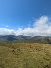
A lovely circular hike on 12th June from Glenridding, via Striding Edge, up to Helvellyn. A gorgeous day for it, and luckily the rain kept away until I was safely back in Windermere:

View attachment 182453View attachment 182454View attachment 182455View attachment 182456View attachment 182457
My all time favourite hike, I'm glad you enjoyed it!

== Doublepost prevention - post automatically merged: ==

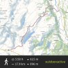
Fantastic day out today walking from Blaenau Ffestiniog (train there! The Conwy Valley line never fails in the views department) to Beddgelert, over Cnicht, the Welsh Matterhorn.

Lovely views as the cloud just about held off the summit whilst I was there. It was also lovely seeing Cwmorthin Quarry, the wonderfully underrated Moelwynion range, and Pont Aberglaslyn, one of my favourite spots in North Wales.

For those wanting to do Cnicht, and are happy to use public transport, this is a great way to do it. From Blaenau, you DESCEND down to Croesor, so the famously unforgiving steep section near the top is done going down instead of up (depends on your preference, but I'd rather let gravity do some of the work for me!).

The section after Cwmorthin, before the pull-up to Cnicht North Top was tricky path finding at times, where there wasn't a clear route to follow, but it's easy enough to loosely head in the right direction, and some paths crop up here and there.

About 18km, 600m ascended, around 750m descended, and done in 5 hours. (OurdoorActive says 6, but I'm quite a fast Walker!)

View attachment 182901
View attachment 182899
View attachment 182900
View attachment 182903

That looks beautiful
 

Hamma52

Member
Joined
4 Nov 2024
Messages
53
Location
North Wales
Another range that I always wanted to explore was the Rhinog area,some 70 sq miles of wilderness,hardly any roads or habitations,bliss ! Too old now though ,the regrets of old age eh ?
Absolutely. The Rhinogydd are a different breed to the rest of Eryri. Would be fantastic to explore
 

dangie

On Moderation
Joined
4 May 2011
Messages
2,353
Location
Rugeley Staffordshire
Another range that I always wanted to explore was the Rhinog area,some 70 sq miles of wilderness,hardly any roads or habitations,bliss ! Too old now though ,the regrets of old age eh ?
I believe it can be quite tough walking in the Rhinog’s. Many of the books I used to read referred to the Rhinog’s as ankle breakers :)
 

Acey

Member
Joined
16 Nov 2018
Messages
428
I believe it can be quite tough walking in the Rhinog’s. Many of the books I used to read referred to the Rhinog’s as ankle breakers :)
That's what I believe as well,mind you at my age a bowling green is an ankle breaker !
 

Hamma52

Member
Joined
4 Nov 2024
Messages
53
Location
North Wales
I have a friend who did the Cambrian Way a year or so ago, and he said the Rhinogydd was one of the hardest parts of the walk.

A lot of the terrain is rocky heather/gorse moorland with scattered boulder fields and mixed rocky moorland higher up, and very large and deep peat bogs in valleys and cwms. Makes it difficult to walk through, as it can be dense and ridiculously uneven. There's the one main path that traverses the length of the range that is little more than a sheep's trail most of the time too.

Fantastic walking away from the crowds he said, but that comes at a cost! However, I see a lot of joy to be had in the wilder parts. It's why I love the Carneddau (particularly Northern Carneddau) over the Glyderau and Yr Wyddfa ranges. Areas like the Rhinogydd, Arenig range and southern Moelwynion range around Rhobell Fawr appeal to me a lot!
 
Last edited:

johnnychips

Established Member
Joined
19 Nov 2011
Messages
3,826
Location
Leeds
Spending a week on a farm next month in the village of Chelmorton near Buxton.
Any thoughts of walks (preferably from the village) of up to 7-8 miles would be most welcome. Plenty of footpaths shown on the OS Map but would be interested if others have walked the area.
Walk down Deep Dale and visit a massive cave on your right, then Chee Dale, eschewing the disused railway to Millers Dale. Continue along Litton Dale to Monsal Head and carry on to Ashford. TransPeak back to Chelmorton.
 

THC

Member
Joined
21 Sep 2009
Messages
721
Location
Stuck on the GEML
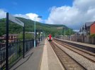
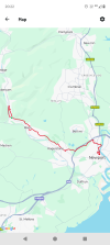
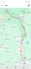
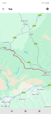
Three days on the Mon & Brec:

Day 1: Crosskeys to Newport, 11 miles. A mile beside a main road was worth it to pick up the Crumlin arm of the Mon & Brec Canal at Pontywaun. We then followed what remains of the cut, stopping at some fine pubs en route in Risca and Rogerstone, descending the derelict Fourteen Locks before weaving our way into Newport to finish beside the River Usk.

Day 2: Newport to Crickhowell, 31 miles. From the railway station I headed north to pick up the cut before turning immediately under the M4 and starting the climb to the main line contour level. Although not open to navigation, various locks have been restored, which will only see a boat again when hell freezes over. Through Cwmbran and past the Five Locks flight, the navigation proper began after eight miles, at which point a narrowboat appeared - the last I'd see actually going anywhere for the next ten miles. After Pontypool the Usk valley opened up with some magnificent views all the way past Abergavenny, before the valley widened out to Llangattock, from where I left the canal to cross the River Usk into Crickhowell.

Day 3: Crickhowell to Brecon, 17.5 miles. Back over the Usk for the climb to Llangattock and the final stretch into the hills. Past Glanusk Park, which in a month's time will be transformed for the Green Man festival, but for now an oasis of calm, then up a flight of five locks to Talybont for a well-earned refuel, before shadowing the River Usk all the way to Brecon. Time enough for a celebratory pint in the Brecon Tap before finding the bus to begin the slow journey home.

THC
 

Attachments

  • IMG_20250706_114754233.jpg
    IMG_20250706_114754233.jpg
    5.2 MB · Views: 13
  • IMG_20250707_080803707.jpg
    IMG_20250707_080803707.jpg
    2.9 MB · Views: 11
  • IMG_20250708_135221197.jpg
    IMG_20250708_135221197.jpg
    5 MB · Views: 13
  • Screenshot_20250706-202215.png
    Screenshot_20250706-202215.png
    426.8 KB · Views: 14
  • Screenshot_20250707-204004.png
    Screenshot_20250707-204004.png
    621.8 KB · Views: 12
  • Screenshot_20250708-135515.png
    Screenshot_20250708-135515.png
    451.1 KB · Views: 13

THC

Member
Joined
21 Sep 2009
Messages
721
Location
Stuck on the GEML
An epic journey. Congratulations!
Thank you @johnnychips - I'd wanted to walk the Mon & Brec for years and the opportunity finally presented itself. So as a warm-up, last Saturday I walked from...

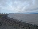
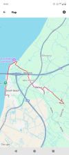
Severn Beach to Pilning, 4 miles. A short but mighty walk under not one but two major river crossings at the very edge of England. Starting at Severn Beach, the end of the line in so many ways, I walked along the Severn estuary under the two bridges to New Passage, from where the ferry went before the bridges were built. I turned inland at that point through Pilning village to the railway station, to wait for one of its two departures each week. Fortunately it stopped as planned, otherwise I'd be waiting there until next Saturday!

THC
 

Attachments

  • IMG_20250705_134248265.jpg
    IMG_20250705_134248265.jpg
    4.3 MB · Views: 14
  • IMG_20250705_141213248.jpg
    IMG_20250705_141213248.jpg
    4 MB · Views: 11
  • IMG_20250705_153223853.jpg
    IMG_20250705_153223853.jpg
    4.2 MB · Views: 15
  • Screenshot_20250705-155017.png
    Screenshot_20250705-155017.png
    650.6 KB · Views: 14

Hamma52

Member
Joined
4 Nov 2024
Messages
53
Location
North Wales
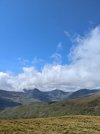
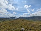
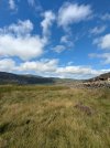
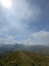
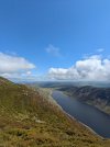
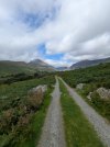
Fantastic day today up some seldom summited peaks in the South Eastern Carneddau range of Eryri, the largest of which being Pen Llithrig y Wrach.

Tough going at times as the underfoot conditions we're unforgiving and paths few and far between, but it was worth it for the amazing views and not seeing a single person between getting off the bus and arriving in Dolgarrog.

I'll always love the Carneddau. Such sweeping, wild, rugged terrain. Always a special day out in these hills.
 

Attachments

  • PXL_20250718_113645042.jpg
    PXL_20250718_113645042.jpg
    1 MB · Views: 11
  • PXL_20250718_132211904.jpg
    PXL_20250718_132211904.jpg
    1.5 MB · Views: 12
  • PXL_20250718_124040884.jpg
    PXL_20250718_124040884.jpg
    1.7 MB · Views: 11
  • PXL_20250718_121218930.jpg
    PXL_20250718_121218930.jpg
    1.2 MB · Views: 11
  • PXL_20250718_111920978.jpg
    PXL_20250718_111920978.jpg
    959.6 KB · Views: 12
  • PXL_20250718_111442468.jpg
    PXL_20250718_111442468.jpg
    1.3 MB · Views: 13
  • PXL_20250718_095216918.jpg
    PXL_20250718_095216918.jpg
    1.6 MB · Views: 13
  • image_20250718_100147_556.jpg
    image_20250718_100147_556.jpg
    596.8 KB · Views: 13
  • PXL_20250718_113642802.jpg
    PXL_20250718_113642802.jpg
    1.5 MB · Views: 12

Acey

Member
Joined
16 Nov 2018
Messages
428
Excellent pics,it really is a fairly underused part of the range but worth the effort !
 

Iskra

Established Member
Joined
11 Jun 2014
Messages
10,696
Location
West Riding
A little late, but midweek I did Horton in Ribblesdale-Ingleborough and return. It’s a nice easy ascent with beautiful views that just keep getting better. Unfortunately on the way home, I found myself in that annoying 3-hour Southbound timetable gap, so I took the train North to Ribblehead to The Station Inn to pass the time.

IMG_1473.jpegIMG_1467.jpegIMG_1456.jpegIMG_1465.jpegIMG_1469.jpegIMG_1448.jpegIMG_1447.jpeg
 

SuspectUsual

Established Member
Joined
11 Jul 2018
Messages
6,764
About 13 miles circular Middleham - Jervaulx - East Witton - Middleham the other day. Relatively flat for a bit of a change
 

Attachments

  • IMG_4734.jpeg
    IMG_4734.jpeg
    3.9 MB · Views: 9
  • IMG_4740.jpeg
    IMG_4740.jpeg
    1.9 MB · Views: 6
  • IMG_4745.jpeg
    IMG_4745.jpeg
    3.3 MB · Views: 6
  • IMG_4753.jpeg
    IMG_4753.jpeg
    3.7 MB · Views: 9
  • IMG_4759.jpeg
    IMG_4759.jpeg
    203.8 KB · Views: 9

styles

Established Member
Joined
7 Dec 2014
Messages
4,825
Location
Gwynedd
Anyone here tried long distance footpaths?

I'm considering taking a month off in September to reset a bit, and wondering about taking on a challenge like the Wales Coastal Path. I've normally made my own 'expedition' routes for week-long trips, but following a trail might be quite fun, especially if I set myself a 'goal' of a long distance footpath.

The only real caveat I have is I still have achilles tendonitis so avoiding hills will be necessary if I'm to do a solid 3-4 weeks of walking. Coastal paths seem the most obvious, but as I normally climb Munros and don't spend a huge amount of time at the coast, I'm not really sure which are likely to be more attractive than others. On the flat I'd be happy to do 30mi/day, so up to 900mi total potentially.
 

styles

Established Member
Joined
7 Dec 2014
Messages
4,825
Location
Gwynedd
Crikey.... That's a 10 hour day at 3mph, decent walking speed including stops.
Aye but have the daylight hours and I'm an early riser. Have managed 48mi in a day before, albeit that was me trying to get the 100k in a day steps badge on FitBit.
 

SuspectUsual

Established Member
Joined
11 Jul 2018
Messages
6,764
The only real caveat I have is I still have achilles tendonitis so avoiding hills will be necessary if I'm to do a solid 3-4 weeks of walking. Coastal paths seem the most obvious

Coastal paths can be more up and down than you might think - every river crossing is basically a descent to sea level and a climb back up. Obviously nothing on a Munro, but they're rarely flat

I did the Dales Way, 80ish miles between Ilkley and Windermere, and that was really good (and not too hilly)
 

styles

Established Member
Joined
7 Dec 2014
Messages
4,825
Location
Gwynedd
Coastal paths can be more up and down than you might think - every river crossing is basically a descent to sea level and a climb back up. Obviously nothing on a Munro, but they're rarely flat

I did the Dales Way, 80ish miles between Ilkley and Windermere, and that was really good (and not too hilly)
Aye they're not completely flat, but I plotted say the Wales Coastal Path on OS Maps and got ~320m/day ascent a day on average, which over 50km isn't bad.
 

bspahh

Established Member
Joined
5 Jan 2017
Messages
2,430
Aye they're not completely flat, but I plotted say the Wales Coastal Path on OS Maps and got ~320m/day ascent a day on average, which over 50km isn't bad.
Some less hilly routes are the Ridgeway and the Norfolk Coastal Path.

Tendonitis sounds like an overuse injury. Could you arrange your schedule, so you do other stuff for breaks between walks?

https://www.nhs.uk/conditions/tendonitis/ says you might be able to refer yourself directly to services for help with your condition without seeing a GP.

It also says:
You cannot always prevent tendonitis. But there are things you can do to help reduce the chance of a tendon injury.

Do​

  • warm up before exercising and gently stretch afterwards
  • wear supportive shoes or insoles for exercise
  • take regular breaks from repetitive exercises

Don’t​

  • do not overexercise tired muscles
  • do not start a new sport without some training or practice
  • do not do the same repetitive exercises
 

styles

Established Member
Joined
7 Dec 2014
Messages
4,825
Location
Gwynedd
Some less hilly routes are the Ridgeway and the Norfolk Coastal Path.

Tendonitis sounds like an overuse injury. Could you arrange your schedule, so you do other stuff for breaks between walks?

https://www.nhs.uk/conditions/tendonitis/ says you might be able to refer yourself directly to services for help with your condition without seeing a GP.

It also says:
Norfolk Coastal Path looks interesting, and it's a part of the country I wouldn't normally visit (unless narrowboating!), thanks! I think I'll plan something around that.

I actually have physio appointments already, have been recovering slowly but surely, and we think this may actually help with recovery; but if it's not working out, I'll bail and go kayaking instead :)
 

Paul1160

Member
Joined
31 Mar 2021
Messages
32
Location
Leeds
I have walked Dales Way,Cumbria Way and Great Glen Way.All around same distance.The Cumbria Way is the hardest of the three.
 

davews

Member
Joined
24 Apr 2021
Messages
1,010
Location
Bracknell
River Kennet and Coley Branch Line. This is a much shorter walk than most of those in this thread do, a mere 7 miles, but it includes the former Coley Branch Line which closed in 1983 so may be of interest to some.


Iskra

Established Member
Joined
11 Jun 2014
Messages
10,696
Location
West Riding
Does anyone have any recommendations in Dumfries and Galloway please? I’ve got a walk with a friend planned around the Big Water of Fleet viaduct one day, but I’m staying overnight before and after, so will have a half-day to fill on either side. Alternatively, I could do something en route between there and Yorkshire?
 
Last edited:

dangie

On Moderation
Joined
4 May 2011
Messages
2,353
Location
Rugeley Staffordshire
This is not actually a walk or ramble, but something seen on a walk.

Just had a week in the Derbyshire Dales. On one walk the path went through a farmyard. The farmyard was ‘scruffy’ to say the least. Broken & scrap machinery, dilapidated out buildings etc.

But one particular thing caught my eye, in fact not easy to miss. Dead calf’s. Two or three (hard to tell) bodies of calf’s were on top of each other. At a quick glance it looked like they’d been there a while. For obvious reasons I didn’t loiter around.

I live in a farming area but have never seen this before. Is it an accepted thing in farming to allow dead animals to decay like this, or are there strict rules & regulations to be followed.
 

Lewisham2221

Established Member
Joined
23 Jun 2005
Messages
2,750
Location
Staffordshire
This is not actually a walk or ramble, but something seen on a walk.

Just had a week in the Derbyshire Dales. On one walk the path went through a farmyard. The farmyard was ‘scruffy’ to say the least. Broken & scrap machinery, dilapidated out buildings etc.

But one particular thing caught my eye, in fact not easy to miss. Dead calf’s. Two or three (hard to tell) bodies of calf’s were on top of each other. At a quick glance it looked like they’d been there a while. For obvious reasons I didn’t loiter around.

I live in a farming area but have never seen this before. Is it an accepted thing in farming to allow dead animals to decay like this, or are there strict rules & regulations to be followed.
Absolutely not. They should be disposed of, by authorised means, as quickly as possible. Whilst awaiting disposal, they should be stored in such a way that they are not accessible to birds or other animals, to prevent the spread of disease.

Fallen stock
If livestock dies on your farm, it must be collected, identified and transported from your farm without ‘undue delay’. This means as soon as is reasonably practical under the circumstances.

You must not:

burn or bury fallen stock on your farm
feed fallen stock to red kites or necrophagous birds (birds that feed on carcasses)
You must arrange for the animal to be collected by an approved transporter and taken for disposal to one of the following:

knacker
hunt kennel
maggot farm
incinerator
renderer
The same applies to stillborn animals and afterbirth.

While waiting for your fallen stock to be collected, you must ensure that animals and birds can not access the carcass.

Bins can be used a temporary store for fallen stock, especially during times of high mortality. Your bins must be kept clean and disinfected, must have lids and be leakproof.
 

Top