Our new ticketing site is now live! Using either this or the original site (both powered by TrainSplit) helps support the running of the forum with every ticket purchase! Find out more and ask any questions/give us feedback in this thread!
The only reasons I can see to change at Cambridge South would be if you were doubling back from Foxton to Shelford or vice versa which must surely be a niche pattern.
Admittedly still niche, but it’s not just Foxton to Shelford, I’ve often changed for Shelford at Cambridge from Kings Cross or even Sussex (Thameslink). The connections at Cambridge can be quite tight but Cambridge South will make this much easier.
The only reasons I can see to change at Cambridge South would be if you were doubling back from Foxton to Shelford or vice versa which must surely be a niche pattern.
And on the way back I cycled over the bridge to the south of the station. There has been some track work to the south of this bridge. I understand that this is to improve the line speed of the junction for those trains taking the GN route to KGX. But I couldn't find a location for a picture. It looks like over the past two weekends two new points have been installed on both the up and down running lines north the of the junction. BW DC
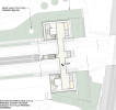
Is the big tower for both lift and stair access, or will they be separate? Will the interchange all be at one end? Maybe it's assumed that the station will mainly be entrance/exit, with not much interchanging?
Thanks, shows the central section stairs and lifts well. Interestingly the station has been built slightly different from that plan - for example the location of the lifts in the western building differs. In reality the lifts are at the core of the main staircase which ascends clockwise around them.
Thanks, shows the central section stairs and lifts well. Interestingly the station has been built slightly different from that plan - for example the location of the lifts in the western building differs. In reality the lifts are at the core of the main staircase which ascends clockwise around them.
Yes that’s an obvious difference. I guess the central island wouldn’t have enough room to do anything similar there.
It also seems likely that there’ll be no public access past the central lift shafts, your May 8 photos suggest to me they probably haven’t enough clearance with respect to the platform edge?
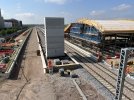
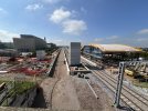
The tower is a double lift shaft. An elevated platform was built on the south side of it a couple of weeks ago and I think this will be where the two footbridges attach (east/west). My assumption is that the stairs down to the train platforms will be attached to the south side of the elevated platform.
I think this footbridge is the only one that will be open to the public. There is a second one at the south end for ‘secondary means of escape’ from the plans is looks like a much smaller structure and I assume for emergency use only.
Not spot on this time!
There is a second footbridge to the South, which is indeed the "Secondary Means of Escape" footbridge, or SME.
This only spans between the island platform and platform 4, but it will be open to the public if anyone wants to use it. Not the main access route at all though.
As for interchange - my assumption is this will be minimal. Everything I’ve seen suggests that all services that call at Cambridge South will also call at Cambridge which will have much better facilities for interchanging and waiting. The only reasons I can see to change at Cambridge South would be if you were doubling back from Foxton to Shelford or vice versa which must surely be a niche pattern.
Yep, whilst I absolutely can't give any details of final service patterns, it's' a pretty safe bet that everything that stops at South wil also stop at central (Must get that re-named!)
Given the two differnt routes to London and the various destinations though, I can foresee a reaosnable interchange flow between the two routes here. (That's just my personal opinion, not anything from modelling etc).
Admittedly still niche, but it’s not just Foxton to Shelford, I’ve often changed for Shelford at Cambridge from Kings Cross or even Sussex (Thameslink). The connections at Cambridge can be quite tight but Cambridge South will make this much easier.
And on the way back I cycled over the bridge to the south of the station. There has been some track work to the south of this bridge. I understand that this is to improve the line speed of the junction for those trains taking the GN route to KGX. But I couldn't find a location for a picture. It looks like over the past two weekends two new points have been installed on both the up and down running lines north the of the junction. BW DC
Yep. We renewed a length of the Up Royston last weekend. We're doing the Down Royston this weekend.
These are renewals to prepare for the final arrangement. The formation is being installed to the final alignment, then the track is put back, but in renewed form, onto the existnig alignment. Come the final comissioning, the tracks will be slued across to their new alignment to meet the realigned Shepreth Branch Junction.
Yes that’s an obvious difference. I guess the central island wouldn’t have enough room to do anything similar there.
It also seems likely that there’ll be no public access past the central lift shafts, your May 8 photos suggest to me they probably haven’t enough clearance with respect to the platform edge?
That is correct and a good spot - the operational platform ends at the lift shafts. There's a short section of non-operational platform at the North end.
That plan is from quite an old version of the plans - the layout has been changed quite a bit since then, as you can see from the lift shaft locations! Refer back to the architectural video I shared a while back to see the final arrangement.
== Doublepost prevention - post automatically merged: ==
----- Additional response below (please someone reply to I can post more in a a separate post!)
This weekend will also see the closure of Websters LC.
The main thing will be the track works on the Down Royston but there will be station works, Civils works and further OLE staging.
Right, I finally have some time to sort some pics for you.
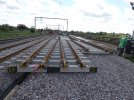
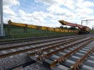
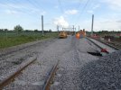
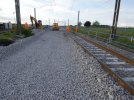
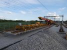
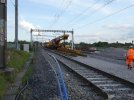
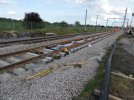
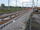
Here's some photos taken in the weekend of 4th/5th May, where we installed our first set of points.
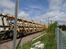
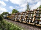
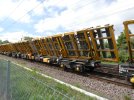
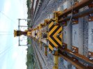
S&C is part site-built and part delivered in panels on a train. Naturally, a set of points is quite wide, and doesn't fit on a normal train if laid horizontally, so we use the special train with tilting wagons on it to transport these to site:
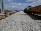
Ballast is prepared with a nice flat and compacted surface:
Sometimes these panels are laid directly in place, but sometimes they are placed nearby ready for later installation:
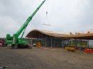
Then the star of the show is of course the Kirow crane, which lifts these heavy panels into place:
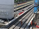
These are the new points which will form the North end of the new Shepreth Branch Junction.
== Doublepost prevention - post automatically merged: ==
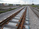
More nice clean ballast ready for track:
More Kirow crane pics because they are always cool:
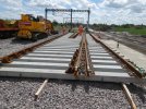
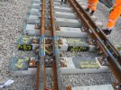
And brand new points on the ground and in place:
== Doublepost prevention - post automatically merged: ==
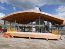
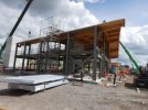
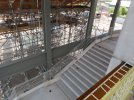
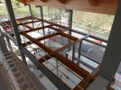
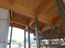
Now back to the station building, which looks amazing:
== Doublepost prevention - post automatically merged: ==
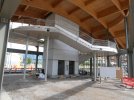
And some inside:
I returned only 1 day later with the station building having advanced substantially. This is now Sunday 5th May:
Not spot on this time!
There is a second footbridge to the South, which is indeed the "Secondary Means of Escape" footbridge, or SME.
This only spans between the island platform and platform 4, but it will be open to the public if anyone wants to use it. Not the main access route at all though.
Yep, whilst I absolutely can't give any details of final service patterns, it's' a pretty safe bet that everything that stops at South wil also stop at central (Must get that re-named!)
Given the two differnt routes to London and the various destinations though, I can foresee a reaosnable interchange flow between the two routes here. (That's just my personal opinion, not anything from modelling etc).
Ditto. I've used Shelford to Cambridge then back down on the Thameslink services, so South will be useful for these kinds of flows,
Yep. We renewed a length of the Up Royston last weekend. We're doing the Down Royston this weekend.
These are renewals to prepare for the final arrangement. The formation is being installed to the final alignment, then the track is put back, but in renewed form, onto the existnig alignment. Come the final comissioning, the tracks will be slued across to their new alignment to meet the realigned Shepreth Branch Junction.
That is correct and a good spot - the operational platform ends at the lift shafts. There's a short section of non-operational platform at the North end.
That plan is from quite an old version of the plans - the layout has been changed quite a bit since then, as you can see from the lift shaft locations! Refer back to the architectural video I shared a while back to see the final arrangement.
== Doublepost prevention - post automatically merged: ==
----- Additional response below (please someone reply to I can post more in a a separate post!)
This weekend will also see the closure of Websters LC.
The main thing will be the track works on the Down Royston but there will be station works, Civils works and further OLE staging.
Thanks for all the information. Unless I have misunderstood are you saying that the second footbridge at the southern end of the station will only span the island platform (2 & 3) and the western platform 4 but will not be connected to platform 1 on the eastern side?
Thanks for all the information. Unless I have misunderstood are you saying that the second footbridge at the southern end of the station will only span the island platform (2 & 3) and the western platform 4 but will not be connected to platform 1 on the eastern side?
That is correct. It's only intended as an SME, not an interchange. Platform 1 will have an emergency exit at the South end into the Biomedical campus. Platform 4 has an emergency exit at the South end into Hobsons park.
Platforms 2/3 are naturally, er, rail-locked, so need a way out. The bridge allows people to exit over the tracks of P3/4 then exit into Hobsons park.
That is correct. It's only intended as an SME, not an interchange. Platform 1 will have an emergency exit at the South end into the Biomedical campus. Platform 4 has an emergency exit at the South end into Hobsons park.
Platforms 2/3 are naturally, er, rail-locked, so need a way out. The bridge allows people to exit over the tracks of P3/4 then exit into Hobsons park.
No probs. I love sharing what I'm able to and appreciate the thank you's.
Platform 1 will have an emergency exit at the South end into the Biomedical campus. Platform 4 has an emergency exit at the South end into Hobsons park.
Platforms 2/3 are naturally, er, rail-locked, so need a way out. The bridge allows people to exit over the tracks of P3/4 then exit into Hobsons park.
I can follow the logic of this, and would completely understand it, if considered in isolation.
But compare it platforms 7 and 8 at the main Cambridge station, or platforms 2 and 3 at Cambridge North, which are also "rail-locked", but only get one footbridge. Why does Cambridge South need two footbridges on the island platform? What's the difference? My initial guess would be passenger numbers, but surely Cambridge is expected to have more passengers than Cambridge South?
(Not that I'm complaining - I think all of the platforms I just mentioned would benefit from a second footbridge!)
I can follow the logic of this, and would completely understand it, if considered in isolation.
But compare it platforms 7 and 8 at the main Cambridge station, or platforms 2 and 3 at Cambridge North, which are also "rail-locked", but only get one footbridge. Why does Cambridge South need two footbridges on the island platform? What's the difference? My initial guess would be passenger numbers, but surely Cambridge is expected to have more passengers than Cambridge South?
(Not that I'm complaining - I think all of the platforms I just mentioned would benefit from a second footbridge!)
More likely grandfather rights, but also with both of those examples you could block one platform line rather and evacuate over sidings (Platform 8 at Cambridge, Platform 3 at Cambridge North) without needing to stop traffic on running lines, whereas at Cambridge South if platforms 2/3 required evacuation over the tracks you'd have to block both running lines of one pair or the other. This would be extremely disruptive if the reason for evacuation was something only to do with the station itself.
More likely grandfather rights, but also with both of those examples you could block one platform line rather and evacuate over sidings (Platform 8 at Cambridge, Platform 3 at Cambridge North) without needing to stop traffic on running lines, whereas at Cambridge South if platforms 2/3 required evacuation over the tracks you'd have to block both running lines of one pair or the other. This would be extremely disruptive if the reason for evacuation was something only to do with the station itself.
At Cambridge North, just North of platform 3, there is a fenced compound with a few on poles. Does anyone know what they are for? IMG_20190103_095905 by bspahh posted 12 Jan 2019 at 09:39 This is the satelite view from Google Maps https://goo.gl/maps/3X7t5R6vDP52 The answer is its an...
At Cambridge North, just North of platform 3, there is a fenced compound with a few on poles. Does anyone know what they are for? IMG_20190103_095905 by bspahh posted 12 Jan 2019 at 09:39 This is the satelite view from Google Maps https://goo.gl/maps/3X7t5R6vDP52 The answer is its an...
Thanks @mr_moo for all the info above. Gutted to be wrong about the bridge!
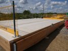
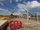
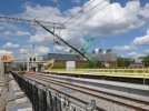
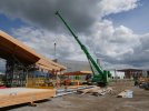
Here is the much delayed video from the 5th May. This shows the station canopy being lifted, as well as work on the new Shepreth junction layout.
I've also attached a couple of photos taken this morning, mostly showing scaffolding being put up, however it also looked like there was a signal base being installed just to the north of platform 4.
== Doublepost prevention - post automatically merged: ==
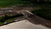
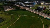
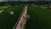
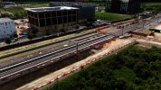
Update - 24th May: I had the drone up again today and took a few photos showing progress. Video to follow.
Main changes are:
The new access bridge to the fields looks like it is now finished. I noticed there are now closure notices on the two farm crossings between the station site and Shepreth Branch junction.
The concrete slab for the main station building floor was poured on (edit!) Wednesday.
Work on the trackbed for P1/P2 continues.
Quite a bit, but not all, of the overhead line has been moved across to the new supports near the junction.
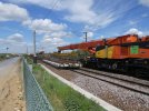
Does anyone know what the white thing on the green pole is? It's next to the track just south of the new station.
I've also attached a couple of photos taken this morning, mostly showing scaffolding being put up, however it also looked like there was a signal base being installed just to the north of platform 4.
Yep. We've installed several signal bases, but have several more to go yet. These are for the new signals that will be comissioned as part of the final layout (to be comissioned as part of the C3R major final comissioing)
Update - 24th May: I had the drone up again today and took a few photos showing progress. Video to follow.
Main changes are:
The new access bridge to the fields looks like it is now finished. I noticed there are now closure notices on the two farm crossings between the station site and Shepreth Branch junction.
Yep. It's not 100% finished but it's usable. We have thus closed the level crossings permanently.
Interestingly, if you look at the sectional appendix they will be listed as temporarily out of use, but they will never actually re-open.
They are simply listed as temporarily closed until the full legal closure process is completed (these are not fast processes...) and also until we have removed all evidence of the crossings. Until then, they are still potential trespass sources and also potential emergency access points if needed, plus landmarks that are visible to train drivers, so we retain them in the sectional appendix as info. Once they completely physically and legally gone, they will be removed from the sectional appendix altogether.
Indeed it does. We've removed the old mast foundations, cable troughing and obstructions, built up and compacted the new formation, and started installing the 6ft drainage.
You won't see track there quite yet though.
Come on neill - Surely you meant to say "mr_moo - What is this please?"
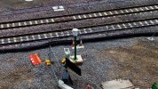
There's a deep hole next to that where we have excavated down to a buried pipe. That pole is a study support, on top of which is an automated monitoring station, measuring rail (and a few other) positions at frequent intervals, just to make sure it's not settling or collapsing etc.
If you look closely at the rails in your close-up photo you'll see reflective targets on them. And if you look at your wider angle photo you'll see the cofferdam nearby.
Yep. It's not 100% finished but it's usable. We have thus closed the level crossings permanently.
Interestingly, if you look at the sectional appendix they will be listed as temporarily out of use, but they will never actually re-open.
They are simply listed as temporarily closed until the full legal closure process is completed (these are not fast processes...) and also until we have removed all evidence of the crossings. Until then, they are still potential trespass sources and also potential emergency access points if needed, plus landmarks that are visible to train drivers, so we retain them in the sectional appendix as info. Once they completely physically and legally gone, they will be removed from the sectional appendix altogether.
Mr_Moo, Firstly thank you for all the updates you've been sharing here! Good progress is clearly happening!
Could I ask, how much attention was paid to upfront / embodied carbon emissions from the project? I see a lot of concrete and steel going up, both relatively high-carbon materials, but simultaneously part of the station building is wood. It'd be interesting to know more!
Mr_Moo, Firstly thank you for all the updates you've been sharing here! Good progress is clearly happening!
Could I ask, how much attention was paid to upfront / embodied carbon emissions from the project? I see a lot of concrete and steel going up, both relatively high-carbon materials, but simultaneously part of the station building is wood. It'd be interesting to know more!
Fully aware of that, but of course recyclability and carbon intensity are two separate factors, and even recycled steel is a carbon-intensive material - and on the other hand, sometimes structural needs require steel or concrete. I was asking out of curiousity whether and how much it was considered during the design phase.
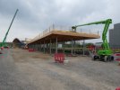
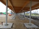
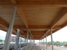
The light grey poles in the foreground are the roof supports, same as the other poles. The darker grey OLE stanchions are in the background and in this shot appear to line up with the poles in the foreground. In reality they are some distance apart.
The verticals of the stanchions pass through holes in the new roof as can be seen in this shot (looking from the opposite direction).
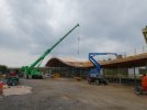
It’s a covered bike storage area that extends away from the station building. I think the photo must have been taken just before the video in post #949, which shows the roof being added to the supports. Please check the video at 1m 15s or so. The overall area with completed roof can also be seen in the last row of photos in post #939.
The light grey poles in the foreground are the roof supports, same as the other poles. The darker grey OLE stanchions are in the background and in this shot appear to line up with the poles in the foreground. In reality they are some distance apart.
The verticals of the stanchions pass through holes in the new roof as can be seen in this shot (looking from the opposite direction).
It’s a covered bike storage area that extends away from the station building. I think the photo must have been taken just before the video in post #949, which shows the roof being added to the supports. Please check the video at 1m 15s or so. The overall area with completed roof can also be seen in the last row of photos in post #939.
All spot on - this is indeed the roof supports above the bike storage area which will be behind platform 4.
500 bike spaces on each side of the station.
Mr_Moo, Firstly thank you for all the updates you've been sharing here! Good progress is clearly happening!
Could I ask, how much attention was paid to upfront / embodied carbon emissions from the project? I see a lot of concrete and steel going up, both relatively high-carbon materials, but simultaneously part of the station building is wood. It'd be interesting to know more!
Being honest, I'm ont really involved in that part, but I do know quite a bit of work has gone into BREEAM certification and we are absoutely giving plenty of consideration to that.
And thank you for the thank you - I always like seeing that people appreciate what I'm sharing.
Being honest, I'm ont really involved in that part, but I do know quite a bit of work has gone into BREEAM certification and we are absoutely giving plenty of consideration to that.
And thank you for the thank you - I always like seeing that people appreciate what I'm sharing.
Hi everyone. Following the announcement of a general election, and given it's clear I'm involved in the Cambridge South project in an official capacity, I am now subject to significant restrictions on what I can share publically until the election is over.
Feel free to ask questions etc about anything specific and I'll respond where I can, but I'm going to stop sharing photos etc for the next few weeks, and may say I cannot answer some things until later.
Hi everyone. Following the announcement of a general election, and given it's clear I'm involved in the Cambridge South project in an official capacity, I am now subject to significant restrictions on what I can share publically until the election is over.
Feel free to ask questions etc about anything specific and I'll respond where I can, but I'm going to stop sharing photos etc for the next few weeks, and may say I cannot answer some things until later.
Thanks for the updates @mr_moo. I'll try to keep the photos and video coming .
No photo, but I saw today that the first floor was being installed in the admin/office area of the western station building. It looked like a metal form that would be concreted in due course.
We are aware of an issue with emails from the Forum to Microsoft-based email accounts (hotmail/outlook/live.com email addresses). This is being looked into currently, thanks for your patience meanwhile.