Our new ticketing site is now live! Using either this or the original site (both powered by TrainSplit) helps support the running of the forum with every ticket purchase! Find out more and ask any questions/give us feedback in this thread!
Further to Peter's answer, Farnham is *west* and slightly south of Guildford, and Hindhead is south and slightly east of Farnham (and due south-west of Guildford).
Advice needed. I frequently walk up Pilsdon Pen in West Dorset. The "PeakVisor" app says I should be able to see Pen y Van in the Brecon Beacons at 79 miles away. Does that sound feasible? I haven't been able to pick it out even on what seemed like a very clear day. The app gives a height of 886m and a "proportional prominence" of 670m. Is that the apparent height above the horizon?
In the opposite direction, the Viewfinder Panoramas website entry for Pen y Fan shows that Pilsdon Pen is a line of sight at 79 miles.
Looking at the vistas for both locations, there doesn’t seem to be a discernible prominence that would make them stand out when viewed in either direction. But it should be possible to see Pen Y Fan from Pilsdon Pen with good binoculars and great viewing conditions.
Never realised St Paul's was large enough to be seen so far away.
I've seen other features of the London skyline from Hindhead, but never St Pauls.
Oddly even though I first went up there in the 80s (summer 1984 I think) I never saw London - but perhaps there just weren't enough skyscrapers for it to be prominent.
== Doublepost prevention - post automatically merged: ==
The only Telegraph Hill I can see on the OS 1:25000 of that area is south-west of Fernhurst. It seems to be wooded and the only close approach is via a private drive. It's only 207m high though. The map marks a viewpoint about 1/4 mile south at Woolbeding Common.
I believe Haste Hill just south-east of Haslemere centre was the next semaphore station towards London. It also seems to be thickly wooded and a similar elevation.
North from there the next semaphore station was at Banacle Hill near Brook. There are good views from nearby but nothing particularly spectacular or unusual.
The two highest points I know of in the area are Blackdown - south east of Haslemere at 280m max; and Gibbet Hill - east of Hindhead at 272m. The former has views south and east to the South Downs, the latter has views north and east to the North Downs and Greensand ridge. @Taunton said above that St Paul's is visible from Hindhead - I've never seen that far myself but maybe I'll try to get up there with a long zoom and binoculars next time we have a clear day.
Telegraph Hill is indeed further southwest, roughly between Haslemere and Petersfield but about 5 miles SE of the railway line. The actual summit is in a private field but you can get fairly close to it on a nearby footpath, just to the west. Views are somewhat restricted due to trees: the best viewpoint in the area is Older Hill, around 0.25 miles further west on open heathland. This gives extensive views of the South Downs and east Hampshire hills, though no very long-distance views.
That said Telegraph Hill is quite a prominent feature in the area, as it's the highest point on the greensand ridge which it is part of, and said ridge abruptly ends just to the west, so it's clearly noticeable as the western end of that ridge. The eastern end of this ridge, Bexley Hill, features the Midhurst TV mast. This is part of the greensand ridge which runs just north of the South Downs, though the ridge becomes very hard to discern further east, and is, overall, much less prominent than the equivalent ridge which is just south of the North Downs, and which features Leith Hill.
Blackdown is the highest point in Sussex and third-highest in southern England from Berkshire eastwards (Walbury Hill and Leith Hill being first and second).
While having a wooded summit plateau it features several viewpoints on the edges of the summit area, notably "Temple of the Winds" to the south, featuring an extensive view of much of the Downs and Weald, as far east as the Lewes area.
There is also an extensive viewpoint on the west side of the hill from which you can see the Downs around Butser Hill and large parts of the Hampshire chalk plateau. The Isle of Wight is visible if you leave the path and head a little west of the viewpoint. I have the feeling the Hannington mast is visible from there though would have to go at night to be sure (the lights are more prominent than the mast itself).
More recently, areas of trees have been cleared on the north side of Blackdown which has opened up views towards the Surrey Heath area, the North Downs and also, IIRC, the Chilterns.
I don't think London is visible though. There are some viewpoints on the east side from which you can see the North Downs around Guildford but have never noticed any London features so guessing the Surrey hills get in the way.
Blackdown is the highest point in Sussex and third-highest in southern England from Berkshire eastwards (Walbury Hill and Leith Hill being first and second).
While having a wooded summit plateau it features several viewpoints on the edges of the summit area, notably "Temple of the Winds" to the south, featuring an extensive view of much of the Downs and Weald, as far east as the Lewes area.
There is also an extensive viewpoint on the west side of the hill from which you can see the Downs around Butser Hill and large parts of the Hampshire chalk plateau. The Isle of Wight is visible if you leave the path and head a little west of the viewpoint. I have the feeling the Hannington mast is visible from there though would have to go at night to be sure (the lights are more prominent than the mast itself).
More recently, areas of trees have been cleared on the north side of Blackdown which has opened up views towards the Surrey Heath area, the North Downs and also, IIRC, the Chilterns.
I don't think London is visible though. There are some viewpoints on the east side from which you can see the North Downs around Guildford but have never noticed any London features so guessing the Surrey hills get in the way.
I explored some of Blackdown in the early 2000s when my dad lived in Haslemere. It's the views south and east from the Temple of the Winds that I remember, I don't think I found anywhere with a westward view.
Since you mentioned as well that recent clearance has improved northward views, that's another day's exploration I need to plan for whenever we get some better weather.
I explored some of Blackdown in the early 2000s when my dad lived in Haslemere. It's the views south and east from the Temple of the Winds that I remember, I don't think I found anywhere with a westward view.
I explored it as far back as 1981 when I was still a child - loved the place. There is a circular path around the edge of the summit plateau, if you follow it clockwise from Temple of the Winds along the western edge you get one small viewpoint, another small viewpoint and then a very extensive westwards viewpoint perhaps 0.5 miles from Temple of the Winds.
Since you mentioned as well that recent clearance has improved northward views, that's another day's exploration I need to plan for whenever we get some better weather.
Next week, apparently - warmer than the whole of July and August possibly. (Out of the UK at the moment so can't comment first hand).
Mind you might be perhaps a little hazy, not sure. The optimal setup for views would be cool, dry settled weather with N or NW winds but after that horrendous July and August it's probably best to take the opportunity with any form of dry, fine weather!
Yes, true but you do need a clear day, though there’s plenty of closer features to look at as well. It is though currently closed for an indeterminate period for repair work.
Yes, I was puzzled by the two separate groups to the right of the Shard, but drawing the line from my viewpoint to the Shard on Google maps does indeed confirm that the Vauxhall and Nine Elms development would be just to the right of it, with Canary Wharf further right.
I've also subsequently spotted that on the second photo, the Crystal Palace mast is visible close to the left edge, which I hadn't seen when I was looking in real life.
Another visit with a longer zoom is definitely needed, but not in tomorrow's weather!
Great pictures Del W. The second picture , shows the clock tower , which was the Aldershot military hospital. It was called the Cambridge hospital. I think it closed in the early 1990s. My brother was born there when my dad was based in Aldershot in the 80s.
Regarding what you said about the Crystal Palace transmitter in the picture, I think maybe the Croydon one? The Crystal place one has a white antenna and possibly a different shape?
I always thought of London being quite far from Aldershot , but when you see these pictures it shows that it isn’t actually too far.
Great pictures Del W. The second picture , shows the clock tower , which was the Aldershot military hospital. It was called the Cambridge hospital. I think it closed in the early 1990s. My brother was born there when my dad was based in Aldershot in the 80s.
Regarding what you said about the Crystal Palace transmitter in the picture, I think maybe the Croydon one? The Crystal place one has a white antenna and possibly a different shape?
I always thought of London being quite far from Aldershot , but when you see these pictures it shows that it isn’t actually too far.
Thanks for that, now I've realised how good the panorama is I shall try some more with a longer zoom on another occasion.
You may well be right about the transmitter - the image is quite indistinct, and I was guessing from a memory of seeing the Crystal Palace mast years ago. If there's a second one nearby it could well be that.
Thanks for that, now I've realised how good the panorama is I shall try some more with a longer zoom on another occasion.
You may well be right about the transmitter - the image is quite indistinct, and I was guessing from a memory of seeing the Crystal Palace mast years ago. If there's a second one nearby it could well be that.
Great pictures Del W. The second picture , shows the clock tower , which was the Aldershot military hospital. It was called the Cambridge hospital. I think it closed in the early 1990s. My brother was born there when my dad was based in Aldershot in the 80s.
Regarding what you said about the Crystal Palace transmitter in the picture, I think maybe the Croydon one? The Crystal place one has a white antenna and possibly a different shape?
I always thought of London being quite far from Aldershot , but when you see these pictures it shows that it isn’t actually too far.
Thanks for that, now I've realised how good the panorama is I shall try some more with a longer zoom on another occasion.
You may well be right about the transmitter - the image is quite indistinct, and I was guessing from a memory of seeing the Crystal Palace mast years ago. If there's a second one nearby it could well be that.
On the day I was there, the groups of tower blocks were visible with the naked eye, but only really as clumps, it was difficult to pick out individual buildings in the way that the photos allow. I didn't see either Crystal Palace or Croydon transmitter masts at all, but I wasn't really looking closely in their direction. A pair of binoculars would certainly have helped.
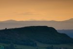
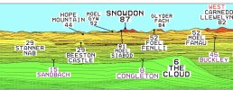
I have come across a great photograph on Twitter, taken by James Grant, which shows Yr Wyddfa / Snowdon (and the Snowdon Horseshoe) visible from The Roaches in Staffordshire. A distance of 87 miles.
Looking closely at the picture, the foreground appears to show The Cloud hill in Cheshire. The mid-range hills have a number of wind turbines on them and checking on a map this could possibly be the Clocaenog Forest in Denbighshire.
Great conditions and a very good camera for capturing this line of sight. (Picture taken by James Grant Photography in 2021).
I have come across a great photograph on Twitter, taken by James Grant, which shows Yr Wyddfa / Snowdon (and the Snowdon Horseshoe) visible from The Roaches in Staffordshire. A distance of 87 miles.
Looking closely at the picture, the foreground appears to show The Cloud hill in Cheshire. The mid-range hills have a number of wind turbines on them and checking on a map this could possibly be the Clocaenog Forest in Denbighshire.
Great conditions and a very good camera for capturing this line of sight. (Picture taken by James Grant Photography in 2021).
The zoom makes everything look much nearer than it actually is. For example the mid-range hills look only a few miles away, and Snowdon, perhaps 20-30.
I have come across a great photograph on Twitter, taken by James Grant, which shows Yr Wyddfa / Snowdon (and the Snowdon Horseshoe) visible from The Roaches in Staffordshire. A distance of 87 miles.
Looking closely at the picture, the foreground appears to show The Cloud hill in Cheshire. The mid-range hills have a number of wind turbines on them and checking on a map this could possibly be the Clocaenog Forest in Denbighshire.
Great conditions and a very good camera for capturing this line of sight. (Picture taken by James Grant Photography in 2021).
The zoom makes everything look much nearer than it actually is. For example the mid-range hills look only a few miles away, and Snowdon, perhaps 20-30.
Yes, I had to take a closer look because I thought the hill in the foreground was still part of The Roaches when in fact it’s 6 miles away in Cheshire.
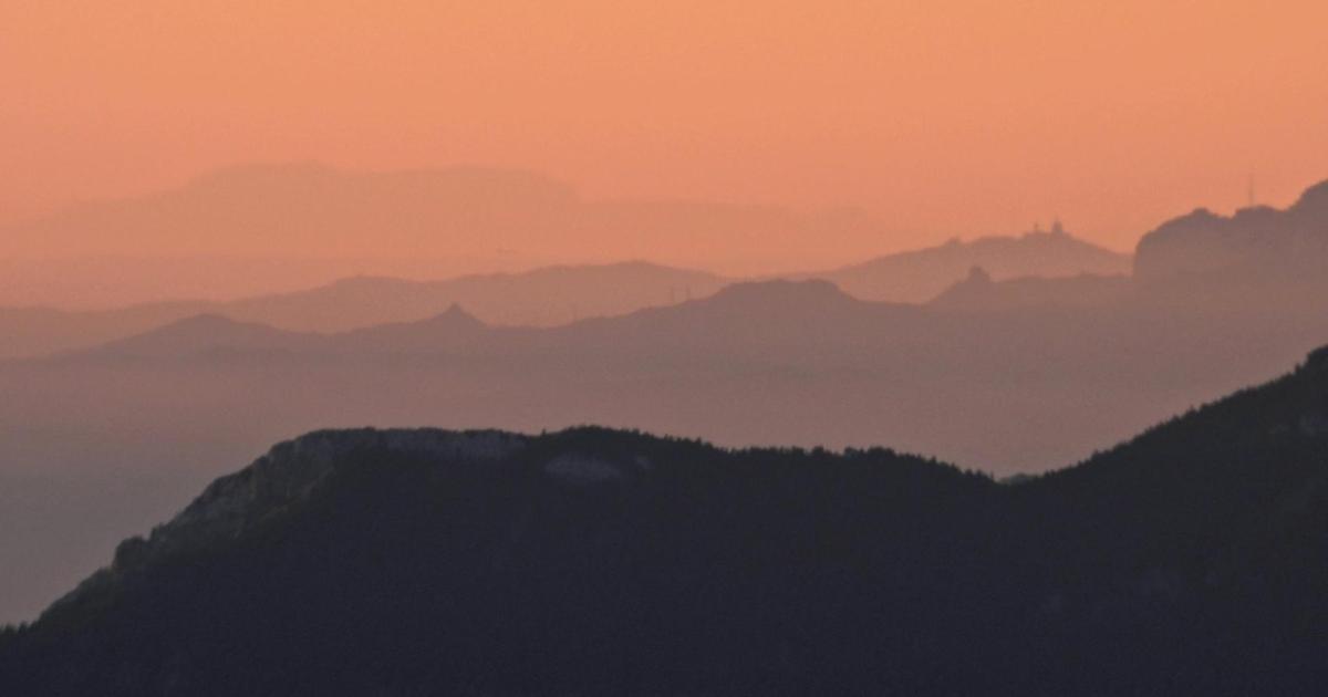
This isn't UK but well worth a mention I hope, Mallorca seen from Andorra? Wow....it's not unusual to see Mallorca from Barcelona in the morning under the right conditions, but from half as far again?
Last week with the nw'ly winds and clear skies I was hoping to do some long-range UK shots, but conditions were never right unfortunately, and when they were (ie seeing the coast from Choeley Old Road approaching Horwich) I didn't have my camera - and my phone's not good enough!
A twitter link to the original photos; and a press article in English;
Clear skies and great weather provide unique opportunity. Barcelona is some 200 kilometres away from Mallorca
www.majorcadailybulletin.com
Over the past few weeks some magnificent pictures have been taken of Mallorca, in particular the Tramuntana mountains from Barcelona, however the big surprise this week was a set of photographs off Mallorca taken from Andorra by Comando Tibidabo.
This is a particular and special circumstance, as it should not be forgotten that some 200 kilometres separate the crest of the Serra de Tramuntana mountain range from the Catalan coast.
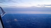
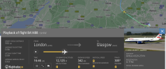
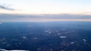
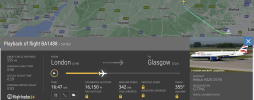
These are from the air so it's cheating a little, but here are some long-distance observations from a flight home from LHR I took on Saturday afternoon. See the (edited for clarity) photos and corresponding altitude data below. Locations are estimated as these were taken shortly before and after the heading change. Sorry for the size of the images!
#1 - Southampton, the IoW and east Dorset coast visible from above Buckinghamshire
#2 - Bristol, the Severn and South Wales visible from above Oxfordshire
These are from the air so it's cheating a little, but here are some long-distance observations from a flight home from LHR I took on Saturday afternoon. See the (edited for clarity) photos and corresponding altitude data below. Locations are estimated as these were taken shortly before and after the heading change. Sorry for the size of the images!
#1 - Southampton, the IoW and east Dorset coast visible from above Buckinghamshire View attachment 146637
Was in Turkey last month and whilst enjoying a lovely alfresco meal with a sunset backdrop at the excellent restaurant at the top of Mt Babadag near Fethiye you could clearly see the mountains on Rhodes some 70-80 miles away.
I’ve been to that area of Turkey a lot of times and never managed to see Rhodes as there’s usually a lot of heat haze or marine mist, but this was clear as day. Shame I only had my phone camera with me.
This isn't UK but well worth a mention I hope, Mallorca seen from Andorra? Wow....it's not unusual to see Mallorca from Barcelona in the morning under the right conditions, but from half as far again?
Last week with the nw'ly winds and clear skies I was hoping to do some long-range UK shots, but conditions were never right unfortunately, and when they were (ie seeing the coast from Choeley Old Road approaching Horwich) I didn't have my camera - and my phone's not good enough!
A twitter link to the original photos; and a press article in English;
The longest line of sight ever taken was from the Pyrenees as well, on a mountain called 'Pic de Finestrelles' 20-30 miles west of Andorra. The photo captured Pic Gaspard some 440km+ away in the Alps thanks to the right atmospheric conditions.
Current Guinness World Record Longest Line of Sight A thin line of Mountains rises over the Horizon: The Alps, with Barre des Écrins (4.102 m) in the middle left of the image. Distance443 Kilometer…
beyondrange.wordpress.com
I feel like the conditions have to be precise to get it. Much like when I first posted in this thread, sometimes there is a slim or very wide window, depending on the conditions. It was indeed very sunny during Summer of 2022 when I crossed the Pennines and took that photo. But sometimes it can change with the snap of a finger. Hope you have another try!
Was going to post about another long sight I saw but I've ran out of time and will be back in a sec...
I'm envious - down here in the south-east we've had low cloud and/or freezing fog for a week or more now, with the coming week's forecast being nearly continuous rain. Just a glimpse of the sun would be lovely!
More on topic, I'm looking forward to some clear crisp winter days to revisit Caesar's Camp and Hindhead, but it looks like I'll be waiting a while yet.
I'm envious - down here in the south-east we've had low cloud and/or freezing fog for a week or more now, with the coming week's forecast being nearly continuous rain. Just a glimpse of the sun would be lovely!
More on topic, I'm looking forward to some clear crisp winter days to revisit Caesar's Camp and Hindhead, but it looks like I'll be waiting a while yet.
The best conditions for extensive views are an Arctic air mass in winter with an anticyclone. Such conditions don't happen very often in the UK but when they do, it is impressive how close distant landmarks appear.
We discussed this one previously and someone found this excellent shot from Gibbet Hill, Hindhead - in the group in The City, 22 Bishopsgate is the tallest, NatWest Tower is the leftmost of the group, and St Pauls is the dumpy one to the left of that. Should be visible from Farnham as well, as that benefits from being on the extended line which is an official protected view from Richmond Hill to the cathedral. All those hills in the Farnham-Hindhead Surrey Downs area are visible from the London Eye as you go over the top, so the reverse ought to be true.
Is Gibbett Hill the furthest out you can see any of the London skyscrapers? You cannot see any of the city at an equivalent distance north of London. Went to Gibbett Hill a few years ago. There is some interesting history associated with the place.
The best conditions for extensive views are an Arctic air mass in winter with an anticyclone. Such conditions don't happen very often in the UK but when they do, it is impressive how close distant landmarks appear.
Unfortunately in order to get to see those views, it would mean getting extremely muddy in the process, and you would have to worry about getting home before it gets dark.
The best conditions for extensive views are an Arctic air mass in winter with an anticyclone. Such conditions don't happen very often in the UK but when they do, it is impressive how close distant landmarks appear.
However, as recounted above, when living by the sea front at Hoylake on the Wirral, the rare appearance of the Lake District across the sea only occurred in high summer, never at other times.
Incidentally, if anyone has the ability to identifying all those high London buildings right across that classic photo skyline from Gibbet Hill, Hindhead, I think the participants here would be very grateful.
Is Gibbett Hill the furthest out you can see any of the London skyscrapers? You cannot see any of the city at an equivalent distance north of London. Went to Gibbett Hill a few years ago. There is some interesting history associated with the place.
Unfortunately in order to get to see those views, it would mean getting extremely muddy in the process, and you would have to worry about getting home before it gets dark.
Depends which end of winter I guess. Remember by late Feb we have almost 2 extra hours of evening daylight. Also the air tends to be clearer and drier in late winter in any case.
On Twitter, I follow a number of photographer accounts across the north west.
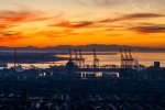
A couple of these recently have caught my eye, showing great visibility conditions from Liverpool at sunset. The elevated parts of Liverpool can give some great vistas and lines of sight.
This first photo was taken earlier this month by Steve Ward and shows the docks at Seaforth looking towards North Wales. As far as I can see when zooming in, this photo shows (from left) Moel Siabod; Snowdon/Yr Wyddfa; a glimpse of the very rugged top of Tryfan; the Glyders; and the Carneddau.
The second photo was taken by Andy Mallins and posted in August this year. It shows the construction of Everton’s new ground, with the Isle of Man on the horizon.
We are aware of an issue with emails from the Forum to Microsoft-based email accounts (hotmail/outlook/live.com email addresses). This is being looked into currently, thanks for your patience meanwhile.