• Our new ticketing site is now live! Using either this or the original site (both powered by TrainSplit) helps support the running of the forum with every ticket purchase! Find out more and ask any questions/give us feedback in this thread!

Walking and Rambling discussion

_toommm_

Established Member
Joined
8 Jul 2017
Messages
6,295
Location
South West London
That really looks like drudgery, and possibly not good for leg or knee-joint recuperation either.
I prefer to cycle ex-railway lines and anything like your walk (I cycled the old Severn Bridge over to Chepstow and back in July 1974. I can't imagine walking it!)

My last walk (apart from Musselburgh station to the town centre along the riverside cycle route 3 days ago) was a train- and bus-assisted trip with an old schoolfriend from Cowroast to Buckland Wharf. Lots of reminiscences about when we used to play on the recently-withdrawn BWB narrowboats tied up along the Wendover arm, and how good it was to see the canal (mostly dry in our childhood) being returned to water.
A

It was a flat walk on easy ground and quite short, which is quite different to what I used to do before, which was hilly, 20+mile hikes like Scarborough to Whitby, Yorkshire Three Peaks, Scafell (to name some of my favourites).
 
Sponsor Post - registered members do not see these adverts; click here to register, or click here to log in
R

RailUK Forums

D365

Veteran Member
Joined
29 Jun 2012
Messages
13,175
About three weeks ago, it was still boarded off. As was the section in Rotherham near the New York stadium (so I had to take quite a diversion via Masbrough instead). Of course things might have changed since.
No progress since our walk last winter then...
 

RichJF

Established Member
Joined
2 Nov 2012
Messages
1,200
Location
South London
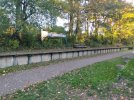
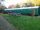
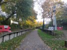
Cycled/walked a section of the Downs Link today. Not done this since I was young in the late 90s/early 00s! Did West Grinstead to Henfield. Planning to do West Grinstead - Christs Hospital next weekend.

My bicycle decided it wanted a multiple puncture (too many holes for my patch repair kit) nr Henfield so I had to walk back! I often do disused railways & abandoned rail infrastructure so I might start uploading more.
 

Attachments

  • IMG20221113150903.jpg
    IMG20221113150903.jpg
    1.2 MB · Views: 14
  • IMG20221113151054.jpg
    IMG20221113151054.jpg
    619.2 KB · Views: 14
  • IMG20221113150852.jpg
    IMG20221113150852.jpg
    1.2 MB · Views: 14

Kite159

Veteran Member
Joined
27 Jan 2014
Messages
22,759
Location
West of Andover
In Yorkshire this weekend, making the most of the dry weather (after last weekend was a wash-out). Yesterday I did the disused railway path (Spen Valley) from Low Moor towards Dewsbury, including a little loop to do the Spen Valley Ringway [which was rough in places before the tarmac returned]. A good quality path [majority tarmac] and well used. Although not much left in the way of the old stations [i.e. old platforms].

This morning, I did Dewsbury towards the town of Ossett on the mixed used path/former railway, before following the Calder and Hebble Navigation from the Saville Town marina towards Brighouse. A mixed route of path quality [both in terms of width, surface & signposting] but some nice scenes along the way [especially nearer the Brighouse end].
 

eastwestdivide

Established Member
Joined
17 Aug 2009
Messages
3,407
Location
S Yorks, usually
Previous weekend, Derbyshire Wayfarer ticket Sheffield-Derby-Duffield, £10 single on the Ecclesbourne Valley line uphill to Wirksworth, then about 6 miles walk: steeply uphill from Wirksworth to the High Peak trail, nothing doing at Steeple Grange light railway, then level for a bit with huge views over Cromford, steeply down the trail to High Peak Junction, quick cafe stop and along the Cromford Canal to Whatstandwell station for the trains back to Derby and Sheffield). Approx route in yellow dashes:

Wirskworth-Whatstandwell.jpg
 

32475

Member
Joined
2 Nov 2019
Messages
815
Location
Sandwich
A walk home from Dover to Ash last Friday on a dry day. Great cliff top views to France, past some WW2 installations and walked along part of the track bed of the Guildford Tramway (1903-30).
At over 21 miles this was a new personal best for our Cavalier King Charles spaniel.
 

S&CLER

Member
Joined
11 Jan 2020
Messages
787
Location
southport
Did a good circular walk from Parkgate (Wirral) on Sunday which included a bit of the old railway, with an early lunch at Hadlow Road station. Dismayed to notice that the length of track in the platform area was flatbottom and not bullhead, which surely would have been in use in 1952, the supposed date of the restored station.
 

Iskra

Established Member
Joined
11 Jun 2014
Messages
10,687
Location
West Riding
While not on the scale of many documented walks on this thread, I just had a lovely wintry walk around one of the many reservoirs in the North West Sheffield area. It’s a very peaceful area and the weather added to that. This one is More Hall and I think it is becoming my favourite. Note the water level is still very low. One photo from today and a couple from warmer times:

91D18E4C-A552-41D3-9471-8849F2F1EFBB.jpeg7DDE9FC9-989B-49E5-8CF2-259483516841.jpeg079903F7-91AA-4E63-857D-7FBE4E726FE0.jpeg
 

Birmingham

Member
Joined
14 Mar 2020
Messages
514
Location
United Kingdom
Today I walked the River Stort Navigation in its entirety, 16 miles from Bishop’s Stortford to Hoddesdon (use Rye House or Broxbourne stations).

A really lovely route; passes through a few towns — Sawbridgeworth, Harlow, and the village of Roydon — and is rather rural and very peaceful in-between them.

Sections of the towpath were muddy and slightly flooded so it would be advisable to attempt when it’s drier if you don’t fancy dealing with that.
 

Kite159

Veteran Member
Joined
27 Jan 2014
Messages
22,759
Location
West of Andover
Yesterday I did the Kennet & Avon canal from Thatcham towards Reading. Quite peaceful in places and scenic with the leafless trees.

Although the towpath was muddy in places (especially in the sections where it goes across fields) and nearer the Reading end flooded in places as the river level is high.
 

D6130

Established Member
Joined
12 Jan 2021
Messages
9,051
Location
West Yorkshire/Tuscany
Fabulous photo @Iskra ! We had similar temperature inversion in the Calder Valley today, but by the time I had managed to get up onto the tops, the setting sun had become obscured by a band of high cloud over in the Manchester direction.
 

_toommm_

Established Member
Joined
8 Jul 2017
Messages
6,295
Location
South West London
A short walk yesterday morning alongside the Ogmore Valley Extension, from Pyle to Tondu. Definitely very chilly! I need to go back and do the full thing from Tondu to Margam Yard.

6D57EABF-4685-4DE1-A5A5-2AFB8B80090E.jpeg83C05326-0ACF-471F-B259-989B4E350A1E.jpegCFA72EEA-4297-4EF3-A99B-64F12186FC74.jpegBED2F028-55C5-463C-801D-B3828F9C4F31.jpeg
6CC7CD6F-9BD3-4AA9-BEF6-2C53B4494A7F.jpeg

(The photo of the tracks was taken at a foot crossing, and even though the railway is marked OOU, I took all precautions and exited as soon as it was took)
 

Iskra

Established Member
Joined
11 Jun 2014
Messages
10,687
Location
West Riding
Fabulous photo @Iskra ! We had similar temperature inversion in the Calder Valley today, but by the time I had managed to get up onto the tops, the setting sun had become obscured by a band of high cloud over in the Manchester direction.
Thanks! I had the same issue- just missed the Matlock waterfall being lit up gold by the setting sun! Hopefully you still had an enjoyable walk though :)
 

johnnychips

Established Member
Joined
19 Nov 2011
Messages
3,826
Location
Leeds
Had a surprisingly scenic walk today with other forum members from Stockport to Stretford (10 miles) largely along the banks of the Mersey. I was expecting a river surrounded by Manchester-sprawl housing estates, but actually a large floodplain has to be maintained either side in case of, erm, flooding. Recommended.
 

Iskra

Established Member
Joined
11 Jun 2014
Messages
10,687
Location
West Riding
Today I did the Ingleton Waterfall Trail and have to say it was excellent, a moderate walk taking in many stunning waterfalls which are extra impressive considering the recent precipitation. A wonderful cafe awaits at the end of the walk too. Only downside is the £8 entrance fee, but it was worth it in all honesty.
 

S&CLER

Member
Joined
11 Jan 2020
Messages
787
Location
southport
Last Sunday I went on a 10.5 mile walk from Roddlesworth visitor centre near Darwen Tower to Brinscall. Part of our return route was along the Withnell Nature Trail, part of the old Chorley to Blackburn line, which can be walked as far as Abbey village. it is most attractive. A short less attractive section of the old line can be walked north of the old station, which is occupied and not accessible. (You can get a look at it from the overbridge.)
 

Kite159

Veteran Member
Joined
27 Jan 2014
Messages
22,759
Location
West of Andover
Had a surprisingly scenic walk today with other forum members from Stockport to Stretford (10 miles) largely along the banks of the Mersey. I was expecting a river surrounded by Manchester-sprawl housing estates, but actually a large floodplain has to be maintained either side in case of, erm, flooding. Recommended.
That is on my (rather large list to do at some point, I did part of it last year from Stockport towards East Didsbury so the next section needs doing.

Last weekend I had a couple waterside walks, from Shotton along the River Dee to Chester before the Shropshire Union canal, decent towpath quality (with signs of it being upgraded in places). Very rural and peaceful in places until Ellesmere Port where it runs close to a motorway.

Also on Sunday from Stoke to Kidsgrove via the Trent & Mersey canal, another decent towpath (always a worry this time of year about muddy quagmires of paths), with a detour at the Kidsgrove end due to Harecastle tunnel. Also gave some views of the remains of the sprinters involved in the Salisbury tunnel crash.
 

Bletchleyite

Veteran Member
Joined
20 Oct 2014
Messages
113,243
Location
"Marston Vale mafia"
Not been recently, but as long as you're OK with lots of hills the area around the east of Manchester, like Marple, Broadbottom etc, is absolutely superb walking country. I don't think I've ever seen such a dense network of footpaths anywhere in the country, and the views including of Manchester are stunning. So easy to get to as well.
 

D6130

Established Member
Joined
12 Jan 2021
Messages
9,051
Location
West Yorkshire/Tuscany
I don't think I've ever seen such a dense network of footpaths anywhere in the country,
We have an even more dense network of footpaths in the Upper Calder Valley. In fact the OS grid square in which we live (SD99x27x) has the densest concentration of footpaths of any in the country according to the local branch of the Ramblers' Association.
 

ChrisC

Established Member
Joined
7 Oct 2018
Messages
2,255
Location
Nottinghamshire
Had a surprisingly scenic walk today with other forum members from Stockport to Stretford (10 miles) largely along the banks of the Mersey. I was expecting a river surrounded by Manchester-sprawl housing estates, but actually a large floodplain has to be maintained either side in case of, erm, flooding. Recommended.
That is on my (rather large list to do at some point, I did part of it last year from Stockport towards East Didsbury so the next section needs doing.
I walked that next section the summer before last from East Didsbury as far as Jacksons Bridge where the tram goes over the river towards Sale Water Park. I started off in the Fletcher Moss Park and Botanical Gardens in East Didsbury which were very interesting and walked through the park to the bank of the river. I also felt that it seemed very rural considering how it is within the Greater Manchester sprawl. I remember finishing in the garden at Jackson’s Bridge Pub having a drink before walking through a nature reserve to the tram stop at Barlow Moor Road.

74147D89-0997-4DA4-8B54-9FD362AD2A16.jpeg

D3783854-2DD0-43FD-A908-2F8E6988CC09.jpeg
 

johnnychips

Established Member
Joined
19 Nov 2011
Messages
3,826
Location
Leeds
Bit of a funny one today.

I realised I had never been to Rutland, so went by train to Leicester, got the Arriva 5a to Melton Mowbray (£2), which was rather disappointing. Then the R1 to Oakham by Blands, which unfortunately isn’t in the current offer (£4.20). Oakham is lovely.
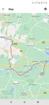
I planned a route via the west side of Rutland Water, and it started off well, until I found a permissive route by the lake was blocked. Not the usual farmer with barbed wire, but a rather large gate by Anglian Water. This meant I didn’t see the lake until the last moment properly, and that was from a road bridge. Anyway, I pressed on to Preston, a delightful thatched village, from where there really was no alternative but to walk a couple of miles on the A-road to Uppingham. It was about nine miles altogether.

I was surprised to see a lot of teenagers walking round the place in school uniform and sports kit, until I realised there was a private school there that presumably runs on Saturdays. Anyway, it was a superb small town with several fine-looking pubs.

Back to Leicester on the Centrebus 747 (£2). I realised I had never been to Leicester before except for the station, and found the city centre surprisingly impressive.

So Rutland: great settlements, perhaps not so good for rambling.
 

Kite159

Veteran Member
Joined
27 Jan 2014
Messages
22,759
Location
West of Andover
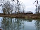
I did another section of the Kennet & Avon canal today, from Hungerford towards Thatcham (linking into the section I did in early January). Towpath was a mixed bag of mud, straw covered mud to tarmac & other hard surfaces. Nice to bring back some memories of my youth. I suspect I will make use of the £2 bus fare by the end of March to do Devizes towards Trowbridge/Bradford on Avon (returning to Salisbury via train).

I had some good timing with a passing steam train
 

Attachments

  • 20230206_132704.jpg
    20230206_132704.jpg
    4.2 MB · Views: 2
Last edited:

Peter Mugridge

Veteran Member
Joined
8 Apr 2010
Messages
17,831
Location
Epsom
All this Kennet and Avon chat reminds me that I have yet to post the details of our own walk last year along this! I shall remedy that now...

I have a few other 2022 walks to post; I'll do that tomorrow.

1675551657491.png

1675551685325.png

1675551706629.png

1675551731295.png

1675551763666.png
 

THC

Member
Joined
21 Sep 2009
Messages
721
Location
Stuck on the GEML
Two walks for me in the last week, both along old canal lines (at least in part):

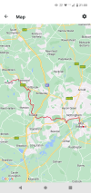
1. Derby to Castle Donington - 16.8 miles. From Midland railway station along the River Derwent before turning south on the line of the old Derby Canal until it met the Trent and Mersey, still in water, then along the towpath to its start (or end!) and finally across the fields to Castle Donny.

2. Heanor to West Bridgford, 19 miles. Down the hill to Langley Mill then along the old Nottingham Canal towpath to Wollaton Hall, into Nottingham city centre then down to the River Trent and across to the posh bit to end in what passes for West Bridgford town centre.

THC
 

Attachments

  • Screenshot_20230203-210023.png
    Screenshot_20230203-210023.png
    1,008.8 KB · Views: 8
  • Screenshot_20230131-173330.png
    Screenshot_20230131-173330.png
    734.4 KB · Views: 7

Top