Southsider
Member
- Joined
- 10 Aug 2015
- Messages
- 937
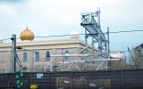
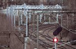
Interesting to note in the first picture they’ve used a spare mast from the 1960s electrification for the overrun onto the Larkfield curve (which ironically is straight).


Don't forget that this part of what is now called the Larkfield spur used to be the main line into St Enoch, hence the straight formationInteresting to note in the first picture they’ve used a spare mast from the 1960s electrification for the overrun onto the Larkfield curve (which ironically is straight).

Don't forget that this part of what is now called the Larkfield spur used to be the main line into St Enoch, hence the straight formation

It might give clearance for a pantograph saving the need for bridge reconstruction.Would it not make sense, given the few trains that use the route, to single track this spur and realign to the middle of the bridge arches?
Given the cost/availability of signalling design resources, the bridge rebuild may well be the easier option! (Edit: there are two bridges on that short link, both major roads. They’ll be challenging).Would it not make sense, given the few trains that use the route, to single track this spur and realign to the middle of the bridge arches?
is there enough room either side of the bridges to lower the track and get them back up to height?It might give clearance for a pantograph saving the need for bridge reconstruction.
would appear to be those bridges so some lowering appears feasible. Redecking a 3rd bridge sounds a bit more costly.Are the bridges under discussion not the ones proposed for track lowering in the paper linked in post #798?
The bridge for which the article proposes redecking is the one currently being finished, Nithsdale Road.would appear to be those bridges so some lowering appears feasible. Redecking a 3rd bridge sounds a bit more costly.
Completion of the redecking and removal of the footbridge would appear to eliminate the last height restrictions between Glasgow Central and Barrhead.The bridge for which the article proposes redecking is the one currently being finished, Nithsdale Road.
Once that's done it should be plain sailing doing the actual wiring. Is there a tentative completion date in the public domain?Completion of the redecking and removal of the footbridge would appear to eliminate the last height restrictions between Glasgow Central and Barrhead.
Work to remove the footbridge starts on 4th Jan and it will have been removed by end of play on the 6th. Darnley Rd is closed over that weekend when the crane will be in for its removal. Heard today from someone how will be working on its removalCompletion of the redecking and removal of the footbridge would appear to eliminate the last height restrictions between Glasgow Central and Barrhead.
Work to remove the footbridge starts on 4th Jan and it will have been removed by end of play on the 6th. Darnley Rd is closed over that weekend when the crane will be in for its removal. Heard today from someone how will be working on its removal
What about where the Cathcart Circle crosses? It was speculated as being a bit of a squeeze with no easy answer.Completion of the redecking and removal of the footbridge would appear to eliminate the last height restrictions between Glasgow Central and Barrhead.
The official date is Dec 2023.Once that's done it should be plain sailing doing the actual wiring. Is there a tentative completion date in the public domain?
doesn't sound difficult to achieve.The official date is Dec 2023.
One thing I've not seen mentioned is this the new run off track at Barhead leading onto single track section. Is it just a case of being brought up to modern standards or something else?

Are there any plans for this available online?The run off track had to be extended to meet modern standards as part of the resignalling project I believe.
Date for Barrhead services to go electric?doesn't sound difficult to achieve.
A quick measurement with Google Earth indicates about 300 yards between the Cathcart Circle bridge and Pollokshaws Road. It may be more of a problem getting back to height between Kilmarnock Road and Larkfield Junction.is there enough room either side of the bridges to lower the track and get them back up to height?
edit: Just had a closer look at the OS map. South end can't start diving because of the bridge over the Cathcart circle line. Therefore track lowering doesn't look to a possibility.
This SHOULD READ 6th - 9thWork to remove the footbridge starts on 4th Jan and it will have been removed by end of play on the 6th. Darnley Rd is closed over that weekend when the crane will be in for its removal. Heard today from someone how will be working on its removal
They are the right sort of codes for OHL masts.Noticed these markings on Glasgow-bound platform 2 at Barrhead. Do they indicate intended locations of OHL masts or something else? They are quite close together, only separated by a few metres.

so not a straight run then. An anchor possibly aka a wicketkeeper end of a tension run etc. I have attached an example on the WCML 3.8 miles north of Preston.They are quite close together, only separated by a few metres.
I think K is right for the Glasgow-Kilmarnock line, but if 11 is the distance from Glasgow Central, then it must be miles, not km, which is a surprise.They are the right sort of codes for OHL masts.
Why is that a surprise? The railway still measures things in miles and chains (or at least the metric conversions thereof).I think K is right for the Glasgow-Kilmarnock line, but if 11 is the distance from Glasgow Central, then it must be miles, not km, which is a surprise.
I think the old electrification on Cathcart Circle was done in miles, presumably it’s following on from that.Why is that a surprise? The railway still measures things in miles and chains (or at least the metric conversions thereof).
Intended OLE mast locations. I'd guess the one marked K/11/09A is a late addition to the final design, being only a few metres to the north of K/11/10.Noticed these markings on Glasgow-bound platform 2 at Barrhead. Do they indicate intended locations of OHL masts or something else? They are quite close together, only separated by a few metres.
Nope, it's kilometres - and the datum is where the line branches off from the Cathcart Circle.I think K is right for the Glasgow-Kilmarnock line, but if 11 is the distance from Glasgow Central, then it must be miles, not km, which is a surprise.
Not, as far as I'm aware, for numbering masts on new or extended electrifications in the last 50 years. The WCML, for example, changes from miles to kilometres at Weaver Junction, as discussed in previous threads. Since a kilometre is less than a mile, this does not lead to any ambiguous numbers - all numbers north of WJ are greater than any to the south.Why is that a surprise? The railway still measures things in miles and chains (or at least the metric conversions thereof).