
• Our new ticketing site is now live! Using either this or the original site (both powered by TrainSplit) helps support the running of the forum with every ticket purchase! Find out more and ask any questions/give us feedback in this thread!

Did RAF Upper Heyford have a rail connection?

Status
Not open for further replies.

Mark24

Member
Joined
18 Sep 2018
Messages
77
Google earth shows what looks like a dismantled railway line between the old air base at Upper Heyford stretching to the outskirts of the village of Kirtlington, which is only a couple of fields away from the Cherwell Valley line.
I can’t find any record of this on the internet. Can anyone confirm it was once a railway?
 
Sponsor Post - registered members do not see these adverts; click here to register, or click here to log in
R

RailUK Forums

AlistairCL

Member
Joined
19 Aug 2018
Messages
8
Google earth shows what looks like a dismantled railway line between the old air base at Upper Heyford stretching to the outskirts of the village of Kirtlington, which is only a couple of fields away from the Cherwell Valley line.
I can’t find any record of this on the internet. Can anyone confirm it was once a railway?
Could this be an ancient structure called Aves Ditch, Wattle Bank or Ash Bank?

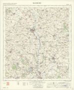
See the one-inch OS map at the National Library of Scotland :


Google maps shows Aves Ditch as part of Gallos Brook, but the OS map shows it as a separate structure crossing Gallos Brook, at almost 90 degrees.
 

Mcr Warrior

Veteran Member
Joined
8 Jan 2009
Messages
17,252
Concur with @AlistairCL that this is almost certainly the 'Aves Ditch' (a.k.a. the Ash Bank or Wattle Bank). Thought to be an Iron Age ditch / boundary dyke, and maybe some three miles long. Marks the civil parish boundary between Lower Heyford and nearby Middleton Stoney.
 
Status
Not open for further replies.

Top